Toggle navigation
Mountains
Routes
Images
Trip Reports
Forum
What's New
People
Areas & Ranges
Articles
Trailheads
Canyons
Huts & Campgrounds
Albums
Logistical Centers
Fact Sheets
Lists
Custom Objects
Gear
Plans & Partners
WELCOME TO SUMMITPOST
SIGN IN
REGISTER
Hoosier Hill
Additional Parents
Image
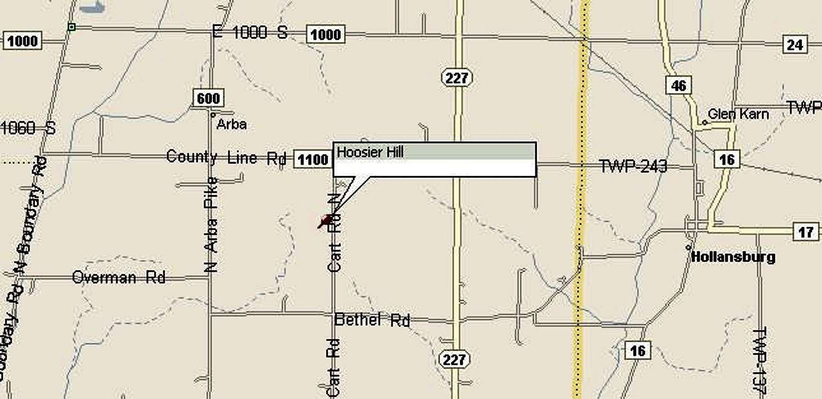
Map to get to the highpoint....
View High-Resolution Image
Map to get to the highpoint....
Map to get to the highpoint. Note that Cart Road is actually called Elliot Road. Map from Ryan Cragun at
his website
. Submitted by permission.
« PREV
NEXT »
hgrapid
on
May 3, 2004 12:22 pm
Comments & voting
Other parents
Lat/Lon:
40.00040°N / 84.8504°W
Image ID:
51756
10264 Hits
75.81
% Score
6
Votes
Log in to vote
Comments
No comments posted yet.
to post!
Don't have an account?
Hoosier Hill
(Mountain/Rock)
« PREV
Viewing
#2 of 36
GALLERY
NEXT »
hgrapid's Image Gallery
« PREV
Viewing
#142 of 5281
GALLERY
NEXT »
×
You need to login in order to vote!
User Name
Password
Remember me
Forgot your password?
Log me out when I close my browser.
Keep me logged in all the time.
sign in as a user
Don't have an account?
Register now for FREE
Rating available
Suggested routes for you
People who climb the same things as you
Comments Available
Create Albums
Register Here


