Toggle navigation
Mountains
Routes
Images
Trip Reports
Forum
What's New
People
Areas & Ranges
Articles
Trailheads
Canyons
Huts & Campgrounds
Albums
Logistical Centers
Fact Sheets
Lists
Custom Objects
Gear
Plans & Partners
WELCOME TO SUMMITPOST
SIGN IN
REGISTER
Red Peak & West Demming & Uneva Peak
Additional Parents
South Ridge
Image
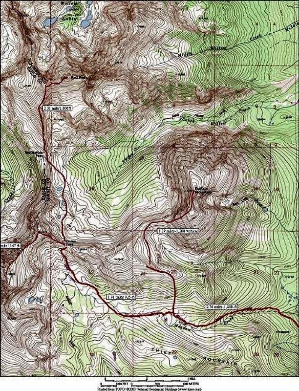
This topo shows RT length and...
View High-Resolution Image
This topo shows RT length and...
This topo shows RT length and vertical gain for the South Ridge Route for Red Peak from Red Buffalo Pass via Eccles Pass and the Meadow Creek Drainage. The map also show alternate , doable routes for Buffalo Mountain and Demming Mountain.
« PREV
NEXT »
Kane
on
May 26, 2004 12:36 am
Comments & voting
Other parents
Lat/Lon:
39.63600°N / 106.17°W
Image ID:
54378
5385 Hits
74.92
% Score
5
Votes
Log in to vote
Comments
No comments posted yet.
to post!
Don't have an account?
Red Peak & West Demming & Uneva Peak
(Mountain/Rock)
« PREV
Viewing
#25 of 70
GALLERY
NEXT »
Kane's Image Gallery
« PREV
Viewing
#1260 of 1853
GALLERY
NEXT »
South Ridge
(Route)
Loading....
×
You need to login in order to vote!
User Name
Password
Remember me
Forgot your password?
Log me out when I close my browser.
Keep me logged in all the time.
sign in as a user
Don't have an account?
Register now for FREE
Rating available
Suggested routes for you
People who climb the same things as you
Comments Available
Create Albums
Register Here


