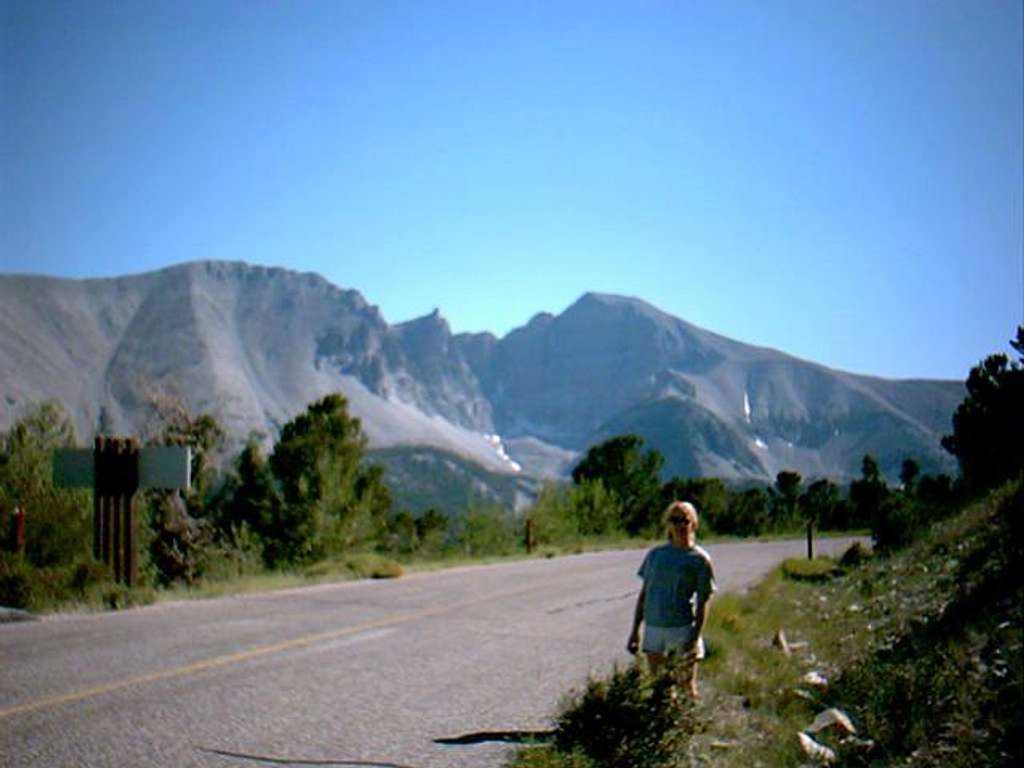
Certainly not the best photo...
Certainly not the best photo of the mountain, but I use it to show an overview of the area. Wheeler Peak is the mountain on the right side of the photo and Jeff Davis Peak (summit not visible) is the large mass on the left. The pinnacle visible between the two peaks is a spire along the saddle connecting the two peaks. The Wheeler Peak trail travels up to the ridge on the far right side of the photo and follows an obvious route to the summit. To gain the summit of Jeff Davis Peak via the north slope, one must leave the trail just before the glacier area (barely visible in the center of the photo) and travel cross country to where the top of the large tree is in the photo (left of center), then go more or less straight up, avoiding obvious obstacles and bearing slightly east.
-Photo taken (looking south/southeast) from the paved road leading to the Wheeler Peak Campground and the trailhead.


