Toggle navigation
Mountains
Routes
Images
Trip Reports
Forum
What's New
People
Areas & Ranges
Articles
Trailheads
Canyons
Huts & Campgrounds
Albums
Logistical Centers
Fact Sheets
Lists
Custom Objects
Gear
Plans & Partners
WELCOME TO SUMMITPOST
SIGN IN
REGISTER
The Frey (Cerro Catedral)
Additional Parents
Photo of the Hour
Image
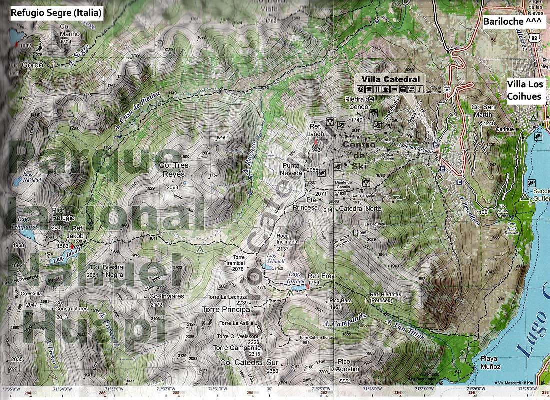
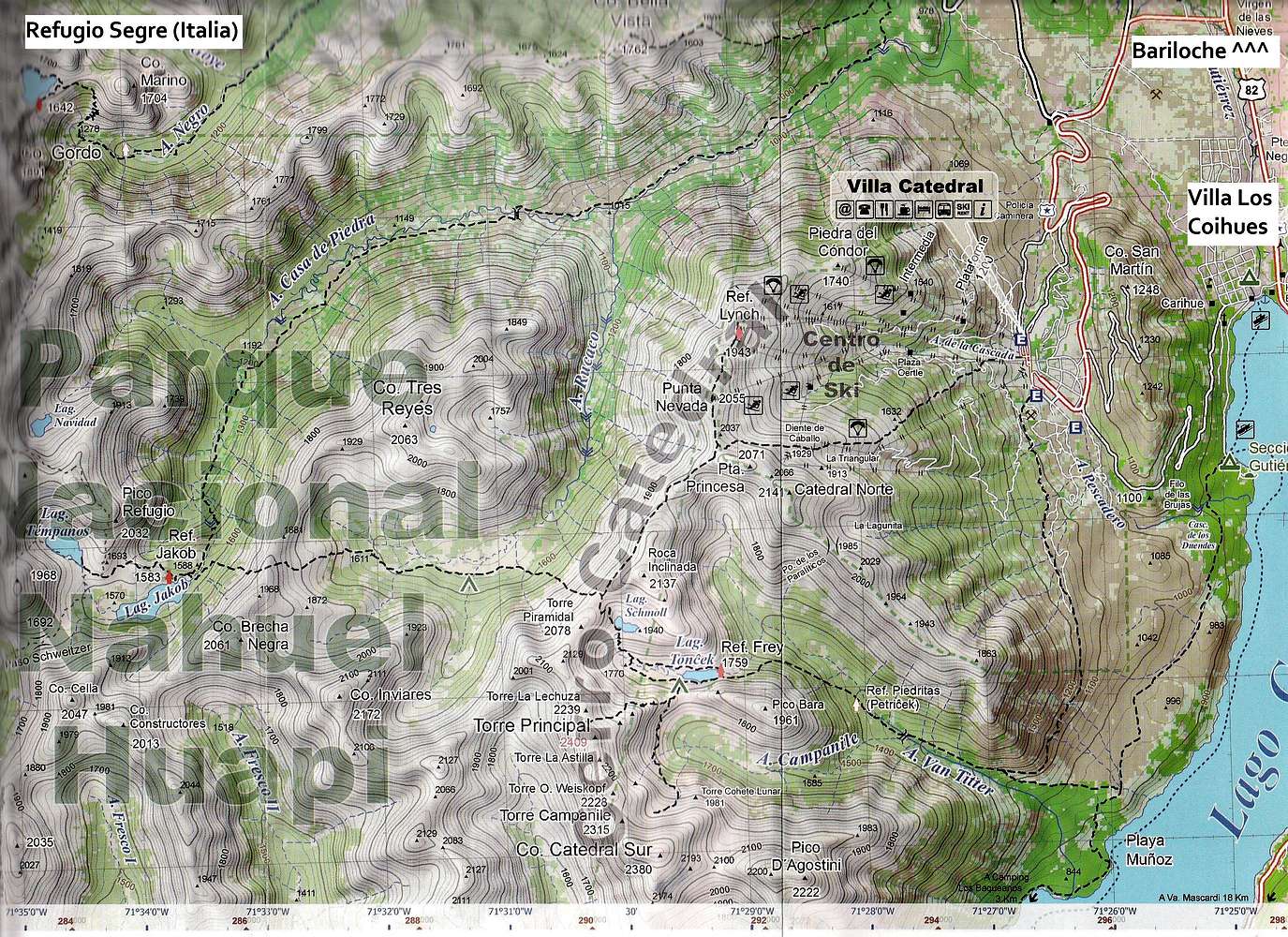
Cerro Catedral route map
View High-Resolution Image
Cerro Catedral route map
Routes around the Frey area. Extract from the Aoneker 1:50,000 San Carlos de Bariloche map available from Club Andino Bariloche.
« PREV
NEXT »
Baarb
on
Feb 18, 2012 1:06 pm
Comments & voting
Other parents
Lat/Lon:
41.19958°S / 71.49696°W
Image Type(s):
Topo/Diagram
Image ID:
777073
5728 Hits
71.06
% Score
1
Votes
Log in to vote
Comments
No comments posted yet.
to post!
Don't have an account?
The Frey (Cerro Catedral)
(Area/Range)
« PREV
Viewing
#65 of 103
GALLERY
NEXT »
Baarb's Image Gallery
« PREV
Viewing
#276 of 361
GALLERY
NEXT »
Photo of the Hour
(Album)
Loading....
×
You need to login in order to vote!
User Name
Password
Remember me
Forgot your password?
Log me out when I close my browser.
Keep me logged in all the time.
sign in as a user
Don't have an account?
Register now for FREE
Rating available
Suggested routes for you
People who climb the same things as you
Comments Available
Create Albums
Register Here


