The page was successfully edited.

|
|
Route |
|---|---|
|
|
37.46970°N / 119.0213°W |
|
|
Download GPX » View Route on Map |
|
|
Hiking |
|
|
Summer, Fall |
|
|
Class 1 - 2 |
|
|
Route
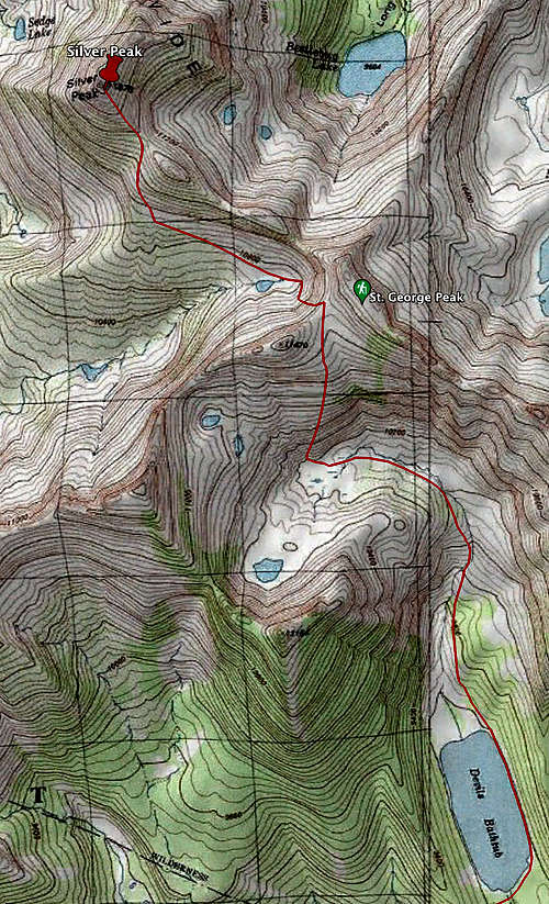
The shortest route to Silver Peak is out of Lake Edison via Devil’s Bathtub, with a round-trip distance of approximately 17 miles and 5,000’ total elevation gain. The net elevation is 4,000’, but you have to drop 500’ from a saddle shortly before the final ridge leading to the summit. The route is class 1 until you start climbing toward the saddle, after which there are some long class 2 rock-hopping sections.
Route from Lake Edison/Devil's Bathtub to Silver Peak:
 |
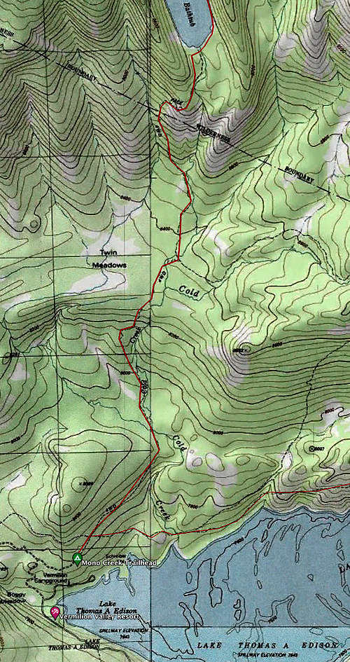 |
Follow the directions on the Silver Peak page to the Devil’s Bathtub trailhead. It’s just over 4 miles and some 1500’ of total elevation, with the steepest part just before the lake, which is the most obvious place to camp if you’re not going to do the trip as a day hike. The east side of the outlet has many large sandy flattish sections that would allow for innumerable campsites. The permit prohibits “Camping within 100 feet of any water source or trail”. Also there are no bear boxes at Devil’s Bathtub itself, but the permit requires counter-balancing your food -- however, convenient big tree limbs are scarce, so you might want to bring a canister. There was no sight or scat of bear when I was there, but you never know.
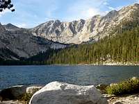
View of Graveyard Ridge from the outlet at Devil's Bathtub. Graveyard Peak is at top right. The route to Silver Peak crosses the saddle at top left.
The Bathtub can be traversed on the right or left side. Once past the Bathtub, move up the the right slope high enough to avoid the brush – there is a faint use trail. Staying well above the creek bed here will also save you from endless bog-tromping , which I did on the way up and highly don’t recommend.
Half a mile or so after leaving the Bathtub you come to a nice section of friction granite. If the granite is wet or icy, or just makes you uncomfortable, Patty Kline reported “an easy route is found on the extreme left side, complete with use trail”. Burd traveled through the trees on the right of the creek.

After the friction granite the canyon turns left -- hike up past the saddle to the head of the canyon. Looking right you will see a ramp leading to the saddle, as mentioned in various trip reports. The ramp is in the center of the photo below. On the return trip, the entrance to the top of the ramp is easy to miss when descending from the saddle – think about placing a duck or two on your ascent. Alternatively, before reaching the end of the canyon you can climb a chute that leads directly to the saddle -- seen to the right of the ramp in this photo. Burd describes the chute as class 2-3.

Note that this is the saddle that is north-west of point 11470 on the 7.5 minute topo, lat/long: 37.459, -119.008. Do NOT head for the saddle on the other side of point 11470 – some parties have reported doing this by mistake – it will take you well out of your way.
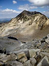
View of Silver Peak from the saddle. The route descends 500' to the tarn in the picture, then follows the base of the ridge. Keep an eye out for the false summit – the reddish point as seen in this picture, just below the real peak. You don't want to climb the false summit; hike around the base and ascend the saddle behind the false summit, then take the ridge toward the true summit.
View from the Silver Peak side of the descent from the saddle . If you like rock-hopping, this section is for you. And you get to do it again on the return. The section near the top is quite steep, but note there are several ramps cutting downwards from left to right that make for an easy descent/ascent.

Summit Panorama -- looking north-west over Sharktooth toward Banner: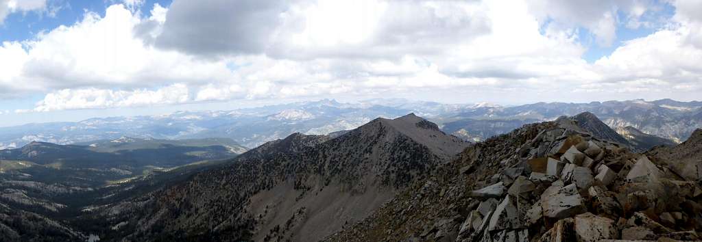
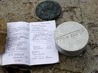
Summit register -- already four entries in 2012!
From Devil’s Bathtub to the peak and back took me 8.5 hours, due to too many rocks and not enough oxygen. From the Bathtub back to the car it was a race to see who would get there first, me or Fatigue. Fatigue won, by about an hour. The consolation prize was a black toenail. But all in all, a great weekend adventure.