
|
|
Mountain/Rock |
|---|---|
|
|
48.36495°N / 122.26856°W |
|
|
Skagit |
|
|
Hiking |
|
|
Spring, Summer, Fall, Winter |
|
|
1727 ft / 526 m |
|
|
Overview
 |
Here is a summit that is good little hike to go for if you are introducing out of conditions friends to hiking or if the weather is bad at higher elevation and still have an urge to get outside and get a quick summit. At first when researching this mountain I had little interest in even putting it up on summitpost because I wasn't expecting much from Devils Mountain. It fits all the criteria for what most Washington state peak baggers affectionately call the "Dumpster Dive" List.
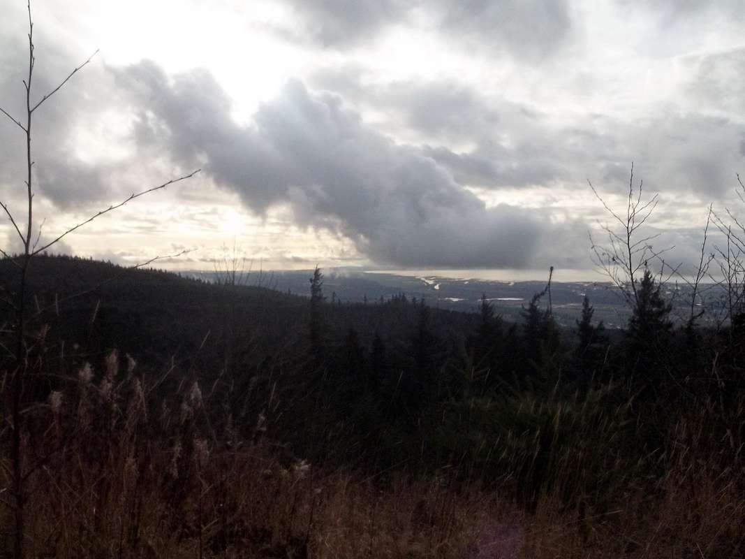
 Views of Devils Lake
That all being said, this summit though ugly in itself with eight communications towers and twenty foot pile of logs on the east end of the summit, has a real charm. For one this peak has excellent views of the Puget Sound and the distant Olympics. With a late fall or early winter low sunlight angle this peak really seems to deliver the views. There is also a great view to the east looking toward Big Lake and the village that is located on it. Finally this summit has a good view of the Cascade Front along with many of the smaller lakes and ponds that surround this summit area.
 More views
As for the true summit, the more natural of the two summit areas in question is actually by the communication towers. There are views very close by that look toward the east towards Big Lake and the Cascade Front. East of the communication towers on what looks to be a lower highpoint area there is large block of logs. Once you climb these logs it actually seems ever so slightly higher than the other summit in question. On top of the log pile someone actually put dirt on top so you can actually stand comfortably on top of it. Use a little caution while climbing up the log pile. Unfortunately I did not have an altimeter so I couldn't measure which is higher but I will conclude that log pile without the twenty feet pile of logs did seem smaller than the communication towers to the east. If you do climb the twenty foot log pile you will be greeted with clearly the best view on the entire summit.
 View from the summit
 The eastern log pile
Getting There
 Map of Drive From Mount Vernon
FROM THE SEATTLE AREA: Get off on the Anderson Road exit from I-5. Head east (right) on Anderson Road. Make a left on Cedardale Road until you reach Blackburn Road. Make a right on Blackburn Road stay on it until you see Little Mountain and Little Mountain on your right. Make a right on Little Mountain Road and take it all of the way down where it ends, which happens to be Amick Road. Take Amick Road roughly a mile to where you see a gated road on left. If you hit Chantrelle Lane you went to far. You will notice that there is one little space for one car right by the gated road.
FROM THE BELLINGHAM AREA: Get off on the Kincaid/Street Exit. Once on the ramp make a left and go over the freeway. Make a right onto Blodgett and take it all the way (roughly 2 miles down to Blackburn Road. Make a left on Blackburn Road stay on it until you see Little Mountain and Little Mountain on your right. Make a right on Little Mountain Road and take it all of the way down where it ends, which happens to be Amick Road. Take Amick Road roughly a mile to where you see a gated road on left. If you hit Chantrelle Lane you went to far. You will notice that there is one little space for one car right by the gated road.
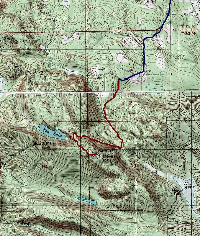
Hiking Map of the Route
 |