Toggle navigation
Mountains
Routes
Images
Trip Reports
Forum
What's New
People
Areas & Ranges
Articles
Trailheads
Canyons
Huts & Campgrounds
Albums
Logistical Centers
Fact Sheets
Lists
Custom Objects
Gear
Plans & Partners
WELCOME TO SUMMITPOST
SIGN IN
REGISTER
Bat
Additional Parents
Image
Map with Bat approach from...
View High-Resolution Image
Map with Bat approach from...
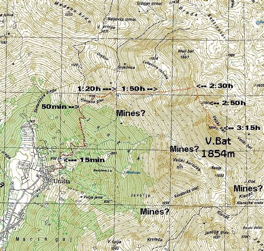
Map with Bat approach from Unista. Red line is interrupted because route isn't marked. This is the best and because of the mines only possible approach today.
Graphics: Aleksandar Gospic
« PREV
NEXT »
Velebit
on
Jan 13, 2005 11:42 am
Comments & voting
Other parents
Lat/Lon:
44.05400°N / 16.48750°E
Image ID:
85100
3448 Hits
74.21
% Score
5
Votes
Log in to vote
Comments
No comments posted yet.
to post!
Don't have an account?
Bat
(Mountain/Rock)
« PREV
Viewing
#22 of 25
GALLERY
NEXT »
Velebit's Image Gallery
« PREV
Viewing
#1342 of 1984
GALLERY
NEXT »
×
You need to login in order to vote!
User Name
Password
Remember me
Forgot your password?
Log me out when I close my browser.
Keep me logged in all the time.
sign in as a user
Don't have an account?
Register now for FREE
Rating available
Suggested routes for you
People who climb the same things as you
Comments Available
Create Albums
Register Here


