Page Type Page Type: Trip Report
Location Lat/Lon: 45.78638°N / 7.37082°E
Date Date Climbed/Hiked: Nov 30, 2015
Activities Activities: Hiking
Seasons Season: Spring, Summer, Fall, Winter

Interview wanders & melancholic Overview


They say that the murderess always returns to the scene of the crime. It may be true, but it certainly changes the mask on his face, the clothes and the way he moves. Everything else remains the same and unchanging in Time and, if you want to search, found the clues and traces of a step away. Almost ancient. Remain carved in the rock and on the bark of trees, but unfortunately disappear in the snow making lose the evidence of a certain and true guilt. This is also highlighted Sundial on the side of the Blavy Chapel measuring the passage of time: "1786 Ma petite ombre mesure ta vie" or "1786 My tiny shadow mesure Your Life". But then, unhappy, afraid of not being understood by men, he insists so clearly peremptory

L'AMOUR ET LA JEUNESSE
C'EST UN SIMPLE PASSAGE
COMME LE SOLEIL ET SON OMBRAGE


Blavy Hamlet (1475m) at the foot of Viou Comba


Dicon che l'assassino torni sempre sul luogo del delitto. Può esser vero, ma sicuramente cambia la maschera sul volto, gli abiti ed il suo modo di muoversi. Tutto il resto rimane uguale ed immutabile nel Tempo e, se avete voglia di cercare, ritrovate gli indizi e le tracce d'un passaggio lontano. Quasi antico. Rimangono scolpite nella roccia e sulla corteccia degli alberi, ma purtroppo scompaiono nella neve facendo perdere le prove di una sicura nonché certa colpevolezza. L'afferma anche la Meridiana sul lato della Cappella di Blavy misurando lo scorrere del tempo: "1786 Ma petite ombre mesure ta vie". Ma poi, insoddisfatta ed avendo paura di non esser dagli uomini facilmente e chiaramente compresa, insiste in modo palesemente perentorio

L'AMOUR ET LA JEUNESSE
C'EST UN SIMPLE PASSAGE
COMME LE SOLEIL ET SON OMBRAGE


Bca de Roisan divides Baltea Valley from Gr. St. Bernard & Valpelline


Legend tells that, knowing he had to arrive Napoleon, wanted to warn to the same that the inhabitants of the Common of Roisan and Villages Parleyaz Blavy and the fact that the War is harmful and that the Glory goes by quickly, while the mountains remain eternally in their place. Smiling to the stupidity of men. Those of Blavy, summoned the Pastor, they provided to issue the message, while those of the underlying Parléaz, as good "pimps" to curry favor with the General, decided to build a Napoleonic fireplace on the roof of a house at the entrance of the tiny village. That still exists today and it is dated 1748. But Bonaparte took his time and crossed the Great St. Bernard only in May 1800. As we did that, after having wandered around here at the beginning of the Sixties, we have returned more than half a Century later to check if everything was in order and if these mountains were still in place. A small turn over Roisan, Aosta, St. Christophe, Quart. To inspect above our house, because you never know what happens ...


"Famous" Bca de Viou over Aosta & Roisan Common


La Leggenda racconta che, sapendo che dovesse arrivare Napoleone Bonaparte, voleva avvisare sia il medesimo che gli abitanti del Comune di Roisan e dei Villaggi di Blavy e Parleyaz sapendo che la Guerra é nefasta e la Gloria passa in gran fretta, mentre le Montagne rimangono eternamente al loro posto. Sorridendo della stupidità degli uomini. Quelli di Blavy, convocato il Parroco, provvidero ad emanare il messaggio, mentre quelli sottostanti a Parléaz, da buoni ruffiani" per ingraziarsi il Generale, pensarono di erigere un camino napoleonico sul tetto d'una casa all'ingresso del minuscolo villaggio. Che esiste ancora oggigiorno e porta la data del 1748. Ma il Bonaparte se la prese comoda e passò il Gran San Bernardo soltanto nel Maggio del 1800. Com'abbiam fatto noi che, dopo avere gironzolato da ste parti agli inizi degli Anni Sessanta, siam tornati più di mezzo Secolo dopo per controllar se tutto fosse in regola e se queste montagne eran ancor lì al lor posto. Un giretto sopra di Roisan, Aosta, St. Christophe e Quart. Ispezionando sopra casa nostra, perché non si sà mai che succeda ...


But not all the peaks are renowned and someone is unknown

Traveling almost 360 °


Before towards the Grandes Jorasses ...


Because the life of a man has a Time-Space very limited. As he gets older, perhaps without realizing it and thinking that everything remains unchanged, however, everything changes. Especially with him and in him. He does not realize looking in the mirror and looking at the mountains. It all seems immutable, as if time has stood still. However it is not so and is simply trying to get back the same. A rise, a climbing again. Where did you spend running in all seasons and from any distance; where everything it seems easy, or at least a lot less difficult. They were certainly smaller, lower and less important. But then measuring them you realize that they are always the same height and have always the same forms. Stone in more or less rock, more or less wide snowfields, steep or expanded. Then you think of an evil curse, to something that you want to interfere in the course of life. Changing to you the cards on the table. Sure, it is certainly the case and there not are other explanations. Incidentally, regarding the Summits, you realize that they are always the same. As twenty, thirty, forty and more than half a Century ago. A bad devil or at least an elf prankster who wants to take you around. Instead then you realize that you are that you kidding yourself and that now do not have to think "above", but that you have to settle for "around" ...


Then moving to the NE towards the Grand Golliaz ...


Perché la vita d'un uomo possiede un Tempo-Spazio molto limitato. Mentre lui invecchia, magari senza accorgersene e pensando che tutto rimanga invariato, invece tutto cambia. Soprattutto con lui e dentro di lui. Non se n'avvede guardandosi allo specchio e nemmeno osservando le montagne. Sembra tutto immutabile, quasi che il tempo si fosse fermato. Invece non é così ed é sufficiente provare a risalire le stesse. Là dove passavi correndo in tutte le stagioni e da qualsiasi distanza; là dove tutto sembrava facile od almeno molto meno difficile. Erano certamente più piccole, più basse e meno impertinenti. Ma poi misurandole t'accorgi che son sempre alte uguali e possiedono sempre le stesse linee e forme. Sasso in più o sasso in meno, nevai più o meno larghi, ripidi od espansi. Allora pensi ad un maleficio diabolico, a qualcosa che ti vuole ostacolare nel corso della vita. Cambiandoti la carte in tavola. Sicuro, é certamente così e non ci son altre spiegazioni. Daltronde, riguardando le Vette, t'accorgi che son sempre uguali. Come venti, trenta, quaranta e più di mezzo Secolo orsono. Un diavolo cattivo od almeno un folletto burlone che vuole prenderti in giro. Invece poi t'accorgi che sei tu che prendi in giro te stesso e che da oggi non devi più pensare "above", ma che ti devi accontentare soltanto d'"around" ...


It closes the Northern Horizon with the V'lan & Grand Combin ...


Because time it is gone is inexorably and never come back.
Even Becca di Pechenville or Roisan has become a chimera, a past reminder, a faded memory that disappears in the cold of winter. Now you can only look from the bottom and turn around looking for new destinations, different objectives and renewed illusions that help later in existence. But no matter, because even this is a new season. Above four Communes ...


But then he reopens to SW Gr. Rousse, Bioula, Nomenon & Grivola ...


Perché quel tempo é inesorabilmente passato e non tornerà più.
Anche la Becca di Pechenville o di Roisan é diventata chimera, un tramontato ricordo che s'eclissa nel freddo dell'inverno. Adesso puoi solo guardar dabbasso e girare intorno cercando nuove mete, diversi obiettivi e rinnovate illusioni che aiutano nel prosieguo di nostra esistenza.
Ma non importa, perché anche questa é una nuova stagione. Sopra quattro Comuni ...


Even Bca Pechenville does not you respect more ...

A 3-day trek from NW to SE


Reached Alp Praperiaz (1737m) you can admire the Mont Velan ...


First Day: ascent to the two Viou Alps and Hill with Bivouac "Penne Nere" (2078m, 2202m, 2696m, 2730m) and Variant towards the nearby Praperiaz Pastures
Once we went to Blavy walk through Sorreley and Parléaz or Parleyaz. Then he went up into the woods, passing the ruins of Varbre reaching the Alps Lower and Upper Viou and from these to the nearby hill of the same name; from this is going towards the Becca Viou and the nearby Mont Mary. Even in the both, even in winter, even in January. Starting by bike from the valley floor, the other side of the Baltea and leaving the same in Sorreley; then up and no one could stop you and not encountering a living soul. No phone, poorly dressed and defying the avalanche. More and more he is waiting to be heard and seen, because the winters were surely richest of snow and the cold more biting.
Then some time after, from Sorreley (790m), Fraction of St. Christophe Municipality, is climbed by car to Blavy (1475m), followed on foot the farm dirt road to the junction 1527 metres and, leaving North the fork to the Alpe Parléaz (1737m), he continued with the same Eastward reaching Varbre (1667m) and, after seven hairpin bends more or less wide in the forest, we reached the Alpe di Viou Bottom (2078m). From this a path for pasture not numbered and not reported goes up immediately to the North, through steep meadows, reaching a height of about 2250 metres with n° 25/105, ex 1A and through larger circle comes from the Alps of Upper Viou or Tsa de Viou (2078m). The same climbs to Viou Hill (2696m), at that time no bivouac, finally Becca Viou (2856m) or Mary (2815m). Maybe even both, first toward one and then the other.
Now in modern times, you go up to Alpe di Viou Lower drive through the dirt road, although it is prohibited without a valid permit as private, and this with the shortcut or around larger tour first East and then North climb with the trail n° 25/105 doing everything else, but meeting just above the Colle di Viou, on the slopes of Mont Trembloz, the Bivouac "Black Feathers" or "Penne Nere" (2730m), nice, friendly, free and always open with ten beds and gas kitchen. Then it goes upwards to Viou, few people to the Mary.
We make a mediation: few start today by Blavy, even rarer by Senin, Sorreley or Porossan on the valley floor. We suggest from Blavy reach the junction 1527 metres and, temporarily leaving the deviation to the East towards the Alps of Viou, reach the Praperia or Praperiaz Pastures, at the foot of Becca's Roisan (2546m) and over the Municipality of the same name. Here you will find a huge 180° panorama that from Grivola to South wheel Westward to the Grandes Jorasses and North to the Mont Velan and Combins. Then returned to the fork and take the remaining crossing the Alps Viou and going to sleep at the bivouac without climbing nor Viou nor Mary. Here the view opens to 340°.

 To Mount Mary : let s go,it s late !
L alpe Viou (2062 m)
around four ... Becca de Viou Southwestern Face 2015
Il bivacco Penne Nere (2730 m) 28-11-2006
Mont Mary


From Praperia Alpages across the Alps Viou, ascending to Bivouac "Black Feathers" located on the Viou Hill between Becca Viou & Mont Mary


Prima Giornata: salita alle due Alpi e Colle di Viou e Bivacco "Penne Nere" (2078 m, 2202 m, 2696 m, 2730 m) con Variante verso l'Alpe Praperia o Praperiaz
Una volta s'andava a Blavy a piedi, passando per Sorreley e Parléaz o Parleyaz. Poi si saliva nel bosco passando il rudere di Varbre raggiungendo le Alpi Inferiore e Superiore di Viou e da queste al soprastante omonimo colle; da questo si andava alla Becca di Viou ed al vicino Mont Mary. Anche a tutte e due, anche in inverno, pur a Gennaio. Partendo in bicicletta dal fondovalle, dall'altra parte della Dora Baltea e lasciando la stessa a Sorreley; poi sù senza che nessuno potesse fermarti e non incontrando anima viva. Senza telefono, scarsamente vestiti e sfidando la valanga; questa sempre più in attesa di farsi sentire e vedere, perché gli inverni eran sicuramente più nevicosi ed il freddo pungente.
Poi qualche tempo appresso, da Sorreley (790 m) si saliva in auto fino a Blavy (1475 m), si seguiva a piedi la strada poderale fino al bivio 1527 metri e, lasciando a Settentrione la biforcazione verso l'Alpe di Parléaz (1737 m), si continuava con la medesima verso Oriente raggiungendo Varbre (1667 m) e, dopo sette tornanti più o meno larghi nella foresta, si raggiungeva l'Alpe di Viou Inferiore (2078 m). Da questa un sentierino da pascolo non numerato e non segnalato saliva subito a Nord, attraverso ripidi prati, raggiungendo a quota 2250 metri circa quello n° 25/105, ex 1A che con giro più largo arriva dall'Alpe di Viou Superiore o Tsa (2078 m). Con lo stesso si saliva al Colle di Viou (2696 m m), a quei tempi privo di bivacco, per concludere alla Becca di Viou (2856 m) o al Mont Mary (2815 m). Magari anche ad entrambi, prima l'una e poi l'altro.

around four ... Parléaz or Parleyaz ancient Village 2015
<i> Margherita Bernardo & Barbara </i> Parléaz Chapel 2015
Tour above Parleyaz Village Napoleonic chimney 2015
around four Commons 1786 Blavy Chapel Sundial 2015
Tour above & around Blavy Hamlet ancient Chapel 2015


By St. Christophe Sorreley Fraction towards Parléaz or Parleyaz with Napoleonic chimney & Blavy Villages with Sundial on the ancient Chapel


Adesso nei tempi moderni, si va fino all'Alpe di Viou Inferiore in auto tramite la strada poderale, anche se é vietata senza regolare permesso poiché privata, e da questa con la scorciatoia o con giro più largo prima ad Est e poi a Nord si sale con il sentiero n° 25/105 facendo tutto il resto, ma incontrando appena sopra il Bolle di Viou, alle pendici del Mont Trembloz, il Biv. "Penne Nere" (2730 m), bello, ospitale, gratuito e sempre aperto con una decina di posti letto ed il fornello a gas. Poi si và sù alla Viou, in pochi al Mary.
Facciamo una mediazione: pochi partono ancor oggi da Blavy, ancora più rari da Senin, Sorreley o Porossan sul fondovalle. Vi proponiamo di farlo da Blavy e raggiungere il bivio 1527 metri e, lasciando momentaneamente la deviazione ad Est verso l'Alpi di Viou, raggiungere l'Alpe di Praperia o Praperiaz, posta ai piedi della Becca di Roisan (2546 m) ed al di sopra dell'omonimo Comune. Qui troverete un grande panorama a 180° che dalla Grivola a Sud ruota verso Ovest alle Grandes Jorasses ed a Nord verso il Mont Velan ed i Combins. Poi rientrate al bivio e fate il restante attraversando all'Alpi di Viou e salendo a dormire al bivacco senza salire né la Viou né il Mary. Qui il panorama s'apre a 340°.


Coming down by bivouac and crossing to the East reach Sénevé Comba ...


Second Day: descent by bivouac to the Viou Alps and crossing in East under Mont Mary Southern Slope towards Senevé Alp into homonym Comba (2206m)
On the trail of ancient Shepherds
: the day after coming down with the same path n° 25/105 to Alpe di Viou Superior, but not down to that of Under. Viou means "Old", but would be more accurate to say "Ancient"; as the very old and semi-abandoned path unnumbered and not reported that, crossing first in Southeast and then Northeast, reaches the bottom of the deep and narrow vallon that descends to the South from Mont Mary. This, in appearance really desolate and lunar, separates the adjacent Comba of Sénevé, where another important and isolated pasture dominates the valleys above the Common of Quart. Passing over those of Aosta and Saint Christophe. You do not find water, but then, knowing look, found a small spring immediately above. the same path is not difficult, but just never the banal. Crossed the center line into the same "reborn" becoming route n° 22, where, with more frank and clear path to the East-northeast, reaches the altitude 2362 metres, rounding the next headland as a rocky-debris promontory, descending to the Senevé Pastures. An ancient path of connection that links the mountain pastures of the Valley of the Great St. Bernard Pass to the West (to us specifically over Roisan) to those of the Central Valley of Dora Baltea up to the Municipalities of Quart and Nus, now at the entrance to the Valley of Saint Barthélemy. Transhumance that is lost in the mists of time and that marked the rhythm of life even before the advent of the ancient People of the Salassi and that meant that they might, thanks to an economy totally rural and pastoral, survival for all those people, including the old Bourg of Cordelia or Cordella, that then became Town of Augusta Praetoria Salassorun and, actually, the City of Aosta. A tradition fallen somewhat after the Second World War with the transformation of the first in industrial and then to tourism, so much so that, while that of Sénevé are still herds of cows, the Alps Viou graze only steers almost solitary. From here you can also go down to the valley floor, but you should stop one night asking for hospitality and maybe sleeping in a barn of this great alp recently renovated. This choice "expand" your possibilities for the next day giving you more chances to visits cultural-historical-religious-archaeological. By Comba's Senevé you will enjoy a panorama of more than 220° on the South side of almost all the Aosta Valley.

Penne Nere bivouac
 NW Crest Mount Mary s
Mont Mary and Becca di Viou
SW side of Mont Mary <i>(2815m)</i>
Il Mont Mary...


From the Camp "Penne Nere" (2730m) back to the Alpe di Viou and crossing Mary in its Southern base reach Sénevé Pasture (2199/2206m)


Secondo Giorno: discesa dal bivacco alle Alpi di Viou e traversata ad Est sotto il Versante Sud del Mont Mary all'Alpe di Senevé nell'omonima Comba (2206 m)
Sulle tracce di antichi Pastori
: il giorno appresso scendete con lo stesso sentiero n° 25/105 fino all'Alpe di Viou Superiore, ma non calate a quella di Sotto. Viou significa "Vecchio", ma sarebbe più giusto dire "Antico"; come il vecchio e semi abbandonato sentiero non numerato e non segnalato 
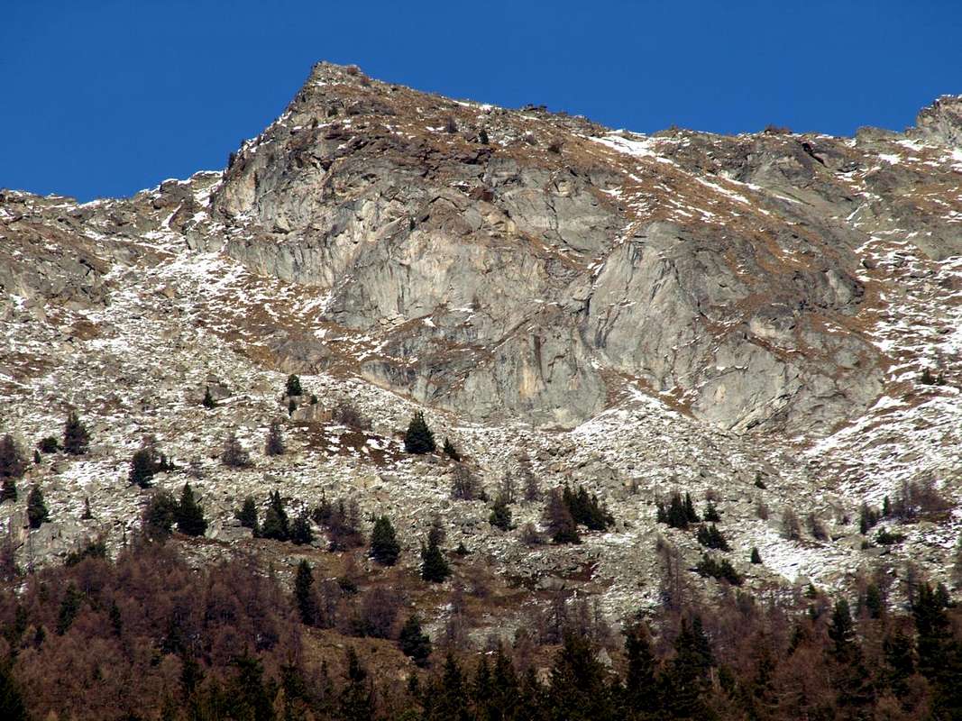
che, attraversando dapprima a Sudest e poi a Nordest, raggiunge il fondo dello stretto e profondo vallone discendente verso Mezzogiorno dal Mont Mary. Questo, di aspetto veramente e desolatamente lunare, separa dalla attigua Comba di Senevé, dove un'altro importante ed isolato alpeggio domina i valloni sopra il Comune di Quart. Transitando sopra quelli di Aosta e Saint Christophe. Non trovate acqua, ma poi, sapendo cercare, trovate una piccola sorgente appena al di sopra. il percorso del medesimo non é difficile, ma altrettanto mai banale. Oltrepassata la mezzeria lo stesso "rinasce" diventando sentiero n° 22 dove, con percorso più franco ed evidente verso Ovest raggiunge la quota 2362 metri e doppiando il promontorio successivo scende all'Alpe di Senevé. Un antico sentiero di collegamento che lega gli alpeggi della Valle del Gran San Bernardo ad Ovest (per noi specificamente sopra Roisan) a quelli della Valle Centrale della Dora Baltea fino a raggiungere i Comuni di Quart e Nus, ormai allo ingresso della Valle di Saint Barthélemy. Una trasumanza che si perde nella notte dei tempi e che segnava il ritmo della vita ancora prima dello avvento del Popolo dei Salassi e che comportava la possibilità, grazie ad una economia totalmente agreste e pastorale, di sopravvivenza per tutte quelle popolazioni, compresa l'antica Città di Cordelia, poi diventata Augusta Praetoria Salassorum. Una tradizione decaduta alquanto dopo la Seconda Guerra Mondiale con la trasformazione dell'economia prima in industriale e poi turistica, tanto che, mentre a quella di Senevé troviamo ancora le mandrie di vacche, alle Alpi di Viou pascolano soltanto i manzi quasi solitari. Da qui potete anche scendere verso il fondovalle, ma vi consigliamo di fermarvi una notte chiedendo ospitalità e dormendo magari in una stalla di questa grande alpe da poco tempo ristrutturata. Questa scelta "allargherà" 
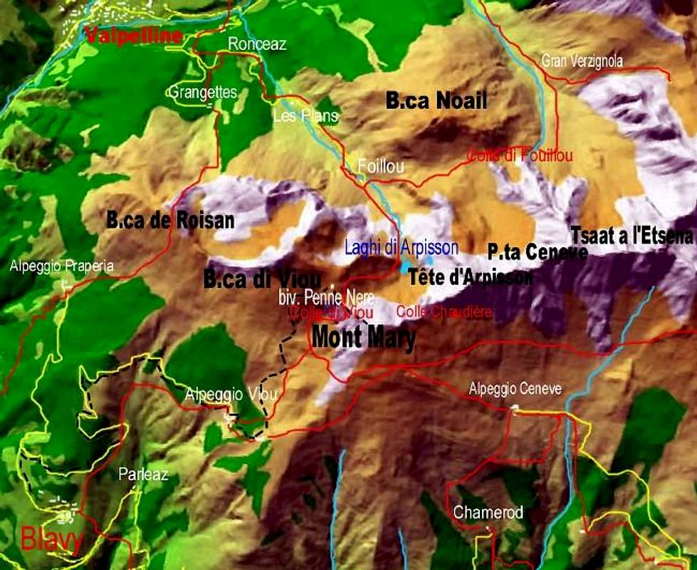
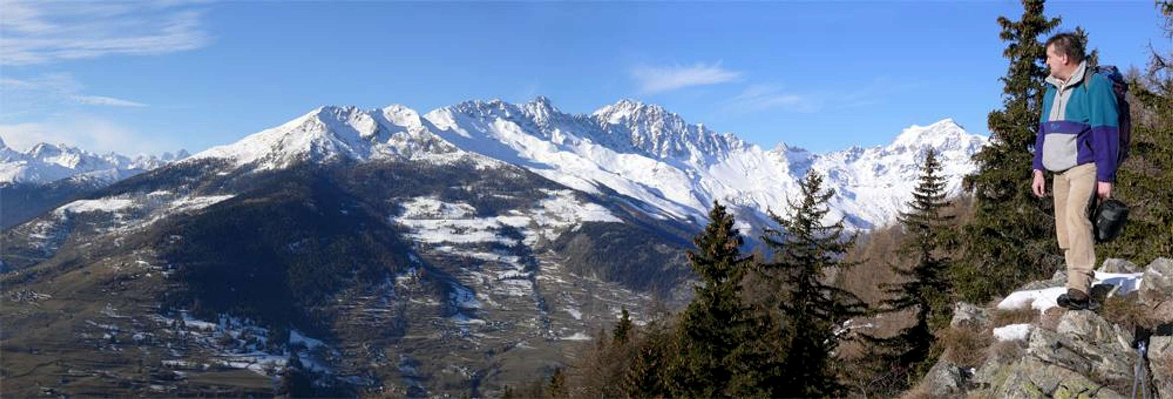
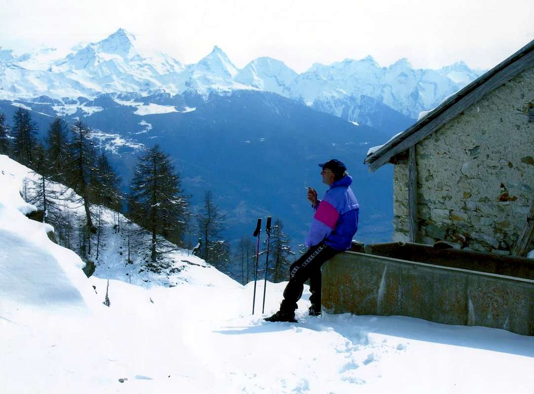
le vostre possibilità per il giorno successivo dando a voi più possibilita per visite culturali-storico-religioso-archeologiche. Dalla Comba di Senevé potete godere d'un panorama d'oltre 220° sul lato Meridionale di quasi tutta la Val d'Aosta.


Senevé we can go down towards valley floor in three different ways ...


Third Day: descent from the Alp Cénevé towards valley floor (Quart) with different possibilities and even cultural visits, historical-religious and archaeological
As we go down to the valley floor? There are several possibilities including three or four most important, and we must keep in mind the logistical plan for the return to city.
1)- From Alpe di Sénevé descend directly to the South via the path n° 1 that, after crossing wide meadows and subsequent forest, reaches an old ruin (1898m) before a water outlet and inserting itself on the private dirt road. Continuing with the same, concomitant path and passing Alpe Prailles or Prayes with four large hairpin bends, you will reach the renovated chalet (1745m) where, abandoning the farm road to the west, just continue with the path reaching the old Village Chamerod (1614m). Always with the same path, adjacent to the farm road that cuts the same reaching the Pastures of Borelly (1483m), Ayette, one unnamed at hairpin bend of the road (1376m), the next hairpin bend 1306 metres alongside the Ru (Brook) de Vernier and where begins the private road (no entry for the cars), just before a water outlet and the isolated Village Praillon or Prayon (1128m). From this, where ending the Municipal Roads from St. Christophe and by Quart, down with two options: a)- with the same reach the Village Morgonaz (1205m, 1181m) and from this the path always n° 1, passing through the small Villages of Etavel, Elobert (1003m), Crétaplana (927m), Moulin du Château, Fourneille, Château de Villair get to 
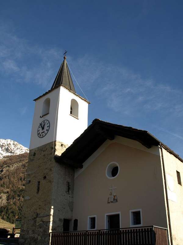
Church of St. Nicholas (774m). b)- From Morgonaz down to Jeanceyaz (1087m; Church of San Leonardo), Cretallaz (1087m), an important junction for "La Montagne" or "The Mountain Area" (1025m, the road continues West to the Villages Parléaz and Blavy), Veynes, and Maillod Sorreley (790m), now in the Municipality of St. Christophe, or on-site, "Saint Cretoublo". From this, passing near the Villages of Thovex and Senin, the junction 692 metres and from this to the Southwest to the Castles Passerin d'Entrèves, Alpine Military School or Jocteau and Aosta, while in Southeast, passing Fontanalle, towards St. Christophe-Chieftown (619m).


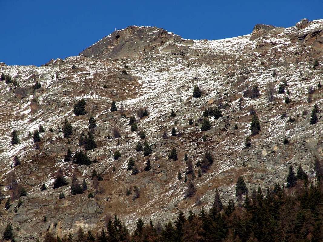
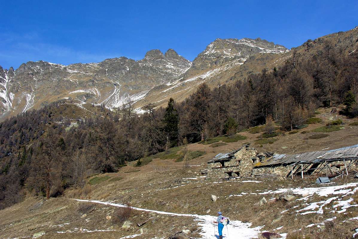
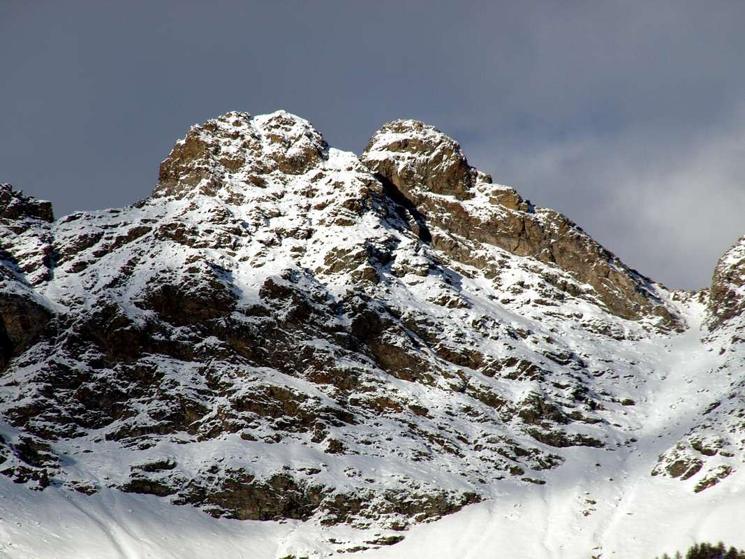
Tsaat a l'Etsena & Fana Pass at the end of crossing on Cénevé Comba ...


2)- From Alpe di Sénevé descend in diagonal to the Southeast through the farm dirt road che, passing through the Alpe Lattaz (1935m) almost in ruins, it is directed more towards the South then reaching those Chamoussin Dèsott and Damon (1940m, 1856m). From here, flexing further south-southeast, it is directed towards the village of Trois Villes-Avisod (1398m). Do not follow it to the village, but about 1 mile before, reaching a height of 1425 metres arrive to a crossroads that goes down towards the Southwest Valseinte Pasture (1399m). From this a narrow farm road descends steeply to the South along the entire steep rocky and "mysterious" Val Sainte or Valseinte until you reach the Oratory of Saint Emeric or Americo (1130m). From this (small open-air altar surmounted by a Cross) a path not marked and unnumbered descends on long-wooded promontory rocky remaining high above the torrent until you reach the Château du Villair (774m). This in South to Quart or West towards St. Christophe.
3)- from the previous crossroads about 1425 metres continue on the private dirt road reaching the Village 
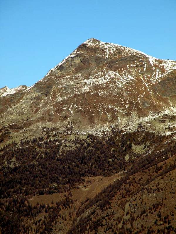
Avisod (1398m) at the foot of Croix de Fana (2212m) and by this fall with two possibilities: c)- by the Regional Road towards the Villages of Porsan (1299m) , Buignod (1135m) , Ville sur-Nus-Planeville (1113m); from this last a farm road go down to Novus (968m) where a trail marked but not numbered reaches that of Vollein (891m) neighboring the homonymous Neolithic Necropolis, dating to 3000 BC and worth a visit (also adjacent Gym Rock). d)- Fall further by Planeville with the Regional Road towards the hamlets of Fornail (1082m) and Vignil (946m); from this a secondary street, but in asphalt, it is directed to the East towards the Vollein's Necropolis. Finally, wanting to close our three-day trip, two more reports: e)- by Avisod you can make a visit to the 
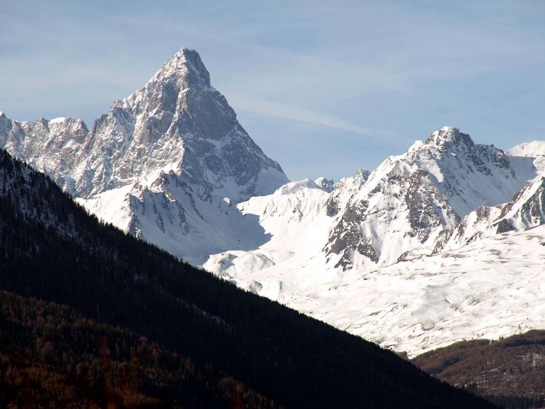
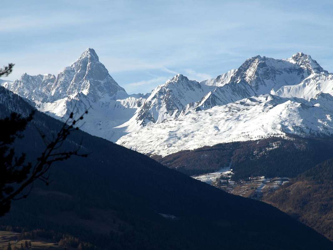
"Monument to the Partisan" in front of the imposing Mountain Ranges of Punta Tersiva (3518m), the Group of Rouèses (3357m) and Monte Emilius (3559m). Just over the small Church take a small asphalt road leading to the Village Effraz (1487m) but leave it almost immediately; a short descent leads to this evocative area. f)- from the Village of Porsan (1299m), one of three of Trois Villes, a unnumbered path down to West-southwest coming near to Porsod (1063m) from which crosses the West f/1)- to the Valseinte and the Oratory of Saint Emeric, while another f/2)-, down more in the Southwest, reaching the small villages of Verney and Josué (671m) just under the Château de Quart or Villair and then to the Commons of St. Christophe or Quart. From Vignil that remains is down to the valley floor at Quart-Villefranche (557m), maybe going to visit the nearby isolated and Tour de Chétoz just above the State Road n° 26 and nearby the locality of La Plantaz, in the direction of Nus Commune.

Tour above Bca de Viou <i>(2856m)</i> from Southwest 2015
M. Mary Tête d Arpisson & Punta di Senevé by SE 2006
Aosta / 4a Chamerod Village old wooden  Rascard  1972
Ancient tree & Arpisson s Head above Senevé Alpage
Around ... from Senevé towards Comba Dèche 2015


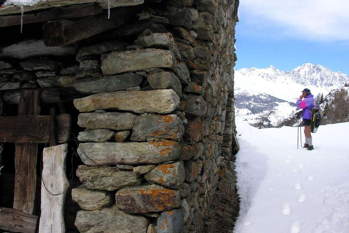
By Viou little Basin reached Cénevé Comba can drop towards 1) Senevé Alpage; 2) Chamerod Village; 3) Trois Villes below Croix de Fana


Terza Giornata: discesa dall'Alpe Senevè verso il fondovalle (Quart) con diverse possibilità ed inoltre anche di visite culturali-storico-religioso-archeologiche
Come scendiamo a fondovalle? Diverse sono le possibilità tra le quali tre o quattro le più importanti, mentre bisogna tenere presente il piano logistico per il rientro in città.
1)- dall'Alpe di Senevé scendere direttamente verso Sud tramite il sentiero n° 1 che, dopo avere attraversato ampi prati e la successiva foresta, raggiunge un vecchio rudere (1898 m) prima d'una presa dell'acqua ed inserendosi sulla strada poderale. Continuando con la stessa, concomitante al sentiero e passando l'Alpe di Prailles o Prayes con quattro larghi tornanti, si raggiunge una baita ristrutturata (1745 m) dove, abbandonando ad Ovest la poderale, si prosegue solo con il sentiero pervenendo al vecchio Villaggio di Chamerod (1614 m). Sempre con lo stesso sentiero, adiacente alla poderale, si taglia la medesima raggiungendo gli Alpeggi di Borelly (1483 m), Ayette, Lo Clou 1420 m), uno innominato presso tornante a gomito della strada (1376 m), il successivo tornante 1306 metri a fianco del Ru de Vernier e dove inizia la poderale (divieto di transito ai mezzi), appena prima di una presa dell'acqua e dell'isolato Villaggio di Praillon o Prayon (1128 m). Da questo, dove terminano le Strada Municipali da St. Christophe e da Quart, scendere con due possibilità: a)- con la medesima procedere verso il Villaggio di Morgonaz (1205 m/1181 m) e da questo con il sentiero sempre n° 1, passando per i Villaggetti di Etavel, Elobert (1003 m), Crétaplana (927 m), Moulin du Château, Fourneille arrivare al Château de Villair-Chiesa di San Nicola (774 m). b)- Da Morgonaz scendere a Jeanceyaz (1087 m; Chiesa di San Leonardo), Cretallaz (1087 m), importante bivio per "La Montagne" (1025 m; ad Ovest continua la strada per i Villaggi di Parléaz e Blavy), Veynes, Maillod e Sorreley (790 m), adesso nel Comune di St. Christophe o, in loco, "Saint Cretoublo". Da questo, passando presso le Frazioni di Thovex e Senin, al bivio 692 metri e da questo verso Sudovest ai Castelli Passerin d'Entrèves, Scuola Militare Alpina o Jocteau, dedicato al Generale degli Alpini Antonio Cantore e visitato da nomi illustri quali quattro Presidenti della Repubblica, ed Aosta, mentre a Sudest, sorpassando Fontanalle, si scende verso St. Christophe-Capoluogo (619 m).
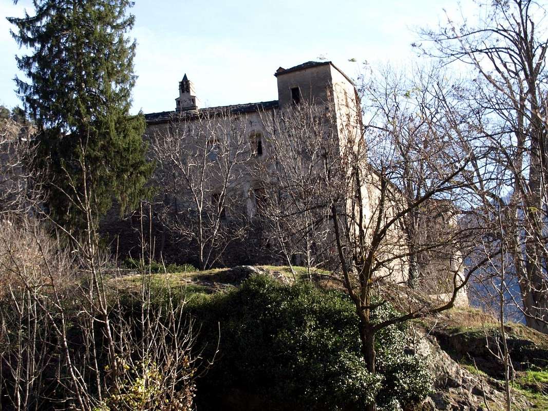


Villair-de-Quart Castle with wooden area towards St. Emeric Oratory ...


2)- dall'Alpe di Senevé scendere in diagonale a Sudest tramite la poderale che, passando per l'Alpe Lattaz (1935 m) quasi in rovina, si indirizza poi più a Sud raggiungendo quelle di Chamoussin Damon e Dèsott (1940 m, 1856 m); da qui, flettendo più ad Sud-sudest, si indirizza verso il Villaggio di Trois Villes-Avisod (1398 m). Seguirla ma non raggiungerlo, bensì circa 1 Kilometro prima a quota 1425 metri pervenire ad un bivio che scende verso Sudovest all'Alpe Valseinte (1399 m). Da questa una stretta poderale cala decisamente a Sud percorrendo tutta la ripidamente rocciosa e "misteriosa" Valseinte o Val Sainte fino a raggiungere l'Oratorio di Saint Emeric o Americo (1130 m). Da questo (piccolo altare all'aperto e sormontato da Croce) un sentiero non segnalato e non numerato scende verticalmente sul lungo promontorio boschivo-roccioso restando alto sopra il torrente fino a raggiungere il Château du Villair (774 m). Da questo in Sud al Comune di Quart oppure ad Ovest verso quello di St. Christophe.
3)- Dal precedente bivio 1425 metri circa continuare sulla poderale raggiungendo il Villaggio di Avisod (1398 m) ai piedi della Croix de Fana (2212 m) e da questo scendere con due possibilità: c)- tramite la Strada Regionale verso i Villaggi di Porsan (1299 m), Buignod (1135 m), Ville sur Nus-Planeville (1113 m); da questo ultimo una strada poderale scende verso Novus (968 m) presso il quale un sentiero segnalato ma non numerato raggiunge quello di Vollein (891 m) nelle vicinanze dell'omonima Necropoli Neolitica, databile al 3000 avanti Cristo e meritevole d'una visita (inoltre attigua Palestra di Roccia). d)- Scendere ancora con la Regionale da Planeville ai Villaggi di Fornail (1082 m) e Vignil (946 m); da questo una strada secondaria, ma in asfalto, s'indirizza ad Oriente verso la Necropoli di Vollein. Infine, volendo chiudere il nostro viaggio di tre giorni, ancora due segnalazioni: e)- da Avisod si può effettuare una visita al "Monumento al Partigiano" di fronte alle imponenti Catene Montuose della Tersiva (3518 m), delle Rouèses (3357 m) e del Monte Emilius (3559 m). Prendere appena oltre la piccola Chiesa una strada in asfalto che conduce al Villaggio di Effraz (1487 m) ma abbandonarla quasi subito; una breve discesa conduce a questa suggestiva area. f)- Dal Villaggio di Porsan (1299 m), uno dei tre di Trois Villes, un sentiero non numerato scende verso Ovest-sudovest arrivando nei pressi di quello di Porsod (1063 m) dal quale attraversa ad Ovest f/1)- verso la Valseinte e l'Oratorio di Saint Emeric, mentre un altro f/2)-, scendendo più a Sudovest, raggiunge i Villaggetti di Verney e Josué (671 m) sotto il Château de Quart o Villair e quindi ai Comuni di St. Christophe o Quart. Da Vignil non rimane che scendere a valle presso Quart-Villefranche (557 m), magari passando a visitare la vicina isolata Tour de Chétoz sopra la Statale presso la località La Plantaz.

Trois Villes Monument to the Partisans Fighters 2015
around four ... Jeanceyaz down to Villair Castle 2015
Low Northern ... Villair de Quart Castle of 1185 2015
Archaeo ... Fénis Château  & Baltea Plain by Vollein 2015
Aosta Town Chétoz Tower below Croix de Fana 2015


By Tois Villes-Avisod Area can drop towards the 4) Valseinte with Villair-Castle; 5) Vollein Necropolis; 6) Tour de Chétoz above Villefranche


Comments

No comments posted yet.