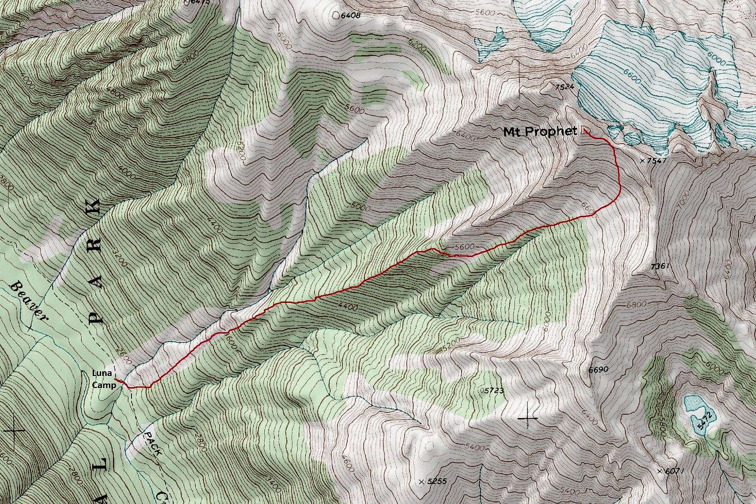
From Luna Camp ford the creek and turn up-slope. Bushwhack through some light brush and continue straight up passing around some mossy slabs. The slope narrows into a rib. Ascend to 5450 feet and then traverse east below a rock wall. An altimeter or GPS might be essential here.
Descend along the base of the wall until you come to the top of a rock step. There are several options to get down this rock step. A narrow down-sloping ledge can be traversed left onto some slabs. Alternatively, a dirty gully can be scrambled half way down to reach 10 feet of class 4 scrambling. There's also a chimney with good hand holds and footholds right below the start of the ledge but it's not visibly apparent from above.
From the base of the rock step, traverse on loose rock below the slabs into the large basin. Depending on the season, the basin will be filled with snow or unstable talus. Climb to near the top of the basin where a rock wall spans from the upper southwest rib to the south ridge. A left slanting ramp on the right side of this rock wall allows easy access to the upper slope and summit ridge crest. Attain the saddle east of the summit and follow the crest west, traversing under a minor gendarme just before the reaching the top.
NOTE: This route is best with some snow in the upper basin. Mid and late summer ascents parties might prefer the south ridge route.


