

Dean - Apr 1, 2005 1:16 pm - Voted 10/10
ExcellentStellar way to show the routes.

hgrapid - Apr 1, 2005 2:23 pm - Voted 10/10
Re: ExcellentMuch appreciated for those of us planning to climb Boundary at some point. Makes the route a whole lot clearer!

cp0915 - Apr 1, 2005 3:35 pm - Voted 10/10
Re: ExcellentAgreed! An excellent and very helpful shot.

bearbnz - Apr 1, 2005 4:55 pm - Hasn't voted
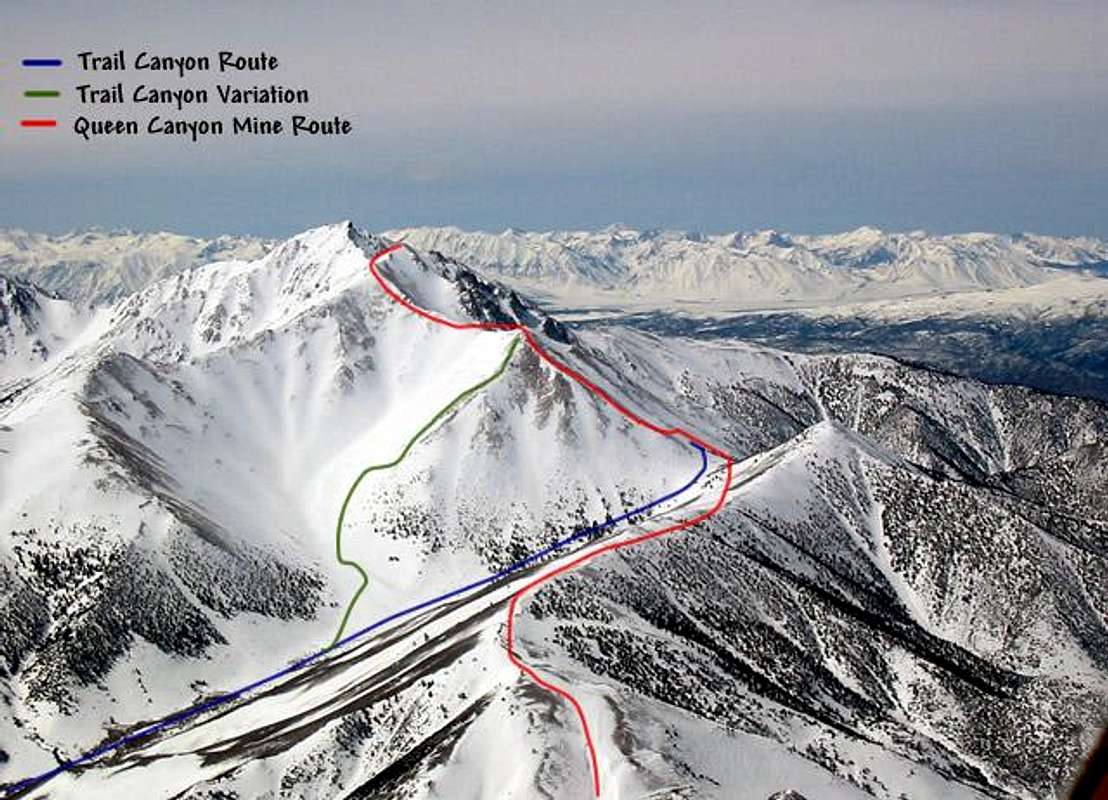
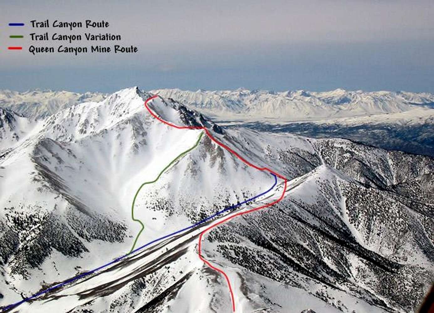
Re: ExcellentThe flyby gives an excellent overview with no intermediate features to block the view. The first time I was up there, it was pretty unclear. We ended up doing the Trail Canyon Variation shown in green.

Day Hiker - May 4, 2005 9:59 pm - Hasn't voted
Excellent InformationThis website's purpose, at least for me, is to provide information on how to successfully complete hikes and climbs. This picture does an excellent job of providing route information for someone like myself, who is considering doing this hike. Thanks. We need more pictures like this.

treygrand05 - Aug 17, 2005 5:01 pm - Hasn't voted
coolYou gave me a post about my picture needing to be roated and enhanced, well I already tried it and with my software that is the best I can format it fot the roated version gets really distorted and crushed. I would also like to know how you are able to add lines for the route marking and trails.
thanks,
trey
bearbnz - Aug 17, 2005 6:22 pm - Hasn't voted
Re: coolTrey, sent an e-mail to the address on your profile page.

Diesel - May 19, 2015 8:48 pm - Voted 10/10
Great helpAs straight forward as this hike seems, I keep reading that a lot of folks lose the trail and end up somewhere else. This pic is a great help. Thanks for sharing it. I wish I knew how to mark the trails like that.

kteichert - May 27, 2017 12:49 pm - Hasn't voted
InvertedFrom looking at maps, it looks as if from Trail Canyon saddle, one would turn right after leaving trail canyon and heading to the summit. This picture shows a left turn. Am I seeing that wrong?
bearbnz - Jun 5, 2017 4:30 pm - Hasn't voted
Re: InvertedYes, you are. It is a left turn toward the summit of Boundary and Montgomery.
kteichert - Jun 12, 2017 11:47 am - Hasn't voted
Re: InvertedI was looking at the map from google maps and mistook Trail Canyon as the canyon leaving the town of Montgomery. I can see now why that is NOT a good route :) haha. I summited via Queen Mine Canyon, and certainly it was a left turn to the summit ;)


Comments
Post a Comment