Questa parte é devoluta ai torrenti della sponda orografica ed idrografica Meridionale o di destra della
; un successivo lavoro sarà dedicato all'opposta o Settentrionale rivolta ai Buthiers ed ad altri importanti torrenti che percorrono la Valle di Aosta. Non più partendo dal Col de la Seigne e dal Monte Bianco fino alle estremità Orientali sopra l'abitato di Pont Saint Martin, al termine della Regione Valle di Aosta, bensì esclusivamente conglobando tutte le Dore che iniziando a Nord dai Colli di Ferret, subito ad Oriente del Mont Dolent
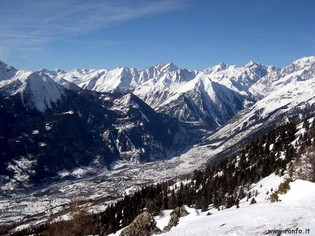
. Infatti al termine della Valle Vény prende inizio quel settore che costituisce la sponda orografica ed idrografica destra o Meridionale della Valle di Aosta. Questa abbandona il confine con la Francia al termine della Valle di Rhêmes, dove questa continua in territorio francese con la Valle del
. Avremo così una successione di Dore che da Nordovest verso Sudest al confine con la Valle di Champorcher che possiamo così riassumere, anche se l'ultima, ovvero il torrente che scende dalla Valle di Cogne, non é propriamente una Dora bensì una
. Ma, si sà, quelli di Cogne sono sempre "particolari".
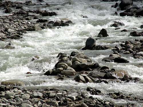
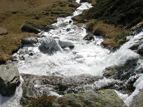
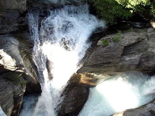
In turn all these Dore are fed by smaller streams that run through the secondary valleys and generally vertical in respect to the main or bottom into floor valley.
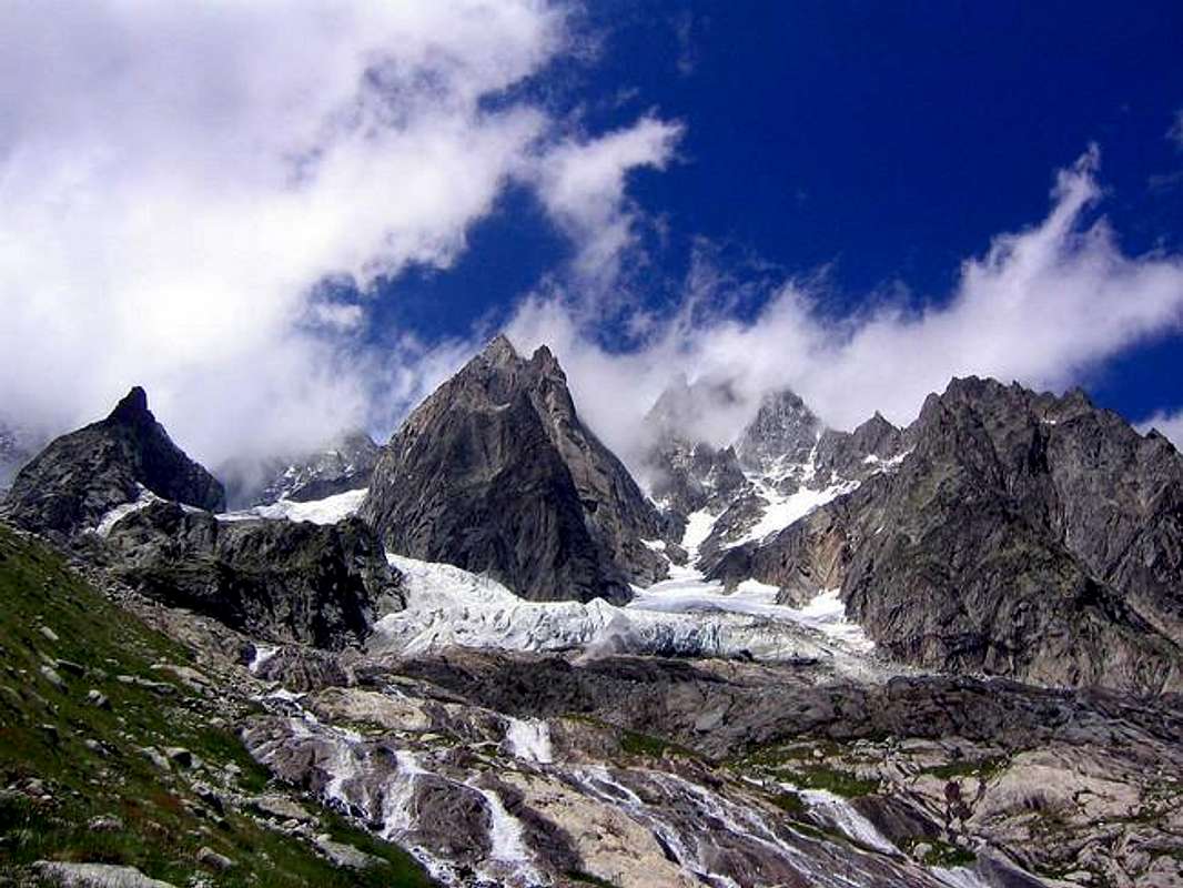
How the Torrent of Fréboudze or Freboudgie in Val Ferret, the Miage and Frêney in Val Veni, the
Torrent de Verney from the Little Saint Bernard, the
Nivolé or Nivolet in Valsavara or the
Grauson, Urtier in Cogne Valley. But they are only examples, because we could mention hundreds since every valley, that, logically, it has at least one for the waters drain. Just as we can not forget the lakes, true containment basins of the same, we can always list from West to East with
Combal, Miage in Val Veni,
Verney, Rutor or Ruitor, Ussellettes in La Thuile,
Arpy and the superior of
Pietra Rossa in the homonym adjacent basin above Morgex Pré St. Didier Communes,
Tsatalèina, Granta Parei just above Rhêmes Notre Dame,
Nivolé in the homonym tableland over Valsavarenche and to Val di Cogne with very numerous
Garin, 4 Lussert, Corona, 3 Doreire, Money, 2 Pontonnet, Ponton, Acque Rosse, Bardoney and finally the spectacular
Lauson, right front to the whole of the
Gran Paradiso Chain. All of these courses or water bodies or basins would form the
Dora Baltea that, being born at the foot of the South side of
Mont Blanc at the confluence of the two
Dore Ferret and Veni, flowing toward the wide Po Valley, along with sister
Dora Riparia, to the
Adriatic Sea, together, from
Monviso and passing through Turin, reaching over most powerful of the
Po, or main river of Italy.
A loro volta tutte queste Dore sono alimentate da più piccoli torrenti percorrenti le vallate secondarie ed in genere verticali rispetto a quella principale o di fondo. Come il Torrente di Fréboudze o Freboudgie in Val Ferret, il Miage e Frêney in Val Veni, il
Torrent de Verney dal Piccolo San Bernardo, del
Nivolé o Nivolet in Valsavara oppure il
Grauson e l'Urtier in Val di Cogne. Ma son soltanto esempi, perché potremmo citarne a centinaia poiché ogni valloncello, logicamente ne possiede almeno uno per lo scolo dell'acque. Così come non possiamo dimenticare i laghi, veri bacini di contenimento delle medesime, che possiamo elencare sempre da Ovest verso Est con
Combal e Miage in Val Veni,
Verney, Rutor o Ruitor ed Ussellettes a La Thuile,
Arpy ed il superiore di
Pietra Rossa nell'adiacente omonimo bacino al di sopra dei comuni di Morgex e Pré Saint Didier,
Tsatalèina e Granta Parei a Rhêmes,
Nivolé in Valsavarenche ed in Val di Cogne i numerosissimi di
Garin, 4 di Lussert, Corona, 3 di Doreire, Money, 2 di Pontonnet e Ponton, Acque Rosse, Bardoney ed infine lo spettacolare del
Lauson, proprio frontalmente all'intera
Catena del Gran Paradiso. Tutti questi corsi o bacini acquiferi concorrono a formare il corso della
Dora Baltea che, nascendo ai piedi del versante Meridionale del
Monte Bianco alla confluenza delle
Dore di Ferret e Veni, scorre verso l'estesa Pianura Padana sin al
Mare Adriatico, insieme, dal
Monviso e passando attraverso Torino, alla gemella
Dora Riparia, raggiungendo il corso più potente del
Po, o fiume principale d'Italia.
Getting There towards Courmayeur La Thuile Valgrisa Rhêmes Savara & Cogne
By car:
- From TORINO, MILANO, etc: Motorway A5. Exit at IVREA or Quincinetto (PIEDMONT)
From IVREA Town: in West (Southern side) to Pont Saint Martin, Donnas, Bard, Champdepraz, Pontey, Fénis, Saint Marcel, Grand Brissogne, Pollein, Charvensod, Gressan, Jovençan, Aymavilles, towards Villeneuve, Arvier, Avise, Morgex (Internal side) and to Pré Saint Didier, Courmayeur Municipalities (Western side).
From Courmayeur Resort: in East to Morgex, La Salle, Saint Pierre, Sarre, Aosta (Norhern side) Municipalities.
![]()
Southern Side:
From Aymavilles to Cogne Valley
From Aymavilles (646m) towards Cogne Valley with Regional Main Road: Vieyes (1132/58m) Fraction, Mario Gontier private Shelter, through small path in Nomenon Vallon. Continue to Sylvenoire (1331m), Laval's Bridge (1364m) before Epinel Crétaz Hamlets (1434m, 1494m), Cogne (1534m) Resort, through Main Road.
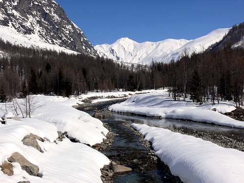
From Villeneuve towards Savara Valley or Valsavarenche
From Villeneuve to Savarenche Valley, Dégioz-Valsavarenche (1541m) up to the Pont Valsavarenche (1946m). From this or neighbor to Federico & Renato Chabod, below North Buttress of Gran Paradiso and nearby Laveciaù Glacier; Vittorio Emanuele II° (Old & New), between Gran Paradiso and Montcorvé Glaciers.
Internal Dora Baltea Areas from Villeneuve to Arpy Conca
From Villeneuve (620m), Martignon (823m), San Bernardo through dirt road in Southeast, towards Prorayé Alp to Upper Champlong in Poignon Vallon.
From Introd (873m), with Municipal or dirt road towards Buillet (1030m)/Biolay (1042m) small Villages to Montagne.
From Arvier (776m), with Regional Road, towards Crête, Verney, Petit Haury, Scierie, Grand Haury with Municipal Road, to Combes Basin.
From Avise-Runaz (786m), with Municipal Road, to forks 956, 998, 1115 metres, Marbrière Pasture, Faveroy Alp to Monte Colombo.
From Derby-Chez Les Gontiers (839m) Village, with short Municipal Road through path in South towards Créton (1523m), Dailley (1621m) Alpages. Through two parallel secondaries small paths, to fork 1823 metres with dirt road and Tillac Alp (1848m) to Faveroy Area.
From Morgex (920m), with Regional Road in South, towards Liarey, Pre Villair, Mont Rotie, alternative around 1275m just before Tirecagne Pasture (1532m), with dirt road in Southeast, towards Costablinaz de Meitin Pasture (1420m), after through path, towards Damon (1445m), Champex (1519m) Pastures, Plan Rançon Alp (2098m) to Becca Pouignenta Northern Area.
From Morgex (920m), crossing the bridge above Baltea with Regional Road in South, towards Liarey, Pre Villair, Mont Rotie small Villages, alternative around 1275m) just before Tirecagne Pasture (1532m) and the Main Roads to Arpy Basin.
![]()
From Villeneuve to Rhêmes Valley
From Villeneuve (670m) to Rhêmes Valley: Introd (880m), Rhêmes Saint Georges (1171m), Notre Dame (1725m) Communes, through Regional Main Road, up to the Thumel Village (1887m) with Municipal Road and to Gian Federico Benevolo Refuge (2280m), through dirt farms road or underlying path.
From Liverogne (Arvier) to Valgrisenche
From Arvier to Liverogne Fraction (730m) and from this to Valgrisenche Valley, up to the Valgrisenche Municupality (1664m) and Mondanges, Surier, Us(s)eliéres Villages around the artificial Beauregard Dam, through Regional Road. Mario Bezzi at Vaudet and Chalet de l'Epée Refuges through paths.
From Pré Saint Didier to La Thuile & Little Saint Bernard Valleys
From Pré Saint Didier (1010m), with State Road, to La Thuile Valley: Elévaz, Balme Villages, La Thuile Commune, 1441m; from this to Little Saint Bernard Vallon towards the Little Saint Bernard Hill (2188m), through State Road. To Albert Deffeyes Refuge with muletrack from La Joux Fraction.
Western and Northern Sides:
From Courmayeur to Aosta Town
From Courmayeur (1198m) towards Pont des Chèvres, Notre Dame de la Guérison, Lassy Dèsot/Perthud Villages, Gabba, Chalets du Miage, La Visaille Cave, Plan de Lognan Alp (1676m), with Municipal Road; from this to Lake Combal (1950m) and to Refuge Elisabetta-Soldini (2197m), through dirt road.
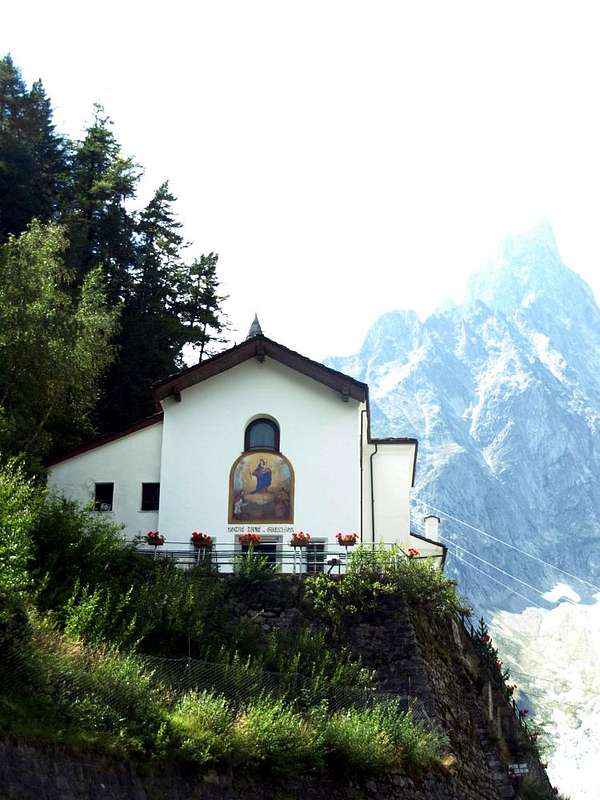
From Courmayeur-Notre Dame de la Guérison Sanctuary (1444m), through private dirt road, to Monte Bianco Refuge (1666m).
From Courmayeur-la Palud (1370m), towards Montitaz, Planpincieux (1593m) Villages, Tronchey (1620m), Praz Sec du Milieu, Lavachey (1640m), Arnouva Dèsot (1769m) Villages, through Municipal Road, to Malatrà Vallon and Walter Bonatti Refuge. Also from Arp Nouva to Elena Refuge, through dirt road on valley floor; or from the fork after Planpincieux, small bridge, towards Leuchey Dèsott, Damon Pastures to Mont de la Saxe Hump/Giorgio Bertone Refuge.
![]()
- From FRANCE: through the Mont Blanc Tunnel to Entrèves-crossroads to Vény/Ferret Valleys - Mountain Guides of Courmayeur - La Saxe Rock Gym - Courmayeur. By Little Saint Bernard Pass, closed since November until half May to La Thuile Valley - Pré Saint Didier - Courmayeur.
It is not necessary to take Motorway A5: you can drive on State Road n° 26, in the direction of AOSTA - IVREA - TURIN.
By plane:
- Aeroporto Internazionale "Corrado Gex" Saint Christophe (Aosta)