Even this area includes five adjacent municipalities from East to West. It forms the Northern edge of the hill above the City of Aosta, and offers a varied possibility of walking, hiking or simply cultural visits at the foot of the Subgroups of Tsaat Etsena
(2974/5m) to the East and to the West of Mount Fallère
(3059/61m). An area that deserves to be explored in its surroundings, which offer great views towards the South
"embracing" in a large panoramic Graian Alps from Monte Avìc Subgroup until the Rutor Chain and partly the whole Pennine from Grand Golliat up to Monte Rosa Range. From the valley floor and close to all municipalities rise beautiful trails or mule tracks, sometimes fallen into oblivion, which date from the low and medium hill reaching some small basins and a few small valley suspended above the City of Aosta and content between the Commons of St. Christophe to the East and to the West Sarre. With a small digression to the North with the Municipalities Roisan (to the East) and Gignod (West), both
"perched" above the tail of the Torrent Buthier before reaching the Dora Baltea, now belonging to the entry into the Grand San Bernardo Valley. An important
"welding", that also follow the meeting and the passage of different millenary cultures that see evolution history of the Valley of Aosta from the Neolithic to the People of Celtic Salassi and since the arrival of the Romans until the present day with the Salassian Route horizontally halfway up the hill and with continued vertically at first with the military Way for the Helvetia and Gaul and later with the commercial and religious with the ancient Alps Road and Via Francigena. But also, and more simply, a diverse base day for easy trips and excursions.
But do not forget the lower middle hill that offers, wandering amongst these, many and varied beautiful walks to be combined with historical, cultural visits ...
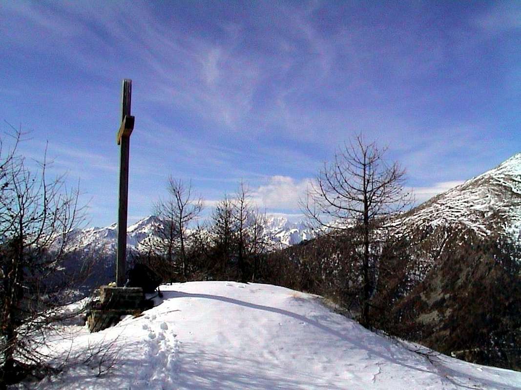
Walks & Trips from St. Christophe, Aosta, Roisan, Gignod & Sarre Communes all in North from Aosta Town
by Osw 2015/16
Anche quest'area comprende cinque Comuni adiacenti da Oriente ad Occidente.
Costituisce il margine Settentrionale della Collina soprastante la Città di Aosta ed offre una variegata possibilità di effettuare passeggiate, escursioni o semplici visite culturali ai piedi dei Sottogruppi della Tsaat a l'Etsena ad Oriente e del Monte Fallère ad Ovest. Una zona che merita di essere esplorata anche nei suoi dintorni, che offrono grandi vedute verso Meridione
"abbracciando" in una grande panoramica le Alpi Graie dal Gruppo del Monte Avìc fino alla Catena del Rutor ed in parte le intere Pennine dal Grand Golliaz fino al Gruppo del Monte Rosa. Dal fondovalle e nei pressi di tutti i comuni salgono bei sentieri o mulattiere, a volte cadute nell'oblio, che risalgono la bassa e la media collina raggiungendo alcuni piccoli bacini e qualche valloncello sospesi sopra la Città di Aosta nonché contenuti tra i Comuni di St. Christophe ad Est e di Sarre ad Occidente. Con una piccola divagazione verso Settentrione con i Comuni di Roisan (ad Est) e Gignod (ad Ovest), entrambi
"appollaiati" al di sopra della parte finale del Torrent Buthier prima di raggiungere la Dora Baltea, ormai appartenenti all'ingresso nella Valle del Gran San Bernardo. Una
"saldatura" importante, tale da segnare anche l'incontro ed il passaggio di diverse culture millennarie che vedon evolversi la storia della Valle di Aosta dal Neolitico al Popolo Celtico dei Salassi e dall'arrivo dei Romani fino ai giorni nostri con la Via dei Salassi in orizzontale a metà collina e con il prosieguo in verticale dapprima con la Via militaresca per l'Elvezia e le Gallie e poi con quella commerciale e religiosa con l'antica Via delle Alpi e la Francigena. Ma anche, e più semplicemente, un variegato punto base per facili gite ed escursioni.
Ma non dimenticatevi della medio-bassa collina che offre, girovagando tra questi, numerose e varie belle passeggiate da abbinare a visite storico-culturali ...
![]()
East towards West visiting five Commons
Are two possibilities to visit the zone of "Adret", ie in the area most exposed to sunlight and then placed to the North in respect on the scrolling of the same.
1)- From Quart Common with the opposite direction or West by Aosta Town (
Tour de Chétoz above Quart, Villefranche locality, and clearly visible from the bridge over the Dora Baltea, between Carné Prebenda small Villages) to the one carried out this far and starting from Quart Municipality on Regional Road with a detour (2 Km. further to West; brown sign), with a detour to the North to that of Etollin to reach the above Villair de Quart Fraction (
627/64m; Church of Saints Fabiano, Sebastiano and Rocco) and continuing in a short time you get to the
Château de Quart (774m). Wanting a short trip to the Northeast with small trail reported
n° 7 leads to the above
Hermitage of St. Emeric (
1130m; 1h'15/1h'30), under the same name
"Bois". Returning and proceeding with an alternative Regional Road, higher than the State Road, you reach Saint Christophe Commune (
584/619m with overlying Fractions Sorreley (
790 and West of Senin (
766/805 m. The descent reaches Aosta passing near the
Castles of "Passerin d'Entrèves" and "Duca degli Abruzzi" or Jocteau and home to
"Alpine Military School of Aosta", dedicated not long to General Alpine Troops Antonio Cantore. Here, near the small Busseyaz Village
(664m), we find an old and round
"Mound Celtic", currently under exploration (
Is a Tomb of an ancient burial of a Salassian Prince?).
2)- : Wanting to discard the first hypothesis, from Pollein Commune through the new bridge on the Baltea can quickly get to the National Road No. 26 and this in a moment to the Municipality of Saint Christophe, now at the gates of Aosta City. After reaching a roundabout with a monument dedicated to the
"Local Cuisine", you will soon reach the Chief town (
619m. Left to right deviation
"Mountagne", which leads to the small Village of Prevot (
584m; secondary connections with the Fraction of Villair de Quart), however, continue to the left (West) with a long diagonal, passing the Fractions and Chabloz Fontanalle, reaches next round with a monument to the
"Popular Sports" (tsan, rebatta and fiollet) near a small
Votive Chapel dedicated to a Partisan shot by the Nazis in 1944. The road splits:
a)- a branch up to the right (Northeast) to the important Fractions of Sorreley and Veynes (
790m, 805m. Wanting to continue on the hill you will reach the Villages Cretallaz, Jeanceyaz
(1087m) and Morgonaz at entrance to the Combe de Sénevé and beautiful routes to the Castle of Villair de Quart. Or with a fork from Lumian small Village
(1025m) Northwest to the Villages Parléaz or Parleyaz and Blavy
(1274m, 1467m), at the foot of Becca's Viou
(2856m), as well as the emblem of the Commons of Saint Christophe and Aosta-Northeast.
b)- From the second roundabout (
junction 692 metres nearby the
"Castello" St. Christophe or Passerin d'Entrèves, you continue left (Northwest) reaching the Hamlet of Senin
(766/805m). Playing field for Traditional Sports over the
"Area Tsatelet" with Quota BP or Baden Powell). From the Castle of St. Christophe the Regional Road falls in the Southwest, and surpassed the
Castle of the Alpine Military School, soon reached the city at
Roman Bridge, Arch Augustus's. From here, going to the West, in an equally short time (
500 metres about) you reach the entrance to the very ancient city and the triple
Porte Praetoriane (Pretorian Doors of "Augusta Praetoria Salassorum"). Downright you are now inside the Urbs.
Variant "High" from St. Christophe towards Roisan Communes: avoiding the city, you may with street in asphalt from Senin-Thovex attaining progressively the Villages Serod, Porossan
(723m) and Closellinaz Dessus
(800m) Roisan reaching the junction with the National No. 27 for the Gran San Bernardo. Otherwhise directly passing Aosta City and with the State Road No. 27, past the Variney Fraction
(782m), reach the junction at the locality of Moulin
(777m) and then return to the South-southeast with the Regional, reaching the previous route. Or from the junction at Ravoire, just before Variney, you can continue to the Great St. Bernard always on Main Road reaching the Municipality of Gignod
(994m), located to the Eastern slopes of Pointe Chaligne. Also in this section it is possible to travel to the West on the old
Road of Salassians reaching the hill just above the adjacent Common of Sarre
(657m), at the foot of Punta Met or Metz, and from this towards the now new Thouraz or Thôra small Village (1593/1652m).
We are right in front of Becca France (2312m) with his landslide that at dawn of July 06, 1564 swallowed the whole ancient village with its 600 inhabitants ...
Hikes from Chamerod, Morgonaz, Trois Villes Villages, St. Christophe, Aosta & Sarre towards Senevé Basin & Thouraz Hamlet
by Osw 2015/16
Esiston due possibilità per andar visitar l'"Adret", ovvero il settore maggiormente esposto al sole e quindi collocato a Settentrione rispetto al corso dello stesso.
1)- : Da Quart con il percorso inverso a quello fino a qui effettuato da Aosta (
Tour de Chétoz sopra Quart in località Villefranche e ben visibile dal ponte sulla Dora; subito più avanti ad Ovest tra i Villaggetti di Carné e Prebenda) e partendo da questi sulla Strada Regionale, con una deviazione (2 Km. oltre verso Ovest con segnalazione color marron) a Nord per quello di Etollin, si raggiunge il soprastante Villair (
627/64 m e proseguendo in breve tempo si arriva al
Château de Quart (774 m). Volendo una breve escursione a Nordest con sentierino segnalato come
n° 7 conduce all'
Eremo di San Emerico (
1130 m;
1h'15/1h'30), sotto l'omonimo
"Bois". Ritornando e procedendo con un'alternativa Strada Regionale, più in alto rispetto alla Statale, si raggiunge il Comune di Saint Christophe (
584/619 m con le soprastanti Frazioni di Sorreley (
790 m ed a Ovest di Senin (
766/805 m. La successiva discesa raggiunge Aosta passando dai
Castelli dei Passerin d'Entrèves e Duca degli Abruzzi o Jocteau "Scuola Militare Alpina di Aosta", dedicata da non molto al Generale Antonio Cantore. Appena prima del Villaggio di Busseyaz
664 m), troviamo un antico tondeggiante
"Tumulo Celtico" di un Principe Salasso?, attualmente ancora in fase d'esplorazione. Questo sulla collina appena prima dello ingresso alla città ed in un prato subito a monte della nota
Scuola Militare Alpina.
2)- : Volendo scartare la prima ipotesi, da Pollein il nuovo ponte sulla Dora permette d'arrivare rapidamente alla Strada Statale n° 26 e da questa in un attimo al Comune di St. Christophe, ormai alle porte d'Aosta. Raggiunta una rotonda con monumento dedicato alla
"Cucina locale", in breve si raggiunge il Capoluogo. Lasciata a destra la deviazione
"Montagne", che conduce al Villaggio di Prevot (
584 m; collegamenti secondari col Villair di Quart), si prosegue invece a sinistra (Ovest) con un lungo diagonale che, passando le Frazioni di Chabloz e Fontanalle, raggiunge una successiva rotonda con monumento agli
"Sports Popolari" (tsan, rebatta e fiollet) vicino ad una
Cappelletta Votiva dedicata ad un Partigiano fucilato dai nazisti nel 1944. Qui la strada si sdoppia:
a)- un ramo sale a destra (Nordest) verso le importante Frazioni di Sorreley e Veynes (
790 m, 805 m. Volendo continuare sulla collina si raggiungono i Villaggi di Cretallaz, Jeanceyaz (
1087 m e Morgonaz, all'ingresso della Comba di Senevé e con bella strada di collegamento col Castello del Villair de Quart. Oppure con un bivio da Lumian
(1025 m) a Nordovest verso i Villaggi di Parléaz o Parleyaz e Blavy (
1274 m, 1467 m, alle falde della Becca di Viou
(2856 m), emblema del Comune di St. Christophe e di Aosta-Nordest.
b)- Dalla seconda rotonda (bivio
692 metri), appena sopra il
Castello di St. Christophe o Passerin d'Entrèves, si continua a sinistra (Nordovest) raggiungendo la Frazione Senin (
766/805 m campo da gioco per gli Sports Tradizionali sopra l'
Area Tsatelet con Quota BP o Baden Powell). Dal Castello di St. Christophe la Strada Regionale scende a Sudovest e, sorpassato il
Castello della Scuola Militare Alpina, in breve raggiunge la Città presso
Ponte Romano ed Arco d'Augusto. Da qui, andando ad Ovest, si raggiungono l'ingresso alla Città e le antiche triplici
Porte Praetoriane. Siete ormai dentro l'antica Urbs.
Variante "Alta" dal Comune di St. Christophe verso quello di Roisan: evitando la città, si può con strada in affalto da Senin-Thovex raggiungere progressivamente i Villaggi di Serod, Porossan
(723 m) e Closellinaz Dessus
(800 m) arrivando a Roisan alla congiunzione con la Statale n° 27 per il Gran San Bernardo. Altrimenti direttamente passando attraverso la Città di Aosta e con la Strada Nazionale n° 27, oltrepassando la Frazione di Variney
(782 m), raggiungere il bivio presso la località di Moulin
(777 m) per poi rientrare verso Sud-sudest con la Regionale raggiungendo la precedente. Oppure dal bivio presso Ravoire, appena prima di Variney, si può continuare sulla Statale del Grande raggiungendo il Comune di Gignod
(994 m), posto alle pendici Orientali della Pointe Chaligne. Sempre in questo tratto é possibile percorrere verso Ovest la vecchia
Strada dei Salassi raggiungendo la collina appena sopra l'adiacente Comune di Sarre
(657 m), ai piedi della Punta di Met o Metz, e da questa al nuovo Villaggio di Thouraz (1593/1652 m).
Siam proprio davanti alla Becca France (2312 m) con la sua frana, che il 6 Luglio 1564 inghiottì l'intero antico Villaggio di Thôra con tutti i suoi 600 abitanti ...
Excursions & Ascents from St. Christophe, Aosta, Roisan, Gignod, Sarre towards Croix de Fana, Mont Mary, Becca di Viou & Mont Fallère
by Ilario Garzotto 1968/69 & Osw 1972/76