


-
 1902 Hits
-
 79.78% Score
-
 11 Votes
|
|
Route |
|---|---|
|
|
45.71001°N / 7.47240°E |
|
|
Hiking |
|
|
Spring, Summer, Fall, Winter |
|
|
Half a day |
|
|
E/EE/F (Hiking / Expert Hikers / Easy |
|
|
Note
|
La montagna chiama i suoi figli, ed essi rispondono fedelmente al suo appello… Osvaldo Cardellina, Diario alpinistico, 1964-65 Page texts: @ OsvaldoCardellina "Osva", passed away on May 2, 2022. Page owners: Christian Cardellina e Osvaldo Cardellina. Any updates from September 12, 2022: Antonio Giani, page administrator, friend and climbing companion. Testi della pagina: @ OsvaldoCardellina "Osva", scomparso il 2 maggio 2022. Proprietari pagina: Christian Cardellina e Osvaldo Cardellina. Eventuali aggiornamenti dal 12 settembre 2022: Antonio Giani, amministratore della pagina, amico e compagno di salite. |
Fénis Overview St. Marcel
Even the Saint Marcel small Valley is a small vallon in the size of the entire Alpine Arch, but is large enough compared to the entire, complete tiny Valley of Aosta.
To propose ten trips designed to make known in its entirety this long valley over 10 Kilometres from Saint Marcel Common, Upper Les Druges locality, up to the Hills of Crotey, Lavòdilèc, Tessonet, St. Marcel or Coronas, Vallonet, Leppe and Salé also of the Grande Roise. Rather it is given more space to Approaches than to the Routes, described here in more than synthetic and certainly more terse, remaining the same, in our opinion, a simple guideline, stops the possibility of other personal choices and maybe completely different or diversified. As regards the former, however, is given a complete and comprehensive writing with the aim of power easily "break into" in this valley or an excursion where you should "lean", albeit marginally, to the next Saint Marcel Common with which, in addition to being adjacent, is definitely connected. This into consideration especially for trips to Mont Saint Julien with his famous Sanctuary, territorially belonging to the Fénis Municipality, La Torrasse or Mont Touriasse and Mount Corquet, although the way described here takes place entirely in this valley, from Clavalité through the Tramouail de la Rossa. Nothing prevents you from doing the excursion on the opposite Northern side through what is considered the "Traditional Route", taking advantage of a paved road connecting that Fènis, through the small Pieiller small Valley, connects to that, coming from St. Marcel, goes to the little Villages of Les Druges Lower and Higher, where the valley splits, sending a sub-branch in Southeast towards the Alps of Fontanafredda, Bren, Prapremier and Corquet and towards Mont Corquet, while the main, after rounding the Mont Roux with its Coppermines Chuc-Servette, more salt Westwards the real Valley St. Marcel and the Hunting Reserve of Grand Avert, property at present by Marquis Attilio Turati and already former Hunting Preserve by Baron Beck Peckoz of Gressoney.
![]()
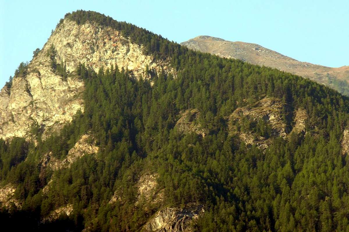
East partition with Clavalité Valley from Northeast, by Osw 2015
To propose ten trips designed to make known in its entirety this long valley over 10 Kilometres from Saint Marcel Common, Upper Les Druges locality, up to the Hills of Crotey, Lavòdilèc, Tessonet, St. Marcel or Coronas, Vallonet, Leppe and Salé also of the Grande Roise. Rather it is given more space to Approaches than to the Routes, described here in more than synthetic and certainly more terse, remaining the same, in our opinion, a simple guideline, stops the possibility of other personal choices and maybe completely different or diversified. As regards the former, however, is given a complete and comprehensive writing with the aim of power easily "break into" in this valley or an excursion where you should "lean", albeit marginally, to the next Saint Marcel Common with which, in addition to being adjacent, is definitely connected. This into consideration especially for trips to Mont Saint Julien with his famous Sanctuary, territorially belonging to the Fénis Municipality, La Torrasse or Mont Touriasse and Mount Corquet, although the way described here takes place entirely in this valley, from Clavalité through the Tramouail de la Rossa. Nothing prevents you from doing the excursion on the opposite Northern side through what is considered the "Traditional Route", taking advantage of a paved road connecting that Fènis, through the small Pieiller small Valley, connects to that, coming from St. Marcel, goes to the little Villages of Les Druges Lower and Higher, where the valley splits, sending a sub-branch in Southeast towards the Alps of Fontanafredda, Bren, Prapremier and Corquet and towards Mont Corquet, while the main, after rounding the Mont Roux with its Coppermines Chuc-Servette, more salt Westwards the real Valley St. Marcel and the Hunting Reserve of Grand Avert, property at present by Marquis Attilio Turati and already former Hunting Preserve by Baron Beck Peckoz of Gressoney.
Anche il Vallone oppure Valle di Saint Marcel é alquanto piccola nella grandezza dell'intero arco alpino, ma abbastanza grande rispetto alla minuscola Val d'Aosta.
Si propongono dieci escursioni adatte a fare conoscere nella sua completezza questa lunga valle di oltre 10 Kilometri, dal Comune di Saint Marcel in località Les Druges Alte insino ai Colli Crotey, Lavòdilèc, Tessonet, St. Marcel o Coronas, Vallonet, Leppe e di Salé o della Grande Roise. Anzi si é data più importanza agli Avvicinamenti che non alle Vie, qui descritte in modo più che sintetico quasi stringato, rimanendo le medesime, a nostro avviso, una semplice indicazione di massima, ferma la possibilità di effettuare altre scelte personali e magari completamente diverse o diversificate. Per quanto concerne i primi, invece, s'é data una stesura completa ed esauriente con il fine di potere agevolmente "introdursi" in questa valle o di effettuare una escursione dove conviene "appoggiarsi", anche se marginalmente, a quella adiacente di Fénis-Clavalité con la quale, oltre ad essere confinante, risulta intimamente connessa. Questo in considerazione particolare per l'escursioni al Mont Saint Julien con il suo rinomato Santuario, territorialmente appartenenti al Comune di Fénis, al Mont Touriasse o La Torrasse nonché al Mont Corquet, anche se la via qui descritta si svolge completamente in questa vallata, passando dalla ramificazione di sinistra (Sudest) di questa valle. Nulla vieta d'effettuare l'escursione al Mont Corquet sull'opposto tramite la considerata "Via Tradizionale", approfittando anche di una strada asfaltata di collegamento che da Fènis, tramite il Valloncello del Pieiller, si collega a quella che, arrivando dal Comune St. Marcel, si dirige verso i piccoli Villaggi di Les Druges Basse ed Alte, ove la valle va sdoppiandosi ed invia un ramo secondario a Sudest verso le soprastanti Alpi di Fontanafredda, Bren, Prapremier e Corquet nonché in direzione del Mont Corquet medesimo, mentre il principale, dopo aver doppiato il Mont Roux con le sue Miniere di rame di Chuc-Servette, sale più ad Occidente verso il Vallone vero e proprio di Saint Marcel con la Riserva di Caccia del Grand Avert, attualmente di proprietà del Marchese Attilio Turati e già ex Riserva di Caccia del Barone Beck Peckoz di Gressoney.
![]()
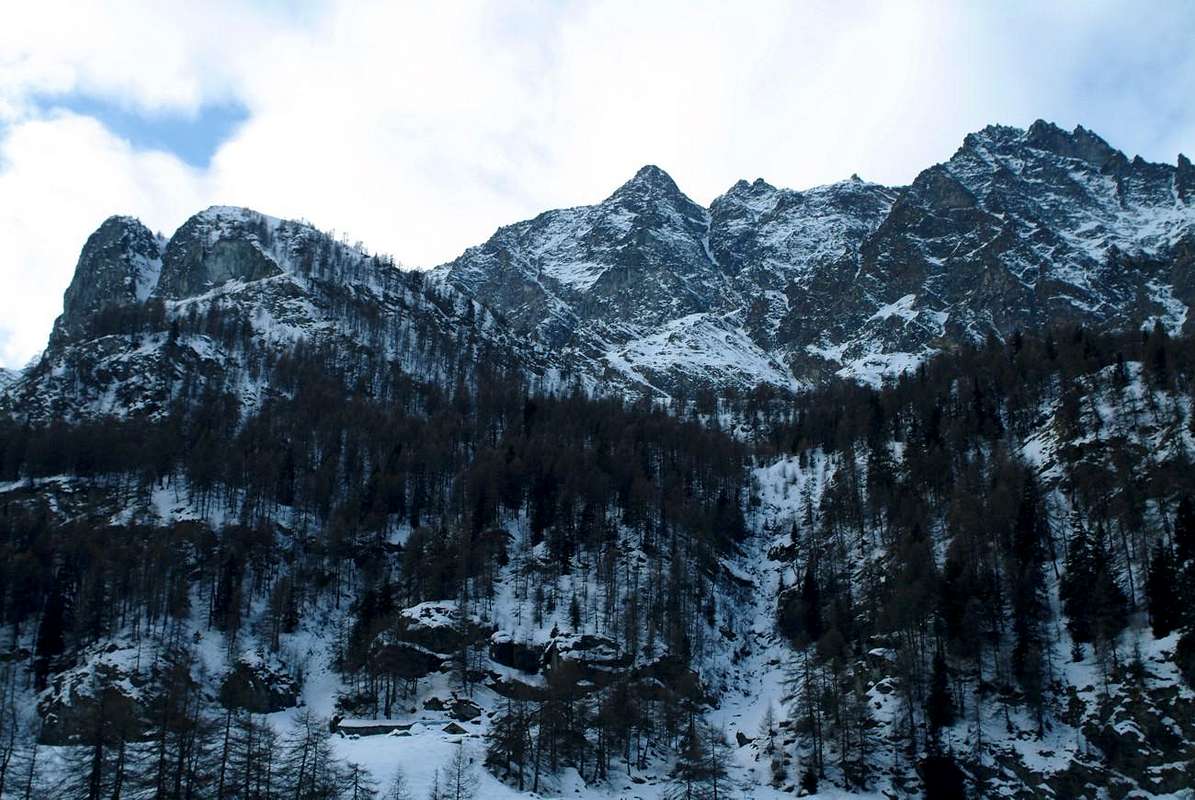
Western watershed with Les Laures Vallon from Northeast, by Osw 2015
Si propongono dieci escursioni adatte a fare conoscere nella sua completezza questa lunga valle di oltre 10 Kilometri, dal Comune di Saint Marcel in località Les Druges Alte insino ai Colli Crotey, Lavòdilèc, Tessonet, St. Marcel o Coronas, Vallonet, Leppe e di Salé o della Grande Roise. Anzi si é data più importanza agli Avvicinamenti che non alle Vie, qui descritte in modo più che sintetico quasi stringato, rimanendo le medesime, a nostro avviso, una semplice indicazione di massima, ferma la possibilità di effettuare altre scelte personali e magari completamente diverse o diversificate. Per quanto concerne i primi, invece, s'é data una stesura completa ed esauriente con il fine di potere agevolmente "introdursi" in questa valle o di effettuare una escursione dove conviene "appoggiarsi", anche se marginalmente, a quella adiacente di Fénis-Clavalité con la quale, oltre ad essere confinante, risulta intimamente connessa. Questo in considerazione particolare per l'escursioni al Mont Saint Julien con il suo rinomato Santuario, territorialmente appartenenti al Comune di Fénis, al Mont Touriasse o La Torrasse nonché al Mont Corquet, anche se la via qui descritta si svolge completamente in questa vallata, passando dalla ramificazione di sinistra (Sudest) di questa valle. Nulla vieta d'effettuare l'escursione al Mont Corquet sull'opposto tramite la considerata "Via Tradizionale", approfittando anche di una strada asfaltata di collegamento che da Fènis, tramite il Valloncello del Pieiller, si collega a quella che, arrivando dal Comune St. Marcel, si dirige verso i piccoli Villaggi di Les Druges Basse ed Alte, ove la valle va sdoppiandosi ed invia un ramo secondario a Sudest verso le soprastanti Alpi di Fontanafredda, Bren, Prapremier e Corquet nonché in direzione del Mont Corquet medesimo, mentre il principale, dopo aver doppiato il Mont Roux con le sue Miniere di rame di Chuc-Servette, sale più ad Occidente verso il Vallone vero e proprio di Saint Marcel con la Riserva di Caccia del Grand Avert, attualmente di proprietà del Marchese Attilio Turati e già ex Riserva di Caccia del Barone Beck Peckoz di Gressoney.

Getting There
BY CAR:
![]()
Fénis & Saint Marcel Valleys, by Gangolf Haub 2004
- From TORINO, MILANO, etc: Motorway A5. Exit at IVREA or Quincinetto (PIEDMONT).
- From IVREA Town: in West (Southern side) to Pont Saint Martin, Donnas, Bard, Champdepraz, Pontey, Fénis, Saint Marcel.

- From Fénis (537m) on Pieiller small Valley towards Le-Pieiller-de-Sermaz, Maison Longue, Le Plany Hamlets (1.075m, 1.112m, 1.174m); through asphalt road) and subsequent connection with La Morgetta(z), Pressunettaz, alternative before Champremier (1.383m) at Les Druges Lower Upper small Villages (1.567m, 1.587m).
From Saint Marcel (630m) to Saint Marcel small Valley and Turati Reserve up to the Mulac-St. Louis & Grande Chaux Hunting Houses and Alp (1.937m, 2.370m).![]()
Connection roads to Les Druges, by Osw 2015
Specific Road
By SS.26, 15 Km by Aosta Town, crossing the stonebridge over the Dora Baltea, just after the Country of Nus (output Motorways A5), arriving at the junction 539 meters, and immediately after the field of Football, leave the roundabout to the left on the same (various large signals), and go up to the Chief Lieu. -
From FRANCE: through the Mont Blanc Tunnel to Entrèves-crossroads to Vény/Ferret Valleys - Mountain Guides of Courmayeur - La Saxe Rock Gym - Courmayeur. By Little Saint Bernard Pass, closed since November until half May to La Thuile Valley - Pré Saint Didier - Courmayeur. It is not necessary to take Motorway A5: you can drive on SS.26, in the direction of AOSTA - IVREA - TURIN.

BY PLANE:
![]()
Mulàc/Praborna Manganesemine, by emilius 2003
From Saint Marcel Common through in asphalt and dirt roads towards Upper Les Druges and to the Mulàc Hunting House Marquis Turati, by emilius 2002 & 2003
With departure from Fénis towards the Plan of Clavalité, or (see below) to the La Morgettaz, Champremier and Les Druges "Basse ed Alte":
by the Municipality follow the rectangular signs (brown with indication Barche; 607m) to the Barche Fraction at the entrance on Val Fénis/Clavalité/High Comba Tersiva. The ban is to continue Lovignana small Village (1.169m) along the entire Clavalité long Valley to Pasture Grande-Alpe (2.129m), through the local path n° 2, pratically almost concomitant with the private farm dirt road in soil, except for brief shortcut after Celey Dèsott Pasture (1.556m; E/F; 4h'00/4h'30 from Barche upper Fraction; 5h'00/6h'00 Lovignana).
Con partenza da Fénis verso il Pianoro della Clavalité, oppure (vedi sotto) verso La Morgettaz, Champremier e Les Druges "Basse ed Alte":
dal Comune seguire i cartelli rettangolari (color marrone con indicazione Barche; 607 m) per la Valle di Fénis/Clavalité/Alta Comba Tersiva. Il divieto di proseguire si trova al Villaggetto di Lovignana (1.169 m); percorrere tutto il Vallone fino all'Alpe Grand'Alpe (2.129 m), tramite il sentiero locale n° 2, praticamente quasi completamente concomitante con la strada poderale privata in terra, tranne qualche breve scorciatoia subito appresso Celey Dèsott (1.556 mE/F; 4h'00/4h'30 dalla Frazione di Barche; 5h'00/6h'00 dal divieto).
Municipal Road in Pieiller Vallon to Le Coteau Village, by Osw 2015
- Aeropoto "Corado Gex" Saint Christophe (Aosta).
Approaches by Fènis & St. Marcel towards Les Druges
 |
 |
 |
 |
 |
With departure from Fénis towards the Plan of Clavalité, or (see below) to the La Morgettaz, Champremier and Les Druges "Basse ed Alte":
by the Municipality follow the rectangular signs (brown with indication Barche; 607m) to the Barche Fraction at the entrance on Val Fénis/Clavalité/High Comba Tersiva. The ban is to continue Lovignana small Village (1.169m) along the entire Clavalité long Valley to Pasture Grande-Alpe (2.129m), through the local path n° 2, pratically almost concomitant with the private farm dirt road in soil, except for brief shortcut after Celey Dèsott Pasture (1.556m; E/F; 4h'00/4h'30 from Barche upper Fraction; 5h'00/6h'00 Lovignana).
Con partenza da Fénis verso il Pianoro della Clavalité, oppure (vedi sotto) verso La Morgettaz, Champremier e Les Druges "Basse ed Alte":
dal Comune seguire i cartelli rettangolari (color marrone con indicazione Barche; 607 m) per la Valle di Fénis/Clavalité/Alta Comba Tersiva. Il divieto di proseguire si trova al Villaggetto di Lovignana (1.169 m); percorrere tutto il Vallone fino all'Alpe Grand'Alpe (2.129 m), tramite il sentiero locale n° 2, praticamente quasi completamente concomitante con la strada poderale privata in terra, tranne qualche breve scorciatoia subito appresso Celey Dèsott (1.556 mE/F; 4h'00/4h'30 dalla Frazione di Barche; 5h'00/6h'00 dal divieto).
 |
From the Village of Fénis, accessible from Highway n° 26 crossing the bridge over the Baltea Stream, just after the Country of Nus (output Motorways A5), arriving at the junction 539 meters, and immediately after the field of Football, leave the roundabout to the left on the same (large signals), and go up to the Chief Lieu. Following the signs in marron "Saint Julien" and, still leaving the Municipal Road to the East to Barche Hamlet and towards Clavalité's Vallon satisfy the signs for the "Vallon of Pieiller", a tarmac road dates back to the South, starting between the Villages of Le Perron (582m) and Pommier (614m), and through road bends that door, through the woods, to the small Village of Le Boit-du Chat (695m) and the subsequent of Champlan. After four more through the windings road nearby the Torrent Bioley and goes West towards the basin left its course, always with tight bends reaches The Pieiller-de-Sermaz (1.075m) and then Maison Longue (1.112m) and The Plany (1.174m) small Villages, with a last bend to the West towards the Morgettaz tiny Hamlet reach the junction, with small parking lot on the floor, for the little, old and semi-abandoned and ruined Village of Le Coteau (1.234m).
Various Remarks
Renowned Plout Sanctuary (968m) built in 1200, by Osw 2015
The carriage, which then continues over and again crosses the Bioley Torrent in altitude of 1.230/40 meters about reaching the other side or Western, with a wide hemi circle first and then North-northwest to West-southwest, reach a subsequent junction just beyond the Village Champremier (1.383m), connecting to the Main Road leading up to Saint Marcel Municipality towards wide Les Druges Conch or Higher Basin in average of 1.550/600 meters around, below the Mont Roux (2.277m) with its Coppermines, thus combining the "viability" in the upper area between these two adiacent communes. Please note that the path is formed by a narrow road with many windings inside the wood, for which reason it is good thing to pay caution. This Road Connection also allows power to vary the same trip, and after the climb in Southeast towards Mont Saint Julien (1.384m), such as going to Area Pic Nic (1.570/80 meters about) of Les Druges "Alte" (1.575 meters about; Higher), placed in the middle of a beautiful and dense forest, with the
Various Opportunities:
a) - : Stay with the same modest sum payment (large parking in compress earth, various fountains near the "islets" with benches and tables in wood, stone barbecue, toilets);
b) - : visit the Sites of the Coppermines and Ironmines by Chuc-Servette (from the nearby location of Furnace, now in ruins, the tops of which are accessed through marked trails and a General Map departure (Various mines entrances, Houses and the remains of the Miners of large Ropeways wood for the transport of Ore to the valley floor);
c) - : from Les Druges Alte (High or Upper) (1.567m) ascending with the route n° 14 starting at the fountain with adjoining gorgeous little wooden and squared "Rascard" and lift the nearby Chapel of Saint Bernard, from this, depending on your choice , you can continue up to the summer Pastures of Fontanafredda or Fontanafreida (around 1.800 meters), Bren (1.961 m; fountain) and finally the last semiruined of Prapremier or Praz-Premier (2.010m; ruined and abandoned), right on the border with Fénis Municipality.
Regarding the descent to valley floor, in case of extension of the excursion to the Area of Druges, it is convenient from the junction of the road on the right Champremier abandon climbed and get off at Saint Marcel Municipality through the Regional Road, in such a way passing from the "Locanda del Diavolo or Inn of the Devil" nearby Leycher or Leyché and Malplanet Alps, small Villages of Champremier (1.383m), Viplana, Ronc, Crêtes, Sazailland and Seissogne small Hamlets (1.066m; beautiful wooden mill; monument to the Partisans shot by the Nazis; in the adjacent Petit Seissogne little votive Chapel with "a Hell really caged ie Hell's Penis") you will reach the Village Plout with its very famous Sanctuary of 1640, but existing as a niche, since 1200, dedicated to "Notre Dame des Hermites" (968m; beautiful "Via Crucis" outside on the arcade, which depicts the "Fifteen Mysteries of the Rosary" with fifteen paintings which appear in as many niches, by a Painter "Toso Laurentius by Avogadro" in 1817). From Plout also Plou continue to Enchasaz, Réan, Mezéin (793 m, 300 m before, turn right for Fénis, but with ban), Troil, Jayer, Crétaz, Moulin, Faverge small Hamlets towards St. Marcel (Ancient Castle in Paquier Fraction; 609m), and finally, passing under Motorway and crossing the bridge over Baltea near the ancient Foundry Copper (547m) you get to Highway n° 26.
Combining it with the ascent on M. Saint Julien with St. Grat Shrine and Hermitage from Fénis through Pieiller Vallon, is Fantastic Hiking Tour, scenic, cultural and instructive.
Bren Alp at the Northeast foot of Mont Corquet, by emilius 2002
Various Remarks
 |
The carriage, which then continues over and again crosses the Bioley Torrent in altitude of 1.230/40 meters about reaching the other side or Western, with a wide hemi circle first and then North-northwest to West-southwest, reach a subsequent junction just beyond the Village Champremier (1.383m), connecting to the Main Road leading up to Saint Marcel Municipality towards wide Les Druges Conch or Higher Basin in average of 1.550/600 meters around, below the Mont Roux (2.277m) with its Coppermines, thus combining the "viability" in the upper area between these two adiacent communes. Please note that the path is formed by a narrow road with many windings inside the wood, for which reason it is good thing to pay caution. This Road Connection also allows power to vary the same trip, and after the climb in Southeast towards Mont Saint Julien (1.384m), such as going to Area Pic Nic (1.570/80 meters about) of Les Druges "Alte" (1.575 meters about; Higher), placed in the middle of a beautiful and dense forest, with the
Various Opportunities:
a) - : Stay with the same modest sum payment (large parking in compress earth, various fountains near the "islets" with benches and tables in wood, stone barbecue, toilets);
b) - : visit the Sites of the Coppermines and Ironmines by Chuc-Servette (from the nearby location of Furnace, now in ruins, the tops of which are accessed through marked trails and a General Map departure (Various mines entrances, Houses and the remains of the Miners of large Ropeways wood for the transport of Ore to the valley floor);
c) - : from Les Druges Alte (High or Upper) (1.567m) ascending with the route n° 14 starting at the fountain with adjoining gorgeous little wooden and squared "Rascard" and lift the nearby Chapel of Saint Bernard, from this, depending on your choice , you can continue up to the summer Pastures of Fontanafredda or Fontanafreida (around 1.800 meters), Bren (1.961 m; fountain) and finally the last semiruined of Prapremier or Praz-Premier (2.010m; ruined and abandoned), right on the border with Fénis Municipality.
Regarding the descent to valley floor, in case of extension of the excursion to the Area of Druges, it is convenient from the junction of the road on the right Champremier abandon climbed and get off at Saint Marcel Municipality through the Regional Road, in such a way passing from the "Locanda del Diavolo or Inn of the Devil" nearby Leycher or Leyché and Malplanet Alps, small Villages of Champremier (1.383m), Viplana, Ronc, Crêtes, Sazailland and Seissogne small Hamlets (1.066m; beautiful wooden mill; monument to the Partisans shot by the Nazis; in the adjacent Petit Seissogne little votive Chapel with "a Hell really caged ie Hell's Penis") you will reach the Village Plout with its very famous Sanctuary of 1640, but existing as a niche, since 1200, dedicated to "Notre Dame des Hermites" (968m; beautiful "Via Crucis" outside on the arcade, which depicts the "Fifteen Mysteries of the Rosary" with fifteen paintings which appear in as many niches, by a Painter "Toso Laurentius by Avogadro" in 1817). From Plout also Plou continue to Enchasaz, Réan, Mezéin (793 m, 300 m before, turn right for Fénis, but with ban), Troil, Jayer, Crétaz, Moulin, Faverge small Hamlets towards St. Marcel (Ancient Castle in Paquier Fraction; 609m), and finally, passing under Motorway and crossing the bridge over Baltea near the ancient Foundry Copper (547m) you get to Highway n° 26.
Combining it with the ascent on M. Saint Julien with St. Grat Shrine and Hermitage from Fénis through Pieiller Vallon, is Fantastic Hiking Tour, scenic, cultural and instructive.
 |
Dal Paese di Fénis, raggiungibile dalla Strada Statale n° 26 attraversando il ponte in pietra sulla Dora Baltea, subito dopo il Paese di Nus (uscita Autostrada A5), arrivando al bivio 539 metri; subito dopo il campo di Calcio, lasciare a sinistra la rotonda sulla medesima (ampie segnalazioni), e salire verso il Capoluogo. Seguendo i cartelli in color marron "Saint Julien" e, lasciando ancora ad Est la strada Comunale per la Frazione Barche e la Clavalité, assecondare le indicazioni per il "Vallone del Pieiller"; una strada in asfalto risale verso Mezzogiorno, partendo tra le Frazioni di Le Perron (582 m) e Pommier (614 m), e tramite stretti tornanti si porta, in mezzo al bosco, al piccolo Villaggio di Le-Boit du Chat (695 m) ed al successivo di Champlan. Dopo altri quattro tornanti attraversa il Torrent Bioley e si porta ad Ovest verso il suo corso idrografico sinistro; sempre con stretti tornanti raggiunge il Villaggetto di Le Pieiller-de-Sermaz (1.075 m) e successivamente quelli di Maison Longue (1.112 m) e Le Plany (1.174 m). Tramite un ultimo tornante ad Ovest verso il piccolo Villaggio della Morgettaz raggiunge il bivio, con ridotto parcheggio in terra, per il piccolo Villaggio semi abbandonato di Le Coteau (1.234 m).
Annotazioni Varie
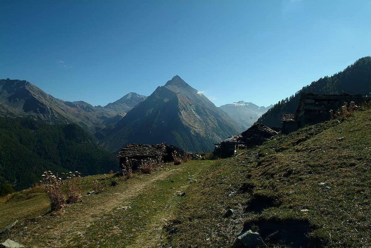
Prapremier Alp, above Fénis & St. Marcel Communes, by Emilio Bertona aka emilius 2003
La carrozzabile, che continua oltre attraversando nuovamente il Torrent de Bioley portandosi sull'altra sponda od Occidentale, con un largo giro dapprima a Nord-nordovest e quindi ad Ovest-sudovest, raggiunge un bivio appena oltre il Villaggio di Champremier (1.383 m), collegandosi alla Strada Comunale risalente da St. Marcel verso la Conca delle Druges unendo così la "viabilità" nella zona alta tra i due comuni adiacenti. Da segnalare che il percorso é formato da numerosi tornanti a gomito internamente al bosco, per cui é cosa buona prestar attenzione. Questa Strada di Collegamento permette di poter variar la gita medesima e, dopo la salita al St. Julien (1.384m), ad esempio salire All'Area Pic Nic di Les Druges "Alte"(1.570/80 metri circa), collocata all'interno d'una fitta splendida foresta appena prima di dirigersi all'ingresso del Vallone di St. Marcel, con Varie Possibilità:
a) - : sostare alla medesima con modica cifra di pagamento (buon parcheggio, fontana, numerose "isole" con panche e tavoli in legno, barbecue in pietra, servizi igienici);
b) - : visitare i Siti delle Miniere di Rame e Ferro di Chuc-Servette con partenza dalla vicina Località di Fornace, ormai in rovina, alle parti superiori alle quali s'accede tramite sentieri segnalati ed una Mappa Generale alla partenza; sussistono ancora i vari imbocchi, Case dei Minatori e resti delle grandi Teleferiche in legno per il trasporto del Minerale;
c) - : da Les Druges "Alte" (1567 m) salire con il sentiero n° 14 partendo alla fontana con attiguo splendido e piccolo squadrato "Rascard" in legno e risalita alla viciniora Cappelletta di San Bernardo; da questa, a secondo della vostra scelta, potete continuare fino alle Alpi di Fontanafredda od, in loco, Fontanafreida (1.800 metri circa), Bren (1.961 m) ed infine all'ultimo di Prapremier o Praz-Premier (2.010 m), proprio appena oltre il confine con Fénis. Qui giunge anche una parallela e sottostante ad Est strada poderale.
Per quanto concerne la discesa, in caso di prolungamento della gita insino l'Area delle Druges, conviene dal bivio di Champremier abbandonare sulla destra la strada percorsa in salita e discendere al Comune di Saint Marcel con la Strada Regionale. In siffatta maniera passando dalla "Locanda del Diavolo" presso le Alpi di Leycher o Leyché e Malplanet, i Villaggetti di Champremier (1.383 m), Viplana, Ronc, Sazailland e Seissogne (1.066m; bel mulino in legno; monumento ai Partigiani fucilati dai nazisti presso l'adiacente Petit Seissogne Cappelletta votiva rappresentante le "Pene Infernali od il Diavolo ingabbiato") si raggiunge il Villaggio di Plout con il suo famosissimo Santuario del 1640, ma esistente, come nicchia, già dal 1200, dedicato a "Notre Dame des Hermites" (968 m; splendida "Via Crucis" all'esterno nel porticato, raffigurante i "Quindici Misteri del Rosario" che appaion con quindici affreschi posti in altrettante nicchie, ad opera di Pittore "Toso Laurentius a Avogadro" nel 1817). Da Plout o Plou continuare per Enchasaz, Réan, Mezéin (793 m; 300 metri prima, bivio a destra per Fénis, ma con divieto di transito ai mezzi non autorizzati), Jayer, Crétaz, Moulin, Faverge e Saint Marcel (Antico Castello a Paquier; 609 m); infine, passando sotto all'Autostrada ed attraversando il ponte sulla Dora nei pressi dell'antica Fonderia del Rame (547 m), s'arriva alla S. Statale n° 26.
Abbinandola alla salita dal Villaggio di Coteau del Mont Saint Julien (con presso la Cima, il Santuario di San Grato ed il sottostante rifugio scavato nella roccia dell'eremita San Giuliano) da Fénis pel Valloncello del Pieiller, risulta Fantastica Gita Escursionistica, paesaggistica, istruttiva nonché culturale, molto adatta a ragazzi ed anche per i bambini.
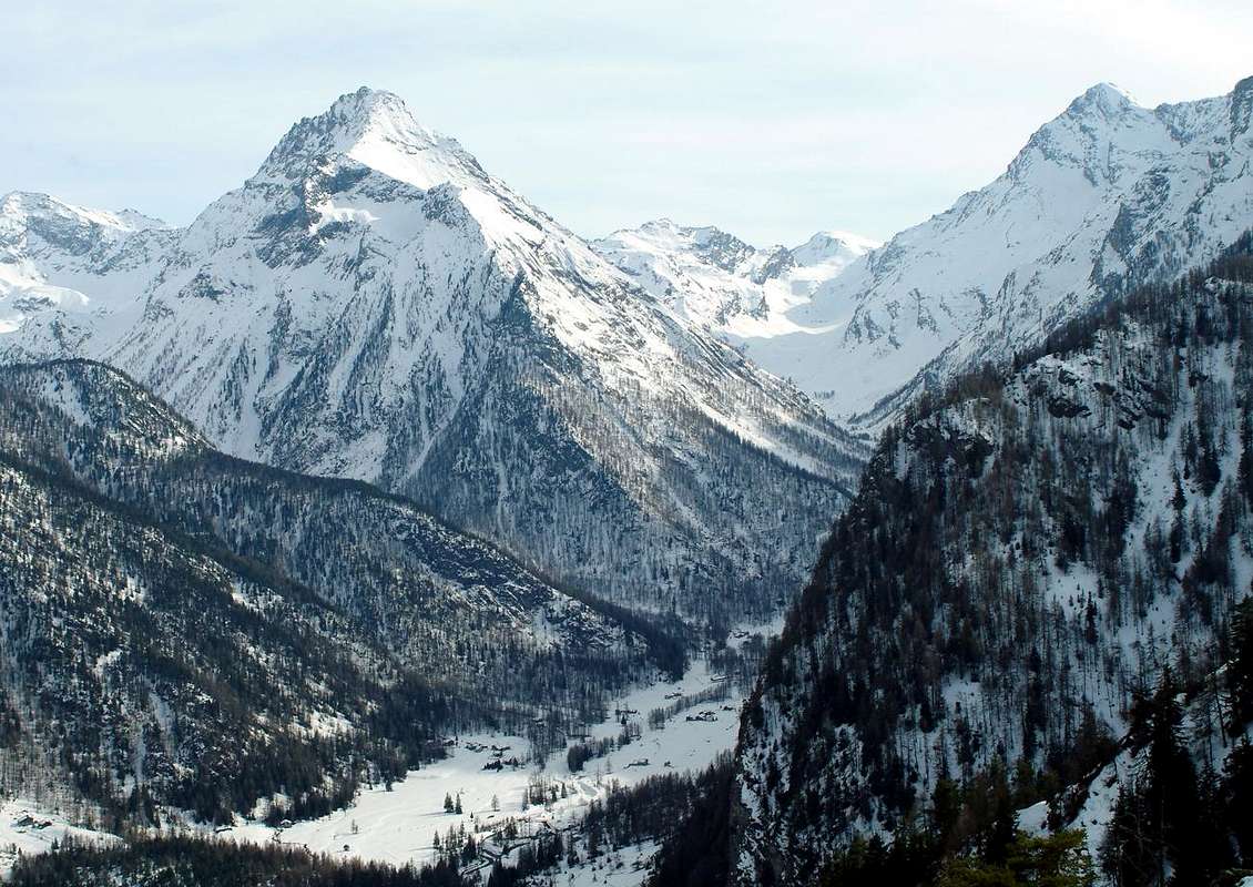
St. Marcel Common towards Upper Les Druges below Mont Roux and to the Sevette Mines with Rouèses Mountain Chain in foreground, by Osw 1996 & 2015
Annotazioni Varie
 |
La carrozzabile, che continua oltre attraversando nuovamente il Torrent de Bioley portandosi sull'altra sponda od Occidentale, con un largo giro dapprima a Nord-nordovest e quindi ad Ovest-sudovest, raggiunge un bivio appena oltre il Villaggio di Champremier (1.383 m), collegandosi alla Strada Comunale risalente da St. Marcel verso la Conca delle Druges unendo così la "viabilità" nella zona alta tra i due comuni adiacenti. Da segnalare che il percorso é formato da numerosi tornanti a gomito internamente al bosco, per cui é cosa buona prestar attenzione. Questa Strada di Collegamento permette di poter variar la gita medesima e, dopo la salita al St. Julien (1.384m), ad esempio salire All'Area Pic Nic di Les Druges "Alte"(1.570/80 metri circa), collocata all'interno d'una fitta splendida foresta appena prima di dirigersi all'ingresso del Vallone di St. Marcel, con Varie Possibilità:
a) - : sostare alla medesima con modica cifra di pagamento (buon parcheggio, fontana, numerose "isole" con panche e tavoli in legno, barbecue in pietra, servizi igienici);
b) - : visitare i Siti delle Miniere di Rame e Ferro di Chuc-Servette con partenza dalla vicina Località di Fornace, ormai in rovina, alle parti superiori alle quali s'accede tramite sentieri segnalati ed una Mappa Generale alla partenza; sussistono ancora i vari imbocchi, Case dei Minatori e resti delle grandi Teleferiche in legno per il trasporto del Minerale;
c) - : da Les Druges "Alte" (1567 m) salire con il sentiero n° 14 partendo alla fontana con attiguo splendido e piccolo squadrato "Rascard" in legno e risalita alla viciniora Cappelletta di San Bernardo; da questa, a secondo della vostra scelta, potete continuare fino alle Alpi di Fontanafredda od, in loco, Fontanafreida (1.800 metri circa), Bren (1.961 m) ed infine all'ultimo di Prapremier o Praz-Premier (2.010 m), proprio appena oltre il confine con Fénis. Qui giunge anche una parallela e sottostante ad Est strada poderale.
Per quanto concerne la discesa, in caso di prolungamento della gita insino l'Area delle Druges, conviene dal bivio di Champremier abbandonare sulla destra la strada percorsa in salita e discendere al Comune di Saint Marcel con la Strada Regionale. In siffatta maniera passando dalla "Locanda del Diavolo" presso le Alpi di Leycher o Leyché e Malplanet, i Villaggetti di Champremier (1.383 m), Viplana, Ronc, Sazailland e Seissogne (1.066m; bel mulino in legno; monumento ai Partigiani fucilati dai nazisti presso l'adiacente Petit Seissogne Cappelletta votiva rappresentante le "Pene Infernali od il Diavolo ingabbiato") si raggiunge il Villaggio di Plout con il suo famosissimo Santuario del 1640, ma esistente, come nicchia, già dal 1200, dedicato a "Notre Dame des Hermites" (968 m; splendida "Via Crucis" all'esterno nel porticato, raffigurante i "Quindici Misteri del Rosario" che appaion con quindici affreschi posti in altrettante nicchie, ad opera di Pittore "Toso Laurentius a Avogadro" nel 1817). Da Plout o Plou continuare per Enchasaz, Réan, Mezéin (793 m; 300 metri prima, bivio a destra per Fénis, ma con divieto di transito ai mezzi non autorizzati), Jayer, Crétaz, Moulin, Faverge e Saint Marcel (Antico Castello a Paquier; 609 m); infine, passando sotto all'Autostrada ed attraversando il ponte sulla Dora nei pressi dell'antica Fonderia del Rame (547 m), s'arriva alla S. Statale n° 26.
Abbinandola alla salita dal Villaggio di Coteau del Mont Saint Julien (con presso la Cima, il Santuario di San Grato ed il sottostante rifugio scavato nella roccia dell'eremita San Giuliano) da Fénis pel Valloncello del Pieiller, risulta Fantastica Gita Escursionistica, paesaggistica, istruttiva nonché culturale, molto adatta a ragazzi ed anche per i bambini.
 |
 |
 |
 |
 |
Routes Description
These 10 routes have been grouped into three large blocks. It is considered the longest and most complete way leading to Mont Saint Julien, the La Tourriasse towards East and West side of Mount Corquet through the very long Valley of St. Marcel. Clearly everyone can organize, depending on your imagination and the degree of training, the intermediate stages that reach various pastures or distinct locations, constituents already in themselves an autonomous goal. Purpose is to be considered valid the hypothesis of an average of about 350 400 vertical meters per hour, although much depends on the specific characteristics of each territory and is closely related to their personal abilities and degree of training. With Snowshoeing calculated to double the travel time uphill and increase by half during descent than the walking path. Even here, however, many other factors come into play such as the thickness of the snow cover and the type of the same: surely with high and fresh snow all becomes more difficult and tiring ...
To Mont St. Julien with Hermitage from Le Coteau, by Osw 2013
1/1bis) - Mont Saint Julien (1.384m) or Mont Roux (2.277m), through Western Eastern Slopes: it starts with the path n° 10B (wooded signpost to St. Julien) at the hairpin-junction between the Villages of La Morgettaz Le Pieiller (1.230m) after a short distance on a dirt track and soon you get to the source "Village Phantom" Le Coteau (1.234m), in the woods. Here is another similar sign, hanging from the old alp, half in ruins and in front, pointing towards the South direction, a small ramp leading to the little votive Chapel/Oratory of St. Joseph, just behind the old village, now abandoned (one renovated house) and looking ghostly, where in times not so long ago there was "Life". He turns to the East and with gentle climb you pass a brook with a flat stone, which acts as a miniscule bridge, leaving below a pasture with grass at the edge of the woods that is about to go broke, you continue progressing toward Northeast until meet the plates of polished rock and blackish (aimed at a small climbing didactics; in the area are succulents). The trail begins to rise before addressing slope towards a grassy collar, scrapping on the left, (Collar of Saint Julien? Impassable because beyond presents a vertical rock face) and then decisively in the direction of North to a long wooden boardwalk that a good fence protects against a quantum leap rock, above the Pieiller Vallon. The next stretch leading to the wooden walkway that "cuts" the West Slope with a diagonal to the North, and very exposed an impressive leap rock, but protected by a fence that is hanging in the balance at the end because, due to the winter snow, it is off exit from its base. You have to pay a little attention, especially in the presence of childrens. After crossing the same, the trail climbs to the North-northeast, and with a beautiful stone staircase, pleasant to go, achieving a rampart with beautiful views of the Central Valley, the Dora Baltea and the Aosta Town; while the West stands the Range Roèses (to photograph must come in the morning), preceded by the South Coast more than Mont Saint Julien goes up to the nearby Torrasse (1.854m), Mont Corquet (2.527m) to eventually decline with semi-circular route to Mont Roux (2.277m; from Prapremier Alp passing with the small path n° 14 through the ancient and hemi ruined Corquet Alp (2.124m); see just below), the site of ancient Ironmines and Copper. Turning to the right with a nice diagonal through the woods, on the trail soft, slightly steep and studded safe from dawn of mushrooms, you get to the Saint Grat Sanctuary with octagonal Church its high, white and square (T/E; 0h'35/0h'40). The true Summit is just above and you can reach in a short time with a trace of grass and trees immediately to the right (South).
From Les Druges "Basse & Alte" (Lower 1567m; Upper; 1.586m) Village towards Fontanafredda, Bren, Plan des Meyes and Prapremier Alpages, by emilius 2002, 2003 & 2004
2/3/4/5/6) - By Les Druges "Alte" towards Fontanafredda, Bren, Plan des Meyes or Prapremier Alpages to La Torrasse or Mont La Tourriasse (1.903m) from Les Druges Alte, through the dirt road concomitant with the path n° 14 towards Fontanafredda isolated Alpage (1.829m); from Fontaine Froide three possibilities:
 |
1/1bis) - Mont Saint Julien (1.384m) or Mont Roux (2.277m), through Western Eastern Slopes: it starts with the path n° 10B (wooded signpost to St. Julien) at the hairpin-junction between the Villages of La Morgettaz Le Pieiller (1.230m) after a short distance on a dirt track and soon you get to the source "Village Phantom" Le Coteau (1.234m), in the woods. Here is another similar sign, hanging from the old alp, half in ruins and in front, pointing towards the South direction, a small ramp leading to the little votive Chapel/Oratory of St. Joseph, just behind the old village, now abandoned (one renovated house) and looking ghostly, where in times not so long ago there was "Life". He turns to the East and with gentle climb you pass a brook with a flat stone, which acts as a miniscule bridge, leaving below a pasture with grass at the edge of the woods that is about to go broke, you continue progressing toward Northeast until meet the plates of polished rock and blackish (aimed at a small climbing didactics; in the area are succulents). The trail begins to rise before addressing slope towards a grassy collar, scrapping on the left, (Collar of Saint Julien? Impassable because beyond presents a vertical rock face) and then decisively in the direction of North to a long wooden boardwalk that a good fence protects against a quantum leap rock, above the Pieiller Vallon. The next stretch leading to the wooden walkway that "cuts" the West Slope with a diagonal to the North, and very exposed an impressive leap rock, but protected by a fence that is hanging in the balance at the end because, due to the winter snow, it is off exit from its base. You have to pay a little attention, especially in the presence of childrens. After crossing the same, the trail climbs to the North-northeast, and with a beautiful stone staircase, pleasant to go, achieving a rampart with beautiful views of the Central Valley, the Dora Baltea and the Aosta Town; while the West stands the Range Roèses (to photograph must come in the morning), preceded by the South Coast more than Mont Saint Julien goes up to the nearby Torrasse (1.854m), Mont Corquet (2.527m) to eventually decline with semi-circular route to Mont Roux (2.277m; from Prapremier Alp passing with the small path n° 14 through the ancient and hemi ruined Corquet Alp (2.124m); see just below), the site of ancient Ironmines and Copper. Turning to the right with a nice diagonal through the woods, on the trail soft, slightly steep and studded safe from dawn of mushrooms, you get to the Saint Grat Sanctuary with octagonal Church its high, white and square (T/E; 0h'35/0h'40). The true Summit is just above and you can reach in a short time with a trace of grass and trees immediately to the right (South).
 |
 |
 |
 |
 |
2/3/4/5/6) - By Les Druges "Alte" towards Fontanafredda, Bren, Plan des Meyes or Prapremier Alpages to La Torrasse or Mont La Tourriasse (1.903m) from Les Druges Alte, through the dirt road concomitant with the path n° 14 towards Fontanafredda isolated Alpage (1.829m); from Fontaine Froide three possibilities:
1) - leaving the same, from the following alternative 1.885 meters turn briefly before Northeast with short dirt road, after through the path n° 9 towards Plan des Meyes (1.887m) and Meyes (1.893m) Pastures. From this last, pathless, to the altitude 1.901 meters and, through the forest with sparce rocks, in North-northeast to Summit (E/F; 1h'15/1h'30 from Les Druges Alte). Also
2) - from Fontanafreide continue up to the preceding alternative reaching Bren Alp (1.965m; last still used and with beautiful fountain in front); a short descent amongst the prairies with the small path n° 9C lead to Les Meyes Pasture and previous route.
3) - Even continuing until Prapremier Alp (2.010m; semiruined and abandoned) and with traverse throuhg hemicircular trail n° 9B connecting with route from La Rossa Tramouail (Mid Alp, Fénis-Clavalité Valley). Beautiful excursion by snowshes with various departures, as above described; in this case, we recommend the tour starting downhill through a serie of sparce traces amongst grassy fields by Prapremier old Alp.
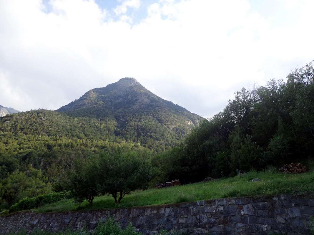
Mont Torrasse above Clavalité & St. Marcel Valley, by emilius 2004
7/8/9/10) - Chuc-Servette Mines, Lavanché, Crotey Dèsott Damon Alps and Crotey Hill with Mont Corquet (2.530m), by Southern Crest from Crotey Pass: through the route n° 3 from Les Druges Higher (1.586/7 meters about) up to the Chuc-Servette Coppermines (1.733m now abandoned but restored) at the entrance on St. Marcel Valley and at the Western foot of Mont Roux; leaving the same to the right, continue South through the path n° 18 towards the junction 2.151 meters, just before Lavanché Pasture (2.071m). From the crossroads continue East through the path n° 3E into a small secondary vallon reaching the nearby Crotey Dèsott Damon Alps (2.348m, 2.358) just below the homonym Hill (2.458m). From this in North before by an evident track n° 8A, that arrives in East from the Tramouail de la Rossa (Fénis-Clavalité Valley), and after, through flat prairies with grassy fields, that more easily towards the cairn of Mont Corquet (E/F; 0h'45 from Crotey Hill; 1h'30/1h'45 by Lavanché Pasture).
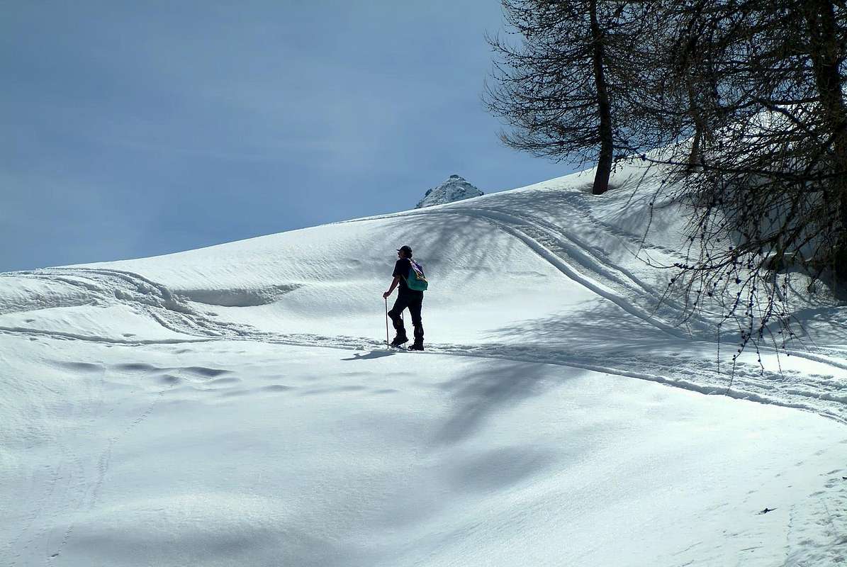
Bren-Prapremier towards Mont Corquet snowshoing, by emilius 2002
 |
7/8/9/10) - Chuc-Servette Mines, Lavanché, Crotey Dèsott Damon Alps and Crotey Hill with Mont Corquet (2.530m), by Southern Crest from Crotey Pass: through the route n° 3 from Les Druges Higher (1.586/7 meters about) up to the Chuc-Servette Coppermines (1.733m now abandoned but restored) at the entrance on St. Marcel Valley and at the Western foot of Mont Roux; leaving the same to the right, continue South through the path n° 18 towards the junction 2.151 meters, just before Lavanché Pasture (2.071m). From the crossroads continue East through the path n° 3E into a small secondary vallon reaching the nearby Crotey Dèsott Damon Alps (2.348m, 2.358) just below the homonym Hill (2.458m). From this in North before by an evident track n° 8A, that arrives in East from the Tramouail de la Rossa (Fénis-Clavalité Valley), and after, through flat prairies with grassy fields, that more easily towards the cairn of Mont Corquet (E/F; 0h'45 from Crotey Hill; 1h'30/1h'45 by Lavanché Pasture).
 |
Questi 10 itinerari sono stati raggruppati in tre grandi blocchi. Infatti viene considerata la via più lunga e completa che conduce al Mont Saint Julien, alla Torrasse verso Oriente e nel lato Occidentale al Mont Corquet tramite il lungo Vallone di St. Marcel. Chiaramente ognuno può organizzare, a seconda della propria fantasia e del grado di allenamento, delle tappe intermedie che raggiungono vari alpeggi o ben distinte località, costituenti già di per sé stesse una meta autonoma. All'uopo é da considerare valida l'ipotesi di una media di circa 350 400 metri di dislivello all'ora, anche se molto dipende dalle caratteristiche specifiche di ogni terreno ed é in stretta relazione con le proprie capacità personali. Con Racchette da neve calcolare di raddoppiare il tempo di percorrenza in salita ed aumentare della metà in fase di discesa rispetto al percorso a piedi. Entrano in gioco molti altri fattori quali lo spessore del manto nevoso nonché la tipologia del medesimo: sicuramente con neve alta e fresca tutto diventa più difficile e faticoso ...
Highly variable depending on the Excursion and as directed by T/E (Tourist or Hiking) to EE/A (Expert Hikers/Mountaineers) or by Snowshoe.
Molto variabili a seconda dell'Escursione e come rivolte da T/E (Turistiche od Escursionistiche) ad EE/A (Escursionisti Esperti/Alpinisti) oppure in Racchette da neve.
Equipment
For Hiking or with Snowshoeing.
Da Escursionismo o con Racchette da neve.
 |
 |
 |
Essential Gear
DifficultiesHighly variable depending on the Excursion and as directed by T/E (Tourist or Hiking) to EE/A (Expert Hikers/Mountaineers) or by Snowshoe.
Molto variabili a seconda dell'Escursione e come rivolte da T/E (Turistiche od Escursionistiche) ad EE/A (Escursionisti Esperti/Alpinisti) oppure in Racchette da neve.
 |
Equipment
For Hiking or with Snowshoeing.
Da Escursionismo o con Racchette da neve.
Campings
Remember that free camping is forbidden (except for emergency reasons, over 2.500m, from darkness until dawn).Mountain Condition
- Meteo: you can find all the needed informations at the official site of the Valle d'Aosta Region:
- Valle d'Aosta Meteo
Important Information
- REGIONE AUTONOMA VALLE D'AOSTA the official site.
- FONDAZIONE MONTAGNA SICURA Villa Cameron, località Villard de la Palud n° 1 Courmayeur (AO) Tel: 39 0165 897602 - Fax: 39 0165 897647.
- A.I.NE.VA. (Associazione Interregionale Neve e Valanghe).
Useful numbers
- Protezione Civile Valdostana località Aeroporto n° 7/A Saint Christophe (Ao) Tel. 0165-238222.
- Bollettino Meteo (weather info) Tel. 0165-44113.
- Unità Operativa di Soccorso Sanitario Tel. 118.