


-
 1915 Hits
-
 77.48% Score
-
 8 Votes
|
|
Route |
|---|---|
|
|
45.66666°N / 7.27928°E |
|
|
Hiking |
|
|
Spring, Summer, Fall, Winter |
|
|
Half a day |
|
|
F (Easy) |
|
|
Note
|
La montagna chiama i suoi figli, ed essi rispondono fedelmente al suo appello… Osvaldo Cardellina, Diario alpinistico, 1964-65 Page texts: @ OsvaldoCardellina "Osva", passed away on May 2, 2022. Page owners: Christian Cardellina e Osvaldo Cardellina. Any updates from September 12, 2022: Antonio Giani, page administrator, friend and climbing companion. Testi della pagina: @ OsvaldoCardellina "Osva", scomparso il 2 maggio 2022. Proprietari pagina: Christian Cardellina e Osvaldo Cardellina. Eventuali aggiornamenti dal 12 settembre 2022: Antonio Giani, amministratore della pagina, amico e compagno di salite. |
Pear-shaped Overview
That Time when the Gods walked the Ridges is now remotely Past. Kidnapped by a large UFO, which took them perhaps forever, recovered towards Heaven and the Galaxies of an infinite Universe. There remain only small and poor men that hang out and haunt at the foot of the Great Mountain called La Pierre or the Stone but carved in the shape of "Pera" by the Giant Gargantua. When the sea still lapped his feet, before the big chill that has turned into Glacier Balteus that ran down to Ivrea in the Po Valley.
![]()
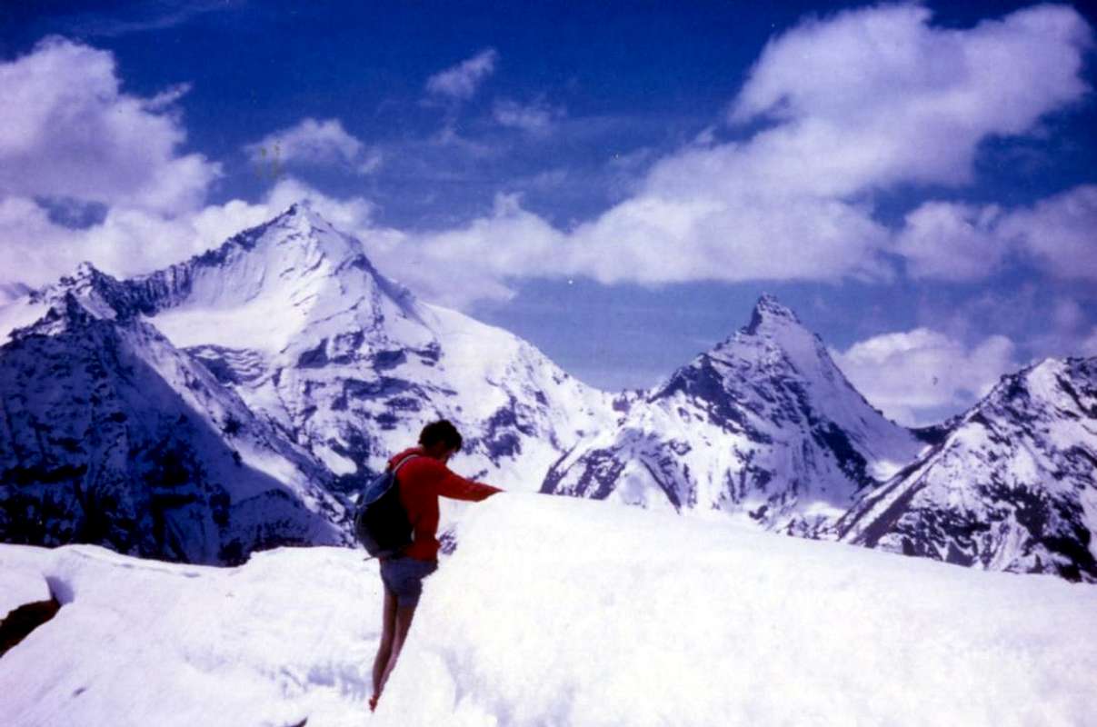
"La Pera" (2.653m) above Pila Basin & Jovençan Common supervised by an U.F.O., by Antonio
Quel Tempo ove sulle Creste camminavano gli Dei é ormai lontanamente Passato. Rapiti da un grande U.F.O., che li ha avvolti forse per sempre, son risaliti verso il Cielo e le Galassie di un Universo infinito. Rimangono soltanto piccoli e poveri Uomini che bazzicano ai piedi della Grande Montagna chiamata La Pierre o la Pietra ma scolpita a "Pera" dal Gigante Gargantuà. Quando il Mare ne lambiva ancora i piedi, prima del grande freddo che l'ha tramutata nel Ghiacciaio Balteo scorrente giù sin Ivrea ed alla Pianura Padana.
![]()
Vineyards and apple orchards in Gressan with Medieval Tour de Voella, by Osw 2015

Quel Tempo ove sulle Creste camminavano gli Dei é ormai lontanamente Passato. Rapiti da un grande U.F.O., che li ha avvolti forse per sempre, son risaliti verso il Cielo e le Galassie di un Universo infinito. Rimangono soltanto piccoli e poveri Uomini che bazzicano ai piedi della Grande Montagna chiamata La Pierre o la Pietra ma scolpita a "Pera" dal Gigante Gargantuà. Quando il Mare ne lambiva ancora i piedi, prima del grande freddo che l'ha tramutata nel Ghiacciaio Balteo scorrente giù sin Ivrea ed alla Pianura Padana.

At its base, however, it was felt waist Villages, Towers, Churches and Castles, Meadows and the Herds, the Vineyards and Horses, all powered with its fresh waters that she generously expands from East to West to the Baltea between the Municipalities of Gressan, Jovençan, Aymavilles and up to the entrance of the nearby Valley of Cogne.
Going up by the Dora Baltea to the vast Basin of Pila, Paradise of Skiers and gateway to climbing in the Mont Emilius Group, while after Aymavilles and over the Grand'Eyvia rise above the forests and meadows that reach the Village of Ozein at the foot of the Northwest slopes of "Pera", here really suitable for trips Ski-Mountaineering and Snowshoeing. Between these two sectors, one third falls in the North completely covers its slopes with a dense forest that only a good knowledge of the area may attend. This formed by the Bois de Liautaysaz, Brin, Champchenille and Côte-Noire expands downwards in the direction of the small villages of Bren, Turlin Dessus Dessous and on the border between Gressan and Jovençan. An area more suitable for Rangers, Explorers-Scouts than to Walkers for which it is advisable to "turn off" resting on the hips to the East in the direction of the localities of Grand Pailler-La Premou-Bren-Alpetta-Fernier on the run ski-country bearing Pila-Posse or to the Southwest reaching the Pasture of Rompérein and that those Champchenille, Borbolet, la Pierre. Sight-seeing opportunities and historical-cultural satisfactions also offer the itineraries of the Middle-Lower hill.
![]()
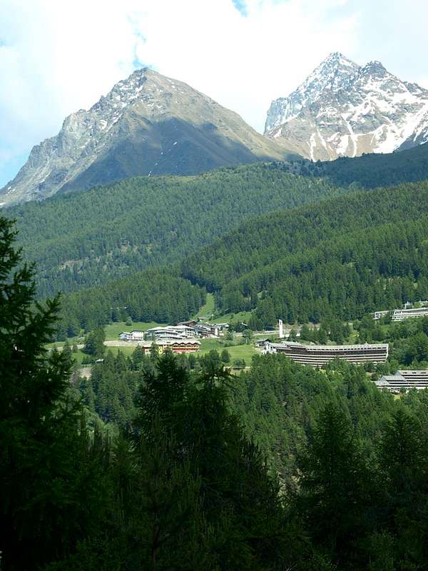
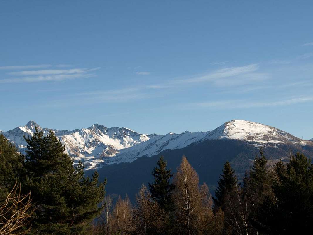
Pila Basin (1.850m) at the beginning of various routes, by Osw 2015
Alle sue pendici però é sorta la Vita con Villaggi, Torri, Chiese e Castelli, i Prati e le Mandrie, le Vigne ed i Cavalli, tutti alimentati con le sue fresche acque che lei generosamente espande da Oriente ad Occidente verso il corso della Dora tra i Comuni di Gressan, Jovençan, Aymavilles nonché insino all'entrata dell'adiacente Valle di Cogne. Salendo dalla Dora Baltea verso il vasto Bacino di Pila, Paradiso degli Sciatori e porta di ingresso per le scalate nel Gruppo del Monte Emilius, mentre dopo Aymavilles e sopra la Grand'Eyvia salgono foreste e prati che raggiungono il Villaggio di Ozein ai piedi Nordovest della "Pera", qui veramente adatta a gite di Sci-Alpinismo nonché Racchette da neve.
In mezzo a questi due settori, un terzo cala a Settentrione ricoprendo interamente i suoi pendii con una fitta foresta che sol un buon conoscitore del territorio può frequentare. Questa, formata dai Bois de Liautaysaz, Brin, Champchenille e Côte-Noire s'espande verso il basso in direzione dei Villaggetti di Bren, Turlin Dessus e Dessous, al confine tra i Comuni di Gressan e Jovençan. Area più adatta agli Esploratori che non agli Escursionisti pei quali é consigliabile "girare largo" appoggiando sui fianchi verso Oriente in direzione delle località di Grand Pailler-La Premou-Bren-Alpetta-Fernier sulla pista di sci di fondo che porta a Pila-Posse oppure verso Sudovest raggiungendo l'Alpeggio di Rompérein e da questo quelli di Champchenille, Borbolet e la Pierre. Buone opportunità di visite storico-culturali e belle soddisfazioni offrono anche gli Itinerari della Medio-Bassa collina.
Going up by the Dora Baltea to the vast Basin of Pila, Paradise of Skiers and gateway to climbing in the Mont Emilius Group, while after Aymavilles and over the Grand'Eyvia rise above the forests and meadows that reach the Village of Ozein at the foot of the Northwest slopes of "Pera", here really suitable for trips Ski-Mountaineering and Snowshoeing. Between these two sectors, one third falls in the North completely covers its slopes with a dense forest that only a good knowledge of the area may attend. This formed by the Bois de Liautaysaz, Brin, Champchenille and Côte-Noire expands downwards in the direction of the small villages of Bren, Turlin Dessus Dessous and on the border between Gressan and Jovençan. An area more suitable for Rangers, Explorers-Scouts than to Walkers for which it is advisable to "turn off" resting on the hips to the East in the direction of the localities of Grand Pailler-La Premou-Bren-Alpetta-Fernier on the run ski-country bearing Pila-Posse or to the Southwest reaching the Pasture of Rompérein and that those Champchenille, Borbolet, la Pierre. Sight-seeing opportunities and historical-cultural satisfactions also offer the itineraries of the Middle-Lower hill.
Alle sue pendici però é sorta la Vita con Villaggi, Torri, Chiese e Castelli, i Prati e le Mandrie, le Vigne ed i Cavalli, tutti alimentati con le sue fresche acque che lei generosamente espande da Oriente ad Occidente verso il corso della Dora tra i Comuni di Gressan, Jovençan, Aymavilles nonché insino all'entrata dell'adiacente Valle di Cogne. Salendo dalla Dora Baltea verso il vasto Bacino di Pila, Paradiso degli Sciatori e porta di ingresso per le scalate nel Gruppo del Monte Emilius, mentre dopo Aymavilles e sopra la Grand'Eyvia salgono foreste e prati che raggiungono il Villaggio di Ozein ai piedi Nordovest della "Pera", qui veramente adatta a gite di Sci-Alpinismo nonché Racchette da neve.
In mezzo a questi due settori, un terzo cala a Settentrione ricoprendo interamente i suoi pendii con una fitta foresta che sol un buon conoscitore del territorio può frequentare. Questa, formata dai Bois de Liautaysaz, Brin, Champchenille e Côte-Noire s'espande verso il basso in direzione dei Villaggetti di Bren, Turlin Dessus e Dessous, al confine tra i Comuni di Gressan e Jovençan. Area più adatta agli Esploratori che non agli Escursionisti pei quali é consigliabile "girare largo" appoggiando sui fianchi verso Oriente in direzione delle località di Grand Pailler-La Premou-Bren-Alpetta-Fernier sulla pista di sci di fondo che porta a Pila-Posse oppure verso Sudovest raggiungendo l'Alpeggio di Rompérein e da questo quelli di Champchenille, Borbolet e la Pierre. Buone opportunità di visite storico-culturali e belle soddisfazioni offrono anche gli Itinerari della Medio-Bassa collina.
Getting There
BY CAR:
By plane:
- From TORINO, MILANO, etc: Motorway A5. Exit at IVREA or Quincinetto (PIEDMONT).
- From IVREA Town: Charvensod, Gressan, Jovençan, Aymavilles Municipalities.
 |
- From Charvensod (main road from Pont Suaz 567m) or by Gressan (603m; alternative road) to Tivet, Les Fleurs Hamlets (1.292m, 1.414m) Pila Basin and Resort (low parking nearby Cableway 1.800m; upper parking 1.850m). Arno Shelter (2.660m), always open but unguarded, nearby Couiss Summit on watershed Pila/Cogne Valley.
- From Jovençan (631m) to Western Pila Conca, exclusively through path-muletrack to Tourlin Dessous (1.466m) and by dirt road to Pila-Posse Tennis (1.776m).
- From Aymavilles (646m) to Western Pila Conca, through Main Road to Cogne Valley, alternative road to Ozein/Turlin Dessus Hamlets and dirt road to Pila-Posse.
 |
- From FRANCE: through the Mont Blanc Tunnel to Entrèves-crossroads to Vény/Ferret Valleys - Mountain Guides of Courmayeur - La Saxe Rock Gym - Courmayeur. By Little Saint Bernard Pass, closed since November until half May to La Thuile Valley - Pré Saint Didier - Courmayeur. It is not necessary to take Motorway A5: you can drive on SS.26, in the direction of AOSTA - IVREA - TURIN.
By plane:
- Aeroporto "Corrado Gex" Saint Christophe (Aosta).
Seven / Eight Routes Description
 |
 |
 |
 |
 |
There are several Walks and Excursions possible to "La Pera", also with Snowshoeing or Ski-Mountaineering. Generally, the same is achieved mainly by Pila Basin as Hiking excursion, while the opposite side departing from Ozein-Dailleuy (1.349m, 1.480m) takes the classic to the Sci-Mountain and the "adventurous" in Snowshoe. But also made the Walks on its slopes know a good attendance by a large group of Tourists or Vacationers departing from both areas, especially on track linking Ozein and Pila path from one to the other in both directions, generally starting from the first location mainly known as "La Premou" with the outward journey and return. Also a walk fairly popular is the one that reaches from Pila towards Alps Grimondet and Grand Grimod (2.105m, 2.232m), closing the circular route passing through the Lake Leissé (2.114m). On another front instead you can turn to the Walk of Pastures and Rompérein Champchenille, intermediate route in the direction of "La Pera" with skiing or snow rackets, in a nice and quite long Excursion that reaches the next Pastures of Borbolet Dèsott and Damon of the Pera, on-site "la Pira" (2.119m); by the latter easily and in a short time you get to Punta Vadaille or Vedailles (2.338m) above a rocky promontory of over 1.000 meters on the Stream Grand'Eyvia descending from Gran Paradiso (4.061m) and passing through the Cogne-Resort. An unusual view of the entire massif with superb views on the very close Grivola (3.969m), incidentally always in evidence on all routes to the "La Pera". The other itineraries, with routes from the plain of the Dora Baltea to the low and medium hill below to it, as well as to allow a good to kick one's legs to make beautiful tours in the historical-cultural aspect in an area already well known is that by the Salassi and from the Romans more than 2000 years and offering well leftovers significant vestiges of Medieval castles, towers and civil construction. Also just as full of ideas it comes visiting religious sites with the remains of ancient Churches and votive Chapels, are still popular today. Regarding the Walks around the ancient settlements of Calventianus or Calvetianus (Charvensod), Gratianus or Gressanum (Gressan), Joventianus or Juventanum (Jovençan) and Aimus et Avilius (Aymavilles) we leave completely free choice according to the imagination of each one, remembering only that a dense network of trails connects these adjacent municipalities. But also Hiking in the middle hill lead us to "Santa Colomba" Les Fleurs-Peroulaz (1.380m), Grande and Petite Cerise, Eaux Froides, Rossellin and Charémoz, Leysettaz, Champlan and Matechanaz, Tivet (1.299m), Pila, Bren-di-Milieu (1.642m), Turlin de Jovençan or Dessous (1.466m) Turlin Aymavilles or Dessus (1.536m), Ozein and Sérignan Villages and always with beautiful walking paths and trails that depart from these locations all at the foot of the "Pera" or "Pear".
1) - Trekking or ski touring trip to Pointe de la Pierre or "La Pera" departing from the District of Pila (about 1.850 meters) and through the Col de la Pierre:
by Pila, reached passing Charvensod Commune through the old Regional Road or with the new regional Road from Gressan Municipality, reach the breadth superior square-parking lot (1.870m) immediately below the long concrete tunnel, where he leaves the car (various prohibition signals for the following dirt roads). From this to reach an i cross of three farms dirt roads, site between Gorraz and Gorraz Damon, taking that middle, concidente with the path n° 23 and to follow it with direction Southwest (abundant posters). Passing below the Cableway Gorraz/Leissé Damon, to reach at first the Pasture of Lap ((2.076m), that he leaves as soon as on the left, introducing then himself in the homonym wood; reaching Grand Grimod Dessous (2.158m), where a new triplex intersection of paths happens (to the right or North for the Grimondet (2.105m) and to the left or Southeast for the Grand Grimod Dessus (2.232m ; arrival of the Cable-way). Continue instead among the two with the path n° 23A toward the hairpin bend 2.294 meters, just below the Chair lift that from the Alp Grivel (1.910m) reaches it as soon as above; changing direction in South to reach the small station of arrival and to continue through backs meadow and small basins grassy-debris. To reach an assistant under the Collar de the Pierre (about 2.600 meters) and, through a steep but brief line, to reach the same one along his Slope East-northeast. Folding up to the right or Northwest to reach the homonym Hill (2.594m) and easily with the path n° 23A/1 , along the Crest Southeast, with almost level and old run a small rocky line on the right, to reach the tall and thin Cross in wood posts on the Summit (E/F or BSA; 0h'20 from the hill; 3h'00 by Pila).
2) - Ski touring trip to Pointe de la Pierre starting from the Village of Ozein (1.349m), Dailleuy resort (1.480m) and through the slope of the Northwest Face: on the Regional road by Aymavilles towards Cogne Valley, before reach Ozein Hamlet, (1.349m) with Parking in place near Belley 1.369m). From Ozein you can go on, along the road to Turlin Dessus and Low, till a fork on the right side, wherefrom starts the farm road, (concomitant with the path n° 1; , leading to the mountain Pastures of Romperein (1.867m) and to the next of Champchenille (2.212m). This, of course if the road is free, normally in winter you have to start from Ozein and get this point along some short cuts, avoiding the 7 km of the road. From Champchenille, ascending on fine slopes, straight to the Summit, by ski (BSA; 3h'00/4h'00 from Dailleu also Dailleuy alternative).
3) - Circular Tour by people with snowshoes starting from the fork of Dailleuy (1.490m) passing Alpages Rompérein, Champchenille, Borbolet Low and La Ruì:
this tour can be carried out indifferently on one side or the other.
a) - In fact, reached the Pastures of Rompérein, you can continue to Southeast as in the previous itinerary and path 1 until Campchenille; from here, leaving to the left (East) the way for the "Pera", go down briefly with unnumbered path to Borbolet Alpe di Sotto (Low; 2.108m) and from there via a detour onto a farm dirt road to the nearby La Rui Alpage (1.923m). From the latter, with the farm road that reaches the High Pastures Bardoney and la Pierre, it descends again to those of Rompérein and Titeun (1.760m) closing the circle.
b) - Or from 1.706 meters junction, after the Alp isolated from the Premou (1.685m) and before the nearby Titeun Pasture, you continue with the trail n° 8 that comes from Ozein-Belley-Léonard-Chantal reaching La Ruì (F; 3h'00/4h'00 for both directions of travel).
4/5) - Beautiful and long Excursion towards Barbolet Viou and la Pierre Alpages reaching Pointe de la Pierre or Vadaille:
Through the preceding routes up to La Ruì or Lower Borbolet Alpages; from the both in South with trail n° 8 reach the most ancient Borbolet Viou or Damon Pasture and subsequent always very ancient of la Pierre highest Alpage (2.072m, 2.077m). From La Pierre Alp continue to fork 2.303 meters and from this, with path n° 8,
a) - in East-northeast, on Western slopes, to de la Pierre Hill (2.584m) and the Summit, through easy Southeast Crest (2.653m; EE/F+; 1h'45/2h'00); in South, with small path always n° 8 and debris and traces at the end bypassing some easy and small rock in final part, to
b) - Punta Vadaille or Vedailles (2.338m; E/F;0h'45/1h'00 by La Pierre Alp).
6) - Traverse into the Bois de Brin on run ski-country from the locality of "La Premou" (1.685m) reaching Pila-Posse new Resort:
from Turlin Dessus (1.536m) small Hamlet, reached from below Ozein Village with Regional Road to the East and between Aymavilles and Jovençan Municipalities, through the Bois de Brin (Brin's Forest) towards Bren du Milieu (Midst; 1.642m), Alpetta (1.718m), Fernier (1.773m) Alps and crossing on Fernier, Plan de Leyvie Torrents, Posse Village (1.776m; T/E; 1h'20/1h'40), immediately below thr Pila Resort. Walk increasingly "fashionable", round trip on farms road becomes a track in winter cross-country skiing.
7/8) - Circuits from Gressoney walk to the Basin Pila in MB or even passing by the Alps Bren Dessous and di Milieu (1.642m) or the old ski slope Leysettaz:
in this proposal we want to offer you two two routes pointing to the "old and the modern times" not to forget the past and highlight "new ideas" of the present "Age youth".
a) - Gressan-Moline goes up towards the small Villages of Champeriet, Novellioz, Tanace e Chavanace and climb by the trail n° 21B almost concurrent to the private dirt road, making it comparable to the East, reaching the Alps of Bren Dessous and Milieu, this recently renovated, and fitting into the previous crossing or to Pila Resort or dropping to Turlin Dessus. This route is currently very popular with young people in Mountain Bike. In traditional walking route from the valley floor (E/F) instead compute a 3h'00/3h'30.
b) - good last and always starting from Gressan Municipality want to remember the old mule track of "Leysettaz" that from Gressan, Clapey locality (769m), dates back to the path-mule track not numbered towards the Villages Palathiaou, Perrial, Leysettaz Dessous and Dessus and then reach Peroulaz locality (1.380m) on the Regional Road to Pila Resort. It constituted, before the construction of the cable car from Aosta, the Sunday trip for fans of ski touring the city in the Fifties. Starting on foot and on skis on their shoulders from Piazza Chanoux reached a watershed with Cogne's Valley at 2.660 meters near the "Pera" and the old "Cabin Arno" dedicated to local Mountain Carrier Simone Facchinello (now restored as a beautiful camp with light and always open) and this came back with a single and adventurous descent, then celebrate by telling all to their Friends.
 |
 |
|
 |
 |
Diverse sono le Passeggiate e le Escursioni possibili verso "La Pera", anche con Racchette da neve o in Sci-Alpinismo. In genere la stessa viene raggiunta prevalentemente dal Bacino di Pila come gita Escursionistica, mentre dal versante opposto con partenza da Ozein-Dailleu(y) avviene quella classica per lo Sci-Alpinismo nonché quella "avventurosa" in Racchette da neve. Ma anche le Passeggiate effettuate alle sue pendici conoscono una buona frequentazione da parte di una nutrita schiera di Turisti o Villeggianti con partenza da entrambe le aree, soprattutto nella pista di collegamento tra Ozein e Pila, detta "La Premou", con percorso da una all'altra in ambo i sensi, generalmente partendo dalla prima località e con viaggio di andata e ritorno. Inoltre una passeggiata discretamente frequentata risulta quella che da Pila raggiunge le Alpi di Grimondet e Grand Grimod, chiudendo il percorso circolare transitando per il Lago Leissé. Sullo altro fronte invece si può tramutare la Passeggiata agli Alpeggi di Rompérein e Champchenille, itinerario intermedio in direzione della "La Pera" con gli Sci o le racchette, in una bella ed abbastanza lunga Escursione che raggiunge i successivi Alpeggi di Borbolet Dèsott e Damon e di la Pera, in loco "la Pira"; da quest'ultima facilmente ed in breve tempo s'arriva alla Punta Vadaille o Vedailles sopra un salto roccioso d'oltre 1.000 metri sul Torrente Grand'Eyvia che scende dal Gran Paradiso passando attraverso Cogne. Una vista inusuale su tutto il Massiccio con scorci superbi sulla vicinissima Grivola, daltronde sempre in grande evidenza su tutti gli itinerari verso la "La Pera". Gli altri itinerari, con percorsi dalla piana della Dora Baltea verso la bassa e la media collina sottostantemente alla medesima, consentono oltre che a una buona sgambata d'effettuare belle visite sotto l'aspetto storico-culturale in un'area già notevolmente conosciuta sia dai Salassi che dai Romani da oltre 2000 anni e che offre pure resti notevoli di vestigia Medioevali con castelli, torri e costruzioni civili. Inoltre altrettanto ricca di spunti si presenta la visita di luoghi religiosi con resti di antiche Chiese e Cappelle votive, ancora oggigiorno popolari. Per quanto concerne la Passeggiate intorno agli antichi insediamenti di Calventianus o Calvetianus (Charvensod), Gratianus or Gressanum (Gressan), Joventianus or Juventanum (Jovençan) ed Aimus et Avilius (Aymavilles) lasciamo completamente la libera scelta secondo la fantasia d'ognuno, ricordando soltanto che una fitta ragnatela di sentieri collega questi limitrofi comuni. Ma anche l'Escursioni nella media collina ci conducono a "Santa Colomba", Les Fleurs-Peroulaz, Grande e Petite Cerise, Eaux Froides, Rossellin e Charémoz, Leysettaz, Champlan e Matechanaz, Tivet, Pila, Bren, Turlin de Jovençan e Turlin di Aymavilles, Ozein e Sérignan sempre con bei sentieri alternati a buone mulattiere che partono da queste località tutte ai piedi della "Pera".
1) - Gita Escursionistica o Sci-Alpinistica alla Pointe de la Pierre o "La Pera" con partenza dal Comprensorio di Pila (1.850 metri circa) tramite il Col de la Pierre: dal largo piazzale-parcheggio superiore (1.870 m) subito appresso al lungo tunnel in cemento, raggiungibile passando per il Comune di Charvensod con la "vecchia" Regionale o tramite la nuova Strada Regionale da Gressan, dove si lascia l'automobile (cartelli di divieto per proseguire in alto) raggiungere un'incrocio di tre strade poderali, site tra Gorraz e Gorraz Damon, prendendo quella di mezzo, concidente con il sentiero n° 23 e seguirla con direzione Sudovest (abbondante cartellonistica). Passando al di sotto della Funivia Gorraz/Leissé Damon, raggiungere dapprima l'Alpe di Lap ((2.076 m) lasciandola appena sulla sinistra ed introducendosi poi nell'omonimo bosco; raggiungendo Grand Grimod Dessous (2.158 m), dove avviene un nuovo triplice incrocio di sentieri (a destra o Nord per il Grimondet (2.105 m) ed a sinistra o Sudest per il Grand Grimod Dessus (2.232 m; arrivo della Funivia)). Continuare invece tra i due con il sentiero n° 23A verso il tornnte 2.294 metri, proprio sotto la Seggiovia che dall'Alpe Grivel (1.910 m) lo raggiunge appena al di sopra. Cambiando direzione in Sud pervenire alla piccola stazione d'arrivo e proseguire attraverso dossi prativi e piccole conche erboso-detritiche con blocchi sparsi. Arrivare così ad una valletta sotto il Colletto de la Pierre (2.600 metri circa) e, tramite un tratto più ripido ma breve, raggiungere il medesimo lungo il suo Versante Est-nordest. Piegando a destra o Nordovest raggiungere l'omonimo Colle (2.594 m) e facilmente con il sentiero n° 23A/1, lungo la Cresta Sudest, con percorso quasi pianeggiante e superato un piccolo tratto roccioso, facile ma esposto, sulla destra, raggiungere l'alta e semplice Croce in legno posta sulla Sommità (E/F o BSA; 0h'20 dal Colle de la Pierre; 3h'00 da Pila).
2) - Sci-Alpinistica alla Pointe de la Pierre con partenza dal Villaggio d'Ozein (1.349 m) in località Dailleuy (1.480 m) e tramite il pendio del Versante Nordovest :
Dal Villaggio di Ozein raggiungibile con la Strada Regionale che da Aymavilles raggiunge Cogne (1.349; parcheggio nella piazzetta presso la località Belley 1.369 m), continuare per la strada di Turlin Dessus e Dessous insino al bivio sulla destra dove inizia la strada poderale (concomitante con il sentiero n° 1; , che conduce all'Alpeggio di Rompérein (1.867 m), proseguire sino all'Alpe di Champchenille (2.212 m). Da questo punto si può salire anche per scorciatoie evitando i 7 km della strada poderale. Dall'Alpeggio di Champchenille puntare, su splendidi pendii prativi, senza percorso obbligato alla Vetta, che si raggiunge sempre con gli sci (BSA; 3h'00/4h'00 dalla località di Dailleuy o anche Dailleu).
3) - Giro circolare con le racchette da neve partendo dal bivio di Dailleuy (1.490 m) e passando le Alpi Rompérein, Champchenille, Borbolet Dèsott fino a La Ruì:
questo tour può essere effettuato indifferentemente da un lato o dall'altro.
a) - Infatti, raggiunto l'Alpeggio di Rompérein, si può continuare verso Sudest come per il precedente itinerario e sentiero n° 1 fino a Campchenille; da qui, lasciando a sinistra (Est) la via della "Pera", si scende brevemente con sentiero non numerato all'Alpe di Borbolet di Sotto (2.108 m) e da questa tramite deviazione sulla poderale alla vicina di La Ruì (1.923 m). Da quest'ultima, con la strada poderale che raggiunge gli Alpeggi di Bardoney e la Pierre, si scende nuovamente a quelle di Rompérein e Titeun (1.760 m) chiudendo il cerchio.
b) - Oppure dal bivio 1.706 metri, dopo l'Alpeggio isolato di la Premou (1.685m) nonché prima di quello vicino di Titeun, si continua con il sentiero n° 8 che proviene da Ozein-Belley-Léonard-Chantal raggiungendo La Ruì (F; 3h'00/4h'00 per entrambi i sensi di marcia).
4/5) - Bella e lunga Escursione in direzione delle Alpi di Barbolet Viou e la Pierre raggiungendo la Pointe de la Pierre o quella di Vadaille:
Tramite i precedenti itinerari insino all'Alpe La Ruì oppure ai viciniori Alpeggi del più recente Borbolet di Sotto; da entrambi e verso Mezzogiorno con il sentiero n° 8 raggiungere il più antico Borbolet Viou o di Sopra ed il successivo sempre antico di la Pierre (2.072 m, 2.077 m). Dall'Alpe La Pierre raggiungere il bivio 2.303 metri e da questi con sentierino sinuoso n° 8
a) - ad Est-nordest, sul Versante Occidentale della "Pera", al Col de la Pierre (2.584 m) e Cima, attraverso la facile Cresta Sudest aggirando di qua o di lè qualche passaggetto appena esposto (2.653 m; EE/F+; 1h45/2h'00). Invece volendo variare la meta continuando verso Sud, con piccolo sentiero sempre n° 8 e tracce detritiche nel finale zigzagando fra qualche facile roccetta, alla
b) - Punta Vadaille o Vedailles (2.338 m; E/F;0h'45/1h'00 dall'ultimo Alpeggio di La Pierre, conosciuto pure come la Pira").
6) - Traversata del Bois de Brin tramite la pista di fondo dalla località "La Premou" (1.685 m) e raggiungendo la nuova località di Pila-Posse:
da Turlin Dessus (1.536 m), raggiungibile con la Regionale da quello di Ozein e tra i Comuni di Aymavilles e Jovençan, raggiungere consecutivamente attraverso il Bois de Brin gli Alpeggi di Bren du Milieu (Mezzo; 1.642 m), Alpetta (1.718), Fernier (1.773) passando i vari Torrenti di Fernier, Plan de Leyvie e fino al Villaggio di Posse (1.776 m; T/E; 1h'20/1h'40), appena sotto al Comprensorio di Pila. Passeggiata attualmente sempre più di "moda" con andata e ritorno tramite poderale che d'inverno diventa pista di fondo.
7/8) - Circuiti da Gressan a piedi verso la Conca di Pila od anche in MB passando dalle Alpi Bren Dessous e di Milieu o per la vecchia pista da sci della Leysettaz:
in quest'ultima duplice proposta vogliamo offrirvi due itinerari rivolti ai "vecchi ed ai moderni tempi" per non dimenticare il passato ed evidenziare le "nuove idee" del presente.
a) - da Gressan-Moline salire verso i Villaggi di Champeriet, Novellioz, Tanace e Chavanace tramite il sentiero n° 21B quasi concomitante alla strada poderale, che lo affianca ad Oriente, raggiungendo le Alpi di Bren Dessous e di Milieu, quest'ultima da poco ristrutturata, ed inserendosi nella traversata precedente o verso Pila o scendendo a Turlin Tessus. Questo percorso attualmente risulta alquanto frequentato da giovani in Mountain Bike. Nel tradizionale percorso a piedi dal fondovalle (E/F) calcolare invece un 3h'00/3h'30.
b) - buon ultimo e sempre con partenza da Gressan vogliamo ricordare la vecchia mulattiera della "Leysettaz" che da Gressan-Clapey (769 m) risaliva con il sentiero-mulattiera non numerato verso i Villaggi di Palathiaou, Perrial, Leysettaz Dessous e Dessus per poi raggiungere Peroulaz (1.380 m) sulla Strada Regionale per Pila. Costituiva, prima della costruzione della funivia da Aosta, la gita domenicale per gli appassionati di Sci-alpinismo della città negli Anni Cinquanta. Partendo a piedi e con gli sci sulle spalle da Piazza Chanoux raggiungevano lo spartiacque con Cogne a 2.660 metri vicino alla "Pera" ed alla vecchia Baracca Arno"e da questo ritornavano con un'unica ed avventurosa discesa.
The rating is easy (Hiking or E) or BSA (Ski-Mountaneering) and besides for Expert Trippers (EE), by snowshoes.
Le difficoltà sono da valutare come facile escursione od E oppure gita per Buoni Sciatori Alpinisti (BSA) ed inoltre per EE con racchette da neve.
![]()
Equipment
Mountaineering equipment, according to season; by Ski or snow's rackets.
Classico da media montagna, secondo la stagione; da Sci-Alpinismo o con racchette da neve.
6) - Traversata del Bois de Brin tramite la pista di fondo dalla località "La Premou" (1.685 m) e raggiungendo la nuova località di Pila-Posse:
da Turlin Dessus (1.536 m), raggiungibile con la Regionale da quello di Ozein e tra i Comuni di Aymavilles e Jovençan, raggiungere consecutivamente attraverso il Bois de Brin gli Alpeggi di Bren du Milieu (Mezzo; 1.642 m), Alpetta (1.718), Fernier (1.773) passando i vari Torrenti di Fernier, Plan de Leyvie e fino al Villaggio di Posse (1.776 m; T/E; 1h'20/1h'40), appena sotto al Comprensorio di Pila. Passeggiata attualmente sempre più di "moda" con andata e ritorno tramite poderale che d'inverno diventa pista di fondo.
7/8) - Circuiti da Gressan a piedi verso la Conca di Pila od anche in MB passando dalle Alpi Bren Dessous e di Milieu o per la vecchia pista da sci della Leysettaz:
in quest'ultima duplice proposta vogliamo offrirvi due itinerari rivolti ai "vecchi ed ai moderni tempi" per non dimenticare il passato ed evidenziare le "nuove idee" del presente.
a) - da Gressan-Moline salire verso i Villaggi di Champeriet, Novellioz, Tanace e Chavanace tramite il sentiero n° 21B quasi concomitante alla strada poderale, che lo affianca ad Oriente, raggiungendo le Alpi di Bren Dessous e di Milieu, quest'ultima da poco ristrutturata, ed inserendosi nella traversata precedente o verso Pila o scendendo a Turlin Tessus. Questo percorso attualmente risulta alquanto frequentato da giovani in Mountain Bike. Nel tradizionale percorso a piedi dal fondovalle (E/F) calcolare invece un 3h'00/3h'30.
b) - buon ultimo e sempre con partenza da Gressan vogliamo ricordare la vecchia mulattiera della "Leysettaz" che da Gressan-Clapey (769 m) risaliva con il sentiero-mulattiera non numerato verso i Villaggi di Palathiaou, Perrial, Leysettaz Dessous e Dessus per poi raggiungere Peroulaz (1.380 m) sulla Strada Regionale per Pila. Costituiva, prima della costruzione della funivia da Aosta, la gita domenicale per gli appassionati di Sci-alpinismo della città negli Anni Cinquanta. Partendo a piedi e con gli sci sulle spalle da Piazza Chanoux raggiungevano lo spartiacque con Cogne a 2.660 metri vicino alla "Pera" ed alla vecchia Baracca Arno"e da questo ritornavano con un'unica ed avventurosa discesa.
 |
 |
 |
 |
 |
Essential Gear
DifficultiesThe rating is easy (Hiking or E) or BSA (Ski-Mountaneering) and besides for Expert Trippers (EE), by snowshoes.
Le difficoltà sono da valutare come facile escursione od E oppure gita per Buoni Sciatori Alpinisti (BSA) ed inoltre per EE con racchette da neve.
Equipment
Mountaineering equipment, according to season; by Ski or snow's rackets.
Classico da media montagna, secondo la stagione; da Sci-Alpinismo o con racchette da neve.
Campings
Remember that free camping is forbidden (except for emergency reasons, over 2.500m, from darkness until dawn).Mountain Condition
- Meteo: you can find all the needed informations at the official site of the Valle d'Aosta Region:
- Valle d'Aosta Meteo
Important Information
- REGIONE AUTONOMA VALLE D'AOSTA the official site.
- FONDAZIONE MONTAGNA SICURA Villa Cameron, località Villard de la Palud n° 1 Courmayeur (AO) Tel: 39 0165 897602 - Fax: 39 0165 897647.
- A.I.NE.VA. (Associazione Interregionale Neve e Valanghe).
Useful numbers
- Protezione Civile Valdostana località Aeroporto n° 7/A Saint Christophe (Ao) Tel. 0165-238222.
- Bollettino Meteo (weather info) Tel. 0165-44113.
- Unità Operativa di Soccorso Sanitario Tel. 118.