Welcome to SP!  -   
 
 New features are here! - Read More... 
Areas & Ranges·Mountains & Rocks·Routes·Images·Articles·Trip Reports·Gear·Other·People·Plans & Partners·What's New·Forum

WDT Aerial Photo WA Pass

 
[ Sizes: Orig | Med | Small | Thumb ]
WDT Aerial Photo WA Pass
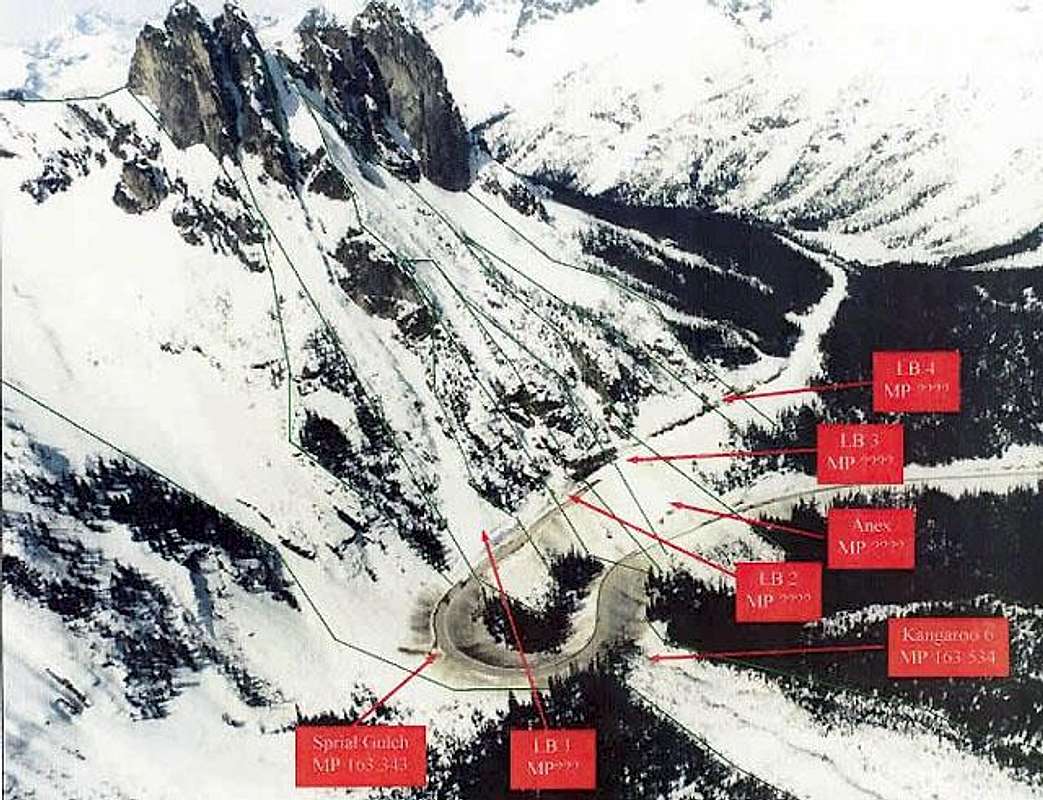
A Washington Department of Transportation aerial photo of Highway 20 and the Liberty Bell Group from the southeast.
The major slide chutes are outlined in green and given their WSDOT designations.
The approach from the hairpin curve to Blue Lake Peak and the Liberty Bell Group ascends directly up the Spiral Gulch slide chute.


Comments

No comments posted yet.


Sign in to post!

Don't have an account? Register now.


Rate This Image
Current Score: 62.91

Log In To Vote
 Blue Lake Peak (Mountain/Rock)

Blue Lake Peak - skiing
« PREV

Viewing
#26 of 26
GALLERY

You are at
the Last
Image

 Fred Spicker's Image Gallery

Thunderbird Mountain, Glacier, and<br> Waterfall from the east
« PREV

Viewing
#748 of 750
GALLERY
Parkview Mountain from the west
NEXT »
Image Data

Fred SpickerSubmitted by Fred Spicker
on Mar 8, 2005 4:15 pm

Image ID: 93888
Hits: 4395 

Lat/Lon: 48.50680°N / 120.6559°W

Image Type(s): Topo/Diagram, Informational


"This is a one line proof...if we start sufficiently far to the left."

© 2006-2012 SummitPost.org. All Rights Reserved.