-
 3605 Hits
-
 75.81% Score
-
 6 Votes
|
|
Canyon |
|---|---|
|
|
Scrambling |
|
|
Summer, Fall, Winter |
|
|
Overview
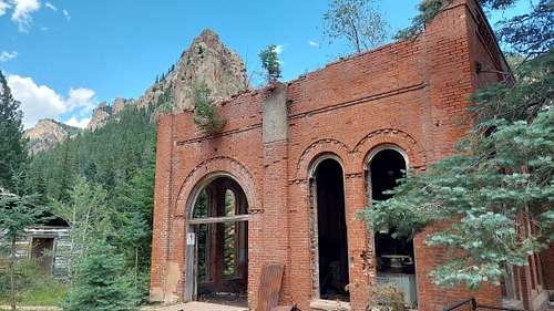
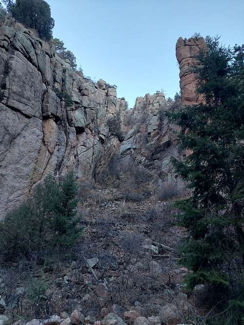
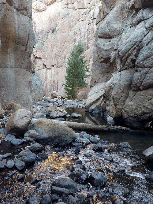
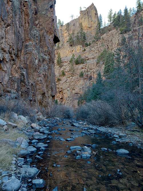
The Beaver Creek WSA & SWA + surrounding areas south of Pikes Peak are probably the most rugged and isolated wilderness areas anywhere along the Front Range. Densely forested, topped with rocky craigs, almost road and trail less with many parts being an impenetrable wilderness few human beings have probably ever set foot in. The only thoroughfare in this wilderness are the canyon systems of the West & East Beaver Creek, winding their way down from the high mountains to the Arkansas Valley.West Beaver Creek not only holds fast stretches of untamed wilderness but also the highly fascinating ruins of the Skagway Power Plant deep in the canyon.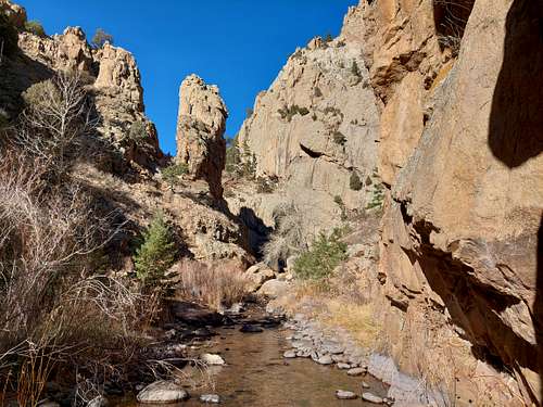
Getting There:
West Beaver Creek Canyon can be accessed from its Northern and Southern End.NORTH: SKAGUAY RESERVOIRFrom Victor (20 miles southwest of Colorado Springs), go 1/2 mile east on County Road 67 to County Road 86, then 1 mile south (right) to County Road 861, and then 6 1/2 miles east (left) to the reservoir.SOUTH: BEAVER CREEK TRAILHEAD From Canon City, go 8 miles E on U.S. HWY 50 to HWY 67 (Phantom Canyon Rd.), then go N 2 miles to CR 123, then E 0.2 miles to CR 132, and then N 9 miles to the parking lot at the end of the road.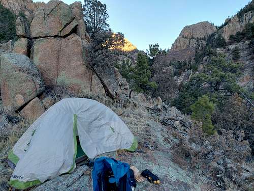
ROUTE
West Beaver Creek Canyon can be broken down into three sectionsPART 1: SKAGUAY RESERVOIR TO SKAGUAY POWER PLANT - HARD From the parking lot descend a dirt road down into the valley West Beaver Creek until a gate closes off the road. Turn on the trail following the creek through pasture . At the end of the pasture you cross the creek for the first time and things get a lot more serious from here on. The canyon closes in and you will hike thru dense forest all the way to Skaguay Plant. The most direct route is marked by pink ribbons (but unlike some reports claim there aren't a ton of them, you need to look around to make sure to stay on route). You will have to cross the creek multiple times. Most crossings are straight forward but the second last crossing may be easy to miss. About 1/3 mile after you crossed a small tributary on the North (left) side of the creek a rock wall is forcing you to cross the creek to the South Side. Right after you passed the rockface you need to cross right back over the creek again to its North side. From here a very distinct path will drop you off at a creek crossing right below Skagway plant. The path continuing on the South Side eventually peters out and disappears into the undergrowth. If you indeed missed the crossing , just cross the creek where ever possible.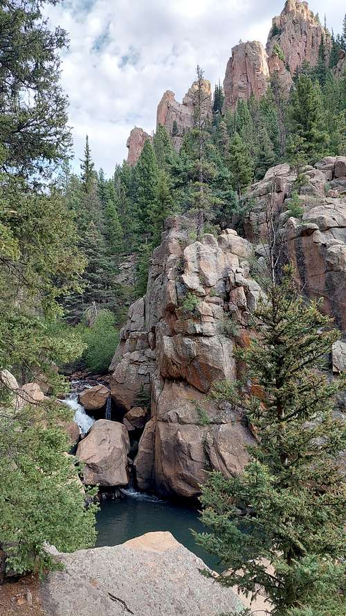
RED TAPE / CAMPING / DANGER/SEASON
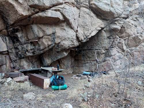
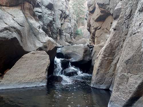
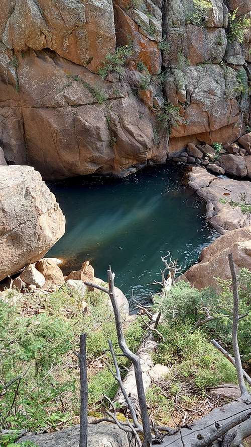
RED TAPE:The majority of the canyon is inside the Beaver Creek SWA ( State Wildlife Area)https://ndismaps.nrel.colostate.edu/index.html?app=propertyfinder&keyword=public&value=Beaver%20Creek%20SWAColorado State Laws requires that anyone 16 years and older needs to be in possession of a valid Colorado fishing license to enter a SWA.CAMPING:SWA is for day use only, no overnight camping allowed. SWA is however pretty narrow and camping is allowed on the BLM land (Beaver Creek WSA) surrounding the canyon bottom.The by far best option to camp is at Skaguay Plant. Please pack out your trash and please leave anything as you find it so other people can enjoy this magical place.Soon after you crossed the First Narrow someone built some kind of camp underneath an overhanging rock on the Southern Side of the creek -with a bench and an old functioning wood stove. This may or may not be in the SWA no camp area but if you need am emergency shelter ( or need to warm up after crossing the pool) this is the best place in the Canyon below the First Narrow.In case you need to camp in the canyon below Skaguay Plant - make sure to pick a spot high enough to be safe from flash floods.DANGER:West Beaver Creek Canyon below Skaguay Plant is one of the most rugged and remote areas in the entire Front Range. The Canyon offers the only exit route as it is surrounded by miles of extremely rugged and trail less wilderness.There is no phone reception in the entire area, only a handful of people ventures that deep into the wilderness per year - a search & rescue ops would be very trickyOnly commit to the section below Skagway Plant if you are very experienced in navigating trail less rugged and isolated areas for long hours. Just the isolation in the canyon can be intimidating if you have never been so far in the wild before.The moment you are past the first narrow below Skaguay and get hurt you will have a hard time getting back to Skaguay. Strong spring run offs will close off the three narrows below Skaguay Plant.The Canyon is prone to flash floods in summer - watch the weather carefully. Water levels may rise so much after heavy rainfalls that you may have to wait for waters to recede to be able to get out of the canyonSome sections of the canyon do not offer an easy way to climb to safety in case of a flash flood.Fast flowing knee deep water can sweep you off your feet !Snow and ice will make this a very slippery and dangerous route.The canyon is prime black bear & mountain lion habitat- bring bear spray and a bear canister for your food.SEASON:Spring: strong spring run off will make creek crossings treacherous if not impossible. Narrows will be most likely impassableSommer: be aware of flash floods after heavy rains - but you will have tons of wonderful swimming holes to cool offFall/early Winter: low waterflow makes it easier to navigate the canyon but crossing the ice cold waters of the First Narrow will be challenging/impossibleWinter: ice and snow will make this a very slippery and dangerous enterprise[img::alignleft:medium:]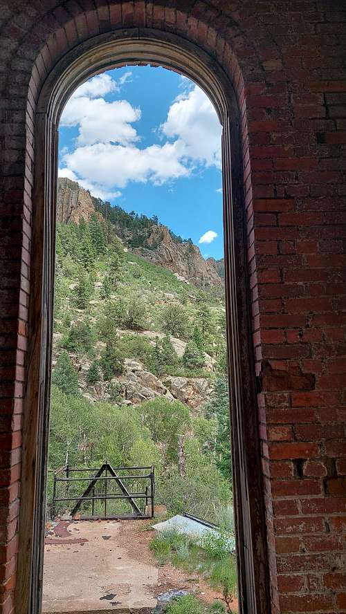
External Links
https://www.alltrails.com/trail/us/colorado/skaguay-power-plantRemains of missing hiker found in Colorado canyon area - NewsBreak - hiker unfortunately died of hypothermia 2 miles from Phantom Creek Road in winter conditions- across the ridge from Beaver Creek canyon. Make sure you are prepared for adverse weather conditions before you hike in this remote area
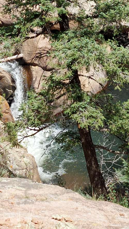
![West Beaver Creek - waterfall]()
![West Beaver Creek emergency shelter - 1st Narrow]()