
-
 252 Hits
-
 71.06% Score
-
 1 Votes
|
|
Mountain/Rock |
|---|---|
|
|
38.96273°N / 106.49721°W |
|
|
Hiking |
|
|
Spring, Summer, Fall |
|
|
13140 ft / 4005 m |
|
|
Overview
‘’West Virginia”
Elevation: 13,140'
CO Rank: 535
CO 13er Rank: 482 of 584
Range: Sawatch
Lat/Lon: 38.96291, -106.49699
West Virginia Peak is sequenced with Virginia Peak and followed by three other 13er summits that comprise a long, ridge-walk day in the Sawatch Range near Winfield. This allows for the completion of five 13er summits in one day. The entire sequence is Class 2 with no particularly difficult sections. Access to the trailhead is best gained by 4WD or a higher clearance vehicle. Passenger vehicles may drive as far as Winfield. Beginning this sequenced hike from Winfield will add about 4 miles of additional hiking to the day. Lidar increased elevation by 12 feet.
Nearby mountain: Virginia Peak
|
|
|
Getting There
|
|
|
Virginia Peak is sequenced with four other summits for a five-summit day. There are two ways this hike may be started.
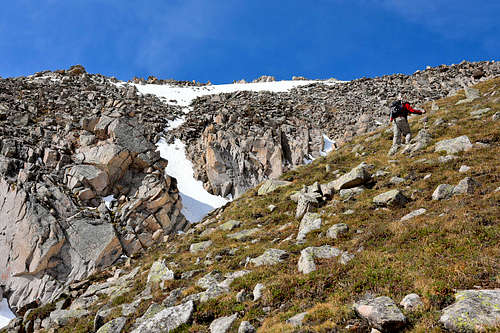
- From the vicinity of the Banker Mine, there is a single-lane vehicle track that heads SW down toward the creek, cutting through some willows. Cross the creek and pick up the trail on the other side. The trail makes two switchbacks up the hillside, then heads SW to cross the broad SE ridge of Virginia Peak down low, before gaining much elevation.
- Drive to the end of the road and the trailhead parking. Walk about 100 yards south along the old roadbed/trail and look for an opening in the forest on the right (west). Depart the trail heading west and work through willows and marshy areas to cross the creek just below the confluence of the main branch and the SW fork coming in from Silver Basin. Once across, head NE some to intersect the trail mentioned in #1 above and from there, you should be on the broad SE ridge of Virginia Peak. This way of getting across the creek is more challenging with some willow-bashing involved.
Route
|
|
|
West Virginia Peak is sequenced with Virginia Peak and followed by three more 13er summits. One way mileage and elevation gain to West Virginia are measured from the summit of Virginia Peak. Round-trip mileage and elevation gain assume completion of the entire five-summit sequence.
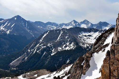
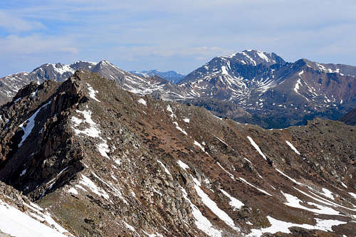
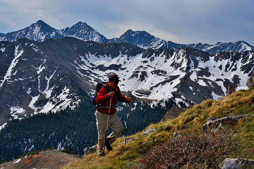
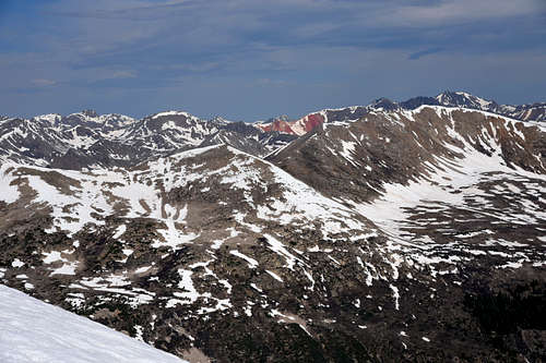
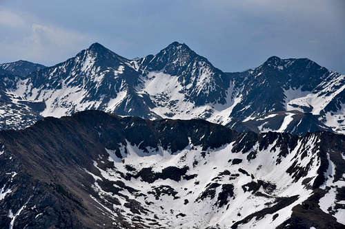
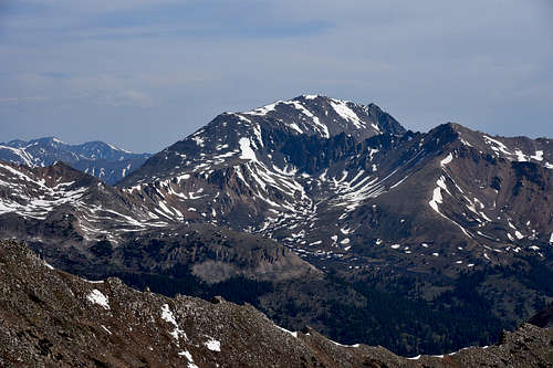
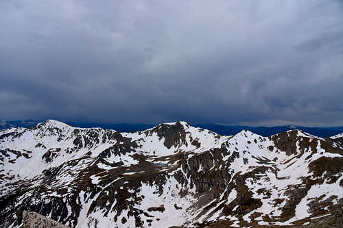
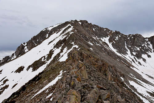
It's fairly easy hiking to the summit of Virginia Peak, walking up over grassy slopes that give way to tundra and rock. This pattern continues for the next mile as you follow the connecting ridge west to “West Virginia Peak.” It does not even require an hour to hike over, and the ridge walk affords nice views of the Ice Mountain group, Silver Basin to the south and below, and the North Fork of Clear Creek drainage below the north side of the ridge. There is one rocky window spot that offers a nicely framed view north for photographers. Otherwise, the trip is largely a mix of low tundra, embedded rocks and medium boulders.
|
|
|
Red Tape
With eight "fourteeners" (peaks exceeding 14,000 feet in elevation), Collegiate Peaks Wilderness probably possesses the highest average elevation of any Wilderness in the Lower 48. You can climb Mounts Yale, Oxford, Columbia, and Harvard (the state's third highest point), as well as Huron Peak, Missouri Mountain, Mount Belford, and La Plata Peak (the state's fifth highest point).Climbing these peaks is a very popular activity, making opportunities for solitude very elusive. Expect to be inundated by people and their dogs on any "fourteener" trail. As you travel through the area, you might notice unusual and deep indentations in the boundary line. These are a legacy of man's hunt for gold and other valuable metals that are still sought just outside. More than a dozen trailheads create a situation in which no one ever stands more than five miles from a road. About 40 miles of the serpentine Continental Divide snake across the area, and this expansive Wilderness lies in parts of three national forests. The beauty of this place and its ease of access ensure torrents of visitors, especially on weekends. Please help keep Wilderness wild by following Leave No Trace practices. In particular, please refrain from having camp fires near treeline. The dwarfed Krummholtz trees that grow there are taking a beating from insensitive campers.
LEAVE NO TRACE
How to follow the seven standard Leave No Trace principles differs in different parts of the country (desert vs. Rocky Mountains). Click on any of the principles listed below to learn more about how they apply in the Collegiate Peaks Wilderness.
- Plan Ahead and Prepare
- Travel and Camp on Durable Surfaces
- Dispose of Waste Properly
- Leave What You Find
- Minimize Campfire Impacts
- Respect Wildlife
- Be Considerate of Other Visitors
When to Climb
Spring, Summer, Fall
Camping
Free camping is available along the left side of County 390 from highway 24 to the trailhead. There is no formal campground- just available primitive campsites. Many have fire rings and are near a creek. If you have a 4WD drive I would recommend camping along the 4WD road between the South Winfield Trailhead and the closure gate. This road is 2 miles long and the last mile of it is where there are some extremely nice free campsites. The sites are on the right side of the road, quite spacious, and have a creek and tremendous views. Even if you dont have a 4WD it might be worth it to park at the South Winfield TH and pack your camping gear a mile or so up the road to get these primo campsites.
External Links