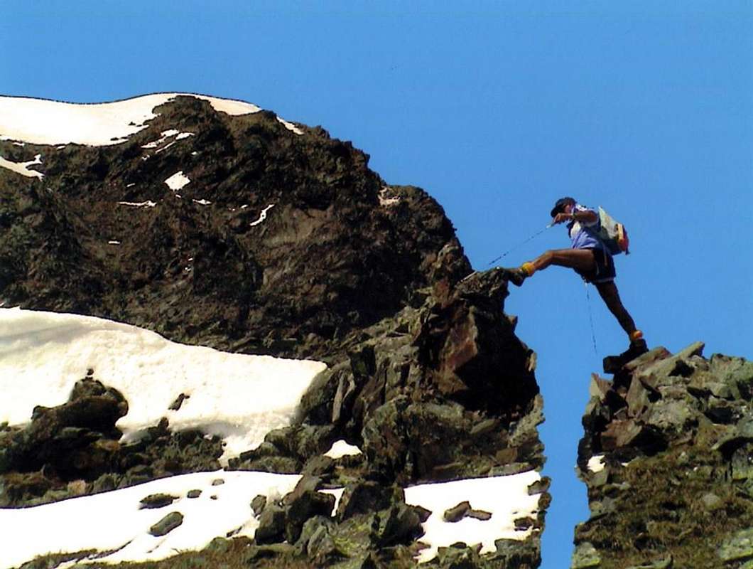
La montagna chiama i suoi figli, ed essi rispondono fedelmente al suo appello…
Osvaldo Cardellina, Diario alpinistico, 1964-65
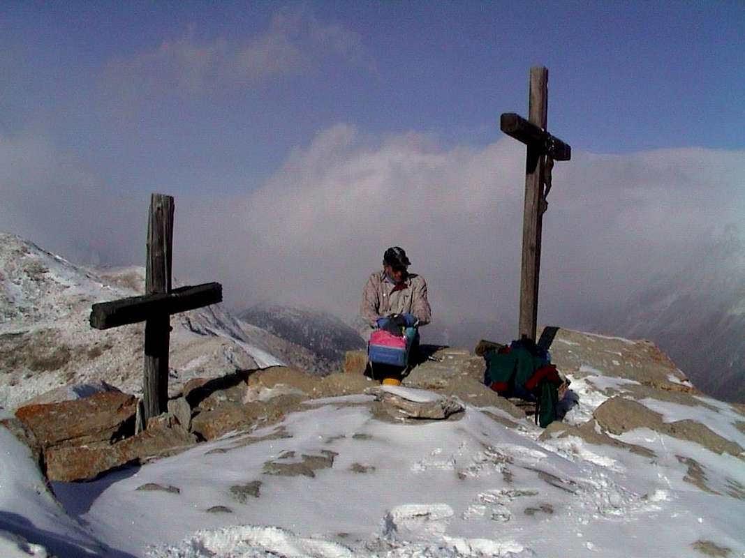
Page texts: @ OsvaldoCardellina"Osva", passed away on May 2, 2022. Page owners: Christian Cardellina e Osvaldo Cardellina. Any updates from September 12, 2022: Antonio Giani, page administrator, friend and climbing companion.
Testi della pagina: @ OsvaldoCardellina "Osva", scomparso il 2 maggio 2022. Proprietari pagina:Christian Cardellina e Osvaldo Cardellina. Eventuali aggiornamenti dal 12 settembre 2022: Antonio Giani, amministratore della pagina, amico e compagno di salite.
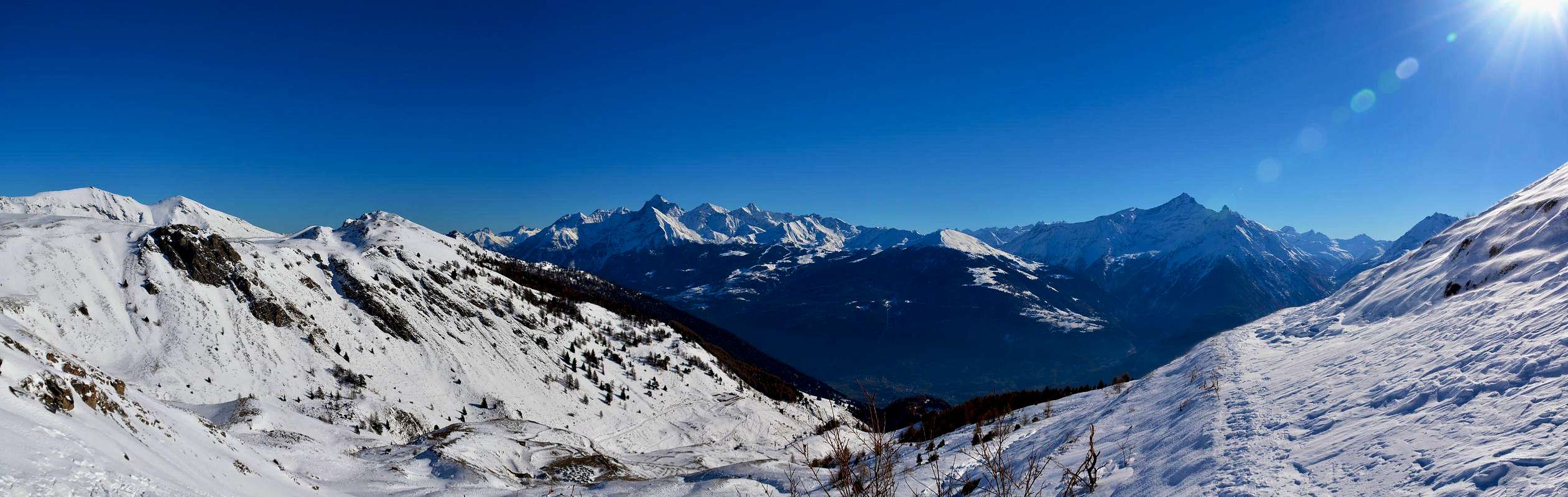
Western Pennine Overview
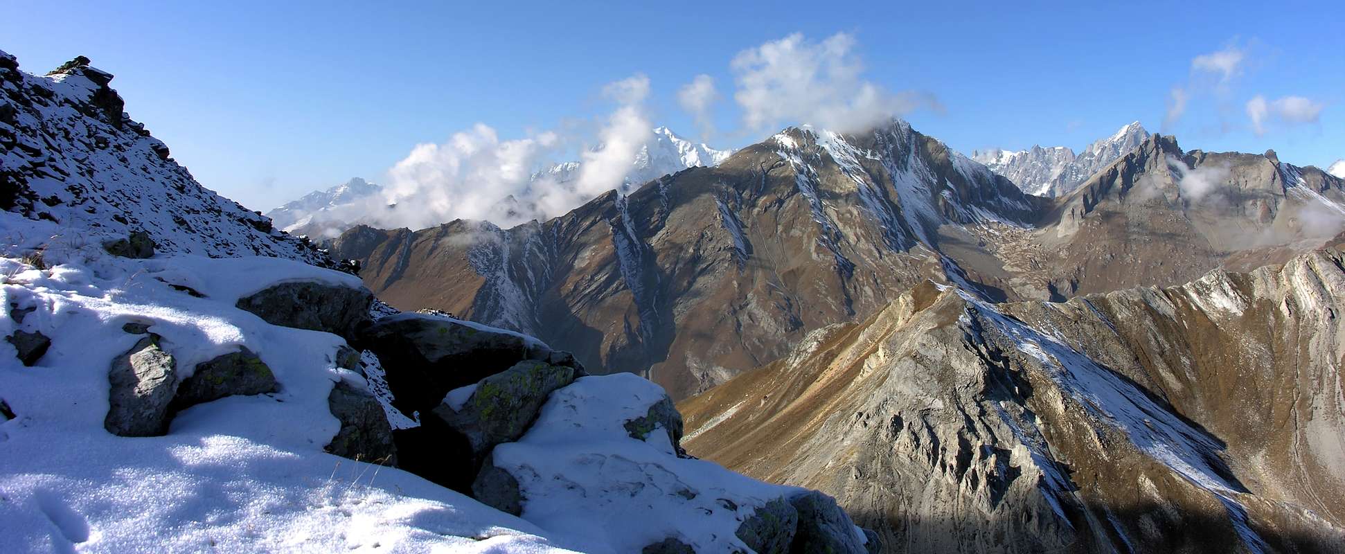
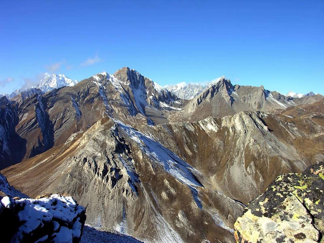
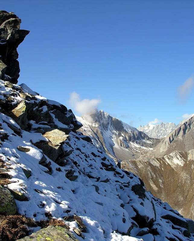
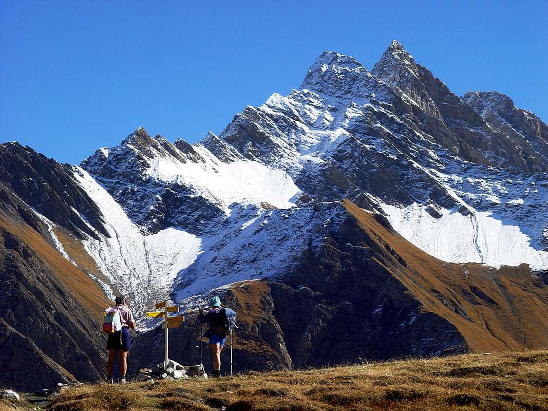
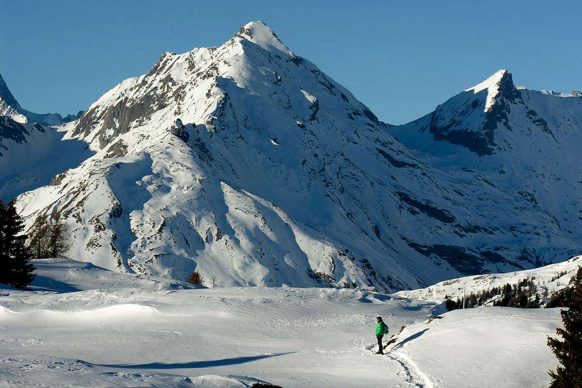
Surely this area than the North Dora Baltea River and towards the West in respect of Town of Aosta, that from the Mont de la Saxe-Val Sapin (Courmayeur, Villair Hamlet) reaches the furthest Eastward mountain above the same city, and offers many opportunities for easy excursions and even to pleasant trips with Snowshoes also by Ski-Mountaineering. Exposure to the South of the small valleys, which follow one another at right angles in a regular manner, promotes transformation in advance of the snow with the consequent possibility of early excursions compared to other areas. So "outputs" allow easier not only the path to the bottom of the same vallons, but also on the uphill side slopes and, above all, the achievement of several top where the location is facing South (Mont de la Saxe, Testa Bernarda, Grande Rochère, Aiguilles de Malatrà and d'Artanavaz, Testa (Head) Serena and Testa of Frà, Court de Bard, Fetita two Summits, Aouillette, Pointe Leissé, Mounts Rosso and Vertosan, Becca France, La Tsa, Summits of Met(z) and Chaligne Cross). Even the tracks at lower altitudes, however, allow nice trips, easy walks, always with the greatest exposure to the sun, which is not a minor thing. Deserving the achievement of certain pastures and visiting many villages overlying the "Salassians Road" with his street that cuts halfway up the hill from Aosta Town to Saint Pierre Municipality. An area frequented almost exclusively by local Mountaineers and until the end of the Sixties used for Hiking, while the Ski-Mountaineering had turned to a few places that were almost always repeated with an identical script (Aiguille d'Artanavaz, Testa Serena, Punta Leissé and Mont Fallère). The publication of C.A.I./T.C.I. in 1971 with "Pennine Alps Volume I°", by Gino Buscaini, and some other later work and in its wake has certainly expanded the the scope of knowledge across this vast zone. It has experienced a significant boost in acquaintances especially for those mountains explored in the middle and at the end of 1800 and then dropped almost completely abandoned, partly because of the poor quality of the rock, which does not offer great prospects for climbing. But especially towards the Ski-Mountaineering (and also for the Snowshoeing) where the sphere of action is greatly expanded. A curiosity in addition, with a view by the New Thouraz, to the remains of the huge landslide that at six o'clock in the morning of July 6th, 1564 buried the old Village of Tôra also Tôrah and today called Thouraz with all its 600 inhabitants. There are many peaks most "internal" and little known of the Pennines admirable from these locations (Grand Rochère, Aiguille Malatrà and Artanavaz, Great Creton and nearby Creton of Midi, Testa Serena, Monte Rosso and Vertosan, Fallère, Mont d'Arsy, La Tsa etc.); reaching the peaks mentioned prior the view stretches then "in the round" to 360° on the whole Aosta Valley.
Sicuramente quest'area Settentrionale rispetto alla Dora Baltea ed a Ovest della Città di Aosta, che dal Mont de la Saxe-Val Sapin (Courmayeur-Villair) raggiunge verso Oriente le estreme propaggini montuose sopra la medesima, offre numerose e pacevoli opportunità per facili escursioni nonché gite con le Racchette da neve. L'esposizione a Mezzogiorno dei valloni, succedentisi perpendicolarmente in modo regolare, favorisce la trasformazione in anticipo della neve con la conseguente possibilità d'effettuare precocemente l'escursioni rispetto ad altre zone. Quindi le "uscite" permettono più agevolmente non solo il percorso del fondo dei medesimi valloni, bensì anche la salita sui pendii laterali e, soprattutto, il raggiungimento di diverse Sommità laddove il percorso é rivolto a Mezzogiorno (Mont de la Saxe, Testa Bernarda, Grande Rochère, Aiguilles de Malatrà e d'Artanavaz, Teste Serena e dei Frà, Court de Bard, Punta Fetita, Aouillette, Punta Leissé, Becca France, Punte di Met e Chaligne). Anche i tracciati alle altitudini inferiori comunque permettono belle gite e facili passeggiate, sempre con somma esposizione al sole, che non é cosa di poco conto. Meritevole il raggiungimento di alcuni alpeggi e la visita di molti villaggi sopastanti la "Via dei Salassi" con la sua strada che taglia a mezza costa la collina d'Aosta insino a Saint Pierre. Una zona frequentata quasi esclusivamente dai locali e fino alla fine degli Anni Sessanta utilizzata per l'Escursionismo, mentre lo Sci-Alpinismo era rivolto a ristrette mete quasi sempre ripetute con identico copione (Aiguille d'Artanavaz, Testa di Serena, Punta Leissé e Mont Fallère). La pubblicazione del C.A.I./T.C.I. nel 1971 con "Alpi Pennine Volume I°" ad opera di Gino Buscaini e qualche altra opera successiva e sulla stessa scia ha sicuramente ampliato l'insieme di conoscenze su tutta questa vasta area. Si é conosciuto un'impulso notevole nelle frequentazioni soprattutto per quelle montagne esplorate nel 1800 e poi cadute in quasi completo abbandono, anche a causa della cattiva qualità della roccia, tale da non offrire grandi prospettive d'arrampicata. Ma soprattutto nei confronti dello Sci-Alpinismo (ed anche per le Racchette da neve), ove la sfera di azione s'é notevolmente ampliata. Una curiosità inoltre, con vista dalla Nuova Thouraz, dei resti dell'immane frana che alle ore sei mattutine del 6 Luglio 1564 seppellì il vecchio Villaggio di Thôra con tutti i suoi 600 abitanti. Molte sono le cime "interne" e misconosciute delle Alpi Pennine ammirabili da queste località (Grande Rochère, Aiguilles di Malatrà e d'Artanavaz, Gran Creton e Creton de Midi, Testa di Serena, Monte Rosso, Fallère, Mont d'Arsy, La Tsa ecc.). Raggiungendo le cime citate prima donde la vista spazia poi "a tutto tondo" su tutta la Valle.
Getting There
BY CAR:
From TORINO, MILANO, etc: Motorway A5. Exit at IVREA or Quincinetto (PIEDMONT).
From IVREA Town: in West towards Pont Saint Martin, Donnas, Bard, Champdepraz, Pontey, Fénis, Saint Marcel, Grand Brissogne, Pollein, Charvensod, Gressan, Jovençan, Aymavilles, to Villeneuve, Arvier, Avise, Morgex and to Pré Saint Didier, Courmayeur Municipalities (Western side). From Courmayeur Resort: in East to Morgex, La Salle, Saint Pierre, Sarre, Aosta Municipalities.
From Courmayeur-Villair Dessus(1.282m), with Municipal Road and through dirt road to fork 1.470 meters and path to Refuge Bertone in Val Sapin. From La Salle1.001m), with Regional Road, towards Challancin (1.610m), Cheverel, Morges (1.829m), Planaval Hamlets (1.750m); from this, through farms dirt road in North-northeast, passing Maison Blanche Pasture, towards the Rantin (2.333m) and Bonalé (2.340m) Alpages, in Upper Planaval small Valley. From La Salle, with Regional Road, towards Challancin Village, Ponteilles (1.741m), Arpilles (1.862m) Pastures to Bard Pass (2.178m) in Arpilles Conca. From Saint Pierre-Pommier(783m) towards Champretavy, Rumiod, alternative just after Persod (1.351m), Ravoise, Chaillod, Clavel, Cerlogne (1.580m) and Vens small Villages (1.750m), with Regional Road in West-northwest. From this last to Joux Saddle (1.930m); through short, always by dirt road, descent to Vertosan small Valley From Saint Pierre-Château Sarriod de la Tour, Rumiod, Petit and Grand Sarriod (1.444/5m), Gerbore, Vetan Dessous (1.670m) and Dessus (1.737m), with Regional Road to Vetan Basin. From this, through dirt road, towards Genevrine Pasture, Chatalanez, Toules, Grand Arpilles Alps to Chaz Creuse small Basin(2.398m). From Sarre(657m), with Regional Road, towards Plèod, Vert Dessous and Dessus, Vareille, Caillod/Ville sur Sarre/Remondet, Moulin/la Cort, forks 1.225m, 1.301 meters, Salet, Chavalançon (1.426m) small Villages to Thouraz Dessous and Dessus Hamlets (1.652m); from the last to Closella and Met small Valleys. From Aosta North Town with Main Route of From Aosta City towards the Great Saint Bernard Valley to alternative nearby Grand Signayes Hamlet (737m); through the deviation, in asphalt, to Arpuilles (1.010m), Excenex (1046m) Fractions. From these by farm dirt roads or various paths, numbered or not, to Tsa de Metz or "Les Arpes Vieilles"(1.419m), below Checotteyes (1.715m) Alp on Arpilles small Valley. From this point to Met Hill, Met Summit and Croix de Chaligne.
From FRANCE: through the Mont Blanc Tunnel to Entrèves-crossroads to Vény/Ferret Valleys - Mountain Guides of Courmayeur - La Saxe Rock Gym - Courmayeur. By Little Saint Bernard Pass, closed since November until half May to La Thuile Valley - Pré Saint Didier - Courmayeur. It is not necessary to take Motorway A5: you can drive on SS.26, in the direction of AOSTA - IVREA - TURIN.
BY PLANE:
Aeroporto "Corrado Gex" Saint Christophe (Aosta).
All Western Central Valleys by Baltea to the North & some advice
To make contact and knowledge with this large area are enough half a dozen Trips. From the table here underexposed it can extrapolate what you want, but I'll try to give advice starting from the West (Courmayeur Common) to arrive at the gates of the City of Aosta. We begin with a Tour in Val Sapin, which brings us to the eponymous hill with great views of the Grandes Jorasses in the West and Grande Rochère on the opposite side, while to the North fanning the side secondaries valleys of the Val Ferret. The Aiguille of Artanavaz (3.071m) is the Summit of the next valley, but not the highest point that is reached by the Grande Rochère (3.326m), beautiful not only hard rock Summit. The first offers a nice trip Ski-Mountaineering, an excursion on the second rock route the inside of a wide scree couloir; to vary, but always starting from Planavalle Westward, a nice long walk through the Valley of Liconi until, depending on your willingness, the homonyms Lake (2.655m), Pass and Summit. On the opposite side you can reach the Colle and the Testa (Head) of Serena, while in the East, but from more below or by the Village of Challancin (1.610m) you can make a nice excursion with Snowshoeing at the Court de Bard and Skiing towards the two Tips of Fetita (Important Remark: for this last attention to descent to the West where there have been various misfortunes cause avalanche, including one still in this winter). The next Vallon or Vertosan is a variation on the much more extensive or Basin Vetan: abandoned in the East this last at 1.600 meters after the junction Saint Nicolas and just before the Village Chaillod (1.218m), is reached to Cerlogne Hamlet (1.580m) under the Joux Saddle (1.930m) with its artificial little lake and the true gateway to the long valley, that ends at Col Citrin (2.484m). We recommend a trip to the Lakes of Dzioule (2.524m) to the North-northwest, while to the East and almost to the entrance of the valley you can go to the Lake Leissé or Leysser (2.418m). But also a nice trip with Snowshoeing to the Alps of Or de Breuil, Jovençan and Tronchey (1.954m) is more than enough to make contact with this valley. But continuing toward the Northeast with the Regional Road and passing through the Villages of Persod, Grand Sarriod, Gerbore, you reach Vetan Dessous and Dessus (1.770m) at the entrance of basin with the same name and at the foot of Punta Leissé (2.771m). This offers a nice of Ski-mountaineering ascent, so fashionable to be included in the World Circuit of this sport. This wide zone opens like a big leaf, and has an easy hike to the Northwest towards Alpe Chaz Creuse or Tsecreusa (2.398m) and the overlying Punta Aouillette or Ollietta (2.616m), right (East) on the other hand gives the opportunity entering the adjacent Valley of Verrogne with two choices:
a) - with a lower path heading to the Alp Loé (1.986m) and to the Becca France (2.312m).
b) - With an altitude of more than 2.206 meters a dirt road heading towards the Alp Les Crottes (2.385m) at the Lac des Grenouilles. From there to the various possibilities of Punta Paletta, the Monte Rosso (2.940m), the Mont Vertosan and Colle Fenetre, the Lake (Dead; 2.634m) and equipped South-southwest Ridge of Mont Fallère. But even the small saddle 2.240 meters around at its base allows you to pass in the Valley of Clusella and then to Lake Clapin 2.617 meters to the Normal Route of Fallère (widely used as an input port for a trip Ski-Mountaineering) or his Lake. Or, further South, with the saddle 2.251 meters towards Tsa de la Comba pasture or, wanting to be always on the watershed, yet to the Becca France. Give you some suggestions: the Aouillette or Lake Morto Hiking, the Punta Leissé and Monte Rosso by Skiing and Becca France with Snowshoeing. But there is a more and more direct way to enter the Val Clusella(z) and is to go up from Sarre with the Regional Road until you cross on that of the "Salassians" at Ville sur Sarre Hamlet ("Hotel des Salasses"; 1.212m), from which a Chavalançon Village and Thouraz (1.212m). From here a private road that immediately splits:
1) - one goes to the North towards the Val Clusella; the second
2) - proceeds to the East towards the Alps of Met or Metz and Condemines. Let Lake Fallère or Mont Fallère for the first and Punta of Met followed by Chaligne for the second, now classic and traditional trips for Hikers of Sarre Aosta but also for those of Gignod, but now entering into the Valley of Gran San Bernardo.
VALLEYS & small Valleys In order to deploy clockwise from Courmayeur-Val Sapin to East above Dora Baltea Central Valley
In Courmayeur, Pré saint Didier, Morgex, La Salle, Avise, Saint Nicolas, Arvier, Saint Pierre, Sarre Municipalities & Aosta Town Central Valley & surroundings from North to South Val Sapin: from Courmayeur to Villair Dessus Fraction (signal no transit); through the path n° 42 to Refuge Bertone, at the beginning of Mount de la Saxe. In descent, to Northwest, with path n° 3/TMB/Haute Route number 1 in Northwest to Ferret Valley, lower part nearby Planpincieux. Liconi small Valley: from La Salle Municipality to Planavalle (1.760m; signal no transit) with Regional Road; from this to Southwest and path n° 20/21 to Piginière Alp. After with Northwest to entrance of Chambave Comba, near Chambave Alp (1.880m); crossing to Weast reach Licony Alp (1.878m; Madonna de Lourdes). Along Licony Torrent, with path n° 4, to Lake (2.555m) and Hill (2.674m). In descent, with path n° 44, to Val Sapin. Chambave-Battaglione Aosta Pass small Valley: from Chambave Alp, with path n° 20 between two torrents, to Grand Plan Alp (2.187m) and through Valley floor to Btg. Aosta Pass; descent in Northwest with traces-path n° 29 towards Armina(z) small Valley to Ferret Middle Valley.
Planavalle-Grande Rochère small Valley: from Planavalle to Eculé Pasture (1.886m) and fork 2.083 meters with unnumbered path along Planaval Torrent; from this in Northwest, without path on moraine, to Grand-Eau Torrent and in West to Grande Rochère (3.326m), West Slopes with traces.
Bonalex-Artanavaz small Valley: from Planavalle in North-northeast to Maison Blanche Pasture (1.871m), Rantin Alpages (2.333m), through the path n° 6/7 concomitant with the steep dirt road; after with path n° 7 to Bonalex Pasture (2.340m) and with unnumbered path and traces in moraine to Lake (2.782m). In North, through sparce trace into the meadows and moraines or snowfields towards the Aiguille of Artanavaz (3.071m; ski-mountaineering). In Northeast Grand Creton (3.071m), by easy rocks on South Face or on short but steep Northwest Crest. From Bonalé, in West, Pass (2.925m), through traces on moraine, and Aiguille (3.201m) by South-southeast Crest with an steep but easy rock (a passage of II°-). Serena Southern small Valley: from fork before Rantin Alp, through the good path n° 6, passing immediately below the Serena Loch, turning in North-northeast towards the wide Serena Hill (2.546m; classic ski-mountaineering), with possibility of a descent in Gran San Bernardo Valley.
Ors-Pisserio small Valley: from fork before Rantin Alp in South with path n° 3A towards Tramail (Hugh Alpage) des Ors (2.390m), crossing Pisserio Torrent, Felita or Fetita Hill (2.557m). East descent to Jovençan in Vertosan Valley or traverse with path n° 3/2 on South Crest to Borromein and Bard Hills (2.176m), between this and Vertosan Valley. Downhill possibilities of descent to Challancin (West) or to Joux Saddle over Vens Hamlet.
Court de Bard Basin: La Salle to Challancin Village (1.610m; signal no transit near a mini parking) through Regional Road. In Northeast with path n°2/2A to Ponteilles Alp and alternative 1.741 meters; from this point in Southeast with path n° 2 to Arpilles Pastures (1.802m; fountain) and in East to Court de Bard Hill. From this
1) - in South to Mount Court de Bard (2.262m; beautiful by snowshoe);
2) - in North to Felita two Summits (2.623m).
Vertosan small Valley: from SS.26, near Saint Pierre Commune, to Vetan Hamlet with Regional Road; before go left to Vens (1.734m) through a deviation to Vertosan Vallon up to the Joux Saddle (1.934m; signal no transit); continue on dirt farm road with a brief descent into walloon reaching Zette Montagna (1.877m), Or de Breuil (1.850m) and Jovençan (1.867m) Alps. After with various paths to:
1) - in Northwest Felita Hill;
2) - in North-northwest Ziule Lake (2.524m), path n° 11.
3) - In North Citrin Hill (2.605m), path n° 10;
4) - in Northeast Vertosan Pass (2.689m), path n° 20.
Vetan-Leissé Comba: with previous route to Vetan small Resort (1.671m; various signals no transit); from this in Northwest through farm dirt road to Thoules (1.919m), Grand Arpilles (2.120m) Pastures and in North-northeast to ancient Le Crotte Alp (2.392m) in Verrogne deep valley. Also from Grand Arpilles in West to Chaz Creuse Alp (2.330m), below Aouillette (2.618m)/Leissé (2.771m) Comba (various Hiking Tour; ski-mountaineering).
Verrogne-Mounts Rosso-Vertosan-Fallère small Valleys and the wide Vetan Basin: from Aosta Town or from Sarre Commune, through, in asphalt, "Salassians Road" to Ville sur Sarre (1.212m), Bellun (1.382m), Homenè (1.448m), Verrogne (1.582m) Hamlets; from this last, with path, in North to Montagna Vergioan (2.106m) and Le Crotte Alp. From this point, with various paths, excursions to Leyssé, Paletta (2.810m), Rosso (2.943m), Vertosan (2.822m) Fallère (3.061m) Mounts and Passes of Paletta (2.707m), Southern Vertosan (2.770m), Finestra (2.729m). Moreover beautiful excursions towards the Lake Morto (Dead; 2.638m) and Rane (Frogs; (2.367m), through enough steep trails under West Face Mont Fallère.
Clusella-Fallère small Valley: from Ville sur Sarre through Municipal Road in asphalt to Touraz (1.652m; signal no transit; in foreground the remains of enourmous landslide from Becca France of July 06th, 1564, with 600 deads, all the inhabitants of ancient Thora). Through farm dirt road to Morgnoz (2.052m), Frumière (2.062m), Chaz de Morgnoz (2.271m) Pastures. Easy excursions to Becca France (2.312m), Lake Fallère (2.415m) and Mount (3.061m; equipped route), Hill 2.674 meters, Mount d'Arsy (2.827m), Croix de Chaligne (2.608m), Met(z) Hill (2.485m) and Point (2.553m), paths.
Clou-Met(z)-Chaligne small Valleys: from Touraz new Hamlet (; Horses Ranch; no transit signal immediately after) in East-northeast through private dirt farms road concomitant with the path n° 6 towards Metz Bionaz (1.731m), Vignon (1.789m), Condemine de Metz (1.874m) Pastures and Metz Alp (2.261m), nearby Labe Torrent. From Alpage always with the trail n° 6 towards Met Hill, between Croix de Chaligne and Met Summit. Arpilles small Valley: from Aosta North Town with Main Route of Great Saint Bernard Valley to alternative nearby Grand Signayes Hamlet (737m); through the deviation, in asphalt, to Arpuilles (1.010m), Excenex (1.046m) Fractions. From these by farm dirt roads or various paths, numbered or not, to Tsa de Metz or "Les Arpes Vieilles" (1.419m), below Checotteyes (1.715m) Alp. From this point to Met Hill and Croix de Chaligne
Per prendere contatto e conoscenza con questa larga area sono sufficienti una mezza dozzina di Gite.Dalla tabella qui sopraesposta ne potete extrapolare quelle che volete, ma un consiglio ve lo proviamo a dare partendo da Ovest (Courmayeur) per arrivare alle porte della Città d'Aosta. Iniziamo con un Tour in Val Sapin, che ci porta all'omonimo colle con grandi viste sulle Grandes Jorasses ad Occidente e sulla Grande Rochère sul lato opposto, mentre verso Settentrione si apron a ventaglio i valloni secondari della Val Ferret. L'Aiguille d'Artanavaz (3.071 m) costituisce il Vertice della valle successiva, ma non il punto più elevato che viene raggiunto dalla Grande Rochère (3.326 m) bella e non difficile Sommità esclusivamente rocciosa. La prima propone una bella gita di Sci-Alpinismo, la seconda una escursione su roccia rotta all'interno di un largo canalone detritico; per variare, sempre partendo da Planavalle, ma verso Ovest, una bella e lunga passeggiata nel Vallone di Liconi fino a raggiungere, a seconda della propria volontà, gli omonimi Lago (2.655 m), Colle e Sommità. Sul lato opposto si può raggiungere il Colle e la Testa di Serena, mentre ad Est, ma partendo da più in basso ovvero dal Villaggio di Challancin (1.610 m), si può effettuare una bella escursione con Racchette da neve alla Court de Bard ed in Sci alle due Punte Fetita (Nota importante: per quest'ultima attenzione alla discesa verso Ovest dove si sono verificate varie disgrazie causa valanga, tra le quali una ancora in questo inverno). Il vallone successivo o di Vertosan é una variante a quello ben più esteso o Bacino di Vetan: abbandonato ad Oriente quest'ultimo al bivio 1.600 metri dopo Saint Nicolas ed appena prima del Villaggio di Chaillod (1.218 m), si raggiunge quello di Cerlogne (1.580 m) precedente la Sella di Joux (1.930 m) con il suo laghetto artificiale e vera porta d'ingresso al lungo vallone terminante al Col Citrin (2.484 m). Consigliamo un'escursione ai Laghi di Dzioule (2.524 m) verso Nord-nordovest, mentre ad Est, quasi all'ingresso del vallone, si può andare al Lago Leyssé o Leysser (2.418 m); ma anche una bella gita con Racchette da neve fino alle Alpi di Or de Breuil, Jovençan e Tronchey (1.954 m) é più che sufficiente per prendere contatto con questo vallone. Continuando invece verso Nordest sulla Strada Regionale e passando per i Villaggi di Persod, Grand Sarriod, Gerbore, si giunge a Vetan Dessous e Dessus (1.770 m) all'ingresso della Conca omonima ed ai piedi della Punta Leissé (2.771 m); questa offre una bella gita sci-alpinistica, talmente di moda da risultare inserita nel Circuito Mondiale di questa disciplina. Questo largo bacino s'apre a guisa di grande ventaglio e presenta una facile escursione a Nordovest verso l'Alpe Chaz Creuse o Tsecreusa (2.398 m) ed alla soprastante Punta Aouillette od Ollietta (2.616 m). A destra (Est) concede invece la possibilità di entrare nell'attiguo Vallone di Verrogne con due scelte:
a) -con un passaggio più in basso dirigersi verso l'Alpe di Loè (1.986 m) ed alla Becca France (2.312 m);
b) - con uno superiore a quota 2.206 metri verso l'Alpe Les Crottes (2.385 m) presso il Lac des Grenouilles. Da qui varie possibilità verso la Punta di Paletta, il Monte Rosso (2.940 m), il Mont Vertosan e Colle Fenetre, il Lago Morto (2.634 m) e la Cresta attrezzata Sud-sudovest del Mont Fallère. Ma anche la selletta 2.240 metri circa posta alla sua base permette di passare nel Vallone di Clusella e quindi al Lago Clapin 2.617 metri, alla Via Normale del Fallère (molto utilizzata come porta d'ingresso per la gita Sci-Alpinistica) od al suo Lago. Oppure più a Sud con la sella 2.251 metri verso l'Alpe Tsa de la Comba o, volendo restare sempre sullo spartiacque, ancora alla Becca France. Diamo qualche suggerimento: l'Aouillette od il Lago Morto come escursioni, la Punta Leissé ed il Monte Rosso con gli Sci e la Becca France con Racchette. Un'altra modalità e più diretta per entrare nella Val Clusella(z) consiste nel salire da Sarre con la Strada Regionale fino ad incrociare quella dei "Salassi" presso Ville sur Sarre ("Hotel des Salasses"; 1.212 m), donde a Chavalançon e Thouraz (1.212 m). Da qui parte una poderale subito sdoppiantesi:
1) - un ramo sale a Nord verso la Val Clusella; il secondo
2) - procede ad Est verso l'Alpi di Met o Metz. Diciamo Lago Fallère o Mont Fallère per il primo e Punta di Met, seguita da Chaligne, per il secondo; gite classiche e tradizionali per gli Escursionisti di Sarre ed Aosta ma anche di Gignod, ormai entrando in Valle del Gran San Bernardo.
Campings
Remember that free camping is forbidden (except for emergency reasons, over 2.500m, from darkness until dawn).
Mountain Condition
Meteo: you can find all the needed informations at the official site of the Valle d'Aosta Region:


 2204 Hits
 80.49% Score
 12 Votes