
|
|
Mountain/Rock |
|---|---|
|
|
48.47065°N / 121.29578°W |
|
|
Skagit |
|
|
6559 ft / 1999 m |
|
|
Overview
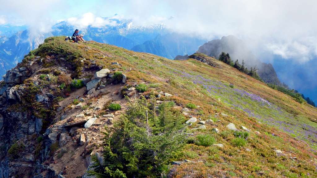
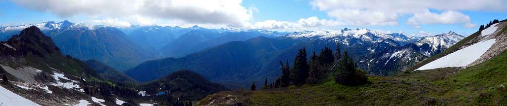
Whale Peak is a 6559' (1099' prominence) summit located eight miles SE of Marblemount, and 11 miles west of Cascade Pass. It is located on the north end of what Fred Beckey refers to as the 'Buckindy-Illabot Group'. Being one of the easier peaks of the subrange to ascend, and offering incredible views, it is a mystery as to why this peak is not a more popular destination. Whale Peak truly offers the best of both worlds - views rivaling those of nearby Hidden Lakes Peak, and almost guaranteed solitude. For those who have not made the connection, Whale Peak derives it's name from Whale Lake, located 1.5 miles south.
Getting There
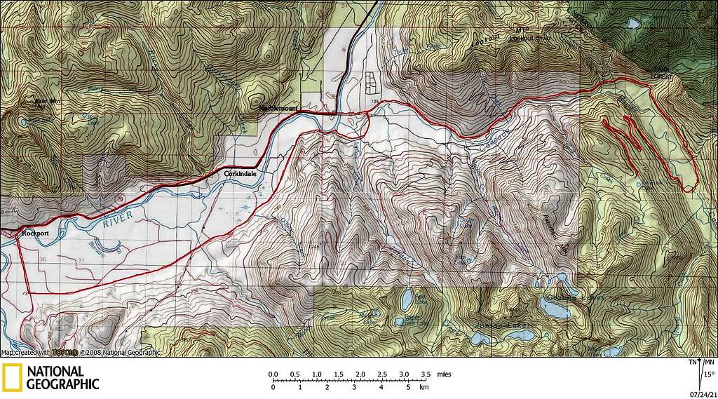
Navigate yourself to Marblemount, located eight miles east of Rockport on SR20. Just east of 'town', cross a bridge over the Skagit River, at which point you will be on the Cascade River Road. Those approaching Rockport via SR530 may find it advantageous to use Rockport Cascade Road in lieu of SR20 to arrive at this point. Now simply follow Cascade River Road for 10.2 miles, at which point the pavement ends. Make a sharp right onto FR1550, and follow this gravel road 7.0 miles to the La Rush Lake trailhead. While four wheel drive is not required, low-clearance vehicles are not recommended. Additionally, the road is narrow and brushy in spots, so vehicles with shiny new paint jobs are not recommended.
Route
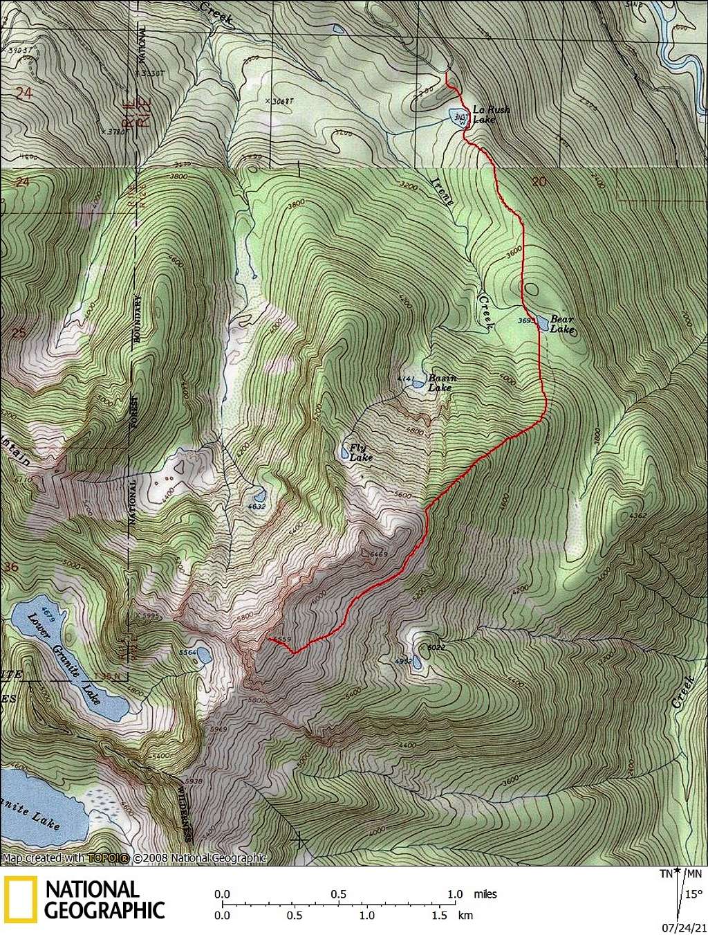
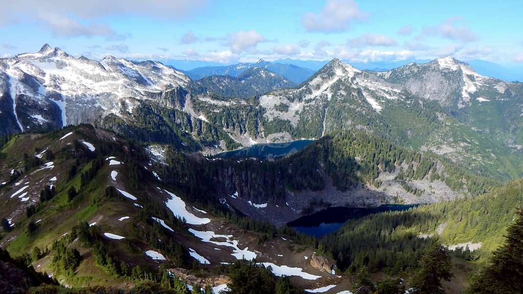
Hike the trail to La Rush Lake, which is an easy five-minute stroll. Continue to the other side of the lake (clockwise), then continue approximately 1.3 miles to Bear Lake. Most peakbaggers will not find much interest in either lake. They are pleasant enough to look at, but a little muddy as opposed to 'alpine'. Old USGS maps show the trail continuing beyond Bear Lake. This old trail tread is badly overgrown, and provides no tangible benefit. From Bear Lake, head S/SE, with the intent of intersecting with Whale Peak's NE Ridge. It will be brushy, but this will only last for 1000'.
Upon starting up the ridge, brush will be minimal. Follow closely to the ridge crest, occasionally on game trail. Lots of red survey tape from 4200' to 5700' will keep you oriented. A couple of small rock steps on the ridge crest are easily bypassed to the left or right. The blueberry brush will increase in intensity between 4700' and 5200', but it is really quite tame by Cascade standards. Above this, pleasant scrambling on mixed forest and heather slopes will bring you to a relatively flat area at 5700'.
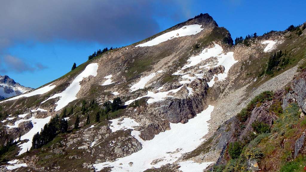
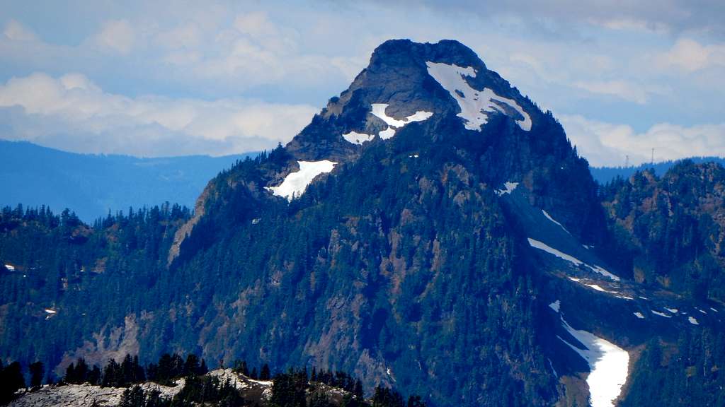
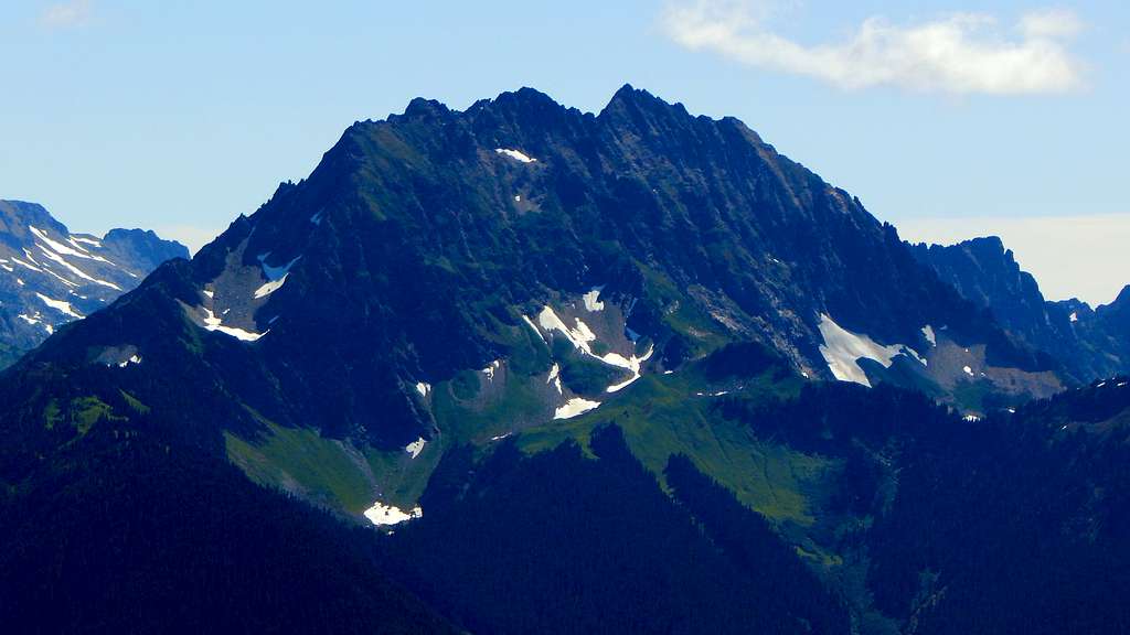
There will be some temptation to continue up easy heather slopes to the summit of Pt. 6469. Unless Pt. 6469 is your final destination (a worthy objective in it's own right), this is not what you want to do. I have also been informed that passing around the right side of Pt. 6469 is a poor choice. Begin a near level traverse around the SE (left) side of Pt. 6469. This 1/2 mile traverse will represent the technical 'crux' of your climb. Steep, frustratingly slick vegetated slopes can be mitigated through the use of instep crampons, ice axe, trekking poles, etc. This is probably not a traverse you would want to do under wet or snowy conditions. In the photo below, the 5700' level can be approximated by the break in the trees on the right skyline of Pt. 6469.
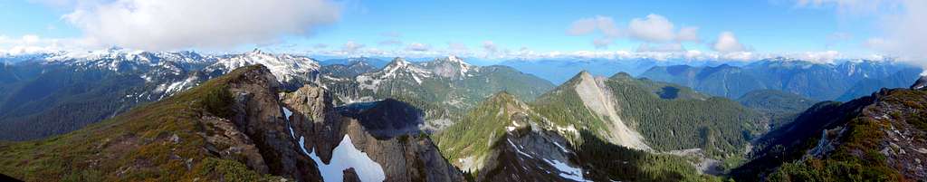
Eventually, you will arrive at a relatively flattish basin just NE of Whale Peak's summit. From here, continue S/SW on mixed heather/rock slopes to Whale Peak's East Ridge. The final 300' to the summit offers easy scrambling on heather slopes. Whale Peak has an inviting, grassy summit - plan to hang out for a while.
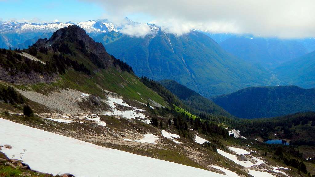
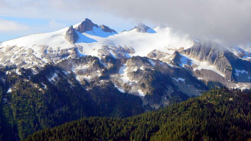
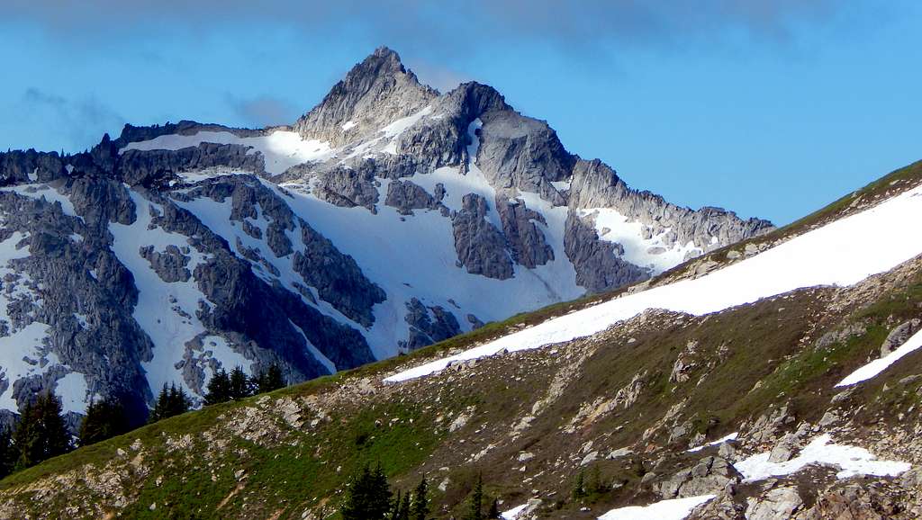
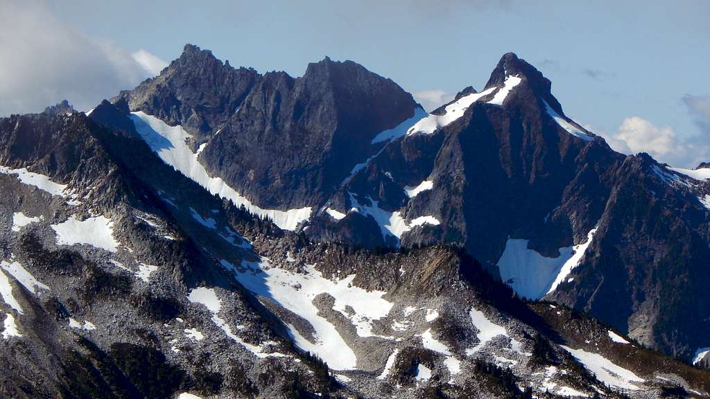
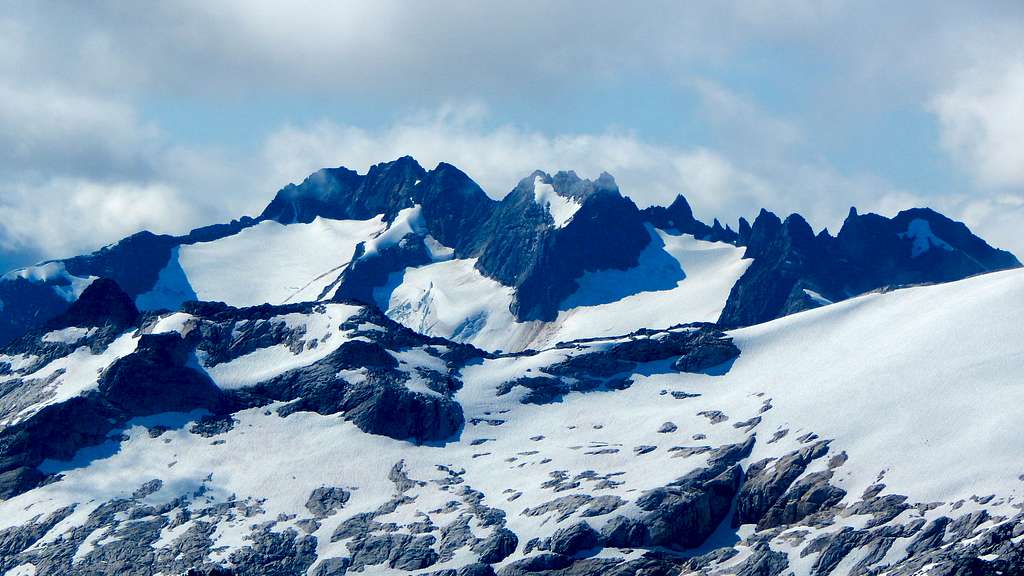
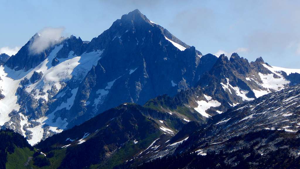
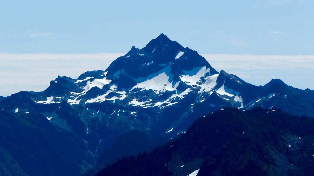
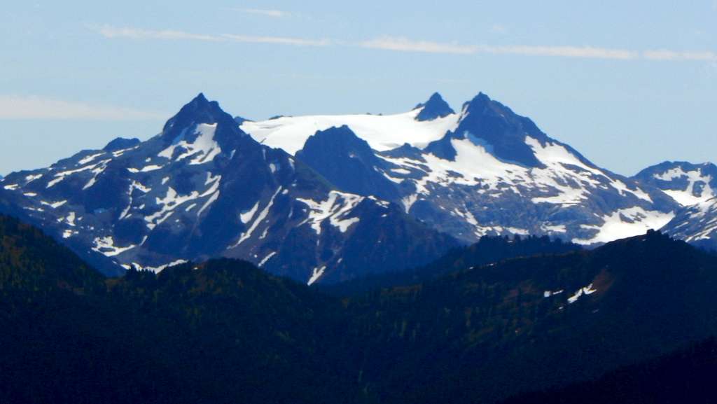
Whale Peak is well positioned for great views of the Buckindy-Illabot Group, as well as the Cascade Pass vicinity peaks. A few of the photos below were taken below the summit, as a thin marine layer obscurred our views east from the summit.
Red Tape
The trail to La Rush Lake is an 'unofficial' trail, and therefore does not require a parking pass.
When to Climb
If I had to guess, June to September would probably provide the best conditions.
Camping
Either of the lakes would provide camping opportunities, as well as several spots near the 5700' level of the ridge. Personally, I would really like to overnight on the summit of Whale Peak one day, as it would likely be spectacular.