
|
|
Mountain/Rock |
|---|---|
|
|
40.29200°N / 114.2693°W |
|
|
Elko |
|
|
Hiking |
|
|
Spring, Summer, Fall, Winter |
|
|
8077 ft / 2462 m |
|
|
 The summit
 Overview
White Horse Mountain is just barely off of US 93 (alt) and is a very appealing mountain as you drive by it on your way to or from Wendover Nevada. Because of this proximity to the highway, I have always been attracted to it and have wanted to find my way to its summit for several years now. One of the reasons it holds appeal besides it good looks, it is one of Nevada's prominence peaks, having 2067' of prominence which just barely puts it on the peak list of peaks with over 2000' of prominence.The west face presents a very cliffy appearance and is a bit intimidating to some who fear they'll have to find their way up through the cliff bands. Probably the majority of those who have climbed this mountain have made their way up the western side but on a review of the maps, I noticed a jeep track on the eastern side of the mountain that allowed for good access and a pretty direct ridge approach leading to the summit area. I'll share that information in the route section below. The summit register has only been in place for 7 years and we noted only five others who had signed in prior to our visit.
White Horse Mountain is named after an indian war chief of the Goshute Indian tribe. In 1863, he and his band burned Eight Mile station down and started the Overland war in Nevada. That is all the history I could find that was associated with the name White Horse.
White Horse is also wild horse country as is much of this part of Nevada and evidence of the wild horses can be seen in quite a few places.
Getting There
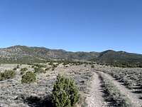
From Wendover, take alt US 93 south to White Horse Pass, about 30 miles or so. After cresting the pass, drop down to a road (see map) and turn off on the signed Kinsley Mountain road. Follow this road as it heads south and contours around the mountain. One key junction that you need to look for is where the main road will turn right and head for a mountain with an antenna structure on it. Take the lesser road that goes straight ahead and that will then turn left a bit, watching for the jeep track (which is in good shape). It is about 11 miles to this jeep track from US 93. Take the jeep track for not quite a mile and park when you see the key ridge that will take you close to the summit (see pic) Area map
Red Tape
None that I am aware of as I believe the land is all BLM land.For more information, contact:
Elko District Office
3900 E. Idaho Street
Elko NV 89801
Phone: 775-753-0200
Office Hours: 7:45 am - 4:30 pm M-F
Camping and Wendover weather
There are no organized campgrounds in the area but since it the area is BLM, you can car camp in the area. Please use previously used areas if possible and practice "leave no trace" ethics.Nearby Wendover has many motels and plenty of services.

Click for weather forecast

Click for weather forecast
 East side of White Horse Mtn
Route
See the map I have posted for an idea of the way we went. Our route was about 4 miles round trip with a modest 1400 feet of elevation gain.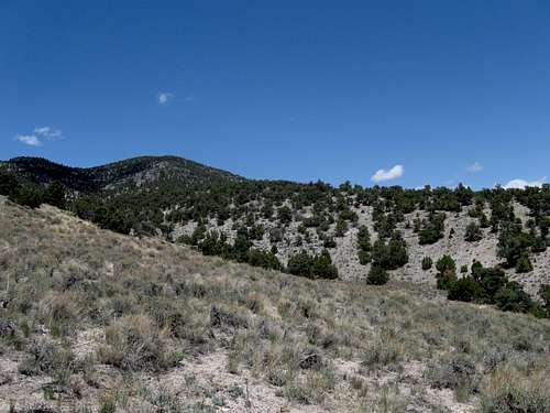 Ridge up
 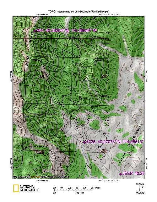 Route
Route  View to Pilot Peak while on route
Summit / links
 Ken on summit
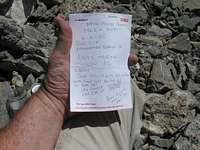 Register
For lots of pics, see the trip report of Victor Zhou's here.