
|
|
Area/Range |
|---|---|
|
|
40.41690°N / 107.4731°W |
|
|
Hiking, Mountaineering, Trad Climbing, Toprope, Bouldering, Scrambling, Skiing |
|
|
Spring, Winter |
|
|
7930 ft / 2417 m |
|
|
Overview
The Williams Fork Mountains are one of the least known ranges in Colorado. This particular range is located south of Craig and Hayden and north of the Flat Tops. The range has good hiking and climbing, but there are a few characteristics that make it a less desirable range than most of the other ranges in the local area of Northwest Colorado. The range as with several other ranges in the area are pretty unusual since most ranges in North America are aligned north-south instead of east-west as this range is.
Parts of the range offer good scenery, good hiking and climbing as well as Craig’s closest good rock climbs. There is more wildlife in this area than I’ve seen anywhere in the world with the exceptions of the tropical rainforest and the African savannas. The best scenery in the range is on the southern slopes.
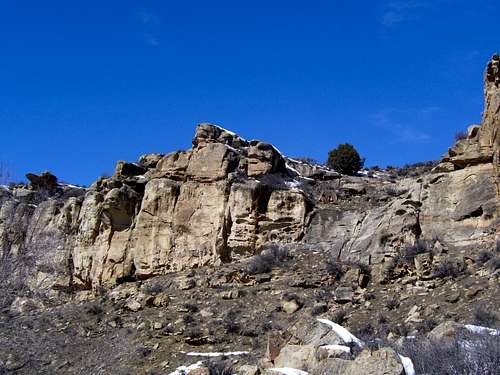 These are the cliffs that some local climbers know as the Hamilton Crags. There is some pretty good rock for sandstone.
As with some other Colorado ranges, this range is plagued by private land issues and has relatively few public access points. Most of the south slopes of the range are on public land, but there is a narrow strip (only a few hundred yards wide) which blocks access to much of the area.
The view from the north (including from Craig) of the range is less than inspiring. If you are a non-miner, you probably won't delighted in view of the strip mine that feeds the power plant that is the lifeblood of the local economy. On the plus side, the mine has done a good job at reclamation after the coal has been mined out.
We all need and use power, but of course that makes the north side of the range less desirable for hiking and climbing. The southern side is better for hiking and climbing. The northern parts of the range are almost entirely private land.
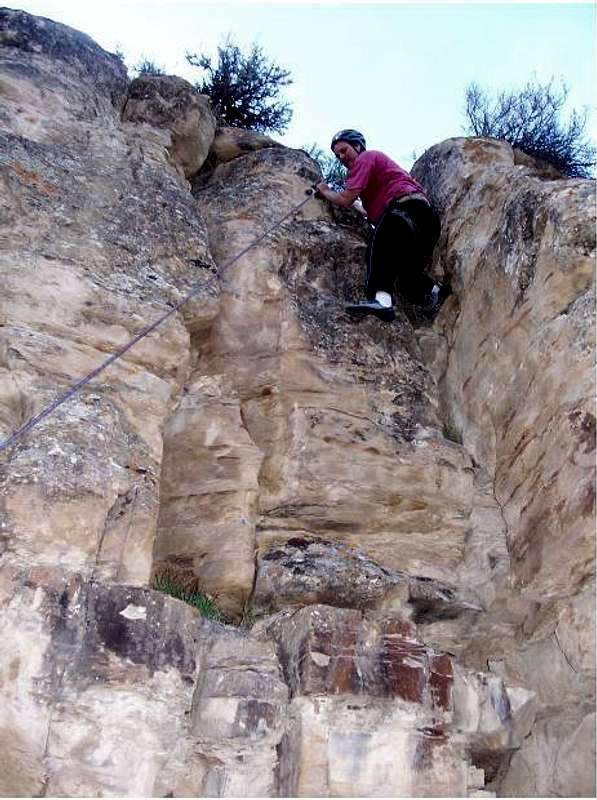 Putting a new route up in Castor Gulch. The rock wasn't that good!
Getting There
Castor Gulch
The best access road is Castor Gulch which is accessed via County Road 93. CR 93 is reached from Highway 13 about 13 miles south of Craig and just north of Hayden. From Highway 13, you can follow the road a short distance to the Hamilton Crags (rock climbing area) or a ways farther to the boundary of the State Wildlife Area. Public land begins only a short distance beyond the highway, but reportedly the nearby land owner doesn’t like climbers on the crags even though they are technically on public land. Climb anyway (but only on public land), but be aware of the situation and pay attention to the property lines on the BLM maps.
 Peak 7415 in the Williams Fork Mountains, which is accessed by way of Castor Gulch. These are the drier south slopes as seen on a March climb.
Nameless Gulch
The nameless gulch off Highway 13 between mile marker 79 and 80 also makes a good access route. A short road goes to a pipeline where several game trails begin.
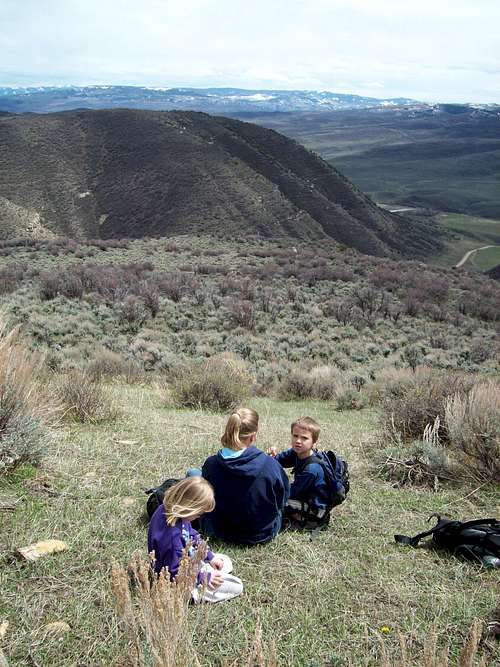
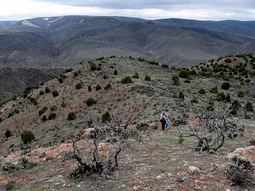 Shaylee, Kimberly and Kessler hiking up the ridge in the Williams Fork Mountains above the nameless gulch on a cold and gloomy April day.
Jeffway Gulch
Jeffway Gulch is another access route. To reach Jeffway Gulch, head east from Hamilton (on Highway 13) on Highway 317 to County Road 33. Just north of the highway, the road crosses BLM land followed by State Land. Sever routes lead up to the steep ridges and peaks on either side of the county road.
 This is the summit of "Jeffway Peak" in the Williams Fork Mountains. Jeffway Gulch is below.
Sage Creek
Sage Creek south of Hayden makes another good access route. From the east end of Hayden, County Road 37 heads south. This roue crosses public land 1-2 miles short of Sage Creek Reservoir and makes a good access point to climb Hillbilly (Hillberry on some maps) Mountain.
 Kimberly and Shaylee near the summit of Hillberry Mountain.
Red Tape
Parking within or driving through the State Wildlife Area in Castor Gulch requires a habitat stamp. See below for details:
Colorado Habitat Stamp
Camping
No camping is allowed in the State Wildlife Area, but you can camp on adjacent BLM lands, though the campsites aren’t great. The best place to camp around here is where Highway 13 crosses the Yampa River south of Craig. There is a nice campsite for a fee of $5.
The area just to the west of Hillbilly Mountain has some good campsites as well.
When to Go
Late April through early June is best. This is the high desert with some of the widest temperature ranges in the country. In the Craig area, temperatures have varied from 100 in the summer, and -56 in the winter. Summers are warm and can be hot. It can be in the 90's, and there are few reliable water sources in the mountains. Winters are cold, and the winter extremes are ridiculously low here. In the winter months, temperatures of -30 are fairly common, without the windchill.
In early spring, and possibly well into April, everything is a muddy mess. Winter skiing and snowshoeing can be good and there is usually enough snow in many areas December through March.
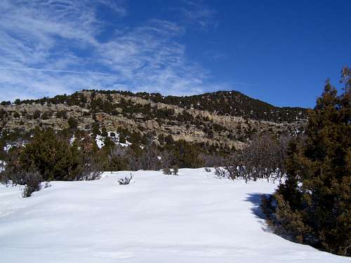
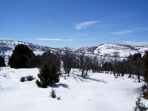 The Williams Fork Mountains in March.
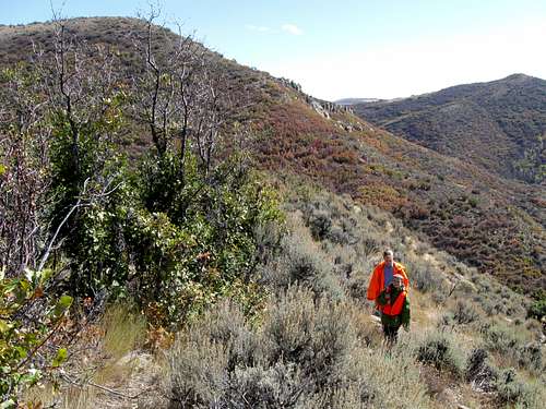
September and October can have pleasant temperatures as well, but the area is a very popular hunting destination. If you go then, wear blaze orange just to be safe.
CLICK HERE FOR WILLIAMS FORK MOUNTAINS WEATHER FORECAST
Below is the climate summary of Craig, north of the Williams Fork Mountains. The data is from 1982-2021. Craig is at 6300 feet elevation, so expect the temperatures to be fairly similar, but perhaps slightly warmer on winter nights and a bit cooler in summer.
| MONTH | AVE HIGH | AVE LOW | REC HIGH | REC LOW | AVE PREC (in) |
| JAN | 29 | 2 | 52 | -44 | 0.88 |
| FEB | 34 | 7 | 61 | -51 | 0.82 |
| MAR | 46 | 19 | 77 | -24 | 1.29 |
| APR | 58 | 27 | 81 | -2 | 1.66 |
| MAY | 67 | 34 | 91 | 12 | 1.54 |
| JUN | 79 | 40 | 99 | 25 | 1.32 |
| JUL | 88 | 46 | 101 | 29 | 1.16 |
| AUG | 84 | 46 | 98 | 25 | 1.39 |
| SEP | 74 | 37 | 95 | 10 | 1.90 |
| OCT | 60 | 26 | 86 | -14 | 1.86 |
| NOV | 44 | 17 | 72 | -21 | 1.45 |
| DEC | 31 | 4 | 59 | -39 | 1.00 |