

desainme - Dec 30, 2005 6:00 pm - Voted 10/10
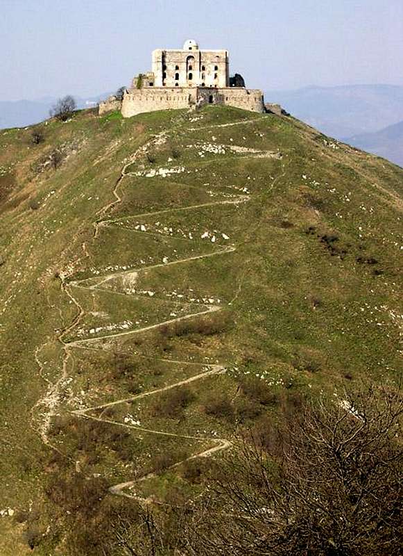
Good View of Zig-Zag path to FortHi Livio, Redraw Mountains Around Center (8.93988, 44.46099)
If this is done, you can see the path exactly as in your photo. Both your photo and the zoomed in interactive map show 15 corners on the zig-zag path.

livioz - Dec 30, 2005 7:21 pm - Hasn't voted
Re: Good View of Zig-Zag path to FortThanks Mark, I had already seen...
Did you read the3 infos that I added to the overview section of Diamante? (it means diamond, obviously)
A very small correction to the coordinates I had obtained from: www.atlanteitaliano.it
should be made according to the zoomed interactive Google map; from my knowledge of the topographic features of the summit (fortress included), the final values (5 decimals are reliable in this case, because of the high definition of Genova hinterland) are:
44.46137° N
8.93992° E
A doubt: because of the fortress on the summit, what's the real height?
Have a look at the interesting link I'm going to add to Diamante page, in particular to:
this one
P.S.:atlanteitaliano is always out of work :-(


Comments
Post a Comment