
Viewing: 1-1 of 1

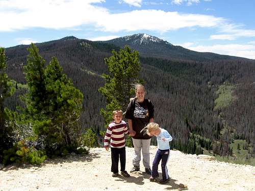
MoapaPk - Dec 9, 2009 7:42 pm - Voted 10/10
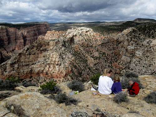
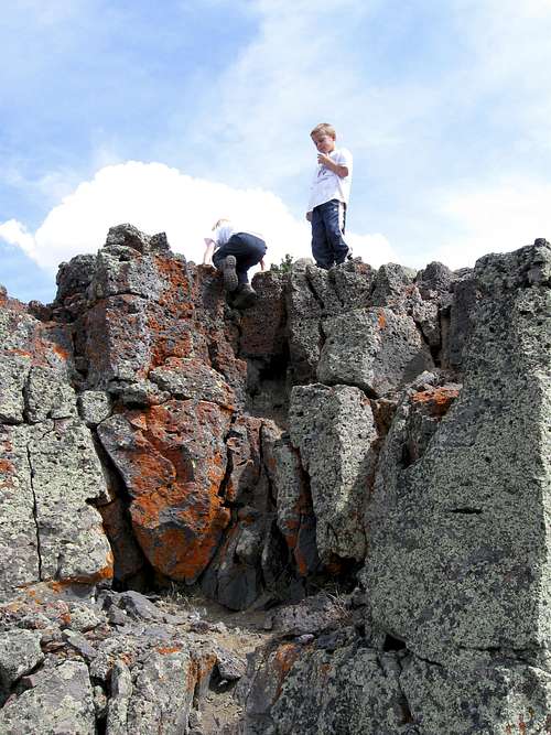
lucky kidsOK, I didn't read everything, just enough to know those are lucky and wonderful kids.
Viewing: 1-1 of 1
|
|
Trip Report |
|---|---|
|
|
Jan 1, 2009 |
This is just a simple log to keep track of our 2009 trips.
See the 2008 Trip Log for last year's trips.
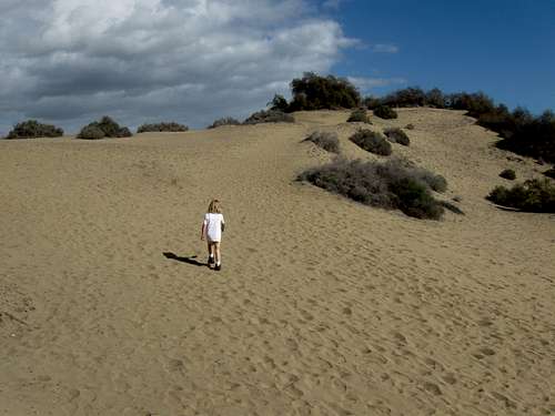
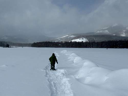
December 31: Dunas de Maspalomas (Gran Canaria, Spain)
After riding the camels through the dunes, Shaylee and I went on a hike through the dunes from Oasis. We followed several of the trails and made a big loop hike. While the dunes are a thrill for Europeans, and were pretty interesting, but I didn’t think they were as scenic as some desert areas in SE Utah for example. Even so, the beaches along the beaches are really nice and the wet sand is easy to walk on. It was our last hike of the year.
December 30: Barranco de Arure (La Gomera, Spain)
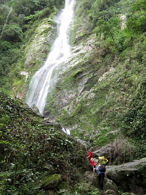
Kessler, Shaylee, Kimberly and I at first decided to try and hike the challenging Barranco de Argaga. It was raining and when we were hiking along the coast someone was warning people of the fresh rockfall and falling rocks in the Barranco. We returned to the Valle Gran Rey and walked up the road to the Barranco de Arure. The Barranco de Arure is a pretty, but challenging canyon that has a nice waterfall at the end. To get all the way to the falls you must climb several boulders and small ledges and cliffs. The kids enjoyed the climbs, but Kessler went ahead and while crossing the creek on slippery rocks he slipped on a rock and got a bruise on his head.
We continued up the canyon and made it all the way to the falls just in time for lunch. After eating lunch we returned back down canyon and back to the Valley Gran Rey. It was a challenging hike, but a good one.
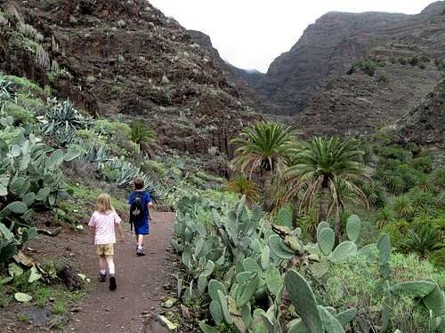
December 28: La Mérica (La Gomera, Spain)
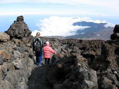
Today Kessler, Shaylee, Kimberly and I climbed La Mérica on the island of La Gomera. We walked from Valley Gran Rey to the bus stop and took a taxi to Arure where we started our hike. We visited the big overlook above Taguluche before heading off towards La Mérica. We enjoyed the fine views along the way and climbed a few summits of La Mérica before eating lunch from the top of one of the summits. After that we followed the trail along the ridge south to the Ricos de La Mérica and then the steep trail back down to Valle Gran Rey. It was a fantastic trip and one of our best hikes so far in the Canaries.
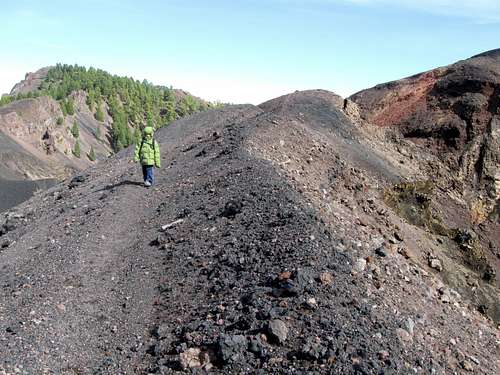
December 26: Pico Nambroque, Montaña del Fraile, Volcán de la Deseada, Volcán Martín (La Palma, Spain)
I was originally planning to do some hiking at the Caldera, but Kessler asked if we could have another shot at the Ruta de los Volcanos. We again rode the bus to El Paso and took a taxi to El Pilar. This time the weather was beautifully sunny.
The Ruta de los Volcanos has a reputation of being quite difficult, but we didn’t find it to be hard. We completed the 19 km (12 miles) hike, but climbed four extra mountains along the way (Pico Nambroque, Montaña del Fraile, Volcán de la Deseada and Volcán Martín), making it a longer hike. It was slightly breezy and sunny and a great trip.
Unfortunately, when we reached Fuencaliente we found that the road back to Puerto Naos was washed out and closed and thus no buses were running. We would have to take the long route around the island to get back. Another couple who hiked the same route and were very impressed with Kessler asked us to share a cab with them. We would all take a cab to El Pilar and then they would drive us to Los Llanos. We did so and everything worked well, but we arrived back in Puerto Naos very late at night, so Kimberly was slightly worried about us.
December 25: Ruta de los Volcanos (La Palma, Spain)
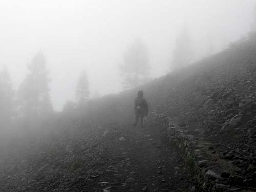
The weather in Puerto Naos was better than it was the day before, so Kessler and I decided to make an attempt of the famous Ruta de los Volcanos. We rode the bus to El Paso and then took a taxi to El Pilar where it was obvious that the weather was very bad. The taxi driver offered us a free ride back to town, but we declined and decided to attempt the route anyway.
The visitor center was closed and roped off so we just walked to the trail and started. The winds were blowing at hurricane force and there were many downed branches of the trees. It was pouring rain and foggy as well. We struggled to make 3 kms/2 miles before finally decided that continuing was futile, pointless and dangerous. The winds would actually knock Kessler off his feet.
We returned to El Pilar and walked the trail down towards El Paso. We passed someone who had parked a car before it started flooding and when the road washed out from under the car, the car tipped sideways. When we intersected the road someone gave us a ride to Los Llanos where we took a bus back to Puerto Naos.
December 24: Reventón, Cumbre Nueva (La Palma, Spain)
After waiting several days for the weather to clear in Puerto Naos on the Island of La Palma, I decided I had had enough of waiting and that I might as well do a climb despite the pouring rain. I took the bus up to the Centro de Visitantes in the Taburiente National Park before heading north and east to the Ermita de la Virgen to find the trail up Reventón. It was raining very hard and with the thick fog visibility was poor and somehow I got off the main track. I followed a road too far south and then found another track heading up the mountain, but unfortunately, it eventually ended. Not wanting to backtrack that far, I decided to head up the mountain without a trail. In the pouring rain and thick brush this was not easy, but if I headed into the pine trees the brush wasn’t too thick.
The slope was very steep but I continued up the mountain hoping I would intersect the trail eventually. After several hours of struggling in the rain and mud I reached a cliff band. It took a while to find a reasonable route up the cliff band and I began to worry about finding the route back down. I decided that I had just better head up the mountain and intersect the real trail. Less than five minutes above the cliff band, I intersected the real trail.
After intersecting the trail, I followed it up to the summit of Reventón and then south along the crest of the Cumbre Nueva. The wind was howling in the trees and the rain was pouring down, but since the trail stayed mostly in the trees, the worst of the wind was blocked.
I followed the Cumbre Nueva south to the road at El Pilar where I planned to walk down to where I started, but as soon as I reached El Pilar in the pouring rain, someone offered me a ride down to where I could catch the bus back to Puerto Naos.
I hear the route I did was spectacular, but in the pouring rain I didn’t see anything.
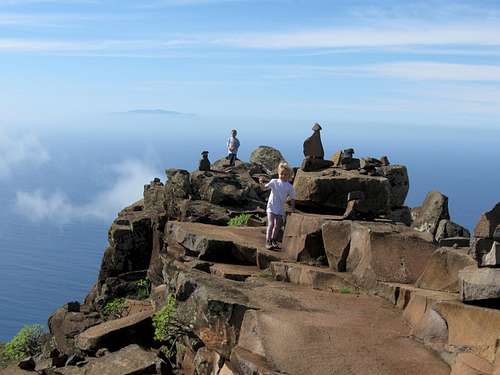
December 19: El Teide, Monte Blanco (Tenerife, Spain)
Kessler, Shaylee, Kimberly and I originally planned to walk all the way up Teide and ride the cable car down, but we got a late start and there was no way we could complete the route on time. We actually rode the cable car most of the way up before heading up and back down the trail. It was a very windy and cold day (but not as windy as the day before), but it was clear and with good views. We walked down the trail after taking all the side trips to the various overlooks. The trail down through the pumice was rather slippery and the kids fell a few times.
Kessler and I also took a side trip to Monte Blanco for some more fine views. From the parking lot, Kessler and Kimberly got a ride back to the cable car station with some college girls from England.
December 18: Roques de García (Tenerife, Spain)
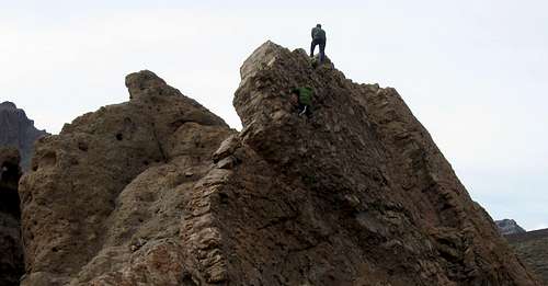
The original plan was to climb El Teide, but it was very windy (the cable car station was reporting 120 km/75 mph winds!), so we (Kessler, Shaylee, Kimberly and I) decided to try the Roques de García instead. It was a nice and scenic hike with some great rock formations and good views of El Teide. On the way back, Kessler and I found a route up to the top of one of the rocks. It was exposed so I told him to wait for me below, but every time I climbed higher, he would follow. After topping out on the rock we returned and finished the loop hike.
December 17: Cuesta de la Cruz (Tenerife, Spain)
After finally arriving in our destination (after flight and other delays), Shaylee, Kessler and I did some short hikes in the hills above Puerto dl al Cruz on Tenerife in the Canary Islands.
See the trip report for details:
Islas Canarias-Fun in the Sun or Pain in Spain?
December 12: Cedar Mountain (Colorado)
The original plan was to climb Duffy Mountain, but we woke up to a snowstorm and were afraid that the road to Duffy Mountain would not be open and even if it were it would have been a nasty drive. Justin Kuhn met at our house and we decided to climb Cedar Mountain instead. My son Kessler came along too.
The snowstorm really wasn’t a bad thing for climbing Cedar Mountain, in fact the new storm scoured out all the cold air that has been hanging around the local area. While previous mornings had been in the minus 20’s, this morning was in the +20’s.
It was snowing as we started up the mountain, but the snow tapered off as we climbed. There was enough snow to have to use snowshoes, but the snow was powdery enough that the snowshoes would sink right down to the rocks in places. Kessler also wanted to carry a sled up the mountain and we all took turns carrying it, but the snow was too powdery for good sledding since it would sink down to the rocks.
We climbed to the summit of the mountain and completed the short loop. Kessler did find a few short places to sled, but they were very short. It was still a nice climb and the last one I will do in Colorado this year.
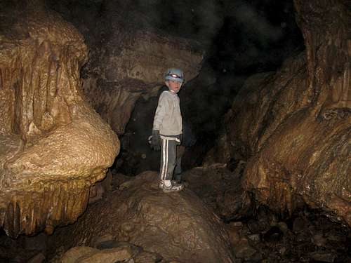
December 5: Spring Cave (Colorado)
Today we (Justin, James, Austin, Kelsey, Kessler and I), decided to explore Spring Cave in the Flat Top Mountains. We hiked through the snow up to the cave entrance and spent seven hours in the cave exploring many passages along the way. We explored all the mapped sections of the cave as well as one long un-mapped section. There were many climbs with ropes that we had to do in order to fully explore the cave. It was an interesting trip.
December 4: Colorado Mines Peak (Colorado)
Today I climbed Colorado Mines Peak alone. I was hoping to climb Flora as well, but didn’t make it.
It was “pleasantly chilly” below timberline and it wasn’t that cold when climbing, but above timberline, it was very windy. By the time I was above 12,000 feet the wind was screaming across the Continental Divide. I found out that my new winter pants aren’t as warm as my other ones and it was pretty chilly. I estimated the wind was at 30-50 mph on the upper slopes, but some gust could have been higher.
I struggled to the summit, but once on the summit, I didn’t stay long. I recorded the temperature at -4F, which would put the windchill at -37F (-61F on the old windchill chart!). Unfortunately, I went to adjust my goggles and accidentally loosened my hat which the wind quickly stole and sent it flying towards Denver, Kansas or where ever. I long gave up the thought of climbing Flora so I took some photos from the summit of Colorado Mines Peak and headed back down.
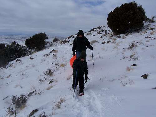
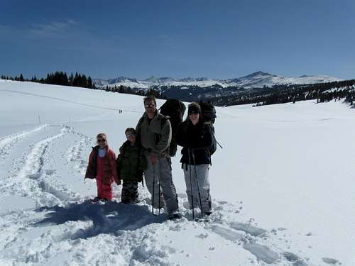
November 26-28: Buckeye Peak (Colorado)
Since people have expressed interest in a “winter practice” mountaineering trip, I thought it would be a good idea to organize a trip over Thanksgiving. Not as many people expressed interest as I thought there would be, but we still had a good group.
The destination was chosen to be Buckeye Peak (12,867 feet/3922 meters) because it should have low avalanche danger and would be an exciting, but not too difficult ascent. We could also spend the night in the Froelicher Cabin which would allow those without winter camping to join us.
Erin, Ryan and Jeff joined Kessler (my seven year old son), Shaylee (my five year old daughter), Kimberly (my wife) and I for the climb.
See also the trip report album below:
Buckeye Peak
November 26
After a 9 am start we headed up towards the Froelicher Cabin. The first 1/3 of the route had mostly shallow or patchy snow before we turned off into the West Fork of Buckeye Gulch. Shortly after we all put on our snowshoes and continued up the mountain. The snow was powdery with some strenuous trailbreaking. Up high and closer to the hut the snow became patchy and tedious with scattered powdery snow, mud and rocky ground. Ryan and Jeff reached the cabin first and waited for the rest of us to arrive. It had taken us just under five hours to reach the cabin, but we knew it would be much faster on the route out with a packed trail.
After arriving at the cabin, Ryan and Jeff quickly found out that the combination we were given to the hut was incorrect. Luckily they had a screwdriver and we were able to get in. Kessler, Shaylee, Kimberly and I cooked a Thanksgiving dinner of ham and turkey which the others ate noodles, potatoes and other goodies.
November 27
The next morning, Kessler, Ryan, Jeff, Erin and I headed off towards Buckeye Peak. Expecting hard snow above timberline, we had made a mistake in leaving the snowshoes at the cabin. Our mistake was quickly apparent as we post-holed up to the ridge between peaks 12,156 and 12,254. We skirted around peak 12,254 and to the ridge towards Buckeye Peak hoping it would be more windblown and the snow would be harder. The snow alternated between soft and hard and we slowly made our way up the ridge.
The crux of the route turned out to be 12,400 to 12,600 feet. We had to scramble up some rocks and traverse left across the slope to avoid some big cornices. After the crux section (which was still not difficult), it was smooth sailing to the summit with a steady not-too-steep uphill grind. Kessler was tired (much of probably due to two nights in a row of playing late into the night instead of going to bed), but we met the others on the summit in time to eat a short lunch. The weather on top was somewhat cold and windy, but the weather was clear and warm the rest of the time and it doesn’t get any better than this in late November.
After summiting the peak, we all headed down the mountain to near the top of the crux section. Ryan and Jeff split from Erin, Kessler and I to try an alternate route down while the rest of us descended the same route that we took on the ascent. We met back with each other at the broad saddle between peaks 12,156 and 12,254. Erin headed down to look for some good snow to snowboard while Kessler, Ryan, Jeff and I discussed what to do next. It was about 1:30 pm. We discussed climbing over to Mount Zion, but after looking at the map, it would be a pretty long haul, especially since we ditched our snowshoes back at the cabin. In the end we decided not to go for Mount Zion and instead climbed Point 12,156 before heading back to the cabin. Ryan and Jeff took a nap while the rest of us played games , talked and did various other activities. Six other people joined us at the hut that night.
November 28
In the morning it was cloudy, but the sunrise was really great. Unfortunately I missed it, but Erin got some photos. We packed up and headed quickly down the mountain. This time with a packed trail, the trip down was uneventful and fast. We made it down the 3.5 miles in 2.5 hours (twice as fast as the ascent) before eating lunch in Leadville and heading our separate ways.
It was a great trip with great company.
November 24: Yampa River Trail (Colorado)
I made another routine hike of the Yampa River Trail.
November 21: Iles Mountain (Colorado)
Kimberly, Shaylee, Kessler and I went for a climb of Iles Mountain. Iles Mountain was chosen because it is one of the few local mountains with public access that I haven’t already climbed (the list has shrank much over the last five years).
Iles Mountain is a long mountain with many personalities. Many of the faces and slopes are gentle, while some are steep and rugged. Unfortunately, all the gentle slopes are blocks by narrow strips of private land, so only the steepest routes on the mountain have public access.
After a late morning start, we found a route through the snow, mud and brush to the base of the mountain. We headed directly up the steep and rugged slopes with some tedious scree, boulders and brush. There were three cliff bands to pass and several traverses, but the exposure wasn’t too bad.
Shaylee and Kimberly climbed around the first cliff band and decided to stop and wait for Kessler and me. Kessler and I climbed through the final two cliff bands before reaching the summit plateau. After the very steep route to the summit plateau, the flatness of the summit area was abrupt and surprising. We explored the summit plateau a bit before descending back to Kimberly and Shaylee waiting below.
After meeting back with Shaylee and Kimberly we started back down the mountain. The route down went quicker, but was fairly slick and muddy in some areas. The weather was mostly clear when we started and clouded over by the time we were on top, but it was a fairly mild day weather wise.
November 20: Sand BM (Colorado)
Kessler and I made an evening climb of Sand BM. We got back after dark, but we counted seeing 33 deer along the way. Most of the mud was frozen, so it wasn’t a messy hike.
November 16: Yampa River Trail (Colorado)
I hiked a section of the Yampa River Trail today. There was snow on the ground, but not that much. The sky was completely clear and sunny, but with the wind it was bitterly cold starting out. In the trees it wasn’t so cold, but in all the open sections it was defiantly chilly.
November 14: Deerlodge Park (Colorado)
My original plan was to climb Mount Zirkel, but a big winter storm put those plans on hold. Kessler and I joined the local Boy Scout troop for a campout at Deerlodge Park in Dinosaur National Monument. It stopped snowing by the time we set up camp on the snow, but the clear night made temperatures drop. It was 7F in the morning and never really did warm up after sunrise.
The scouts went home, but Kessler and I stayed for a time to complete a short hike to along the river and to some old cabins before heading home. Unfortunately, we forgot our cameral on this trip since the fresh snow and frosty trees, cliffs and rocks made a dramatic scene.
November 12: Yampa River Trail (Colorado)
I did another routine hike of a section of the Yampa River Trail.
November 11: Black Mountain (Colorado)
Today I climbed Black Mountain via the Southeast Ridge. There was more snow that I expected, but less snow than there usually is. The snow had enough bare spots that wearing snowshoes probably wouldn’t help much, but the snow was deep enough in places that they could be useful and postholing really slowed me down.
I was surprised to find a horse near the summit of the mountain. I was breaking trail up the mountain and there were no other human footprints around, so the horse must have been there for at least a few weeks. I climbed to the summit, snapped a few photos and went back to the horse. I untied its hobble, but the hobble was on long enough that the horse’s foot was sore or injured. I couldn’t get the horse to go down with me. I couldn’t get the hobble off without a knife (which I didn’t bring this time).
I hurried down the mountain to the trailhead where there was a hunting camp and some people with horses. I told them about the horse and that I didn’t have a knife and they said they would go look for it. I hope the horse is OK.
November 8: Sand BM (Colorado)
Tonight Kessler, Shaylee, Kimberly and I went for a night climb of Sand BM. We took flash lights and the kids liked leading the way in the dark with their lights. We had to watch them careful because there are some cliffs around and because it was dark. It was a very mild night for this time of year and we had a good time.
November 7: Rock of Ages (Utah)
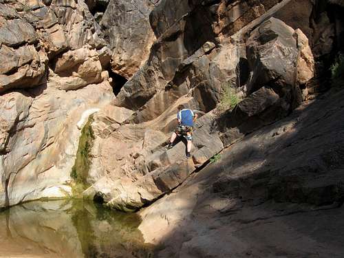
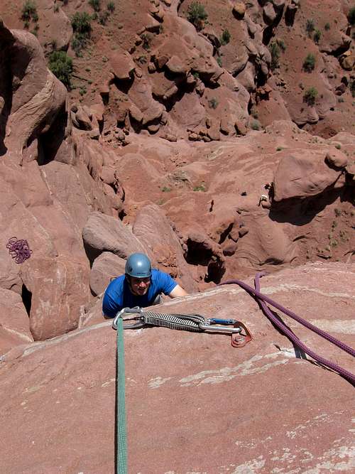
Today the group split again. Kimberly and I chose to join the famous (infamous?) Dodge drivin’ Shane Burrows to do the route known as Rock of Ages. Other members were Shauna, Prego-chick, Mark, Monica, Justin and various others (names will appear later).
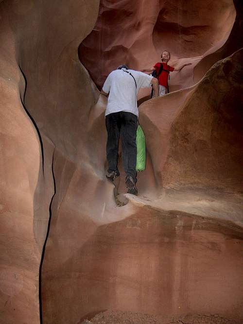
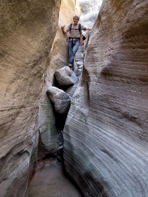
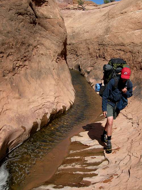
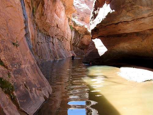
Rock of Ages is a very varied route that includes just a little bit of about everything, but nothing in excess. It has climbing and scrambling up various sandstone fins and domes, climbing down through short but sinuous slot canyons, big views and huge arches.
We drove to Pritchett Canyon in Behind the Rocks and set off upcanyon. We went up a sinuous side canyon and did several climbs and scrambles up to the top of the fins forming Behind the Rocks. Since the group was larger than yesterday’s. We went past Chimney Arch and up to the top of the massive Pool Arch (a.k.a. Tear Drop Arch).
Part of the group went down a route through a steep chute to reach the base of the arch, while the rest of us group rappelled directly off the huge headwall behind the arch. It took a while to get everyone down the wall! At the bottom of the wall there was a pool of water, but an experimental zip line was set up to try and get the people across dry. I was first on the experimental zip line, but landed directly in the water. The method got perfected with each passing person, so by the end it was a routine process.
After getting down the big wall we headed down canyon. The canyon slotted up good and wading, stemming and downclimbing was required. The crux of the route was a short but tricky climb over a big log wedged vertically in the slot.
After the slot, it was more hiking down the nice canyon. It was pretty routine except for two rappels. The first one was optional as it could be bypassed using a tricky and exposed ledge system. The brave climbed down the ledge system while the chickens did the rappel and after watching the others downclimb the sketchy ledges, we were glad we missed them.
The final obstacle was a high rappel with a somewhat awkward start. You either had to start while ducking and kneeling on a ledge while leading over to start the rappel, or you could downclimb down to a platform where the start was easier. After the rappel, the rest of the route out was a piece of cake.
Sadly Kimberly and I had to head home while the others stayed another night and day for more adventure. It was a great trip and we got to meet lots of great folks.
November 6: U-Turn, Dragonfly Canyon and Tier Drop
Several of us met at the mouth of Courthouse Wash near Moab at 8 am. After meeting, we split into two groups and the two groups went our separate ways. The group we (Kimberly and I) chose was a combination of old friends/acquaintances and new friends. AJ, Mark, Mark, Rebecca and Justin came. I already knew Justin and AJ from previous trips, but the other ones are new friends.
The first route of the agenda was a route known as U-Turn. It isn’t quite a climbing route and it isn’t quite a canyoneering route, though it is often referred to as either, but was more of a scramble up to the top of an interesting dome followed by a descent of a minor drainage via a few downclimbs and rappels.
We climbed up to and over the top of the domes near Park Avenue (rock formations in Arches National Park) and enjoyed the fine views from the summit. The route down to the north was enjoyable because we got to be close up to and “behind” some of the balanced rock formations and towers that I have always wondered about. We then downclimbed and rappelled the minor drainage to the north and then followed the rock benches back to the trailhead.
After finishing the U-Turn Route everyone was ready for more action. We decided to descend Dragonfly Canyon (also in Arches National Park). Our little group split soon after beginning. Some of our group wanted to do the entire canyon (which requires swimming several pools) while some of the group decided not to get wet (Rebecca was 7 months and quickly became known as the Prego-chick!). The ones who decided to get wet crossed over to the north slot and descended it. Kim and I dropped into the cold water and waded through the long belly-deep pool while the others found a way to chimney above them. After that there was an interesting downclimb and traverse and other downclimb before-----more pools! We swam through the cold pools (but not quite as cold as the pool in the slot) before reaching the top of the first real drop in the canyon. We rappelled this drop and hiked downcanyon to another drop (135 feet?) and rappelled that one too. After that it was just a hike down to Courthouse Wash and then scramble up the rocks and back to the trailhead, all while trying to keep up with the speedy Prego-chick.
Still hungry for more, we headed back down to Park Avenue to try another route known as Tier Drop. Like the U-Turn Route, it also isn’t quite a climbing route and it isn’t quite a canyoneering route, though it is often referred to as either. We climbed up the same crack/gully to the top of the domes near the head of U-Turn. After that there was a dicey downclimb and a couple of rappels down to the bottom of the drainage. We traversed the ledges that looked exposed from above, only to find them to be not so bad at all. We then hiked up the Park Avenue drainage back to the trailhead.
AJ wanted to do another route known as Not Tier Drop, but the rest of us were ready to wind down. By now it was close to sunset as well. We set off to climb up to the hidden “swimming pool” tucked up in the cliffs above. We climbed some easy cliff pitches, checked out a cave after which we saw and photographed a fair sized scorpion. After seeing the scorpion we found the route up to the “Swimming Pool” and checked it out. It was dry, but still quite interesting. We finished just in time for a nice sunset painting the La Sal Mountains.
See also the trip report album below:
Arches National Park and Behind the Rocks
November 2: Yampa River Trail (Colorado)
Today after work, I did another routine hike of the Yampa River Trail.
October 31: Castor Ridge East (Colorado)
Originally I was hoping to climb Mount Zirkel solo, but with the recent storm I decided to go for something less ambitious. Kessler, Shaylee, Kim and I went to Castor Gulch in the Williams Fork Mountains for some hiking. We hiked an old jeep road to the crest east of the gulch and then followed the ridge crest to a prominent summit. There was snow is the shade and some mud in the sunnier areas, but it wasn’t bad.
October 29: Yampa River Trail (Colorado)
Today I hiked a section of the Yampa River Trail. We were mostly missed by the latest storm, so it was actually fairly dry.
October 24: Lookout BM (Colorado)
The night before Kessler, Shaylee, Kimberly and I camped at Deerlodge Park in Dinosaur National Monument. Dinosaur national Monument was chosen since it was less than an hour drive and because there is no hunting allowed (unlike almost all other areas that are much closer to home).
The weather forecast was good at night, so we didn’t bother to put the rain fly on the tent. At 2 am however, it began to rain so we had to get up in the middle of the night and put the rain fly on. It rained the rest of the night, but was just above freezing (35F) so it didn’t snow.
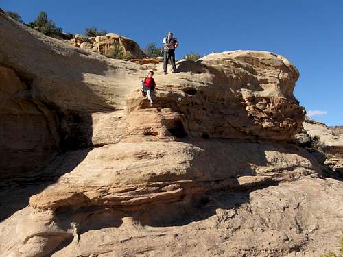
After a mostly sleepless night, we all woke up quickly hit the trail after breakfast. We followed a trail along the Yampa River to Disappointment Valley and then headed up the trail-less slick rock up towards the impressive Lookout Benchmark above the Yampa River Canyon. It was a good, but fairly easy scramble with only a few cliff bands to get through. The cliffs bands were by-passable, but the kids wanted to climb them directly. We climbed through two cliff bands and made our way to the summit.
The Lookout BM has great views and we ate lunch there. We hiked to a few other of the minor summits around that were higher than the Lookout BM, but none were so impressive.
After enjoying all the spectacular views, we headed back down the mountain and to Deerlodge. The weather was pretty good, but on the way home it was raining hard so we completed the climb just in time.
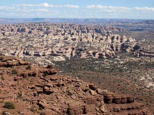
October 15-18: Ernies Country/The Maze (Utah)
The kids were out of school and due to cutbacks, I had to take some unpaid time off, so it was a perfect opportunity to take advantage of the usually fine October weather in the Canyon Country. Kessler chose to go to the Maze in Canyonlands National Park. I had already visited much of the Maze, so we decided to explore Ernies Country which I hadn’t seen much of. Ernies Country is probably the least visited area of the Maze which itself is considered to be one of the most remote areas in the Lower 48.
October 15
I had chosen to access Ernies Country from the top of the Golden Stairs Trail for two reasons. Even though the drive is a rough 4wd road, it is much shorter than driving to the Land of Standing Rocks. The second reason was that I hadn’t used this access before to access the canyons of the Maze.
After spending the night in Green River, I picked up my Dad at the Green River Train Station and we drove the three hours (short as the crow flies, but with rough roads) to the top of the Golden Stairs. On the way we stopped at the ranger station to get our permit and to discuss parts of the route we planned to take. We learned that the spring at our planned campsite (Clells Seep) was dry so this would complicate things.
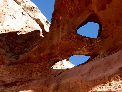
The Golden Stairs Trail is a seldom used historic trail that was built in the 1930’s. It is rather rough, but by standards in this country, it makes a fairly easy access down the cliffs below. We followed the pretty good but washed out trail down the cliffs to the land of Standing Rocks Road. From there we headed east into the Ernies Country on the rugged Fins Trail (the national Park Service removed this route from all their recent maps, but the route is still marked with cairns so it isn’t that hard to follow). There were some steep scrambles, but it was a straightforward route to the bottom of the first canyon. We set off to explore the first canyon and found a really neat arch (Kessler called it Tornado Arch because of its shape) and found a nice Indian ruin before heading to Lou’s Spring where we set up camp.
After setting up camp we set off to explore the area. We explored several steep and exposed climbing routes up to the ledges above the spring. My Dad headed back while Kessler and I explored a very steep scrambling route up to near the rim.
At night the stars and Milky Way were really bright so I left the tent door open all night so we could see them.
October 16
Today we set off for some explorations of the Fins area of Ernies Country. Because Clells Spring was dry, it would be a much longer walk than it would have been from our originally planned campsite. We hiked over to the canyon containing Whitmore Arch and explored it. Whitmore arch is rather hidden, but we thought we saw it from below, but weren’t sure. We continued exploring up canyon to find a fantastic and unexpected slot canyon.
After exploring and climbing through the slot canyon we were stopped by a 30 foot unclimbable dryfall and we headed back downcanyon. Kessler found a (dead) tarantula so we decided to call this canyon Tarantula Canyon. We decided to climb a rock fin so we could look for Whitmore Arch. Coincidentally, we reached the top of the fin right near Whitmore Arch. We climbed through Whitmore Arch and descended down the other side to the floor of the canyon before heading back downcanyon to the Fins Trail.
We followed the Fins Trail east to the dry Clells Spring and then east to where it crosses Sand Tank Canyon. We would head up this canyon to look for Tibbitts Arch, which is the biggest arch in the Maze. It was a long sand slog up the canyon, but there were some spectacular rock fins along the way. We found another large arch before reaching Tibbitts Arch. We tried for about an hour to look for a route up the cliff bands to get into the arch, but we never found a viable route.
It was getting late and we headed back down canyon and then back west to camp along the Fins Trail. It was a very long hike back and we hurried as fast as we could to beat the fading daylight. It was completely dark when we got back and we were lucky that we got back when we did as much of the route would be very difficult to follow in the dark. Kessler didn’t complain much, but did say that he was cold, hungry and thirsty. We had just enough water to make it back to camp. We had completed 15 miles in a single day (not bad for a seven year old and a 66 year old), nine of which were off trail and much of the route was rather rugged. The fifteen miles didn’t include our hour to try and find a route closer to Tibbitts Arch, so it was a long day.
October 17
After yesterday’s very long day, we decided on a shorter (but even more rugged) day. We followed the route up towards the rim that Kessler and I found on October 15. It was a rugged route and we had to climb several cliff bands. One of the cliff bands had some very old moki steps carved into the cliffs, indicating that this was a centuries old Indian route. We found one more Indian ruin and climbed several more cliff bands before reaching the true rim of Tarantula Canyon. We headed north along the canyon rim to look for Cave Arch. The Trails Illustrated map isn’t very detailed, so it would take lots of exploring to find the arch.
We explored several nooks and crannies and were thrilled to find several arches and some flint chips and an arrowhead, but we didn’t find Cave Arch. We followed the rim of the canyon to the head of Tarantula Canyon and found a fantastic double pothole arch. It was really neat.
We explored the east rim of Tarantula Canyon and found a very steep and somewhat scary descent into the canyon. A pile of rocks strategically stacked rocks proved that others had preceded us sometime in the past.
We explored down canyon and explored another side canyon before eating lunch. While trying to get close to another arch, we found an obscure route back up to the rim. It was very steep, but not too scary. We circled around the rim over to a really impressive pothole arch. After taking photos, we found yet another neat arch.
We never did find Cave Arch so we headed back towards camp. We looked for an easier route than the old moki steps route we found, but we never did find one. We returned to camp pretty early in the afternoon, so we had a rest before dinner.
October 18
Today we just packed up and headed back west along the Fins Trail. After the previous two days routes, it was a basically a piece of cake. We headed back up the Golden Stairs Trail. Even though it was uphill on a rugged hill, we made very good time and made the five miles in less than three hours. We enjoyed the views along the way before heading back for home.
It sure was a great trip and we got to explore some awesome country.
See the Trip Report:
Ernies Country and The Fins
October 12: Fish Creek Falls
It was Kimberly’s birthday today and she said that she wanted to go to Fish Creek Falls (near Steamboat Springs). Luckily the leaves turned late this year and there were still some around. It was a beautiful day with great weather and after viewing the Lower Falls we hiked up to the Upper Falls. There were several hikers about, but fortunately people do not hunt here.
After enjoying a long lunch at the Upper Falls we hurried back down in order to pick the kids up from school. It was a good day.
October 10: Hillberry Mountain (Colorado)
Kimberly, Kessler and I went for a climb of Hillberry Mountain today. Hillberry Mountain is in the William Fork Mountains south of Hayden Colorado.
It is hunting season so we thought the middle of the day would be safest for any hikes or climbs. We also wore orange.
There was no trail and mountain is steep, but the ascent went well and wasn’t too long. It was partly cloudy, but we had some nice views. Some of the autumn leaves were still out, but the colors in this area aren’t as brilliant as they can be in some areas of Colorado.
October 7: Cedar Mountain (Colorado)
Tonight I did a night climb of Cedar Mountain. I started out on a well after dark on a very dark night with no moonlight. The stars were brilliant though and the Milky Way was highly visible. I climbed up the peak, startling some deer or elk along the way. I never did see them but they ran into the bushes.
I only spent about a minute on the summit and watched the city lights below. I could see that to the east there were clouds, but a faint outlined proved that the moon was up now but obscured by clouds.
I returned down the mountain, this time being mutually startled by perhaps the same elk or deer. I also heard some strange animal noises, but I don’t know what it was.
It was a nice hike on an unusually warm night for this time of year. There was a breeze from the south, but the air was warm.
October 5: Sand BM (Colorado)
I made a night climb of Sand BM. It was cold and windy with some snow flurries, but there wasn’t too much mud. The snow flurries were very light and I could still see the outline of the moon. There were also several deer on the peak, including some large bucks.
October 3: Dale Peak (Utah)
The original plan was to climb Mount Timpanogos, the second highest mountain in the Wasatch Mountains and one of the most beautiful mountains in the Rockies. Unfortunately conditions were not ideal since a snowstorm 1-2 days prior dropped over a foot of snow in the high Wasatch.
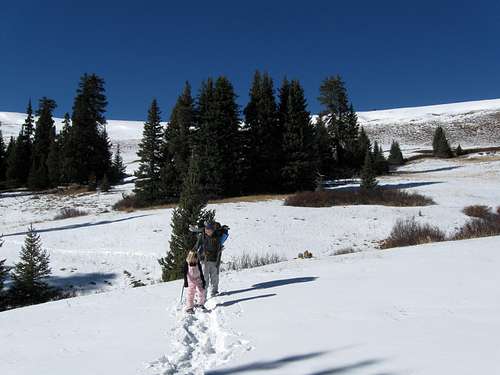
Because of the snowy conditions up high, we set our sights on the much easier and lower Dale Peak, a minor summit in the Wasatch. Kessler, Shaylee, Kimberly and my father joined me for the climb. Some cousins of the children were supposed to come to, but they decided not to go.
We chose the East Ridge route to the summit. It was a pretty easy route and steep in places, but most of the trail was good although the upper part is slightly overgrown. The entire climb was under cloudy skies.
After enjoying the views while eating lunch at the summit, we headed down. We got back just in time since on the drive home there was some very light rain.
September 26: South Fork Buckwater Draw (Colorado)
Austin Gilbert, Justin Kuhn and I did a canyoneering trip to the South Fork of Buckwater Draw. This canyon was chosen because it has some great little 5th class downclimbs, but the canyon is relatively short and easy compared to some of the others and because Kessler (my son) was supposed to come. Kessler was sick in the morning, so he had to stay home.
We drove out the trailhead and made our way down the steep slope into the canyon. We would have descended the canyon with minimal difficulty if it weren’t for the fact that there was lots of very slippery mud which made some of the climbs much harder than they are when dry. We also found that the recent flash floods have altered some of the canyon.
After enjoying the nice canyon we headed back for the trudge up the hill and back to the vehicle. We more or less took the route I had used previously, but we made a slightly harder variation up the first cliff band (which is avoided on the other route).
It was a nice day and with great weather.
September 19: Bears Ears (Colorado)
I was invited to help out with the scouts (boy and girls came) for a campout and a climb of Bears Ears in the Elkhead Mountains. I also took my seven year old son Kessler.
We camped at the base of the mountain and left very early in the morning (relatively warm at 36F) in order to reach the peak by sunrise. The first ones to the top (of which we were) got there too early and had to wait a long time in the dark for sunrise! After the entire group was on the peak, we watched the sunrise and split up and climbed down the mountain.
It was a nice trip and the weather was good.
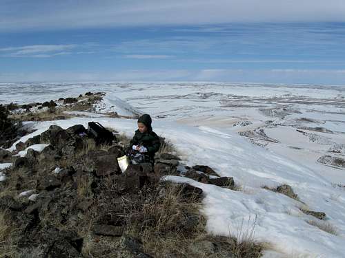
September 11: Meaden Peak (Colorado)
Justin Kuhn and I climbed Meaden Peak in the Elkhead Mountains. I had wanted to climb Meaden Peak since it’s the highest mountain in the Elkhead Mountains that I had not climbed yet and Justin thought it sounded like a good climb.
We drove the rough road to the trailhead and started up the mountain. From the east, the mountain didn’t look very impressive at first, but we were looking at a false summit. We climbed over the false summit and then found another one….and another one…..I believe there were a total of five. It was a good thing though as every summit we reached had a better view and became more aesthetic.
The summit was interesting and had a great view plus a few rock outcrops to scramble up for fun. We took a long break at the summit and headed back down the same way.
September 8: Cedar Mountain (Colorado)
Kessler and I decided to do an evening/sunset climb of Cedar Mountain. We drove to the trailhead and set off for the mountain, but we only made it 1/3 of the way up before the sunset. The sunset was pretty nice, but not as spectacular as I thought it would be (with the smoke in the air) since there were no clouds around. We saw several deer on the way up, including some big bucks. We went over the top and made the short loop arriving back to the vehicle after dark.
September 7: Buck Point (Colorado)
Kessler and I decided to climb Buck Point today. Buck Point is in the Elkhead Mountains and is one of the highest peaks in that range that I hadn’t already climbed yet.
After driving to Willow Creek we hiked the trail up to the Welba-Oliphant Saddle. We then made our way cross country (which turned out to be a tedious route across boulders and fallen trees. Once we reached the Welba-Buck Point Saddle, the route got steeper, but generally easier. We climbed to the summit and found that the last person to sign the register was six years previous.
At the summit it began to snow, which quickly changed to painful hail so we didn’t spend much time on the summit. We quickly left the summit and found that before we reached the Welba-Buck Point Saddle it began to thunder so we were glad that we didn’t reach the summit later.
We made our way back to the trail at the Welba-Oliphant Saddle and then followed the trail back down to Willow Creek. It was a nice climb and the weather wasn’t bad for very long.
September 5: Sleepy Cat Peak (Colorado)
Chores kept me closer to home, so we decided to do some local peaks for the weekend. Kessler and I had climbed Sleepy Cat Peak three years previous and placed a register there so in part we wanted to go see how many people had signed the register.
This time Kimberly and five year old Shaylee would join us. The first half of the climb went easy and the third class section of the ridge was climbed quickly and was fun. After climbing the cliff, the ridge was long and tedious with lots of fallen timber and was longer than we remembered.
Just after we reached the summit it began to snow a little bit and then rain. We found the summit register to have been signed by more people than we thought. Two more people signed the register in 2006, eleven people in four groups signed the register in 2007 and one person signed in 2008. We were the first ones to sign in 2009.
It was a good little climb despite the tedious sections and other than the brief storm at and near the top, the weather was pretty good.
August 23-29: Black Canyon Lake/Rock Lakes/Whitetail Peak/Silver Run Peak/Silt Lakes/Grass Mountain (Montana)
It is rare that I can get time off in summer so when I had a chance to take a week off, Kessler (my seven year old son) and I decided to head off to the Beartooth Mountains for some backpacking, fishing and mountain climbing. Our plan was ambitious. With heavy packs loaded with a week’s worth of supplies we would climb as many peaks as possible (all rated class 2-4 in difficulty) in the time period of seven days. We would also do many side trips to the different drainages and visit several of the other isolated and trail-less cirques and lakes.
August 23
We arranged to have a taxi driver meet us at the West Fork Rock Creek Trailhead and drive us around to the Lake Fork Trailhead. The cost was $80, but it was worth it in order to do a long loop hike.
We left the Lake Fork Trailhead under cloudy skies and hope that the weather would improve. It was a long and hard five miles to the Lost Lake turnoff. Normally, five miles in nothing, especially on a trail, but today it was challenging because of our huge packs. I had brought an over abundance of gear prepared for possible winter conditions (the Beartooth Mountains are well known for possible bad weather) as well as eight days worth of food and supplies. With all this equipment my pack weighed 72 lbs (33 kgs) and Kessler’s weight 10 lbs (5 kgs) so it was slow going.
As soon as we reached the turnoff to Lost Lake we all too happily dumped our packs and set off to explore the spectacular Black Canyon drainage. We had hoped to reach Black Canyon Lake over a rugged off-trail route, but it began to rain just short of the lake and in the boulderfield the rocks were very slippery. We turned back and hiked back down the steep route in the rain. By the time we reached our camp it was raining very heavily.
When the rain tapered off a bit after dinner, we hiked to Lost Lake in the light rain and tried fishing, but didn’t have luck. It began to rain harder again and we headed back to camp (8400 feet/2560 m). Since it was raining hard we spent the rest of the evening in the tent. After dinner Kessler went to bed early and I read High Adventure by Sir Edmund Hillary and enjoyed it very much.
August 24
It rained hard all night, but my morning it was down to a light drizzle at a temperature of 40F (4C). We hiked up the trail to Keyser Brown Lake(where we dropped the packs) in mostly good weather with only some very light sprinkles. We set off towards the spectacular Rock Lakes.
Lower Rock Lake was a relatively easy, but somewhat wet off trail hike, but reaching the Upper Rock Lake proved to be a greater challenge. Our route took us through some rough boulderhopping, wet marshy ground and some thick bushwhacking, but the scenery was spectacular, especially the views of Beartooth Mountain.
On the way down we found an easier route with signs of use that stayed much closer to the stream than the route we took up. We returned to Keyser Brown Lake and started up the hill to timberline at September Morn Lake. Because our packs were still heavy it was pretty slow going, but we set up a nice campsite at 9750 feet (2972 m) and overlooking the lake. The day had pretty good weather and was a mix of clouds, sun and light sprinkles.
August 25
Today would be one of the most challenging days planned for the entire trip. We woke up with a frosty 29F (-2C) with perfect bluebird weather. We were good to go on our climb of Whitetail Peak! Luckily we wouldn’t have to carry our heavy packs today. Without heavy packs we made good time up to Sundance Pass at 11,037 feet (3364 m). We climbed south up Mount Lockhart, scrambling to the summit before starting up Whitetail Peak (at 12,548 feet/3825 meters, it is the 4th highest peak in Montana).
We climbed the ridge up Whitetail Peak, finding it really spectacular and with awesome views. We met a group half way up and they were very impressed to see Kessler up there. They warned us about the exposed section of climbing near the summit. We talked with them a few minutes before heading back up the impressive ridge.
Once we reached the top of the relatively famous Whitetail Couloir and tackled the crux of the route (the one we were warned about above). Some sources rate this pitch as Class 4, but we thought it felt more like a solid Class 3 and the exposure wasn’t that bad. We quickly made the summit for a well deserved, but relatively late lunch break. The views were absolutely spectacular and we kicked back to soak in the sight of all the peaks, glaciers and lakes (one of which was still almost completely frozen). There was only a light breeze and the weather was great so it was a very pleasant experience.
After enjoying the summit we headed back down to our camp at September Morn Lake after a wonderful day.
August 26
It was cloudy and sprinkled the night before, but by morning the weather looked pretty good. Because of the clouds it was a warmer 35F (2C). We headed back up towards Sundance Pass, but it was more challenging than the day before because we were carrying our big packs. We dropped our packs at the pass and headed up south towards Silver Run Peak (at 12,542 feet/3823 meters, it is the 5th highest mountain in Montana). The weather was good and we made our way across the boulderfields to the summit.
The summit of Silver Run Peak is a spectacular place to be because although the east slopes are gentle, the west face drops down to the West Fork Lake Fork below in a steep cliff nearly 3500 feet (1066 meters) high. Although it really isn’t completely vertical, it sure looks like it from the top and the summit is an exciting place to be.
After enjoying the wonderful views from the summit and having a nice lunch we headed back to Sundance Pass where we left our packs. There were two mountain goats at the pass and we spent a few minutes watching them before reluctantly shouldering our big packs and heading down the 30 switchbacks down to the West Fork of Rock Creek.
It was getting late and there were two people (a teenage girl and her father) camped near the stream crossing (9550 feet/2911 m), but they said they didn’t mind company and we shared a campsite. We talked with them and shared our dessert with them before going to bed.
August 27
It wasn’t a restful night. Two mountain goats kept sniffing and digging around the tent and made quite a ruckus. I would shine my light at them and they would run up in the rocks only to return a short time later. I wondered if they were making a game of it and they seemed intent on keeping us awake as long as they could. We awoke to another morning of 35F/2C and we set off to explore the impressive and trail-less valley and cirque at the head of the West Fork Rock Creek. We passed Shadow Lake and headed up to the Silt Lakes. Along the way we climbed through a boulderfield full of spiders that would shake at you (presumably to scare you away) when you passed. We then explored along the creek and moraines to the cirque containing the Silt Lakes. The lakes were beautiful and to get to the upper one we had to walk on the ice a bit, but we enjoyed a nice view above the lake before returning back to our camp and packs.
We shouldered our packs (now much lighter than in days past) and headed down to the Lake Mary Junction near Quinnebaugh Meadows where we set up camp at 8850 feet (2698 m). It was a beautiful evening with an awesome sunset and a nice half moon.
August 28
The last night was the most incredibly cold summer night I had ever spent. The temperature dropped to an almost unbelievable 10F (-12C) and all of our water bottles froze solid. Since our elevation was lower than previous nights, I presume that the cold air sinks off the mountains and pools into this meadow. In fact, this night at least tied the coldest temperature at a camp I have ever recorded anytime between April 17 and October 25. I stayed warm throughout the night, but Kessler got cold and we put his parka on in the middle of the night. A porcupine and skunk (?) kept me up much of the night.
In the morning Kessler and I set off to climb Grass Mountain (11,052 feet/3369 feet) in perfect weather. We hiked the trail up to Lake Mary where we had a cold bath and then left the trail to climb the slopes to the north. We surprisingly found and old constructed trail (probably part of an old route to East Rosebud) and followed it a ways before it faded away. We climbed up the slopes of Grass Mountain and followed the stable and relatively easy boulderfields to the summit. The summit of Grass Mountain was made of interesting blocks of granite and was a fun little climb. We ate lunch and enjoyed the fine views before returning back to Lake Mary and then back to camp.
August 29
We awoke up to a frosty, but warmer than the previous night 28F (-2C) morning. It was sadly our last day and we had to get up early in order to visit the Dinosaur Center in Thermopolis (WY) and to make the entire drive home.
Still in perfect weather we headed down the trail down past some nice waterfalls and rock walls and towers before walking through a long burned out area from a forest fire last year. We made fairly quick time to the trailhead since we were in shape by now and our packs were lighter.
Other than the first evening of the trip, the weather was as close to perfect as can be expected. We were very successful and reached the summit of some nice and spectacular peaks and did some great exploring.
See the trip report:
Mount Lockhart, Whitetail Peak, Silver Run Peak and Grass Mountain
August 19: Stanley Mountain (Colorado)
Today I got off work fairly early so it was time for a climb of Mount Stanley. Not long after I set off driving to Berthoud Pass, I remember I forgot my headlamp. I didn’t want to return (I thought I might miss the sunset if I did) and thought I should be OK without it.
I left the trailhead at 6:33 pm and started up the mountain, climbing as fast as I could to try and reach the summit of Stanley Mountain by sunset. Once I reached Point 12391, the hardest part was finished, but Mount Stanley was still a long way off and I was worried I might not make it by sunset. I ate dinner (a pack of salmon and crackers) while walking and hurried towards the summit.
I was only at Point 12,507 minutes before the sunset so I took a side trip and climbed the point to photograph the sunset since I wouldn’t make it to the highest summit of Stanley Mountain on time. I took a few minutes on the summit to photograph the sunset and then set off towards Mount Stanley. By the time I reached the summit it was getting pretty dark.
I quickly headed back along the north ridge to Point 12,391. By the time I reached the point, it was definitely dark, but the ridge was easy to follow by starlight. Descending to Berthoud Pass was pretty tricky in the dark, especially below timberline where there were trees blocking out the starlight. When it got dark I pulled out the cell phone and used the light for that to stay on the trail.
I arrived back off the mountain well after 10 pm, but it was a nice little climb.
August 15: Black Mountain (Colorado)
I climbed Black Mountain (NE of Craig) today with a co-worker (Justin Kuhn). Kimberly (wife), Kessler (son) and Shaylee (daughter) also joined us.
In the early morning, it was pouring like crazy with plenty of lightning and loud thunder (before 8 am) and had been doing so all night. It was clear at 9 am, so we decided to give the mountain a try, it was good weather and we made good time until lunch at 11:30, when it began to hail at 10,300 feet. Kessler, Shaylee and Kim decided to head back while Justin and I went over the top of Black Mountain (10,860 feet) in the clouds and fog. We never did get any views. We descended the other side and it began to snow at 10,300 feet. It snowed and rained on and off until we were at the Freeman Reservoir trailhead at 8700 feet elevation where it began to snow again. It wouldn't be record breaking, but snow at 8700 feet on a mid-August afternoon is somewhat unusual.
On the drive home, it was 48F in Craig at only 6300 feet elevation and at 4:45 pm. On the drive back we could see that the top of Black Mountain was all white. I assume the cold front was somewhere between Craig and I-70 since the radio said it was 71 at Aspen (~8000 feet), which is usually cooler in the summer than Craig.
August 13: South Hall Creek (Colorado)
After work, I was too tired to climb a mountain, so I took a hike up South Hall Creek. I walked up the creek until the trail fades and then continued another two miles or so. I saw lot of footprints and signs o f animals and heard something big (probably an elk or moose) crashing through the trees, but I didn’t see any wildlife.
August 9: East Mountain (Colorado)
In the evening and into the night, I climbed East Mountain. Because of the late start, I didn’t reach the summit until way after dark, but it was nice because the sky was exceedingly clear and I could see thousands of stars and the Milky Way. In the far distance I could also lightning flashes, but they were a long way away and it remained super clear for the whole climb.
I decided to take an alternate route down because it looked like a nice trail, but it turned out to be rough, slippery and rocky and it wasn’t easy in the dark.
August 5: Lost Lake (Colorado)
In the afternoon to late evening, Kessler, Shaylee, Kimberly and my parents joined me for a hike to Lost Lake in the Never Summer Mountains. It was mostly good weather, but was raining at times. In addition to the hike to the lake, we also did a boulderhopping route all the way around the lake.
August 4: Pole Creek Falls (Colorado)
Kessler, Shaylee and my Dad joined me for a loop hike to Pole Creek Falls, but since I had to work later than expected, we got a late start. We hiked to the top and bottom of the falls and “viewed” it when it was mostly dark. By the time we got back the sun was long gone, but it was a full moon so it wasn’t as dark as it could have been.
August 3: Ninemile Mountain (Colorado)
I had to work today, so Kessler, Shaylee, Kimberly and I did a climb of Ninemile Mountain. We tried to get to the summit in order to view the sunset, but clouds made shadows on the mountains, so we didn’t get as nice of a sunset as we could have. It was still a nice climb and we arrived back to the trailhead at about dark.
August 1: Little Hole and Little Dolores River (Utah)
Kimberly and I rafted Westwater Canyon on the Colorado River to celebrate our 16th anniversary, but we still got some good hikes in on day 1. We hiked up Little Hole to some petroglyphs in the hot time in early afternoon and in the late evening we explored the Little Dolores River. There were some fun scrambles and a really nice and clear pool to swim in, but there wasn’t much water in the waterfalls. It was a fun trip.
July 25: Cascade Mountain (Colorado)
Cascade Mountain is considered the southernmost “big one” in the Never Summer Range in Colorado. Kessler and I decided to give the peak a good attempt.
I got home from work very late the night before, so we didn’t get a very early start, arriving at the trailhead at 9:00 am. We would have to hurry in order to complete the climb in one day. We quickly climbed up to the Blue Ridge and followed it up to the saddle above Bowen Lake before taking a well deserved rest.
After resting we climbed to the summit of Cascade Mountain via its southeast ridge. Since one mountain wasn’t enough to tire out Kessler we also climbed Peak 12198, Ruby Mountain before heading back along the ridge and down the mountain. We also took a side trip to Point 11,686 for some nice photos.
The weather on the climb was cloudy most of the time and we could tell it was storming on many of the nearby peaks, but there was no lighting (and thus no danger) and we only had light rain near the summit and a steady rain on the return to the trailhead.
It was a great climb and we completed the 12.5 mile route in a relatively quick time of just over seven hours round trip.
July 21: Pole Creek Falls (Colorado)
We had already gone to Pole Creek Falls not too long ago, but Kessler and Shaylee asked me to take them again and ask if we could go to the top of the falls this time. It was pretty late when we started, but it’s hard to say no to the kids when they want to go on a hike. Kimberly had a headache (or wanted a break from the kids) so she stayed behind.
We drove the short drive to the trailhead and started up at 6:35 PM. We first went to the top of the falls and then to the bottom of the falls making a loop hike. It was well after dark by the time we got back, but we had a good time.
July 19: Lost Lake (Colorado)
Kimberly, Shaylee, Kessler and I hiked to Lost Lake. It rained on the drive there, but the weather on the hike was great. We hiked to the lake and then all the way around the lake, taking time to climb the rocks and watch the chipmunks and squirrels along the way. Kessler, Shaylee and I took a dip in the cold lake, but I stepped on something sharp (stick?) and it punctured my foot pretty bad. My foot was bleeding pretty bad so we wrapped it up for a while before heading back to the vehicle.
July 18: Corral Peaks (Colorado)
Kimberly, Shaylee, Kessler and I went for a climb of Corral Peaks today. I had to work until mid-afternoon, so we got a late start, but the weather was good. After driving to the trailhead we hiked up the east ridge and took an old trail to the saddle between the two peaks. We climbed the southern peak first, which is the highest of the Corral Peaks. There was some minor scrambling, but we were rewarded by some fine views from the summit.
We returned to the saddle, having a snowball fight along the way and then climbed the northern peak before heading back to the saddle and back down the mountain. It was a nice climb and in great weather. The only drawback was that the sky was somewhat hazy and the mosquitoes were out in places.
July 16: Pole Creek Falls (Colorado)
Kimberly, Shaylee, Kessler and I went for an evening hike to Pole Creek Falls. We did a loop hike passing many beaver ponds and then the falls themselves before returning to the trailhead right after sunset.
July 13: Mount Epworth (Colorado)
I got of work at 5:30 pm, so Kimberly, Kessler, Shaylee and I decided to hurry and do an evening/night climb. I suggested Mount Epworth, but it was a much longer drive than I thought it would be.
We set off from the trailhead at 6:50 PM and climbed as fast as we could. We descended to Pumphouse Lake and then climbed the long talus and boulder field to the summit, reaching it just before sunset. After having a snack and enjoying the fantastic sunset we headed down the mountain. We reached the trailhead after dark and didn’t get back to the condo until very late.
It was a good climb, but a very rushed trip and I wished we had more time to linger.
July 12: East Mountain (Colorado)
Kimberly had a headache, so I took the kids (Kessler and Shaylee) on an afternoon and evening climb of East Mountain. We made the climb as fast as we could in order to reach the summit before sunset and we just made it. After enjoying the sunset and nice views we descended the mountain. On the way down we saw deer and a chicken (?!). It was kind of weird to run into a chicken up there. We got back down the mountain just after it got dark.
July 10: Ninemile Mountain (Colorado)
I had to work a long day today so I could only get in a night climb. Kimberly, Kessler, Shaylee and I left in the evening for a climb of Ninemile Mountain. We climbed as quickly up the mountain as we could and reached the summit not long after sunset. We decided to take a different way down and made a nice loop hike arriving back to the vehicle just as it got dark.
July 9: South Hall Creek (Colorado)
I had to work today, so I just had time for a relatively short hike. I hiked up South Hall Creek and explored the forest for a couple hours.
July 4: Mount Cameron and Mount Lincoln (Colorado)
Kessler, Shaylee, Kimberly and I set off to climb Mount Democrat, Mount Cameron, and Mount Lincoln.
It was a rough night before and the evening of July 3 was very windy. The tent kept blowing down at Kite Lake which was above timberline. We had left our smaller low profile tents home because at the time we weren’t thinking of camping at Kite Lake and it was a last minute decision (and a not very good one). After several trial and error experiences keeping the tent from blowing away we finally got it anchored down good, but a big gust bent the poles and ripped the tent making it unusable. We spent a long night squished in the vehicles.
After waking up after a not-so-restful night we set off for the Cameron/Democrat Saddle. We climbed to the saddle and rested, making the trip in a fast (for a five year old) 1.5 hours. I let the kids decided if they wanted to climb Democrat or Lincoln first and they wanted to Lincoln first since it was the highest. We make the nice ridge over Cameron (which is only an “unofficial peak” because it doesn’t have enough rise over the connecting saddle to be a real peak) and over to Lincoln and reached the summit in about 3 hours from Kite Lake. It was still too early for lunch so we had a long snack.
It was somewhat cloudy to the west so we decided to forego Democrat and head down a secondary route near Mount Bross. We had at first planned to skip that summit (the opened section of the trail bypasses 100 feet below the summit), but I met a group of hikers returning from Mount Bross that explained that some of the owners of the mining claims were up there in vehicles (there is a private jeep road up there from the west side of Bross) and were granting hikers permission to summit the peak. I ran ahead to talk to them, but could see them heading back in their vehicles just before I reached the junction. We asked another of hikers if they had talked to the people in the vehicles and they said no. It was snowing lightly, but there was no sign or sound of thunder so we went over the summit of Bross and down the monotonous scree slope and back to Kite Lake. The round trip was a fast 5.5 hours Kite Lake to Kite Lake.
Lincoln was a nice climb and a pretty one, but my original thoughts on Bross remain (I had climbed the peak in February 2005). Bross is still a monotonous pile of scree with few redeeming traits. Lincoln was the highlight of the trip and other than the blown apart tent the night before, the climb was a good one.
See also the trip report and album:
Mount Spalding, Evans, Peak 11154, Cameron, Lincoln and Bross
July 3: Vance Creek and Point 11,154 (Colorado)
The original plan was to climb Lenawee Mountain, a 13er, but it rained all night the night before and the morning was still cloudy so we changed plans. Since Kessler, Shaylee, Kimberly and I were already camped at Echo Lake we headed out for the Resthouse Meadows trail which started right from the campground we were at.
We climbed a high ridge and descended down to Vance Creek. The sky kept teasing us and one minute it looked like it would rain and the next minute it looked like it was going to clear. We continued on the trail another mile before heading back. We again climbed to the ridge between Echo Lake and Vance Creek and decided to climb the peak and crags to the east of the saddle on the ridge. We scrambled up to the highest point for the fine views and then to the top of several nearby crags just for fun before returning. The weather was good and we had only a few light sprinkles.
July 2: Mount Spalding and Mount Evans (Colorado)
Mount Evans is a pretty peak, but I had long put off climbing it because it has a road to near the summit. In March 2005, I had attempted a winter ascent of the peak via Guanella Pass, Mount Bierstadt and the Sawtooth Ridge, but I wasn’t feeling well and returned not long after climbing Bierstadt.
Mount Evans was chosen for a climb this weekend because the weather forecast was bad in the afternoons and I thought Mount Evans would be short enough for the kids ages seven and five) to get up and back before the threat of thunderstorms materialized.
Kessler, Shaylee, Kimberly and I started the climb at Summit Lake, which was still frozen. We had originally planned to climb Mount Warren first, but we decided to head straight to Mount Spalding so we could get over Mount Evans as soon as we could. If the weather was still good by the time we got back down to Summit Lake we would climb Mount Warren.
As we started the climb we watched several marmots and mountain goats on the slopes of Mount Warren near Summit Lake. After watching them for several minutes, we headed off and climbed to the summit of Mount Spalding where we had a good rest and snack.
Kessler, Shaylee and I slid down a snowfield (we had brought plastic garbage bags just for this purpose) and then headed down to the saddle and up the ridge to Mount Evans. The Mount Evans Ridge was slower than expected and it took more time than we had thought it would, partly because much of the trail was covered with snow and so we climbed the rocky ridge more directly in order to stay off the snow.
The weather was good to the time we were in the summit area, but by the time we reached the summit it was snowing pretty hard and it was cold and windy. We touched the summit and went down a short distance to seek shelter in the old building near a parking lot (as mentioned there is a road close to the summit). We waited out the storm while eating lunch and the skies cleared.
We headed down the steep northeast face of the mountain, but were hit with another storm. It made the going very slippery and the kids did not like this part. We climbed down through the hail and rain storm as quickly as we could and walked the short section of road back to Summit Lake.
Overall, it was a nice and scenic climb, but the weather on the return was not good.
June 28: East Inlet Falls (Colorado)
Shaylee, Kessler, Kim and I took a hike to East Inlet Falls in Rocky Mountain National Park. We didn’t start until 3:35 PM and planned on a short hike, but the kids wanted to continue all the way to the third waterfall. It was a picture perfect day, but unfortunately we forgot the camera. We really enjoyed the scenery and took our time completing 6.2 miles in five hours round trip. It was a great hike.
June 27: Ptarmigan and Bottle Peaks (Colorado)
Shaylee had sore feet from yesterday’s climb (see June 26 entry), so Kessler and I headed for Ptarmigan and Bottle Peaks. We climbed the peaks from the west. The trail was faded, but we made our way to Bottle Pass and then climbed Ptarmigan Peak. After eating lunch at the summit, we returned to Bottle Pass and climbed Bottle Peak before heading back down to the vehicle. It was sunny the whole time and there were no mosquitoes. It was a perfect day.
June 26: Elk Mountain (Colorado)
Today was rainy at times, but in the afternoon it cleared, so Shaylee, Kessler, Kim and I headed out to climb Elk Mountain. The road to the trailhead was very slick and “exciting”, but we did make it to the turnoff for the trailhead.
Unfortunately, our information was outdated and the road to the trailhead was closed permanently. This added three miles round trip to the climb, which wouldn’t be a problem, but we didn’t start up the mountain until 5 pm so it meant we still had six miles round trip to go before dark.
The weather was good and we started up the mountain. The mosquitoes were bad in places and once the trail ended the route became quite swampy. Unfortunately, once we were near the top, the weather deteriorated extremely quickly and a sudden storm blew in. The wind and rain were very fierce (though there was never any thunder what-so-ever) and we donned on all our raingear. Even so we did get wet and we headed quickly over the summit and down the south ridge of the mountain. Visibility was very poor so I had a difficult time navigating once we dropped below timberline, but we just headed down the mountain directly until we intersected the main route.
Even though we brought plenty of coats and raingear, the kids did get a bit cold so it was a relief when we reached the vehicle. The climb had taken us three hours for six miles round trip, which was tough for five year old Shaylee considering the elevation gain, but we really couldn’t stop in the storm and were in a big hurry to get back. We treated the kids to hot chocolate at the first gas station we reached on the return trip.
June 23: West Mountain (Colorado)
Today I made an evening climb of West Mountain. I had hoped to reach the summit in time for sunset, but I was too tired to walk very fast and didn’t make it in time. I still had some nice views and the weather was great, but the mosquitoes are out in full force in some areas. By the time I got down the mountain it was dark, but it was a nice break.
June 21: Monarch Lake (Colorado)
Kessler, Shaylee, Kim and I did a hike around Monarch Lake in the Indian Peaks Wilderness. It was a good hike, but it hailed and rained for a short period. The mosquitoes were also out, but other than that it was a beautiful little trip.
June 20: Colorado River/”Lu Lu City” (Colorado)
I had to work today, but I did get off in the afternoon so we decided to get a hike in before heading home. Kessler, Shaylee, Kim and I started for the 7.4 mile hike (rt) to the Lu Lu City ghost town in Rocky Mountain National Park. The ranger at the trailhead warned us about the length of the hike and the late hour (it was 3:15 pm), but we assured him that we had light, food and raingear and were well prepared.
It was sprinkling rain much of the time and by the time we reached the first cabins we ate dinner before continuing. Actually it started to rain steadier so we decided to head back after visiting the first cabins, so we actually completed 4.6 miles. We met two other kids on the way down and Shaylee and Kessler enjoyed playing with them and racing them down the trail.
We saw some elk very close, but unfortunately I had left the camera in the car after photographing wildlife and mountains from the highway. It was too bad as we would have had the perfect close up shot of a bull elk, though I did get several zoom shots from the highway on the way out.
June 19: Ninemile Mountain (Colorado)
I had been working long hours and hadn’t climbed a peak in six days. That can only mean one thing. It was time for a night climb!
Shaylee, Kessler, Kimberly and I climbed Ninemile Mountain. At first Kim was worried about the kid’s bedtime, but I worked a long day and missed them so I asked them if they would like to climb a mountain instead of going to bed. We all agreed to do a night climb and drove out to the trailhead, arriving just before sunset.
It was light enough to climb to the summit of the mountain and we got some good alpen glow views in the twilight, but we had to descend in the dark. It wasn’t a problem since we brought lights and was actually quite fun to hike down through the spooky forest at night.
June 14: Snow Mountain Falls (Colorado)
Shaylee, Kessler Kim and I took a hike to the Snow Mountain Waterfalls. We started out in clear weather, but by the time we reached the falls it was raining. It was still a really nice hike.
June 13: White Cliffs Peak (Colorado)
Shaylee, Kessler, Kimberly and I climbed White Cliffs Peak on the west side of Fraser Valley today. This climb was significant for several reasons:
1. This was Shaylee’s 50th mountain. Shaylee just turned five years old last month.
2. The round trip distance was 11 miles (19 kms) which was a new record for Shaylee.
3. It was my 35th birthday, but I wish I would stop having those.
We left the trailhead at 9:00 AM and reached the summit (5.5 miles each way) at 12:15 pm. We ate a long lunch whole enjoying the views and looking off the cliffs before heading down the mountain at 1 pm. We reached the vehicle at 3:55 PM.
The weather was great and only with a few sprinkles of rain, though we could look over and see that it was storming in parts of the Indian Peaks and Rocky Mountain National Park and especially on Longs Peak. There was some snow to walk through, but not much and besides the long length it was a pretty easy climb.
It was a great little hike/climb and one to be remembered for a long time.
June 12: Apiatan Mountain
I had to do some work in the morning, so unfortunately we (Shaylee, Kessler, Kim and I) couldn’t leave for the mountain until after lunch time and unfortunately the weather is often worse then. We originally planned to climb Bottle and Ptarmigan Peaks, but since we got a late start we decided to try Apiatan Mountain instead.
From mid-summer on, this is quite a short climb, but we found out that the gate to the access road was locked quite a ways from the normal trailhead. We walked to the normal trailhead and up the peak. It was a steep climb, but not bad. We had a short break/snack at the north summit before heading over to the south summit and highest one. It began to snow hard so we put on our warm clothing before heading back down the mountain. When we got back to the vehicle, we found that the gate was now unlocked for the season! It was a good little trip.
June 8: West Mountain (Colorado)
It was time to attempt another “sunset peak”. I was hoping to climb another peak in the evening for a shot at viewing the sunset, but cloudy skies made the possibilities slim again. I climbed West Mountain, but as expected it was too cloudy to get a great sunset. At least it didn’t rain or snow on the peak I was on as I could see that many of the other surrounding mountains were stormy.
June 7: Sheep Mountain (Colorado)
I left to climb Sheep (Snow) Mountain alone in the early evening. The plan was to reach the summit of the peak hopefully by sunset, hopefully watch the sunset and then to descend by flashlight in the dark.
It was fairly sunny when driving to the trailhead, but as soon as started up the mountain, it began to rain. Luckily it was a light rain, so it wasn’t a big deal. On the way up the peak, I saw and photographed a fox and then saw a huge bull elk higher up the mountain.
It was a cold and very windy day and as I made my way up the ridge I noticed that there was quite a bit more snow than I expected so I wished I had brought my ski poles and maybe even the ice axe. Luckily with the cool weather the snow was very firm.
I made the summit before sunset and took several photographs of the surrounding clouds and mountains and saw another big bull elk right below the summit. I decided not to wait until sunset since it was cloudy and since I could see a wall of clouds approaching from the west. I high-tailed it off the mountain and by the time I reached the false summit to the north of the main summit, it was snowing hard. I made my way down the mountain as the weather cleared and in the dark forest arriving back at the vehicle just before 10 pm. It was a nice little climb.
June 6: Lookout Peak (Colorado)
Kessler, Shaylee, Kim and I decided to climb Lookout Peak today. We parked at the trailhead and did the 8 mile loop over the summit of Lookout Mountain. We went up the North Ridge to the summit and enjoyed a nice lunch before and coming down the South Fork of Buffalo Creek. It was good weather with no rain, but it was very windy on the ridge. We completed the 8-mile loop in 5 ½ hours including lunch time, which wasn’t bad for a five year old.
June 4: Parkview Mountain and Ninemile Mountain (Colorado)
Parkview Mountain
Today our project was shut down early because of fear of the weather forecast and I thought it would be a good day to take half a day off work and climb Parkview Mountain on my way to take some pictures of a project. I climbed the NE Ridge of the mountain from near Willow Creek Pass and was near 11,000 feet at the mine and cirque before getting a phone call saying that I was needed in Granby. The weather was perfect. Frustrated and none too happy, I turned around and headed back down the mountain and back to work.
Ninemile Mountain
Because of the disappointment on Parkview Mountain, early evening Kessler, Shaylee, Kim and I decided to try another summit. We bought sandwiches for dinner and drove to the Ninemile Mountain Trailhead.
We never did find the beginning of the trail so we hiked up the mountain cross country through the mostly dead forest (pine beetles have killed the trees) until we came across the trail. We hiked the trail to a nice viewpoint among the rocks and then to the summit of the mountain and ate dinner.
It sprinkled a little rain at the beginning, but after that it was good weather. It was a nice way to spend the evening.
June 3: South Hall Creek (Colorado)
Today I woke up early to hike South Hall Creek after work. I hiked up the drainage to explore it more fully than I did before. I found pieces of an old constructed trail and an old mine as well as several game trails. After exploring the drainage a bit, I headed back down the mountain.
May 30: Emerald Mountain (Colorado)
Kessler, Shaylee, Kim and I decided to climb Emerald Mountain. We actually did a 7.2 mile loop passing over the summit of Emerald Mountain, Agate Point and Air Cone Point. It took us five and a half hours.
The snow has melted and there was only a little mud, but the mosquitoes were out in places. Other than that it was a great hike with only a little rain and there were good views of the Park Range, Flat Tops and Elkhead Mountains. This weekend will also be our last in this area for a while as we will be living in Granby for a while.
May 27: South Hall Creek (Colorado)
Early morning and before our project started (it was too cold to start and I got there early) I hiked up the nameless drainage south of Hall Creek on the road to Willow Creek Pass (north of Granby). I found an old trail and passed an old mine and various old items scattered about. I explored the creek and valley a ways before returning.
May 25: Monument Butte (Colorado)
It was yet another predicted rainy day. We thought an early morning start would give us the best weather so we (Kessler, Shaylee, Kim and I) got up early and drove to the base of the butte. Monument Butte was a steep climb. In dry weather it would be easy, but it was quite muddy and slippery. We enjoyed the summit before heading down the steep and slippery mud slope. It was cloudy, but it only sprinkled on us. Not long after driving home we were pelted by a big hailstorm.
May 24: Cedar Mountain (Colorado)
Today was rainy, but there was partial clearing in the afternoon so Kessler, Shaylee, Kim and I decided to try and climb Cedar Mountain. It was cloudy so we hiked the short loop and enjoyed the views from the summit before heading down. It sprinkled a bit, but didn’t rain hard until we were back in the vehicle. After we reached the vehicle and on the short drive home, it was pouring rain hard, so we couldn’t have planned it better.
May 23: Cross Mountain (Colorado)
I had originally planned a big five day trip with my brother to the Escalante area for some challenging canyoneering, but a flash flood warning put an end to our plans and we had to cancel.
Instead Kessler and I climbed Cross Mountain. We drove out in the rain, but by the time we were starting the climb it was only lightly sprinkling.
We took a pretty challenging route up the east face of the mountain and the weather improved as time passed. We climbed steeply up the east face to the South Ridge and followed the ridge north over two false summits to the true summit. We were the first ones to sign the register in two years. Cross Mountain has many summits and individual peaks and now Kessler and I have climbed all of them over the past few years.
On the summit, we watched a horney toad and enjoyed our lunch, but left the mountain quickly because the sky was getting really black and thunder could be heard. We high tailed it down the mountain in pretty heavy rain and our steep route was much more difficult on the way back because of the rain made the rocks and steep mud very slick. It was still a good climb though and a good way to spend a day.
May 14: Cedar Mountain (Colorado)
I climbed Cedar Mountain with the boy scouts and some adults. It was a nice hike, but a little windy.
May 11: Yampa River Trail (Colorado)
Just another hike on the Yampa River Trail.
May 9: Peak 7704/Williams Fork Mountains (Colorado)
All others dropped out of a planned canyoneering trip, so Shaylee, Kessler, and Kim decided to head with me to the William Forks Mountains. We parked near the mouth of Castor Gulch and Shaylee and Kessler had to do some bouldering before we climbed up to the ridge between Castor and West Gulches. We followed the ridge east for several miles on an old and faded Jeep track before dropping into upper Castor to the north. There was an old track part way down, but it ended and we found our way through the brush using very steep elk/deer trails. From there and to complete the loop we walked down along the road in Castor Gulch.
May 6: Yampa River Trail (Colorado)
Just another hike on the Yampa River Trail. Lots of wildlife was seen including birds and frogs.
May 5: Sand BM (Colorado)
I climbed Sand BM in the evening and between rainstorms. It was a rather windy and threatening day with some rain, but also some breaks as well.
May 4: Yampa River Trail (Colorado)
Just another (now) routine hike on the Yampa River Trail!
May 1: Escarpment Peak (Colorado)
Today I climbed Escarpment Peak under cloudy skies. The original plan was to climb Mount Snowmass, but unfortunately the weather forecast for Saturday was terrible. I decided to climb something local on Friday instead.
I’ve seen Escarpment Peak from distant peaks from the north (from the north it looks pretty “pointy”) and have thought about climbing it several times, but I hadn’t got around to it yet. I drove to the east side of the mountain and parked.
With minor bushwhacking I made my way up the steep east spur on elk trails. It was steep and there was a bit of mud and snow, but overall it was a pretty easy ascent. I walked the ridge north a ways in order to get some changing views and to get a good view of some interesting badlands that could be seen up there.
Escarpment Peak appears to be a popular summit by Moffat County standards because the summit register indicates that in the past five years there have been 10 signatures, or two a year on average.
Escarpment Peak isn’t the pointy peak that it appears to be from the north, but it was still a pretty nice climb.
April 30: Sand BM (Colorado)
I climbed Sand BM today in the evening. It was very windy, but the area is completely dry now. I didn’t see any wildlife at all which is pretty unusual for the area.
April 28: Yampa River Trail (Colorado)
I hiked a section of the Yampa River Trail. There was much bird life (including great blue herons) around, frogs and greenery, so spring is finally here.
April 25: Liberty Cap (Colorado)
Kim, Shaylee, Kessler and I headed out to climb the Liberty Cap after church in the morning. We took the long and steep (but scenic) switchbacks up the Liberty Cap trail up to the base of the cap from Wildwood Drive. We climbed around to the east side of the summit block and ate lunch. Shaylee wanted to climb the crux pitch and old ladder in order to reach the true summit, but Kessler was too nervous to climb it.
I climbed the pitch with Shaylee and we stood on the summit for the awesome views before returning. By the time we got down, Kessler decided that if his little sister could so it then so could he, so I climbed the pitch with him as well.
After enjoying the views we returned down the longer Corkscrew Trail before returning home. It sprinkled slightly, but was a great trip.
April 24: Ancient Art (Utah)
Kim, Shaylee, Kessler and I met Kris in Grand Junction at which time we drove down to the Fisher Towers. We all hiked to the base of Ancient Art and waited about 30 minutes for another party to finish climbing the first three pitches (we were there at the same time, but I suggested they go first since I felt that they would move faster; in reality we found that we climb faster).
Kris and I climbed Ancient Art while Kim and the kids watched from below. Although it was windy, things went smoothly and quickly and at the top of the P2 (P3 ion Desert Rock) we waited another 30 minutes (we made sure we weren’t in the way of any other parties) for a lull in the wind and for the other climbers ahead of us to finish the climb, but we never got any lulls in the wind lasting more than one minute. We climbed P3 (called P4 in Desert Rock). It was still extremely windy and I chickened out as far as standing on the Corkscrew is concerned. It was scary enough just straddling that narrow “Sidewalk in the Sky” section while being buffeted by the winds. I hate high winds in exposed places; they always make me nervous.
While descending it was so windy that the rope thrown off the third pitch and down the chimney didn’t go down the chimney, it was blown sideways. You could watch it drop maybe 10 feet and could see and hear the rope go sideways.
It was a really great climb. We finished just in time because on the way down there was a group of very slow college students and the weather was also taking a turn for the worst with clouds and rainclouds “spitting” a bit.
April 23: Yampa River Trail (Colorado)
I hiked another section of the Yampa River Trail west of Craig. It was quite windy, but very warm for the time of year. Things have really dried out and there was no mud at all.
April 21: Yampa River Trail (Colorado)
I haven’t done any sections of the Yampa River Trail, a discontinuous 100 mile trail system, so I decided to hike a section of it for something new.
April 20: Cedar Mountain (Colorado)
Shaylee, Kessler, Kim and I decided to climb Cedar Mountain for our “family night”. We started up the trail at 5:55 PM and did the entire 3.5 mile loop in 1 hour 55 minutes. There was some snow and mud, but most of it is gone. Shaylee tripped and skinned a knee, but other than that we had a good time. We saw several deer on top of the mountain.
April 18: Peak 7540/Williams Fork Mountains (Colorado)
It was a cloudy and gloomy day and the weather wasn’t looking that great so Kessler, Shaylee, Kim and I waited until lunch time to decide to climb a peak. The weather looked like it might break, but we expected mud around since we had a good snowstorm two days prior.
We drove to the trailhead and immediately started climbing the very steep slopes to the north. We had a bit of scrambling, but sometimes followed elk trails up to the ridge crest. Once we reached the ridge crest and followed it to the summit of the peak we saw literally hundreds of elk and deer.
After a long break under threatening skies, we turned back and hiked and scrambled back to the vehicle. Along the way we found an old 1930’s vehicle which must have been rolled off the ridge from above.
April 11: Comb Ridge (Utah) and Dinosaur Hill (Colorado)
Today I decided to explore Comb Ridge alone. I explored Butler Wash near the Comb Ridge and worked my way over to what is known as the Wolfman Panel. I also explored some of the ruins in Butler Wash before climbing several highpoints on the Comb Ridge in order to see all the wonderful views. It was cloudy, but the rain held off until I was done with my hike.
On my way back to Craig Colorado I stopped at Dinosaur Hill near Fruita. I had climbed the hill many, many times while living in Fruita and I wanted to hike up it for old time’s sake. I did the short loop hike, which was rather muddy and then headed for home.
April 5-10: Forbidding Canyon/Cliff Canyon (Utah/Arizona)
Forbidding Canyon is a spectacular and seldom visited canyon system on the west slopes of Navajo Mountain. The plan was to meet Jason and Sonia near the mountain and then to spend 8 days exploring the canyons, climbing peaks/buttes, and any side trips and side slots.
After meeting Jason and Sonia at Inscription House the night before we left a car at both the Cummings Mesa and Cliff Canyon trailhead (with much trial and error since roads on the Navajo Reservation go both everywhere and nowhere. Sonia had also brought her poodle along and I was a bit skeptical because the animal was so small.
April 5
After waking up with 22F outside, we all left the vehicle and set off to find the Cummings Mesa stock trail. Decades ago this was a well constructed trail, but it hasn’t seen much use in about 70 years and the elements have ravished it and it took some route finding. Eventually we lost a trail, but it didn’t matter much as we just set out cross country and made our way through the cliffs and bluffs directly into the East Fork of Forbidding Canyon. We found some really interesting rock formations along the way. Woodrow the poodle showed us all up by showing us that his tiny little body could scamper up and down cliffs better than we could.
We dropped our packs here and set off to explore up the east fork for the rest of the day. We found that the East Fork was a spectacular gorge with high walls, narrows, huge cliffs and alcoves. We explored the alcove to find some ancient artifacts such as arrowheads, bone fragments and large pot sherds. Of course we left everything in place.
After exploring the East Fork for several hours we returned to the packs and headed down the gorge to its confluence with the main fork. We found a wonderful campsite next to a nice waterfall.
April 6
After a discussion we decided to forgo exploring up the main fork of Forbidding Canyon and to explore down canyon. We explored down canyon and made a few detours around some deep pools, but we found that on one long bypass we needlessly climbed to high into the bluffs. We explored one side canyon, but found that we couldn’t go that far without some tricky climbs. It was also brushy in the lower end, but we pushed the route as far up canyon as we could without climbing gear. Other than that the day was mostly uneventful and we camped next to a waterfall at the confluence of Forbidding Canyon and Tsagiato Canyon.
April 7
Sonia’s knee was hurting a little bit, so Jason and I set off to explore some slot canyons and to climb some bluffs and cliffs towards Cummings Mesa. We followed the rim of the slot canyon we had found and agreed that the slot looked difficult and impressive. We found that we could climb up the cliff bands much farther than we thought and we continued up through the Navajo Sandstone. Since our little excursion was expected to be short we chugged water in the morning and didn’t take any water and food up the cliffs. Jason thought that there was a possibility that we might push the route to the top of the huge and towering cliffs of Cummings Mesa, but without much water I declined to push the route up.
Jason and I separated and he set off to try and climb Cummings Mesa while I decided to stay close to some potholes I could drink and to climb some of the lower peaks and domes. I succeeded in climbing two of the domed peaks and could see Jason up higher and above the next cliff bands.
Jason was unsuccessful in pushing the route all the way up the towering cliffs, so he returned to where I was. We drank more pothole water and decided to explore the benchlands some more and to go to various viewpoints.
After climbing down through the bluffs and cliffs, we descended the slot canyon mentioned above, but we didn’t do the last section. I wanted to descend the rest of the slot canyon, but Jason suggested that if we couldn’t downclimb the final pitch (which looked quite difficult), re-ascending the slot would be a difficult proposition. We then returned to camp but met Woodrow along the way. He must have heard our voices and climbed up the cliffs to meet us. We had expected a short jaunt of about an hour, but we whittled half a day away on exploration.
We all discussed our next course of action. We all wanted to explore Tsagiato Canyon, but the weather forecast for the next day wasn’t good. I was worried that the main canyon below might be unsafe if it rained since there were rumored to be either some difficult climbing to bypass slots or swimming through several of the slots themselves. After a discussion, we sadly decided to press on.
After doing some easy hiking we came to a narrow section of the canyon where the water filled it wall to wall. We noticed a bench on the left, but I decided to test out the direct route through the narrows. I waded all the way through first and found the cold water to be belly deep. The long wet section could be avoided, but would require climbing some old moki steps (steps original carved by the ancient people and perhaps improved later by the Navajos.
Continuing down canyon there were several water filled slot sections. All of them could be bypassed via tricky climbs, sometimes on old moki steps, but there was one section that Jason and I couldn’t resist. We dropped the packs and did the slot directly. We jumped off the waterfall to find (as we expected) the water was ice cold. We swam through the long pools of the slot and emerged happy and cold.
We continued downcanyon through more and more obstacles until we came to what was the last one; a huge waterfall in the gorge. Jason chose to climb the left wall to a high and exposed bench while Sonia and I climbed the right. Jason shouted to us that our side was impossible and that we should return, but later he also shouted that his side too was impossible because the ledge pinched out.
Now what? We were sort of confused. I found an old monument with JW inscribed on it (almost certainly left by John Wetherill in the early 1900’s). I must be on to something. I found a series of brushy ledges leading down a steep chute that was only a 15 foot drop into a pool. It appeared that with a short rope we might be able to reach a protruding rock and from there jump into the pool. I assume this was part of Wetherill’s route, but the lower part of the ledge had collapsed.
I shouted to Jason and he lowered his pack off the cliff on his (left) side of the canyon and then he returned and came to the right side. We climbed down the ledge route I had found and it appeared that we may have to jump in the water for a long swim. Jason climbed down first with some webbing we brought for a handline and found that there was a ledge next to the pool that we could use without swimming. I lowered the packs to the others before climbing down myself. We all made it down the ledges and skirted the pool at which time after which we made good time to Cliff Canyon. Exhausted, we set up camp just after sunset.
April 8
Today was the day we had been waiting for. We would finally complete our route through Forbidding Canyon all the way to Lake Powell. We expected it to be fairly challenging. We found out that the rest of the canyon was very spectacular, but not difficult. We even found we could avoid the rumored “mandatory” long swimming section by climbing up and traversing some ledges. After completing the canyon to below the high water mark of Powell (Jason went on a little farther) we returned up canyon to camp.
April 9
Since we were a day ahead of schedule (due to our missing of Tsagiato Canyon on April 7) we decided what to do with our extra day. We had the choice of going over to Rainbow Bridge or to explore the high benchlands over to Cathedral Canyon. We found a route to climb up the domes and cliff bands and found some fantastic pictographs (Harvey Halpern told us about them since he explored this lower canyon extensively) up on a smooth wall. They were in absolutely pristine condition since very few people have visited them in modern years. They were really nice and the largest painting looked like a dinosaur.
We continued up the cliff bands and ledges to the top of the Navajo Sandstone. We followed the sometimes rugged (and sometimes easy) benches over to the head of Cathedral Canyon enjoying all the fantastic scenery and views along the way. On the way back I almost got hung up on a ledge, but I was able to slide down it. After returning to camp we decided to push on up Cliff Canyon and up to the junction of Redbud Pass and Cliff Canyon. It was a great and rewarding day.
April 10
Sonia and I wanted to spend a layover day here to go over to Rainbow Bridge, but Jason thought it would be nice to get home a day early. I didn’t mind so much since I could do some exploring on the way home, namely at the Comb Ridge and besides the weather forecast for the next day wasn't that great anyway.
All that was left was to hike out the old Rainbow Bridge Trail and back to Jason’s vehicle. We would even be on an old trail (used quite a bit between 1922-1965 before people started to come to the Bridge by boat). The trail isn’t used much anymore, but is still in pretty good conditions. It was rather relentless though and had much elevation gain. It climbed ruthlessly out of Cliff Canyon and then crossed up and down three more canyon systems. It wasn’t too hard, but now by day 6 we were all beat up, bruised, scratched, bloody and tired so it slowed us down a bit. It took us seven hours to complete the nine miles and was a great trip with good friends.
March 22: Rifle Arch (Colorado)
Today after church in Rifle; Kessler, Shaylee, Kim and I made a hike up to Rifle Arch north of Rifle and on the Grand Hogback. I’ve been there several times, but I always enjoy the hike and the spectacular views of the high sandstone slabs. It was an unusually warm day for March, but it was quite windy as well.
March 20: Canyon de Chelly (Arizona)
Kessler, Shaylee, Kim and I left for a hike down into the Canyon de Chelly and to Whitehouse Ruins. Because the land belongs to the Navajos, White House Ruins is the only place in the complex where you are allowed to hike without a guide. We had a great time on the scenic trail and at the ruins.
After the ruins we went to various overlooks of the ruins, canyon and rock towers, but we couldn’t hike or climb anything there.
March 19: Candelaria Ice Cave/Bandera Crater/El Morro/East Fork Galestina Canyon (New Mexico)
Today we had a lot planned for one day, so we had to get another early start. We drove to the trailhead to the Candelaria Ice Cave and Bandera Crater first. These two places are more tourist attractions than real hikes or climbs, but they are very interesting. The ice cave filled with green ice was pretty nice as was the new (geologically speaking) Bandera Crater which is only a few thousand years old. We spent a few hours visiting the ice cave and hiking up the volcano.
Next we drove to El Morro National Monument which is probably my favorite place in New Mexico. It is a large sandstone outcrop forming a large hill, peak or bluff that stands all alone in an isolated region. There are many ancient petroglyphs and many signatures dating from 1605 AD to the early 1900’s. There is a nice trail circling the peak and then climbing to the top of it. The top of the peak is a nice fantasy land of color with big pine trees growing out of the solid rock.
Are last destination on the agenda was Galestina Canyon. We decided to hike the east fork. We hiked down canyon to the huge dry falls. There was some scrambling to get to the lip and we found some interesting petroglyphs on the rock. The falls was really big and would have required a long detour to find a route around so we returned up canyon and to the vehicle.
March 18: Mount Taylor (New Mexico)
Kessler and I set off to do a winter ascent of Mount Taylor, one of the highest mountains in New Mexico. The weather was perfect, but we weren’t sure how far we would be able to drive up FS Road 193 so we knew it could be a long haul if we wanted to climb the peak.
After an early morning start, we drove towards the trailhead and found that we could only drive two miles on FS 193 before having to stop in our 2wd low clearance vehicle. It would be over three miles each way to reach the summer trailhead (Gooseberry Trail-later we found out that there may be a shorter winter route).
We donned our snowshoes and after walking almost an hour and a half we wondered if we might have over shot the summer trailhead since the area was covered in snow (none of the three ranger stations/visitor centers we visited had a topo map of the mountain for sale!). We decided to head east up the mountain because it really wouldn’t matter if we were on the trail since everything was covered with snow anyway.
We climbed steeply to the ridge through the open forest and followed the ridge up the mountain. We found some scraps of trail and a couple cairns, but when we got high enough on the mountain we could see that the real trail was on the next ridge to the south and across a gaping valley.
We climbed our rugged ridge through the lava rock, having to remove our snowshoes once we hit the rock until we reached the real trail when we weren’t far from the summit. We put our snowshoes back on and climbed to the summit of Mount Taylor on perfect bluebird weather day. It had taken us over six hours to snowshoe the six miles to the summit, which isn’t bad for a six year old.
After eating lunch and enjoying the views from the summit, it was time to head back down. We took the “real trail” down, but found that it really wasn’t an advantage or any faster than the route we took up especially in the areas that were sparse on snow. We followed the trail back to the trailhead where it was a long haul back along the snow covered road to the vehicle. It was a rewarding climb and had taken us ten hours round trip. Kessler was pretty tired and went to bed well that night. It was a record long distance for him on snowshoes and possibly for me as well.
See the full TR with photos:
Mount Taylor
March 17: La Ventana Arch/The Narrows/Zuni-Acoma (New Mexico)
We (Kessler, Shaylee, Kim and I) all got an early start because we had much planned for the day and wanted to pack in as much adventure as possible into a single day.
We started with a hike and scramble to La Ventana Arch, an impressive arch near Grants that only requires a short hike/scramble. We scrambled up to as far as underneath the arch, but on our return someone was blocking off the trail? Maybe they don’t want people going that far? Anyway, it was opened when we started and we had a great time visiting the arch.
Next we hiked the first section of the South Narrows Trail along the sandstone rim above what is known as The Narrows. We walked to various viewpoints and I got some great shots of Mount Taylor and the lava fields in the Malpais.
After visiting the narrows, we hiked the east section of the Zuni-Acoma trail so the kids could see the lava fields up close. We returned when the sun was getting low in the sky and as to make sure we got back by dark. It was a great day.
March 16: Peñasco Blanco (New Mexico)
Kessler, Shaylee, Kim and I made the 8 mile round trip trek to the mesa top ruins of Peñasco Blanco and back. Also along the way were many petroglyphs panels and one pictograph panel thought to represent the supernova of 1054 AD. For Shaylee, it was somewhat long but everyone agreed that it was a rewarding trek.
March 15: Pueblo Alto/North Mesa/Wijiji (New Mexico)
After visiting Pueblo Bonito in the morning Kessler, Shaylee, Kim and I did the loop hike to Pueblo Alto and Jackson Stairs in Chaco Culture National Historic Park. The park is in the middle of the desert in New Mexico and preserves many ancient ruins and petroglyphs.
After hiking to the ruins of Kin Kletso the trail climbs up the cliffs via a steep and interesting chute with some fun scrambling (especially for kids). After reaching the top we hiked across the slickrock and flats of the mesa to Pueblo Alto located right on the summit of North Mesa. After exploring the ruins we hiked over to Jackson Stairway which is an extremely steep and amazing stairway carved out of the rock by the ancient inhabitants. The rest of the hike back was just a nice hike across the slickrock with only minor scrambling. From an archeological standpoint, this loop hike is top notch and very interesting.
In the evening, I hiked to Wijiji solo and to see the sunset.
March 14: Angel Peak (New Mexico)
On viewing Angel Peak, it was obvious that it was a difficult climb made of the worst rock imaginable, so Kessler, Shaylee, Kim and I hiked the interesting badlands surrounding the peak. From the south rim of the badlands we found a class 3 route into the drainage to the north. We explored the drainages badlands around the peak before returning to the vehicle.
March 13: Foot update (Colorado)
See note from March 2. I had been told by the doctor that I had to get some shoes that had good arch support if I want to continue hiking and climbing. My foot felt much better than it had 11 days ago and it was time to put on some miles. I obtained and purchased several custom molded foot inserts from an out of town visit and hoped that they would help solve the problem. We will see and it's time to try them out, but I won't be trying anything technical or difficult for quite a while.
March 12: Cave (Colorado)
Kessler, Shaylee, Kim and I hiked to a cave in the local area for a practice hike before our big trip starting in a few days.
March 7: Sand BM (Colorado)
Because of my injured foot, the most I could muster was a climb up Sand BM. It was after a fresh snowstorm and everything was clean and white with no mud.
March 2: Bad News (Hospital)
It seems I have overstressed my foot from pulling long days out in the wilds. I thought I just broke my foot, but didn’t know how I did since I didn’t fall or anything or did anything unusual so I went to the doctor today. It appears that I could have a stress fracture, but most likely I have foot tendonitis from overdoing it over several years of hiking and climbing and at least some damage could be permanent. I am very scared that I will not be able to climb or hike at the same level. See also February 28 entry.
February 28: Dragonfly Canyon/Eye of the Whale/Tower Arch (Utah)
We hung around Moab until 9 am in order to get a new camera (the other camera was dropped off the cliff-see February 27 entry) and headed back into Arches National Park for an attempt of Dragonfly Canyon. My foot was really hurting, but I don’t remember injuring it the day before. I had to walk with a limp all day.
We drop to a point due east of the canyon before heading east to a viewpoint and looking into the canyon. It looked like a neat place and we dropped our packs off at the Petrified Dunes pull-off and returned to Courthouse Wash where we parked the vehicle and walked the road back to the packs. We started down Dragonfly Canyon and climbed down three neat little pitches. We got to the swimming section and stopped for a while. Dragonfly is an easy canyon, but the ice cold pools didn’t look that inviting to swim in the morning and the drop into the pool of water looked difficult to reverse if we changed our mind. My foot was still hurting and Justin hadn’t done many technical canyons so we decided to wait for another day. We thought that maybe we should just do some easy hikes instead.
We returned up canyon and up the three little pitches and sat down for a snack. We followed the canyon rim (while enjoying the views along the way) for almost a mile before cutting back to the highway. It turned out to be a good choice since my foot was hurting more as we walked back.
We decided to do the Eye of the Whale Jeep trail and I could show Justin some of the sites there. We drove the 4x4 road and did the short hikes along the way to Eye of the Whale Arch and then farther along to Tower Arch before heading for home.
See the full trip album below:
Arches National Park and Moab Area
February 27: Culvert Canyon/Corona and Bowtie Arches/Delicate Arch (Utah)
The original plan was to climb Mount Antero a Colorado 14er, but since the committed people said they would rather wait for better weather Justin Kuhn and I headed for Moab for Friday and Saturday. We had a class in Grand Junction on Thursday anyway and Moab is only 1.5 hours from there.
First on the agenda was Culvert Canyon. We part at the trailhead and quickly made our way up canyon on the east bench before dropping into the canyon. We hiked down the canyon in warm weather but found that most of the potholes in the shaded sections of the canyon were frozen over. Most of the canyon is fairly wide and open, but it does have one slot section. The slot was pretty neat since it had water flowing over the slickrock into a crystal clear pool of water. The only down side was that we had to wade across the water to get down the canyon. We waded across the ice cold pool of water (belly deep) to a nice rappel into a grotto. The rest of the canyon just had minor scrambling.
Next we decided to make the easy hike up to Corona and Bowtie Arches. The arches were impressive, as always.
After doing the easy hike to Corona and Bowtie it was decided that there was still time to drive over to Arches National Park and hike to Delicate Arch in time to see the sunset. We drove to the National Park and quickly hiked up to the arch. Since we still had time available before sunset we climbed some of the bumps and ledges in the slickrock around Delicate Arch and visited two other arches as well. Justin dropped his camera down a 75 foot cliff while climbing up to one of the arches. We watched it bounce down the cliff and watched the battery fly out while the camera continued to bounce down the cliff before landing in the bottom of a sandy wash. I was able to climb down to the camera using a series of ledges and amazingly I found that after putting the battery back in the camera it still worked.
We returned to Delicate Arch and watch the sunset paint the rocks the rocks pink and paint a lighter pink on the La Sal Mountains before returning to the vehicle. We were able to get several photos before the camera died for good.
February 20-21: Peak 11,977/Wingle-Shrine Mountain Ridge/Walters Cabin (Colorado)
Four year old Shaylee, six year old Kessler, Kim and I decided it was time for another winter getaway and since Walters Cabin near Shrine Pass (one of the 10th Mountain Division Hut) was free Friday night and since the kids were out of school Friday, we made a reservation. With the kids we decided to cheat again and use a hut instead of camp.
We left Vail Pass at 12:30 PM and headed towards Shrine Pass in snowshoes. Unfortunately it was cloudy and very windy with a windchill of 0F to -5F. It was much colder than our hut trip in January. The kids were bundled up well, but neither really liked the strong winds and we bribed them with candy and suckers into not stopping for many breaks since it was cold. We more or less went straight to the cabin with only a few short breaks, making the three miles on snowshoes in 2 hours 30 minutes. The cabin (11,223 feet elevation) was a welcome site after being outside in the cold.
It snowed four inches the night of the 20-21st, but quickly became calm and clear throughout the night. This allowed the temperature to drop and we woke up to a sunny but chilly -11F. The original plan was for Kessler and I to climb Peak 11,977, but he was having a good time playing with his sister in the cabin and they decided to stay behind and play.
I set off for the Shrine Mountain Ridge alone. Breaking trail was harder and slower than I thought it would be since there wasn’t a trail broken after the little snowstorm and I couldn’t see the old tracks. It took over an hour and a half just to reach the saddle between Shrine Mountain and Point 11,931. Since the sun was shining brightly and with little wind, it warmed up very fast and I worked up a good sweat climbing to the saddle (I actually initially reached the ridge north of and above the saddle). It looked like a fairly long way to Peak 11,977, so I didn’t take much time to dilly-dally. I climbed over the top of Point 11,931 and then followed the windblown ridgeline to Peak 11,977. The sky was perfectly blue and with great views with the Sawatch Range, including Elbert, Massive and especially Holy Cross; the Gore Range; the Tenmile Range and a number of other nice peaks as well. I shot dozens of photos before heading back down to Walters Cabin reaching it just in time for lunch.
After lunch we tidied up the cabin and headed back down to Shrine Pass and then back down the mountain to Vail Pass. It was a nice and sunny day and not nearly as cold as the day before (with only occasional breezes) so Kessler and Shaylee enjoyed talking to anyone they met along the way. We got several fantastic photos and a good time reaching Vail Pass after two hours from the cabin. It was a good trip.
See the trip report with photos:
Human Popsicles
February 16: Sand BM (Colorado)
I made a quick climb of the Sand BM with lots of deer about.
February 13-14: Steamboat Lake (Colorado)
Our original plan to head to Utah for four days for some technical canyoneering, hiking and climbing was cancelled due to bad weather. I volunteered instead to go with the local scout troop to snowshoe and spend the night in some rustic cabins north of Steamboat Lake. I was also allowed to take my son Kessler. Ten scouts and five adults snowshoed to the cabins. We climbed some of the nearby hills for sledding and snowboarding and for some great views of San Mountain and East Meaden Peak. It was a cold evening (4F), but it began to snow and the temperature slowly warmed throughout the night.
In the morning we climbed some hills for some more boarding and sledding before packing up and snowshoeing back down to the vehicles at Steamboat Lake.
February 7: Cedar Mountain (Colorado)
Once again the weather forecast wasn’t promising so we scrapped our plans to snowshoe to Fish Creek Falls and instead headed for Cedar Mountain. Shaylee, Kessler, Kim and I donned our snowshoes and headed up the trail.
Things went well at first, but this time the lack of snow was a problem. There was less snow on the ground this time in early February than there was last year in late April! We started to alternate between snow, mud and rocks after traversing the south facing side hill. Four year old Shaylee had enough half way up the mountain so Kim and Shaylee headed down the mountain while Six year old Kessler and I headed towards the summit. Eventually the snow became sparse enough that after a long stretch of “mudshoeing” Kessler and I ditched our snowshoes as well.
We continued towards the summit (seeing several deer along the way) in our boots and as long as we stayed on the south side of the ridge there wasn’t too much postholing. After enjoying the summit and eating lunch we headed down the mountain the same way we came up in order retrieve the snowshoes and to join Shaylee and Kim.
February 6: Juniper Mountain (Colorado)
The skies were clear in the morning, but weather forecast wasn’t very promising, so I decided that Juniper Mountain would be a good and safe climb in bad weather. I drove to the trailhead and started up the peak under mostly clear skies.
Conditions on the mountain were very Spring-like and the snow was firm enough to make the climb to the summit much easier than expected (last year on February 8 I climbed the peak and it was a struggle to break trail through the deep snow). While passing through the burned forest area the grey skeletons of trees, the white snow, the grey hills in the background and grey sky made an almost eerie and haunted, if a bit colorless scene. I reached the top and ate lunch while enjoying the views before heading back down the mountain.
Despite the weather forecast and despite the fact that I could see it was snowing on some of the nearby mountains, the weather stayed good the entire time on Juniper Mountain. In fact, it was an unusually warm day and the snow was actually sloppy in places.
January 19-21: Bald Knob and Mount Yeckel (Colorado)
On day 1, Kimberly (my wife), my Father (Russell), Linda Jagger, Tom Jagger, Christy, Georgia, Dave and I climbed to the McNamara Hut east of Aspen. Dave is a newspaper reporter so he will write up the trip in the Colorado Springs Gazette.
After dropping the packs, everyone but Kimberly headed up to the summit of Bald Knob for some spectacular views of the Elk Range. We saw everything from Star Mountain, the Pearl Mountains and Castle all the way to Mount Sopris and all the 14ers in the Elk Range. It was an excellent climb.
On day 2, Christy headed down and everyone else made the long traverse down to Woody Creek and up Spruce Creek to Margy’s Hut. We were all tired by the time we reached the hut, but everyone except Kimberly and my father made the climb to the summit of Mount Yeckel. Mount Yeckel had some excellent views of both the Elk Range and the Holy Cross Wilderness. I lagged behind in order to get some great zoom shots of the rest of the crowd climbing the peak with the even bigger peaks in the background. After enjoying the superb views from the summit we headed down just in time to watch the sunset over the mountains from Margy’s Hut.
On Day 3, we all headed back down and headed for home. We enjoyed more excellent views of the Elk Range and finished the five day trip with another cloudless winter day.
See the trip album:
Smuggler Mountain, Bald Knob and Mount Yeckel
January 17-18: Smuggler Mountain (Colorado)
On day 1, Kimberly (my wife), my Father (Russell), Linda Jagger, Tom Jagger, Christy, Georgia and climbed up to Benedict Hut right near the top of Smuggler Mountain east of Aspen. There were perfect views of the Elk Range and the weather couldn’t have been better or January (there was not a cloud in the sky). On day 2 we headed down the mountain and stayed in Basalt.
January 10: Signal Butte (Colorado)
Kessler and I made a mid-winter ascent of Signal Butte. We had planned to take Shaylee (Kessler’s little sister) as well, but it was -4F (-20C) when we left in the morning so we decided she should stay home this time.
We actually had to walk quite a ways to the base of the mountain because we could not drive all the way there in the deep snow. We broke trail up the mountain following some deer trails, but we ditched our snowshoes too soon (we left them behind because we would be rock scrambling part of the time). Not long after we ditched them we ran into some deep snow and had some deep postholing.
We ate lunch in a little dry alcove in the rocks and then found a route through the rock slabs. We had to be very careful because some the rock slabs were coated in ice. We made it to the summit on a beautiful day. It was slightly breezy and quite cold, but we enjoyed the view before returning to the trailhead right at sunset.
See the trip log:
Signal Butte
January 3: Parque Nacional Jeannette Kawas/Punta Sal (Honduras)
Kimberly, Kessler, Shaylee and I visited the Parque Nacional Jeannette Kawas/Punta Sal. Because most of the park is covered by a huge lagoon (Laguna de los Micos) we visited most of the park by boat and walks were confined to shorter hikes along the coast. We ended up seeing many tropical birds and many White Face (Capuchin) Monkeys.
See the trip album:
Parque Nacional Jeannette Kawas/Punta Sal
January 2: Jardín Botánico y Reserva Biologica Lancetilla (Honduras)
Kimberly, Kessler, Shaylee and I did several hikes in the botanical gardens and biological reserve. The botanical gardens themselves cover 6.5 square miles (16.8 square miles) ranging from elevations 70-2600 feet (20-800 meters) and are said to be the second largest in the world. We hiked several of the longer hiking trails available to form a big loop.
January 1: Cascada El Bujeco (Honduras)
We went to bed early New Year's Eve, but we started the new year with a bang. Kimberly, Kessler, Shaylee and I climbed to the Cascada El Bujeco in the Parque Nacional Pico Bonito.
We took a local guide and crossed the Rio Cangrejal before reaching the climbing trail to the falls. In retrospect the river crossing was hazardous with kids and I wasn’t happy after I found out we could have taken the bridge a few kms upriver (presumably the guide thought we would just give up and wouldn’t go all the way to the falls?). The climbers trail to the falls was a real challenge with the kids, but other than the river crossing was fun. After reaching the falls (quite an accomplishment via the route we took up) we descended by the standard route through on the National Park trail. It was a fairly good trail and less rugged than the route we took up.
See the trip album:
Pico Bonito
Accumulated Totals for 2009:
Days spent hiking or climbing: 141
Summits Climbed: 95
Summits Attempted: 100
Rock Towers: 1
Rock Towers Attempted: 1
Technical Canyons: 8
Technical Canyons Attempted: 9
Overseas Climbs: 10
Goals for 2009:
Days spent hiking or climbing: 100
Summits: 75
Summits with the kids: As many as possible!
Rock Towers: 5
Technical Canyons: 20
Overseas Climbs: At least 1
Highest Elevation Reached
14,291 (4356 meters) on Mount Lincoln (Colorado); July 4.
Highest Elevation Reached in USA
14,291 (4356 meters) on Mount Lincoln (Colorado); July 4.
Highest Sleeping Altitude
12,020 feet (3664 meters) at Kite Lake (Colorado); July 3-4.
Highest Sleeping Altitude in USA
12,020 feet (3664 meters) at Kite Lake (Colorado); July 3-4.
Highest Elevation Climbed To By Month
| Month | Feet | Meters |
| JAN | 11,765 | 3586 |
| FEB | 11,977 | 3651 |
| MAR | 11,308 | 3447 |
| APR | 7520 | 2292 |
| MAY | 8600 | 2621 |
| JUN | 11,773 | 3588 |
| JUL | 14,291 | 4356 |
| AUG | 12,548 | 3825 |
| SEP | 10,848 | 3307 |
| OCT | 9000 | 2743 |
| NOV | 12,867 | 3922 |
| DEC | 12,497 | 3809 |
Highest Outdoors Sleeping Altitude by Month
| Month | Feet | Meters |
| JAN | 11,300 | 3444 |
| FEB | 11,223 | 3421 |
| MAR | 6168 | 1880 |
| APR | 5800 | 1768 |
| MAY | 6063 | 1848 |
| JUN | ||
| JUL | 12,020 | 3664 |
| AUG | 9750 | 2972 |
| SEP | 9860 | 3005 |
| OCT | 5600 | 1707 |
| NOV | 11,650 | 3551 |
| DEC |
March 14-16
It wasn't much of a record, but the camp at Chaco Canyon at 6168 feet (1880 meters) was the highest I have camped in New Mexico.
March 18
Highest New Mexico ascent; Mount Taylor at 11,301 feet (3445 meters).
March 20
It wasn't much of a record, but the hike at White House Trail at 6209 feet (1896 meters) might have been the highest I have hiked in March in Arizona.
March 19-20
It wasn't much of a record, but the camp at Canyon de Chelly at 5539 feet (1688 meters) might have been the highest I have camped in March in Arizona.
July 4
Highest July ascent, Mount Lincoln at 14,291 feet (4356 meters). Previous July record was 14,270 feet (4349 meters) on Mount Evans on July 2 2009.
This was also five year old Shaylee's highest mountain to date.
Highest July Camp; 12,020 feet (3664 meters) at Kite Lake. Previous July record was 11,700 feet (3566 meters) in Missouri Basin on July 2 2005.
This was also five year old Shaylee's highest camp to date.
August 24-26
Highest Montana Camp; September Morn Lake at 9750 feet
August 25
Highest Montana ascent; Whitetail Peak at 12,551 feet (3826 meters).
August 28
Coldest August camp at West Fork Rock Creek (MT) at 10F. Previous August Record was 18F at Shayler Lake (UT) at 18F.
December 19
Highest elevation reached in Spain; 11,712 feet (3570 meters) on Teide.
OK, I didn't read everything, just enough to know those are lucky and wonderful kids.
Comments
Post a Comment