Toggle navigation
Mountains
Routes
Images
Trip Reports
Forum
What's New
People
Areas & Ranges
Articles
Trailheads
Canyons
Huts & Campgrounds
Albums
Logistical Centers
Fact Sheets
Lists
Custom Objects
Gear
Plans & Partners
WELCOME TO SUMMITPOST
SIGN IN
REGISTER
Agujas St-Exupery, Raphael & de la S (Patagonia)
Additional Parents
Maps of South America
Image
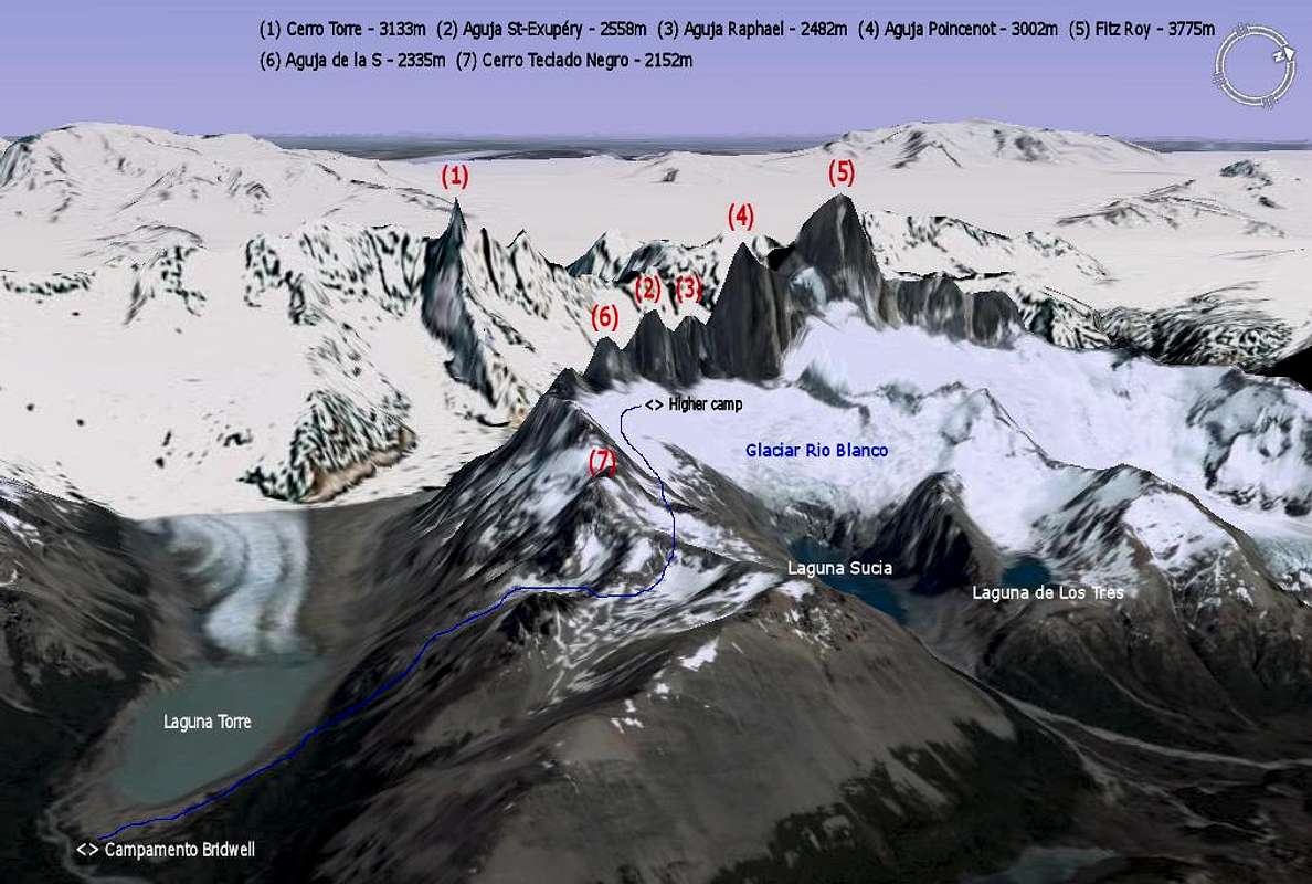
3D map - Access to Aguja St-Exupery
View High-Resolution Image
3D map - Access to Aguja St-Exupery
Map covering the FitzRoy group. The blue line shows the path between Campamento Bridwell (base camp - alt. 600m) and the Higher Camp (alt. 2000m) where climbers sleep when they ascend
Aguja St-Exupery
(2558m). Patagonia - Argentina
« PREV
NEXT »
Andino
on
Oct 22, 2007 9:01 am
Comments & voting
Other parents
Lat/Lon:
49.27959°S / 73.04016°W
Image Type(s):
Topo/Diagram
,
Informational
Image ID:
349851
8248 Hits
85.36
% Score
20
Votes
Log in to vote
Comments
No comments posted yet.
to post!
Don't have an account?
Agujas St-Exupery, Raphael & de la S (Patagonia)
(Mountain/Rock)
« PREV
Viewing
#7 of 12
GALLERY
NEXT »
Andino's Image Gallery
« PREV
Viewing
#138 of 597
GALLERY
NEXT »
Maps of South America
(Album)
Loading....
×
You need to login in order to vote!
User Name
Password
Remember me
Forgot your password?
Log me out when I close my browser.
Keep me logged in all the time.
sign in as a user
Don't have an account?
Register now for FREE
Rating available
Suggested routes for you
People who climb the same things as you
Comments Available
Create Albums
Register Here


