Trip Stats
Who: Matt, Jaclyn and I
Where: Chelan Sawtooth Wilderness east of Lake Chelan
Distance: About 40 miles
Time: 4 days
Summits: Point 8202, Star Peak, Courtney Peak, Grey Peak, and Battle Mountain
Pre-Trip
The last couple months have been very exciting for me as I have been climbing all over Colorado since the end of may. I had spent lots of time in the San Juans around Silverton and into the Elks around Aspen. A TR about that time will come later this week but on July 3rd the southwest monsoons moved in and were going to be relentless.
It was at this time that I decided to head north to get away from all the infamous Colorado thunderstorms that will be lasting through August. I needed a change of scenery anyway.
I was lucky to have stumbled across Matt's shout out for people interested in joining in on a backpacking trip in the Chelan Sawtooths. After getting some conditions information I decided I missed my home state enough to come back early. I didn't have to be back in Renton until the 13th anyway so I had lots of time.
The trip started by meeting Matt and Jaclyn in Twisp. I came in from Idaho on my way from Glacier National Park (TR to come later this week) while they came in from Portland.
We met for dinner in Twisp and ate next to live music which was nice. Since we now had two cars we looked oover a good route and decided to make the trip a point to point trip....my favorite!
I packed and we took my car to the Crater Lake trailhead just outside Twisp off of the Twisp River Road. We spent that first night at the Twisp River Inn.
Day 1 - July 7th 2011
The next morning the fun began. After a quick stop we were on our way to the Eagle Lakes trailhead all the way up to 4800 feet. This was a pleasant surprise to start this high in elevation as my car at the Crater Lake trailhead was all the way down at 3000 feet.
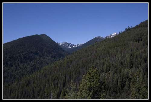
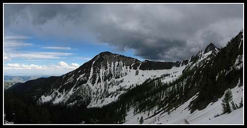
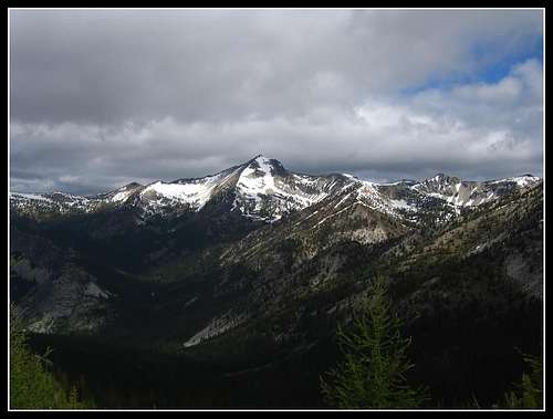
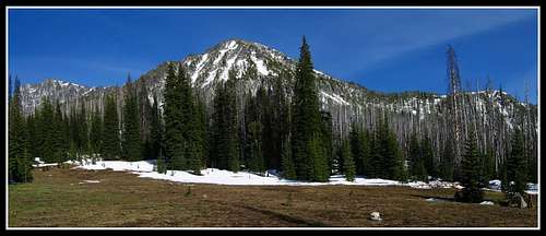
We were on our way about 10:00 am on the trail. It was already very warm and we noticed many great flowers out especially the lupines. It wasn't long until we were greeted with our first views of the Sawtooth Crest. Things were looking promising from our first views.
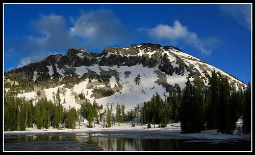
![Getting into the high country]() First views along the trail
First views along the trail
As we slowly rose in elevation we saw a couple heading down from a one night trip. They had told us about lots of snow but they didn't look too prepared either. This would be one of only two groups of people we would see the whole trip.
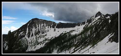
![Getting into the high country]() Getting closer to the high country
Getting closer to the high country
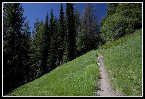
As we gained elevation we passed through more meadows with many wildflowers just starting to come out.
![Horsehead Pass trail]() Lupine filled meadow
Lupine filled meadow
We were surprised to keep walking and passing by the 6000 foot elevation...then the 6500 foot mark and not see any snow on the trail.
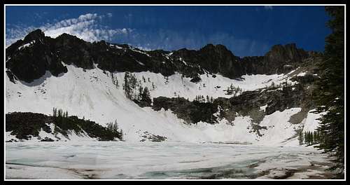
We saw our first patch just above 6500 feet and once we got to about 6900 feet it was a sudden change from ground to complete snow. We saw Lower Eagle Lake completely thawed below us and wanted to see Upper Eagle Lake. We were able to follow the trail up until the junction with the Upper Eagle Lake trail. The basin containing Upper Eagle Lake was still completely snowed in with an average of three feet of snow.
Nonetheless we made it to the lake and had a peaceful lunch break.
![Upper Eagle Lake]() Frozen Upper Eagle Lake with Bigalo in the right center
Frozen Upper Eagle Lake with Bigalo in the right center
After lunch we agreed to head over Horsehead pass and camp at Boiling Lake. We hoped there would be less snow there.
As we pressed on up Horsehead clouds started to roll in but with my knowledge about weather they looked stable so we continued up the snowfield to the top of Horsehead Pass.
![Horsehead Pass]() Views across the valley from the trail up Horsehead Pass
Views across the valley from the trail up Horsehead Pass![Horsehead Pass]() Clouds rolling in
Clouds rolling in
We arrived at the top and were greeted with great views and were relieved to see Boiling Lake about half thawed with dry spots around to pitch tents. We also noticed though a large group of people down there.
We made our way down weaving through patches of snow to the lake and passed by the group of about 10 people. They were a high school NOLS group and had students from all over the country. Glad to see young ones interested in mountaineering. They were in a 4 week backpacking and snow travel course. They were following a similar path than us but they were planning on heading out to Lake Chelan over Purple Pass.
That has to be the best type of school that exists!
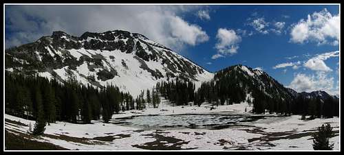
![Boiling Lake...]() Cheops and Boiling Lake
Cheops and Boiling Lake
Despite the group we found a nice secluded spot and pitched the tents.
Views from our campsite were fantastic!
![Boiling Lake and Cheops]() Approaching Boiling Lake
Approaching Boiling Lake
So apparently it is called Boiling Lake because it will bubble up in the summertime due to microorganisms. Weird!
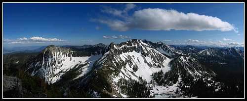
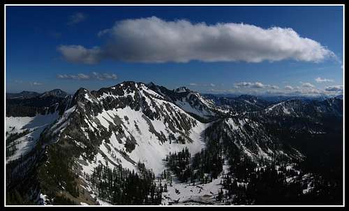
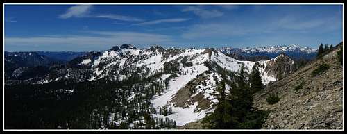
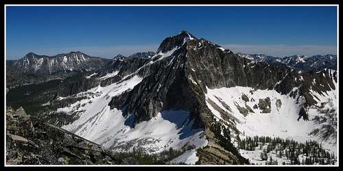
Matt and I took a quick side trip up to Point 8202; the peak just above Horsehead Pass. From here we saw both Eagle Lakes, Bigalo, Boiling Lake (and camp), and all the peaks of the nearby Sawtooth Crest.
We ascended the steep slopes and got to the summit with great lighting.
![Cheops Peak...]() Cheops from Point 8202
Cheops from Point 8202![Point 8202]() Cheops and Boiling Lake
Cheops and Boiling Lake![Cheops from Point 8202]() Cheops and Boiling Lake
Cheops and Boiling Lake
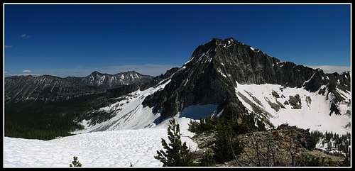
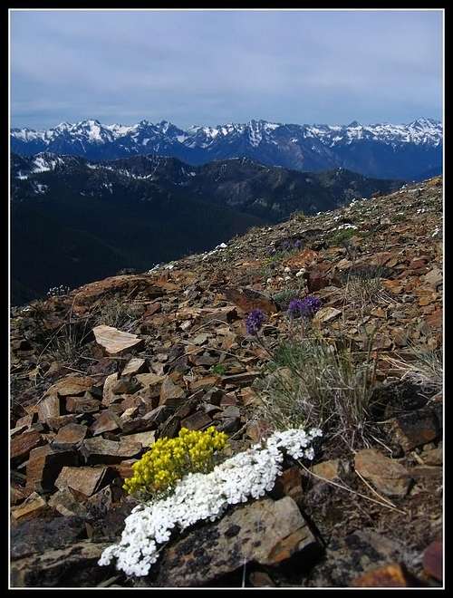
And it was here I captured my favorite photo of the trip looking towards the Eagle Lakes from Point 8202
![Point 8202]() Upper and Lower Eagle Lake from Point 8202
Upper and Lower Eagle Lake from Point 8202
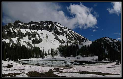
We descended the snow free ridge back to Horsehead Pass and back down to Boiling Lake. We cooked nice dinners and watched the sunset over the Lake. Water was easy to come by this time of year. Cheops sat beautifully in the back of the lake during the sunset.
![Boiling Lake panorama]() Afternoon on Boiling Lake
Afternoon on Boiling Lake![Boiling Lake...]() Boiling Lake
Boiling Lake![Sunset...]() The sun slowly setting
The sun slowly setting![Alpenglow on Cheops]() Last alpenglow on Cheops
Last alpenglow on CheopsDay 2 - July 8th 2011
That night it was below freezing and standing water froze. We woke about 6:30 and slowly got ready to move. That whole morning was cold and had decent cloud cover. By 8 we were on the move an on our way to Chipmonk Pass.
![Views on the trail]() Views on the trail to Chipmonk Pass
Views on the trail to Chipmonk Pass
We had mostly a snow free trail to the top of Chipmonk Pass and took a break up there.
![Chipmonk Pass]() View from Chipmonk Pass
View from Chipmonk Pass
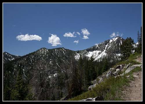
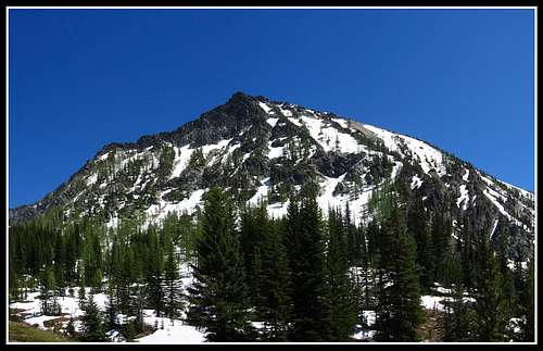
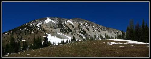
The day slowly warmed up but still had lots of clouds. We had great views of Star Peak though...one of our goals on the trip.
The descent off Chipmonk pass was still snow covered and fairly hard so I glissaded down but Matt and Jaclyn were able to kick step down. I don't have hard soles in my boots so I couldn't kkick as well. We were able to find the trail in just enough places to follow it without using the GPS...unlike later that day.
We saw many fresh bear tracks in the snow patches along the trail but it didn't scare us!
We made our way along the trail crossing maybe a hundred small snow patches before getting to the raging creek that drains the Bernice Lake Valley.
![Star Peak]() Star Peak from the trail
Star Peak from the trail![Star Peak]() Star Peak from the trail
Star Peak from the trail![Star Peak]() Some clouds blocking our blue sky!
Some clouds blocking our blue sky!
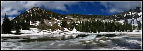
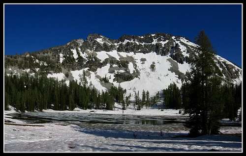
We had to take our shoes off to cross the creek but it wasn't too bad overall. We checked with a past trip report to locate the way trail to Bernice Lake which is where we ditched the packs for a side hike.
Despite one good creek crossing that was barely doable by rock hopping, this had to be one of the best way trails I've ever been on as it was in great shape up to about 6900 feet until it was nearly completely covered in snow. At that point we went straight up to the lake at 7200 feet. It was still frozen but the day turned out great and it warmed up a lot.
![Lake Bernice trail]() Views from the Bernice Lake way trail
Views from the Bernice Lake way trail![Lake Bernice]() Frozen Bernice Lake
Frozen Bernice Lake
We had our lunch here and relaxed for about an hour. We noted this place would be beautiful in the fall due to the abundance of larch trees...way more than there is in the Enchantments.
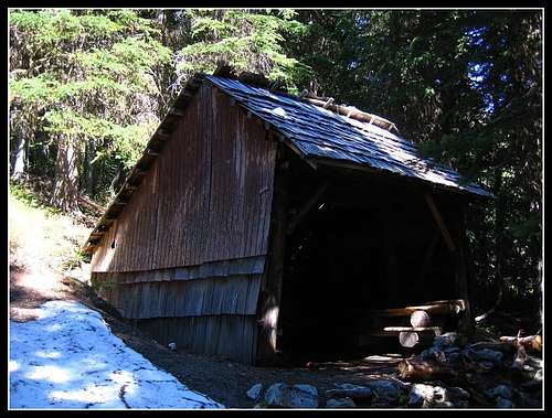
We made our way back down to the packs and continued on the trail and passed by the wonderfully constructed shelter. This shelter was surrounded by small snow patches that we didn't think of much at the time but we would be haunted.
![Old Shelter]() Shelter along the trail
Shelter along the trail
We decided to head up another 1000 feet from 5800 feet at the shelter to 6800 feet and camp at the trail junction with the unnamed pass just below Star Peak. After hitting snow at 6800 feet on our Bernice Lake side trip we thought this would be an easy couple miles...WRONG! This would be the hardest 1000 vertical of the trip as we hit continuous snow shortly after the shelter and lost the trail completely for the couple miles.
We relied heavily on the GPS to keep us from weaving in circles too much and we had to continually find the path of least resistance through an average of 3-4 feet of snow. The only snow free area we passed here was a small portion of the trail that got above the trees.
![Meadow...]() Small meadow...a break from all the snow in the trees.
Small meadow...a break from all the snow in the trees.
The forest in this area was thicker and the ground was shaded much more so the snow stuck around longer at lower elevations. This area probably won't melt out until the end of the month. Lots of little stream crossings too.
After 3 hours of this we made it to the junction and was lucky enough to find a dry area for two tents at a tree well that had melted out. Snow completely surrounded the ground around us. Our feet were very wet and we only had an hour of sunlight left.
I got in my tent and cooked dinner from the tent and went to bed around 8:30 pm.
It was another cold night.
Day 3 - July 9th 2011
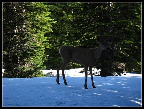
Another cold morning meant another slow break of camp. It was interesting to be sleeping on a rare bare spot in the snow around us. That morning though a deer was taunting us and probably smelled our food.
![A morning deer]() Deer around camp
Deer around camp![A morning deer]() Morning deer
Morning deer
We were on the move again though around 8:30 and was on our way to the unnamed pass at about 7400 feet. We escaped the snow once we broke above the trees (thankfully) and got to the top of the pass on mostly bare trail after that.
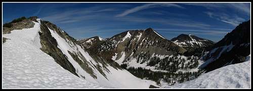
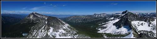
Matt and I then set off for Star Peak. This was a lovely climb up its south ridge.
![Star Peak]() Views on the ascent of Star
Views on the ascent of Star![Oval Peak]() Oval Peak from just below the summit
Oval Peak from just below the summit![Oval Peak]() Oval peak from near the summit
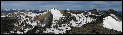
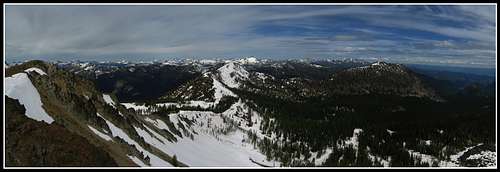
Oval peak from near the summit![Star Peak]() Star Peak summit panorama
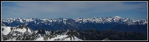
Star Peak summit panorama![North Cascade Peaks]() Heart of the North Cascades
Heart of the North Cascades
We got to the top by around 10 am and had bluebird views of all the North Cascades, Mt. Baker, Glacier Peak, Canada and Mt. Rainier.
We had a quick snack and was hesitant to leave but we had to get bback to the pass. The descent off this was was completely snow covered like Chipmonk Pass was but this one was a little steeper and I was able to pull out my axe and glissade down as my boots didn't have hard enough soles to kick down like Matt and Jaclyn were able to do.
Fun though!
We saw a beautiful choice campsite in a open meadow just below Star Lake surrounded by small creeks. What a step up from the night before!
We set up camp and ate lunch. By 2 pm we set off up the Star Lake basin and to Fish Creek Pass. This basin was filled with snow and Star Lake still frozen but the top of Fish Creek Pass was snow free.
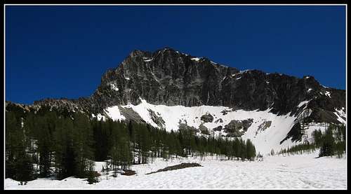
![Courtney Peak]() Courtney Peak from just above camp
Courtney Peak from just above camp
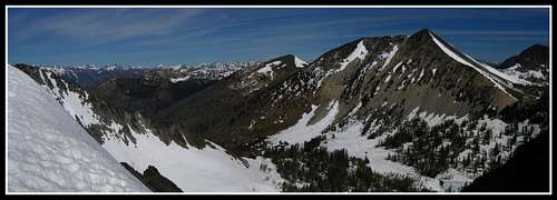
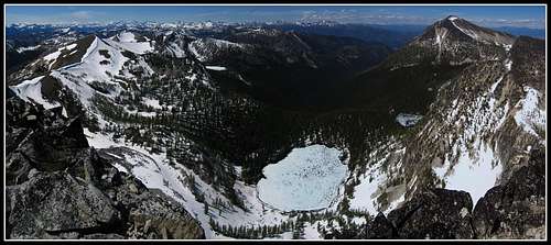
We ascended the east ridge of Courtney and had perfect views of the north face of Star Peak...that cliff we just looked down hours earlier.
Got to the top of Courtney around 4 pm and really relaxed up there. We saw the Oval Lakes basin for the first time and noted the vast expanse of larch trees. Great place in the fall!
West and Middle Oval Lakes were still frozen but the east lake was about 40 percent thawed.
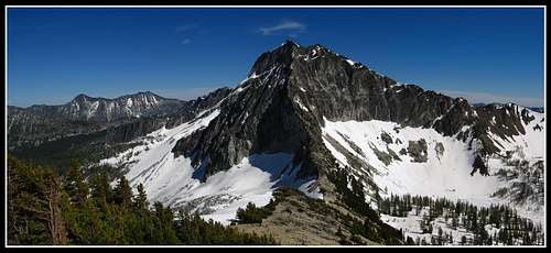
![Star Peak]() Star Peak from near Star Lake
Star Peak from near Star Lake![Star Peak]() Star Peaks north face from the ridge on Courtney
Star Peaks north face from the ridge on Courtney![Star Peak]() Star from Courtney
Star from Courtney![Oval Peak]() Star from Courtney
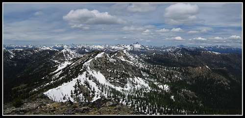
Star from Courtney![Oval and Star Peaks]() Courtney Peak summit panorama featuring Oval AND Star Peaks
Courtney Peak summit panorama featuring Oval AND Star Peaks![Oval Peak]() Oval and east Oval Lake from Courtney
Oval and east Oval Lake from Courtney![Star Peak]() Star Peak from near Fish Creek Pass
Star Peak from near Fish Creek Pass![Oval Lakes Basin]() Oval Lakes Basin from Courtney
Oval Lakes Basin from Courtney
And here's a portrait of Matt and Jaclyn atop Courtney Peak with Star Peak in the background.
As much as I wanted to get Oval Peak I thought about my desire to return and do Oval Peak and explore the Oval Lakes Basin sometime in the fall in the future. There are so many larches down there and if I climbed Oval right then I wouldn't be able to return to the area.
So I didn't traverse to Oval from Courtney and I'll return in the fall sometime.
We went back down to camp and still had about three hours of daylight left since we didn't travel far with the packs that day. I cooked myself a large dinner!
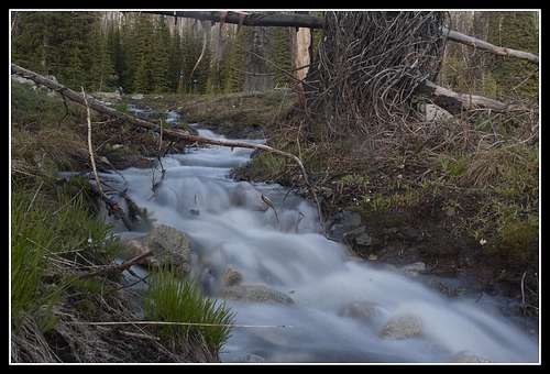
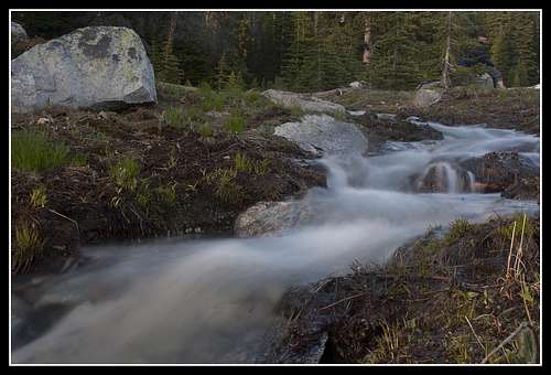
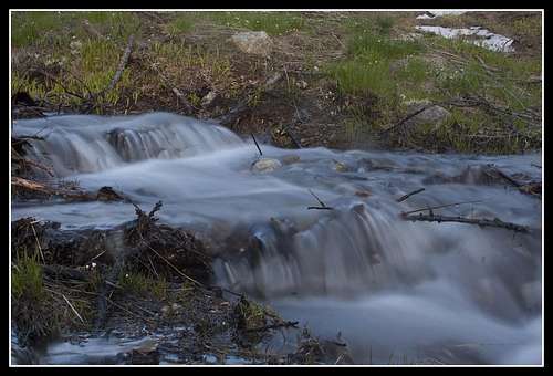
The campsite was very photogenic and I had fun shooting the views and creeks around the tents.
![View from Camp]() Views from camp...notice the tent
Views from camp...notice the tent![View from camp]() Sunset approaching
Sunset approaching![Small runoff streams]() One of many small streams
One of many small streams![Small runoff streams]() Sitting on the rocks
Sitting on the rocks![Small runoff streams]() Small cascade
Small cascade
That evening was much warmer and we enjoyed another sunset before heading to bed.
Day 4 - July 10th 2011
We woke early and started down the trail towards Tuckaway Lake. We got to the point where the trail switchbacked down about a hundred feet into the basin and after examining the basin we decided to bypass the long trail around the ridge extending above Tuckaway Lake and head straight up the basin and over the ridge to Eagle Pass.
On the way we ditched the packs near the lake and ridge-ran to Grey Peak. What a beautiful ridge this was. We were also surprised to see Tuckaway Lake to be completely melted out despite being at the same elevation as the frozen Bernice Lake.
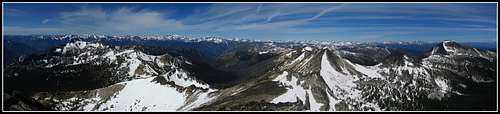
We got to the top of Grey Peak mid-morning and saw by the register that we were the second group of the year to summit that obscure peak.
Ridge was snow free but the basin, as always had lots of snow.
![Wildflowers on Grey Peak]() Flowers near the summit of Grey
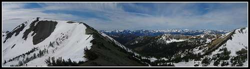
Flowers near the summit of Grey![Grey Peak]() Grey Peak summit panorama
Grey Peak summit panorama![Grey Peak]() Cresting the ridge on Grey Peak
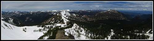
Cresting the ridge on Grey Peak![Grey Peak]() Long 300 degree panorama from Grey Peak
Long 300 degree panorama from Grey Peak
We descended back into Horseshoe Basin and finished our climb up the the ridge connecting to Eagle Pass. We picked up the small boot path descending steeply on loose scree down to Eagle Pass where we had lunch. This descent was snow free but the slopes just below the ridge crests in this area were still decked in snow.
![Eagle Pass]() View down the boot path to Eagle Pass
View down the boot path to Eagle Pass![Eagle Pass]() View down the boot path to Eagle Pass
View down the boot path to Eagle Pass
The clouds were slowly rolling in and I guessed by late afternoon we may get rained on.
From Eagle Pass we just had to go and summit Battle Mountain since it was right there.
The ridge walk was up only about 400 feet but it had some horizontal distance to it. Took us about a half hour each way but the views were worth it despite the lower 7800 foot peak.
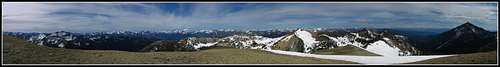
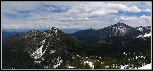
![Battle Mountain]() Battle Mountain view
Battle Mountain view![Battle Mountain]() Oval Peak from Battle Mountain
Oval Peak from Battle Mountain
We returned to Eagle Pass, picked up our packs and started our long descent to my car. I got one last glissade down the snow covered slopes below Eagle Pass and we then walked on easy snow for about a mile before picking up more bare ground and being able to follow the trail.
We were very surprised to see continuous snow all the way down to 6000 feet and lower in this drainage but I guess it's not much different than the evening of our second day where we had lots of snow in a thicker forest.
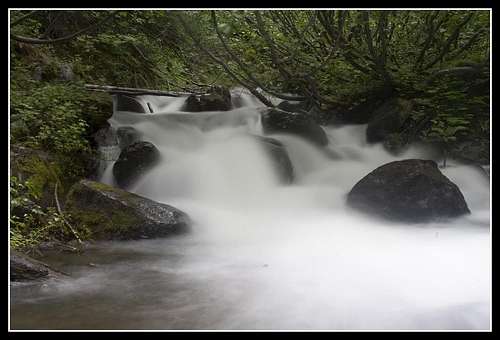
Once we got below 5800 feet on this trail it was mostly smooth sailing for another 5 miles to the car. There were two crossings of the raging Eagle Creek. The first was cross able on logs but the second had to be done without shoes. Trekking poles were very helpful. Actually now that I think of it I would have fallen down dozens of times if I didn't have them.
![Eagle Creek]() Eagle Creek ford
Eagle Creek ford
The trail down lower in elevation had many blowdowns that got very annoying but we made it to the car and was out of there!
We drove back to our starting trailhead at Crater Lake and I dropped Matt and Jaclyn off and we parted.
Looking Back
This trip for me came abut after a sudden change of plans. I originally planned on spending all my time until the 13th of July in Colorado but early monsoons chased me north. I'd like to thank Matt and Jacklyn for doing the research and planning the trip as well as inviting me. I usually do trip planning but it was nice to not have to for once. I also want to thank them for their generosity.
I had no previous knowledge of the area and I honestly wasn't expecting much from the area before the trip. Boy am I glad I went here though as the area far surpassed my expectations and was truly spectacular. It is also high up in elevation for Washington state. We camped every night above 6500 feet and peaked out on Star Peak at roughly 8700 feet. These elevations on the west side for one thing don't exist beside the volcanoes and snow levels over there are still 4000 feet!! Larches in the area would far surpass the larch quality of the Enchantments in the fall and the peaks had very high quality views.
All the snow we traveled on was very consolidated and we rarely post-holed. The bugs were also non-existent! What a fantastic trip despite some snow but in reality, the snow on this trip made things even more beautiful.
I highly recommend the area for trips for the remainder of July especially for this year where thhe west side will never melt out.
You can also find Matt's photos here:
More Chelan Sawtooth photos
Comments
No comments posted yet.