
|
|
Route |
|---|---|
|
|
38.55170°N / 78.316°W |
|
|
hike/climb |
|
|
Half a day |
|
|
hike to class 3 |
|
|
Approach
From DC follow I-66 West and exit onto US 29 at Gainesville. Follow to Warrenton, and take 211 West. Take 211 to Sperryville and turn onto US 522 South. At this point you are 15-20 minutes away. Take 522 for several miles until you hit 231 towards Madison. Take a right at the sign to Old Rag on 601, and follow for several miles. You will merge with route 707. On the left is the parking area, which is about .8 miles from the trailhead. Parking is difficult to find on weekends at the trailhead, so park at parking area, which cost $5. At the trailhead there is the fireroad, or the main trail. TAKE THE MAIN TRAIL.......why?.......because it is the most fun you will ever have hiking in Virginia.Route Description
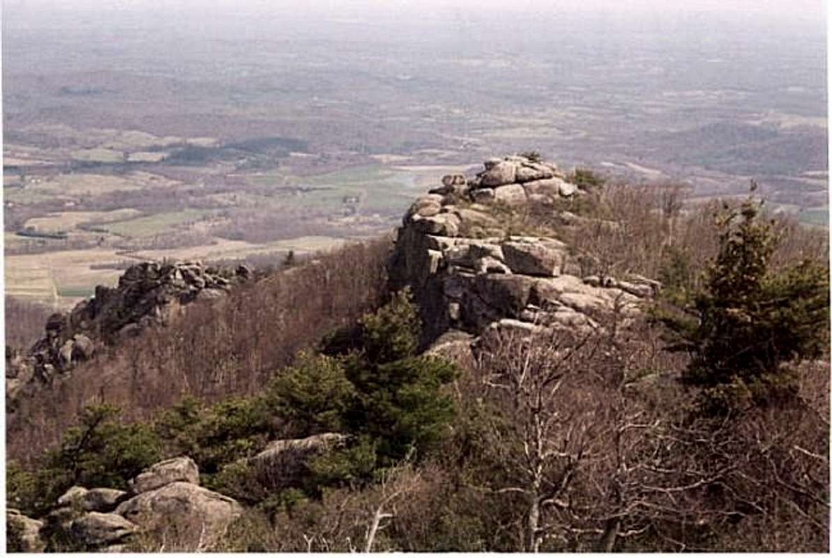
You hike about 2 miles in the woods and over some rocks. The last 30-45 minutes of the hike is an adventure. Follow blue marks on the rocks where you will encounter class 2 boulder hopping, and class 3 steep rock climbs where you will need adequate footholds. It is challenging at times and a lot of fun. Often, on a weekend, you have to wait on line for others to manuever through this rocky obstacle course. The summit area is very clear. When you get to the summit, just find the highest situated boulder and you are the top. The views over the last mile are incredible, with huge boulders and views of the high Shenandoah Peaks, including Hawksbill (4,051') and Stony Man (4,011').
To get to the loop down, get off the summit area, and instead of going back down the way you came up, follow the trail through the woods with blue marks. This is suggested on the way down to avoid long lines and make it easier on your legs. It is 4.5 miles back to the trailhead, and then add on the extra .8 miles back to the parking area. The last 2.5 miles is on the fire road.
Bob Sihler - Aug 3, 2010 6:55 pm - Voted 10/10
Upper lot closedBack in April, the Park Service permanently closed the upper parking lot. They want to build a new lot between the lower and upper one and reduce parking at the lower one. It makes no sense to me, but that's what's going on.