One challenging day climb
Stats:
Rinker Peak via NE Ridge in winter (includes the two unranked Twin Peaks)
Starting elevation of 9,260
Treeline elevation of 11,700
Summit elevation of 13,783
RT Time of 10 hours
The idea for climbing Rinker Peak came when Josh, Jed and I were driving back home after a climb of La Plata earlier in the month. I got a good look at that really steep NE ridge on Rinker Peak which seems to just crash into the valley right next to Highway 82. I simply asked Josh "Wanna climb that next weekend?"
He agreed...this was just the type of climb he loves. Jed thought we were crazy but off we went 1 week later. This peak had been on our minds for awhile as it's a high bi-centennial.
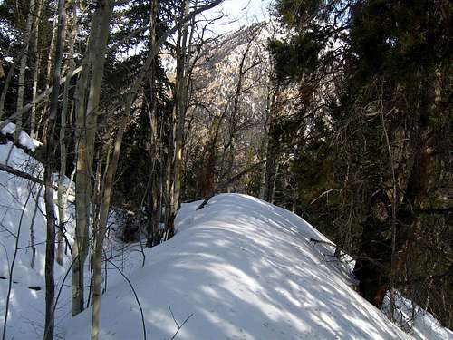
We drove back to the small town of Twin Lakes and parked just off the road right next to the creek as close to the ridge we could get. This wasn't your average "get a warm up on some nice mellow terrain" climb. We donned our packs and stared at the creek merely a few feet away. After crossing the frozen creek that took something like five minutes the introduction was over. We started up the steep, steep ridge in a densely forested area. At first the snow wasn't too deep but after only a few hundred feel of climbing we started postholing to our knees and more with snowshoes on.
![Breaking trail]() A look at our postholing nightmare
A look at our postholing nightmare
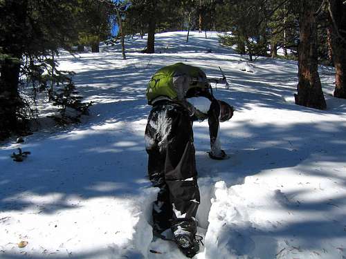
We continued slashing through the trees often times having to use our ice axes to pull ourselves out of chest deep powder on some trees. As much as I hated the trees for protecting all this powder, they made for great handholds enabling us to basically use them for "pull-ups" to extract ourselves from the snow. Averaging about 500 vertical feet per hour we got to the halfway point on the ridge, where it steepened to at least 45 degrees. This was demoralizing to say the least. Luckily it was only a 400 foot section (which took almost an hour) and above this, to our temporary relief the grade became a little easier (maybe 30 degrees). This didn't help much as the snow was only getting deeper. Down to my waist I would go even with the tails attached to my MSR snowshoes. Despite the steepness of the ridge, I never noticed any avalanche dangers although I still made Josh stay on the crest as veering off may have been a problem.
![Josh Breaking Trail]() Josh Breaking trail about 1000 feel below treeline
Josh Breaking trail about 1000 feel below treeline![Nearing Treeline?]() Are we at treeline yet?
Are we at treeline yet?
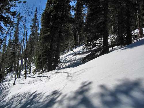
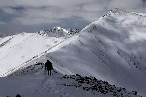
We continued to switch off breaking trail for a total of 5 hours until we reached treeline at 11,700 feet. To our relief, the entire area above treeline was basically snow free and we could actually push down on the ground and gain full upward movement! We stashed the snowshoes and continued up the ridge. We ascended a continued steep 2nd class rock ridge until we reached the unnamed point to the NE of the Twin Peaks. Another demoralizing moment as we had previously thought there were only two peaks to traverse...HA! I could just hear the mountain gods laughing at us as we also still had quite a distance of ridge traversing to actually get to Rinker.
![Twin Lakes from treeline...]() Looking down at Twin Lakes from treeline
Looking down at Twin Lakes from treeline![The unnamed point]() A look at the remaining steep climb to the unnamed point...UGH
A look at the remaining steep climb to the unnamed point...UGH
We began traversing down some class 2+ terrain, then back up to the actual Twin Peak. We didn't stop here and just kept traversing to the next Twin Peak.
![Twin Peaks traverse]() Looking back at the unnamed point from the first Twin Peak
Looking back at the unnamed point from the first Twin Peak
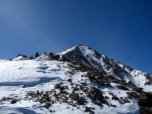
We finally got to the low 13,200 saddle between Rinker and the Twin Peaks; we gritted our teeth pounded out the last 600 feet to the summit. To my surprise, this didn't take as long as I thought it would. On the summit we basically collapsed and ate/drank everything we had. This was one of the most physically demanding climb we both had ever done. We arrived at the summit shortly before 2:30 PM with only a couple hours of daylight remaining.
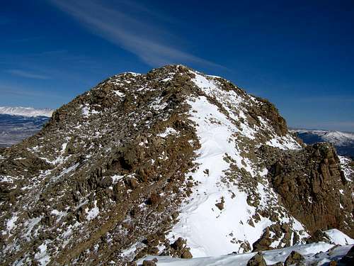
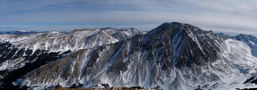
![Rinker]() A look at Rinker from the second Twin Peak on a winter day (Photo by Sarsfield)
A look at Rinker from the second Twin Peak on a winter day (Photo by Sarsfield)![Twin Peaks]() Looking back at the Twin Peaks
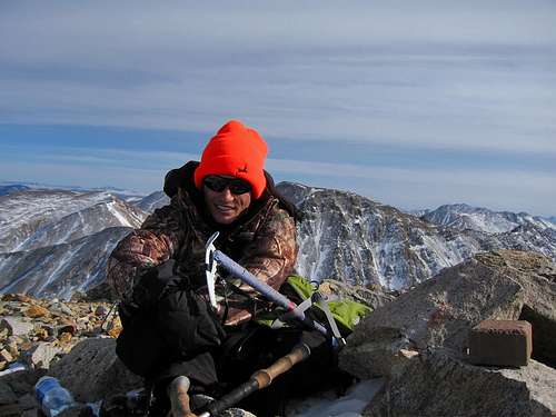
Looking back at the Twin Peaks![Josh on the summit...]() Josh relaxing on the summit
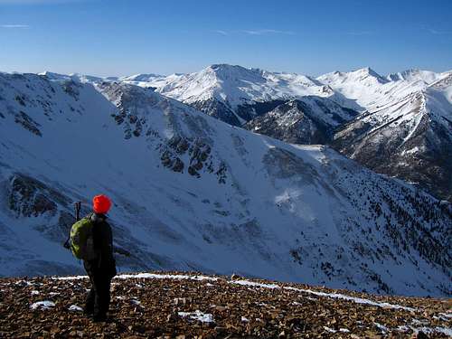
Josh relaxing on the summit![Mt. Elbert and Bull Hill]() Elbert and company from the summit
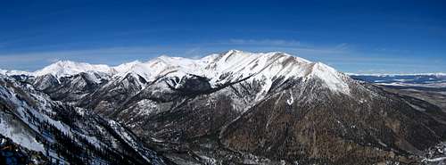
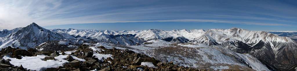
Elbert and company from the summit![Rinker Summit Panorama]() Rinker Peak Summit Panorama
Rinker Peak Summit Panorama
After a good 20 minute break on the surprisingly warm summit, we began our descent. We made good time of the initial descent back to the 13,200 foot saddle but the Twin Peaks re-climb hurt...real bad. I was glad to have those done with as we began walking back down the steep ridge from the unnamed point. The views of Mt. Hope were stunning.
![Descending Rinker...]() Josh taking a break at the saddle between the Twin Peaks
Josh taking a break at the saddle between the Twin Peaks![Mt. Hope]() Panorama of Mount Hope from the unnamed point
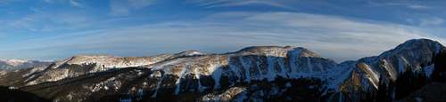
Panorama of Mount Hope from the unnamed point![Still a long way...]() Sunset panorama looking east from near treeline
Sunset panorama looking east from near treeline
The sun began to approach the horizon as we approached treeline once again. After another break and picking up our snowshoes we began plunge stepping back through the trees. It got completely dark on us about 1000 feet from the car...we made good time down this deep snow though and we were thanking the steepness now...lol!
Our warm down consisted of crossing the creek once again and walking about 10 feet on the road to the car...what a relief! Another difficult and rewarding climb in the books.
A map of our route is shown below:
![Rinker NE ridge map]() Rinker Peak NE Ridge Map
Rinker Peak NE Ridge Map
Thanks for reading,
Matt


Comments
Post a Comment