

chugach mtn boy - Jun 23, 2009 11:18 pm - Voted 10/10
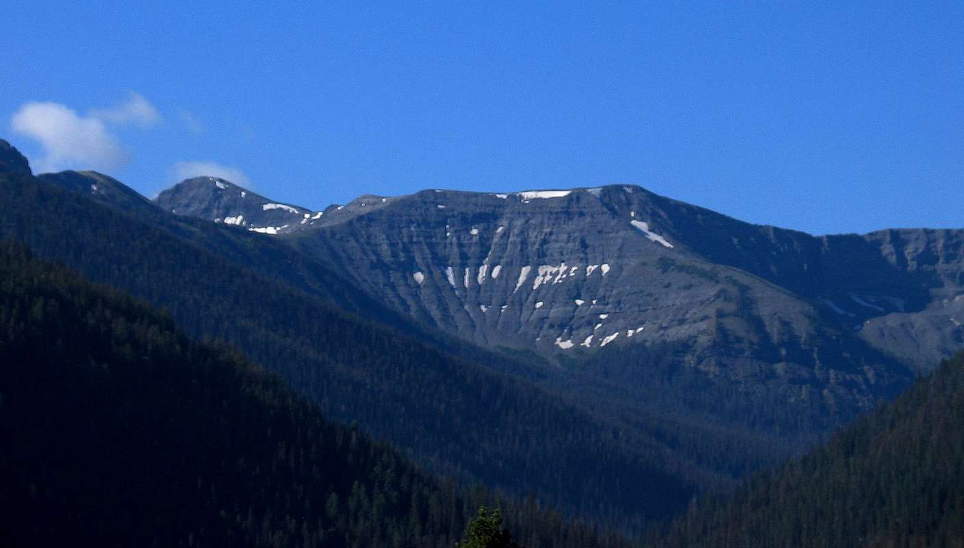
Something elseThat's definitely not Avalanche, from any angle. This is ... hard to square with what's immediately to the north at the East Entrance. Were you maybe looking south?

silversummit - Jun 24, 2009 11:09 am - Hasn't voted
Re: Something elseYes, I might have been looking south. It was along the immediate road as we were getting ready to and leaving the park itself. I tried checking every mountain page on SP but couldn't find a view similar to this.
Any help would be appreciated!
chugach mtn boy - Jun 24, 2009 4:38 pm - Voted 10/10
Re: Something elseWell, I'm drawing on old memory here (I worked in the park hotels in the 70s and the east entrance road was my main stomping ground ... but that WAS a long time ago!). My best guess is that you were looking south shortly after you passed Top Notch Peak (which is on SP), and after Sylvan Pass, just before exiting the park, and you were seeing mountains down toward Reservation Peak and Plentycoups Peak. Hardly anyone ever visits those, by the way. Your peak is definitely not Langford, Doane, Stevenson, Top Notch, Avalanche, Hoyt, Silvertip, or Giant Castle. The person who could tell you (and who would respond to an e-mail) is Tom Turiano--his website is http://www.selectpeaks.com/
chugach mtn boy - Jun 24, 2009 5:26 pm - Voted 10/10
Re: Plenty Coups PeakPS: Just looked at a map and I'm thinking that the mountain in the center of your picture is likely the flat-topped northern shoulder of Plenty Coups Peak. The real summit may be that dome behind and to the left. The profile of that ridge slanting down and to the right from just to the right of the center of the photo really fits the north ridge of Point 10600 to a T (Point 10600 being one end of the flat shoulder). All this would be visible from the road just briefly as you left the park, probably from the little parking area at 7600'. Thanks for a fun riddle!
silversummit - Jun 25, 2009 8:34 pm - Hasn't voted
Re: Plenty Coups PeakThanks chugach mtn boy for all your help in figuring this one out! I will go ahead and caption this photo properly!
Glad you enjoy puzzles!


Comments
Post a Comment