Another Try at Mt Morgan
Following our successful summit of Matterhorn Peak on the northern border of Yosemite, the second major stop on Ruvicha’s and my 2013 Sierra “Unfinished Business Tour” was Mt Morgan – the southern Morgan above Little Lakes Valley. Along with friends Brian and Jim, in 2012 we had attempted Mt Morgan via Little Lakes Peak. That being the first hike of the year (and several of us had just come up from sea level), we collectively ran out of gas a few hundred feet below the Little Lakes Peak summit and turned back. This year, Ruvicha and I decided the Francis Lake route offered a greater prospect of success.
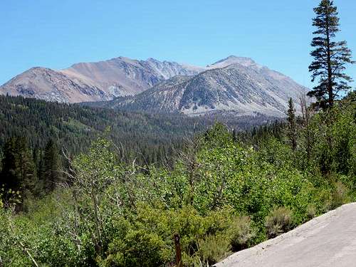
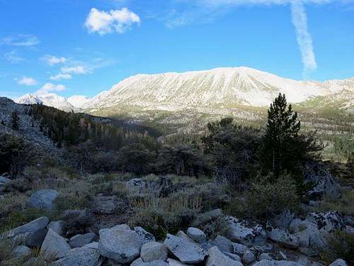
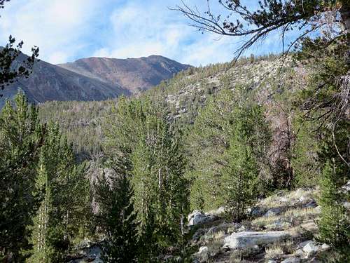
We arrived in the area on August 15 and set up camp at the East Fork Campground, finding a pleasant shaded walk-in site, a few miles below Rock Creek Lake and the Francis Lake trailhead. The drive up Rock Creek Road from Tom’s Place afforded great views of Mt Morgan from the north.
![Mt Morgan]() Mt Morgan from Rock Creek Road
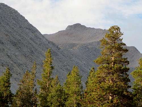
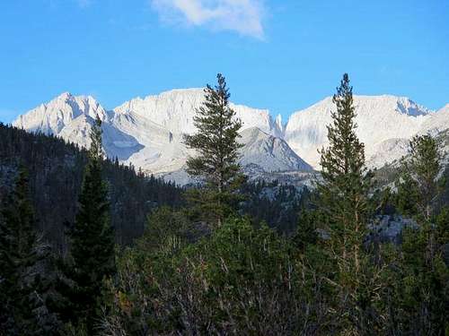
Mt Morgan from Rock Creek Road![Mt Morgan Summit]() Mt Morgan Summit from Rock Creek Road
Mt Morgan Summit from Rock Creek RoadStarting up the Trail to Francis Lake
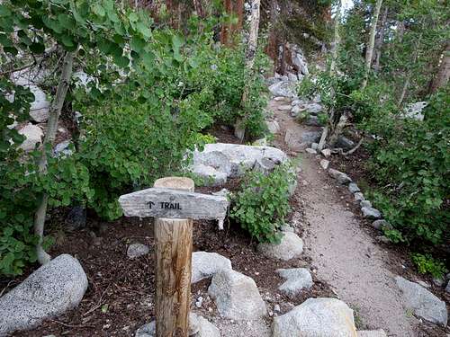
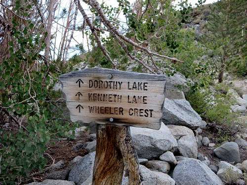
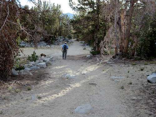
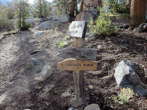
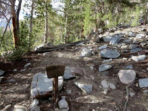
We found the trailhead at Rock Creek Lake just across from the day-parking area, marked with a sign that simply read “Trail.” The sandy and sometimes wide trail climbed in a few switchbacks through pine trees, providing nice views of Rock Creek Lake, Mt Starr and Mts Dade and Abbot, and then hit a T. We took the left trail and almost immediately saw a sign for Dorothy Lake, Kenneth Lake and Wheeler Crest (you will want to follow the signs toward Kenneth Lake, which ultimately leads to the fork to Francis Lake). The trail generally headed toward the east to circle around the end of the northeast ridge of Morgan, after which it turned south toward Francis Lake.
![Francis Lake Trailhead]() Trailhead to Francis Lake at Rock Creek Lake
Trailhead to Francis Lake at Rock Creek Lake![Sign to Francis Lake]() Sign on trail to Francis Lake (after trail Ts)
Sign on trail to Francis Lake (after trail Ts)![Mt Starr]() Mt Starr from trail above Rock Creek Lake
Mt Starr from trail above Rock Creek Lake![Dade, Abbot and Mills]() Mts Dade, Abbot and Mills from trail
Mts Dade, Abbot and Mills from trail![Trail to Francis Lake]() Wide, sandy trail toward Francis Lake
Wide, sandy trail toward Francis LakeContinuing up the Trail
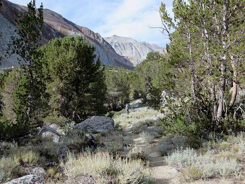
After about a mile, the trail split, and we took the right fork toward Tamarack Bench and Kenneth Lake. The sandy trail now climbed gently through a meadow and more pine trees, and we enjoyed good views to the east of Wheeler Ridge. At 1.8 miles from the trailhead, we found the signed fork to Francis Lake (actually, this was the first and only sign that we saw marked “Francis Lake”). At 2.3 miles, we had our first view since hitting the trail of Morgan’s summit and at 2.6 miles arrived at the north end of Francis Lake, at which time we were at an elevation of about 10,830 feet. The trail all the way to Francis Lake had been very clear and easy to follow – in some places wide enough for a car to drive.
![Cut-off to Kenneth Lake]() Cut-off toward Kenneth (and Francis) Lake
Cut-off toward Kenneth (and Francis) Lake![Wheeler Ridge]() View of Wheeler Ridge
View of Wheeler Ridge![Cutoff to Francis Lake]() Fork to Francis Lake (only sign we saw marked "Francis Lake")
Fork to Francis Lake (only sign we saw marked "Francis Lake")![View of Morgan Summit]() First view of Morgan summit from trail to Francis Lake
First view of Morgan summit from trail to Francis LakeFrancis Lake
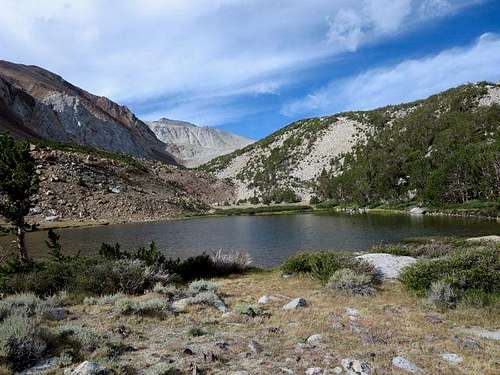
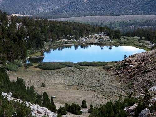
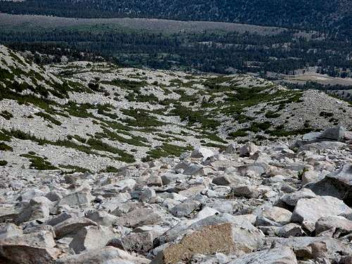
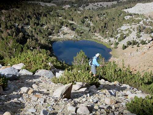
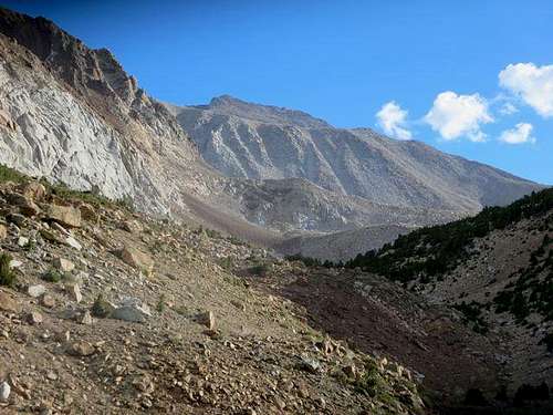
Looking across Francis Lake, we could see two rock and sand slopes up the ridge at the southwest side of the lake. We had reviewed Kathy Wing’s pictures from her 2006 hike to Morgan’s summit, which we found extremely helpful: she and others had counseled ascending those slopes as opposed to staying in the drainage above Francis Lake, which would necessitate a lot of boulder-hopping. We followed a use trail to the right that led to the south side of the lake and chose to ascend the second (southernmost) of the two slopes, finding it a mix of rock, sand and slippery scree.
![Francis Lake]() Francis Lake
Francis LakeAscending Above Francis Lake
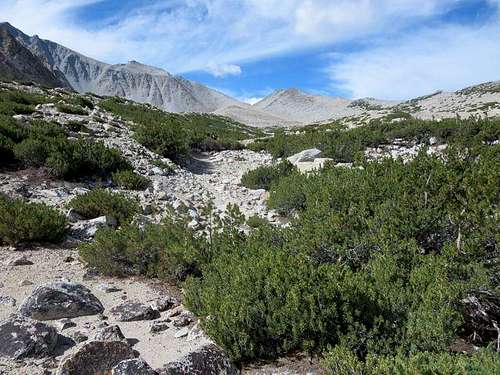
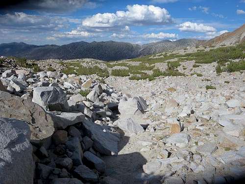
Going up the slope – and slipping back down on the scree – wasn’t much fun, but we soon stood atop the ridge above the lake. From there, we could have proceeded further to the west to get to the top of the northeast ridge of Morgan; while that would have afforded earlier views of Little Lakes Valley, it would have made for a longer hike. We instead followed Kathy’s advice and headed toward the saddle below two hills on the ridge (we named the two hills the Camelback). To get to the saddle, we headed directly south up a sandy wash filled with short trees, sometimes spotting cairns and a trail but often hiking cross-country.
![Ascending Slope]() Ascending slope above Francis Lake
Ascending slope above Francis Lake![Francis Lake]() Francis Lake from halfway up slope
Francis Lake from halfway up slope![View up Wash Toward Morgan Summit]() View up wash toward Morgan summit and saddle below the Camelback
View up wash toward Morgan summit and saddle below the Camelback![Saddle below Morgan]() Closer view of the saddle below the Camelback
Closer view of the saddle below the CamelbackAscending to the Northeast Ridge
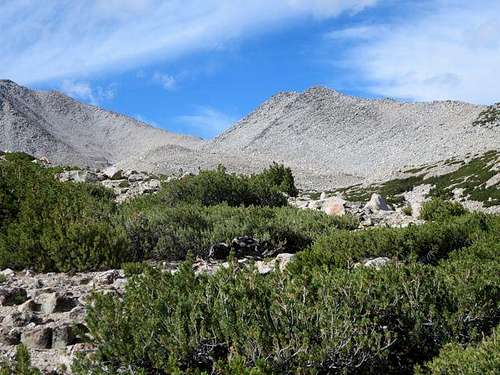
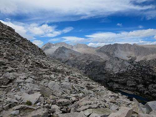
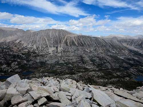
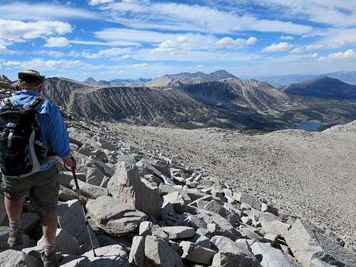
We reached the saddle below the Camelback at 4.1 miles from the trailhead and an elevation of about 11,900 feet. After a short rest at the saddle, we continued climbing over rocks, talus and sand. Moving past the Camelback, we ascended to the ridge, reaching it at 4.7 miles and an elevation of 12,380 feet. At that point, we gained great views of Little Lakes Valley and the high mountains on the valley’s west and southwest sides.
![Wash Above Francis Lake]() Looking back at the wash from the saddle (Francis Lake is over slight ridge in center right)
Looking back at the wash from the saddle (Francis Lake is over slight ridge in center right)![Heading for Northeast Ridge]() Leaving saddle toward northeast ridge
Leaving saddle toward northeast ridge![Nearing Ridgeline]() Nearing ridgeline
Nearing ridgeline![Little Lakes Valley]() Little Lakes Valley from ridge
Little Lakes Valley from ridge![Mts Dade, Abbot and Mills]() Mts Dade, Abbot and Mills from ridge
Mts Dade, Abbot and Mills from ridge![Mt Starr]() Mt Starr from ridge
Mt Starr from ridgeMoving up the Ridge
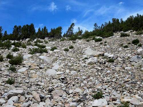
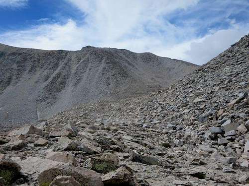
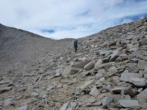
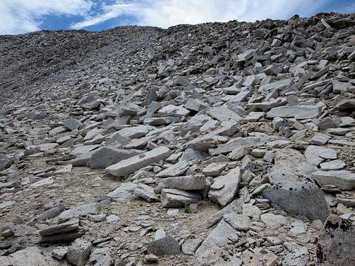
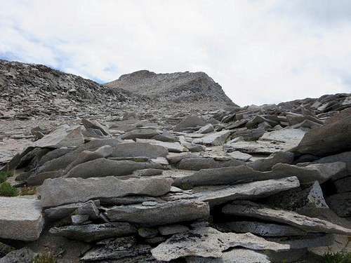
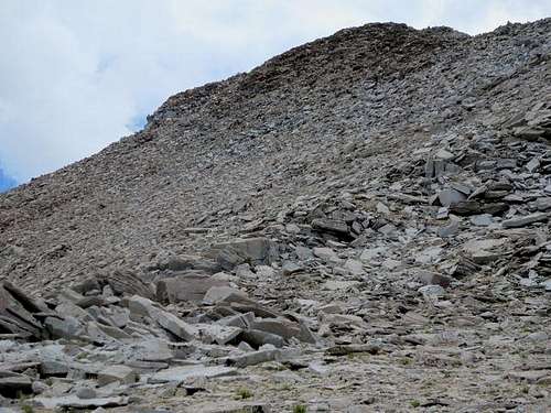
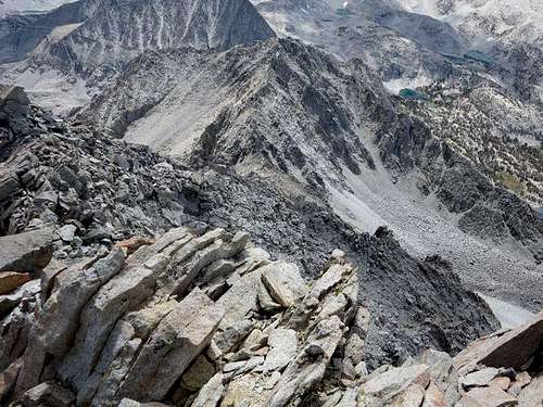
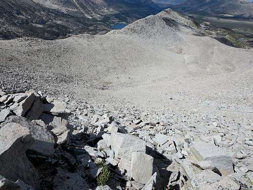
From there, it was a matter of simply following the ridge to the summit, crossing talus and doing some boulder-hopping, all with generally solid footing. We occasionally found short bits of use trail, but they quickly evaporated, only to turn up again higher up on the ridge. Although the slope of the northeast ridge looks dauntingly steep from afar, we found it not bad at all. We briefly lost site of the summit but at 5.1 miles and an elevation of just over 13,000 feet regained the summit view.
![Broken Rock and Talus]() Broken rock and talus on ridge (generally solid footing)
Broken rock and talus on ridge (generally solid footing)![Morgan Summit Bloc]() Morgan's summit bloc
Morgan's summit bloc![Last Stretch to Summit]() Last stretch to summit
Last stretch to summitAtop Morgan
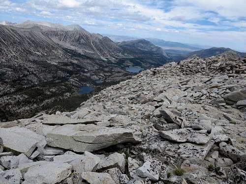
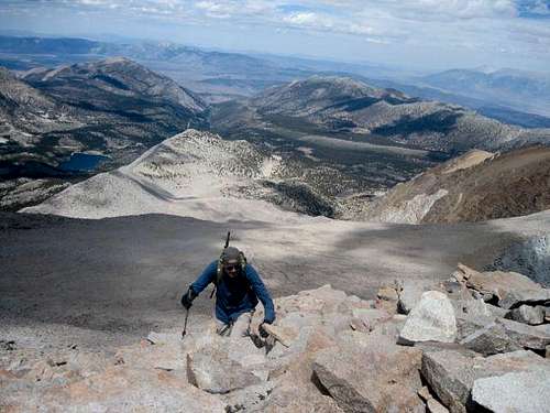
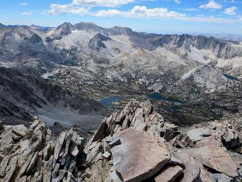
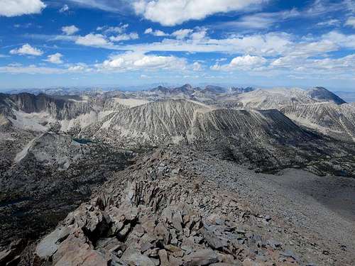
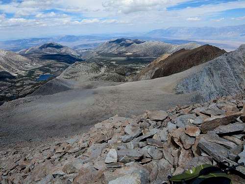
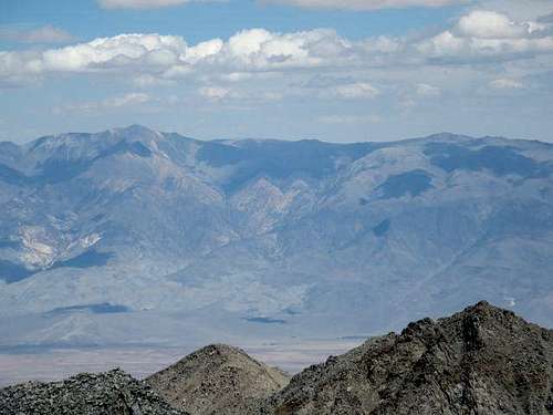
We needed some use of hands to get up the final stretch of boulders and reached the summit at 5.6 miles, an elevation of 13,748 feet, passing a chute that points dramatically down toward Little Lakes Peak. The views from the summit were stunning: most of Little Lakes Valley, the mountains surrounding it and beyond, back to Francis Lake, east to the White Mountains and southeast to Mt Tom (our next “Unfinished Business Tour” target). The view down the ridge to Little Lakes Peak confirmed our sense that, had we reached the summit of that mountain in 2012, we would not have made it to the top of Morgan.
![Summiting Morgan]() Reaching Morgan's summit
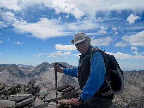
Reaching Morgan's summit![Ruvicha Atop Morgan]() Ruvicha on Morgan's summit
Ruvicha on Morgan's summit![Dade, Abbot and Mills]() Dade, Abbot and Mills from Morgan summit
Dade, Abbot and Mills from Morgan summit![Mt Starr]() Starr from Morgan's summit
Starr from Morgan's summit![Ridge to Little Lakes Peak]() Ridge to Little Lakes Peak from Morgan's summit
Ridge to Little Lakes Peak from Morgan's summit![View Back to Francis Lake]() View back toward Francis Lake from Morgan's summit
View back toward Francis Lake from Morgan's summit![White Mountains]() White Mountains from Morgan's summit
White Mountains from Morgan's summitHeading Down, then Traversing Back to the Ridge
After a half hour on top of Morgan and lots of pictures, it was time to head down. Instead of following the ridgeline back down (to the Camelback), we hiked more directly toward Lake Francis. That quickly brought us to a steep, rocky slope where the footing was not so solid, and we decided then to traverse back to the ridge rather than descending directly.
![Heading Down from Morgan Summit]() Heading down directly on to steep, looser rock
Heading down directly on to steep, looser rock![Heading Back to Ridge]() Traversing back to the ridge
Traversing back to the ridgeReturning to Francis Lake
Once back on the ridge, we retraced our steps to the saddle below the Camelback and then down the sandy wash. We had to search a bit for the slope down to Francis Lake. I ended up going down the northernmost slope, also a mix of sand, rock and loose scree. Ruvicha descended directly down to the drainage south of the lake through the trees between the two slopes, finding somewhat more solid footing there.
![Heading Down toward Francis Lake]() Heading down the wash toward Francis Lake
Heading down the wash toward Francis Lake![Beginning Descent to Francis Lake]() Beginning the descent to Francis Lake
Beginning the descent to Francis Lake![Morgan from Francis Lake]() Last picture of Morgan from Francis Lake as we head back to Rock Creek Lake
Last picture of Morgan from Francis Lake as we head back to Rock Creek LakeAll in All, an Enjoyable Hike
From Francis Lake, it was a straightforward hike back to the trailhead at Rock Creek Lake, and a celebratory Mountain Home dinner at the East Fork Campground. According to Ruvicha’s GPS, the out-and-back trip was 11.0 miles with a net altitude gain from trailhead to summit of about 4000 feet.
All in all, a very enjoyable and scenic hike.
(Thanks again to Kathy Wing for her very useful pictures and to Ruvicha for reviewing this report; photo credit for "Reaching Morgan's summit": Ruvicha)


Comments
Post a Comment