
Comments
No comments posted yet.
|
|
Trip Report |
|---|---|
|
|
57.19610°N / 5.34886°W |
|
|
Jul 19, 2023 |
|
|
Hiking, Mountaineering, Scrambling |
|
|
Summer |
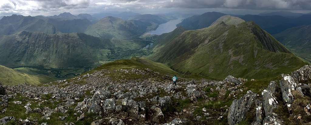
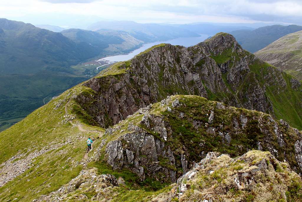
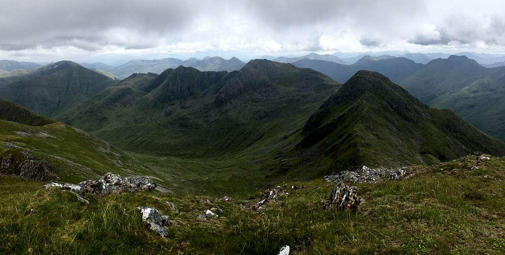
This is the name given to a high mountain ridge running in a rough southeast – northwest direction above the north side of Glen Shiel on Scotland’s northwest coast. The traverse of the ridge is considered to be one of the “classic” Scottish ridge traverses, clocking in at over 10 miles long and with more than 5000 feet of ascent (and descent) taken to complete it.
The name "Five Sisters" refers to the mountain tops along the ridge, these are:
Sgurr nan Spainteach, 990 m (Munro top)
Sgurr na Ciste Duibhe, 1027m (Munro)
Sgurr na Carnach, 1002m (Munro)
Sgurr Fhuaran, 1067m (Munro)
Sgurr nan Saighead, 929m (Munro top)
Beinn Bhuide 869m (Corbett top)
Sgurr na Moraich, 876m (Corbett top)
Those of you with a background in mathematics will have probably noticed… there are more than five tops!
What actually constitutes the “Five” differs from one mountain writer to another. Several writers ignore Sgurr nan Spainteach and Beinn Bhuide, whilst the footpath itself tries to bypass Sgurr nan Saighead, Beinn Bhuide and Sgurr na Moraich.
The 2021 SMC publication “The Munros” describes the route as consisting of a traverse of the whole ridge, over all these tops. We had decided to take the “purists” view and traverse all the tops, if possible.
I’m not sure when I first heard of the Five Sisters of Kintail, no doubt I had read about the traverse in a mountaineering book or magazine. However, I remember the first time I saw the route.
May 3rd 1986 – Gordon, Steve, Brian and I were racing northwards to catch the last ferry from Kyle of Lochalsh over to Skye. As we drove down the glen in the evening, we strained our necks to look upwards at the route we knew was there. You only get glimpses of the ridge from inside a car, it was there somewhere above the steep walls of grass but that was enough to grab my attention.
In June 1989, I was camping at Glen Shiel and hoping to do the traverse. I did the South Glen Shiel ridge (aka the South Clunie ridge) in good weather but this didn’t last and I lost my chance.
I was back in February 1991. We actually parked and made ready to attempt the traverse in winter conditions but the forecast of showers from the west, prompted a debate which caused us to change our plans for the day to a different route. I noted in my diary later that we enjoyed “splendid views of the Five Sisters in sunshine during the afternoon!”
In February 1993, it rained for most of the week. February 1997, February 2012 and April 2018 were all similar.
So, when Marie and I booked a two week stay in a nearby cottage during July 2023, I was convinced that my time to do the traverse had come.
The answer to this question has a major influence on a decision to do any route in Scotland’s northwest mountains. Sure, anyone can walk in the rain but the route could quickly go from just unpleasant to very dangerous, so good weather is better.
It doesn’t help that weather forecasting is not an exact science. (Some would argue it is not a science at all, more akin to Astrology or Tarot card reading).
We have a tried and tested formulae for assessing weather forecasts after years of experience.
Step 1 – Get as many forecasts from different sources as possible. Marie and I use 5 or 6 well-known forecasters. If they all agree on the weather forecast, it will either be really good weather or really bad. Usually, they are all different forecasts for the same area on the same day.
Step 2 – Choose the forecast you like the most and plan around that. It probably won’t be correct anyway.
Step 3 – Wait until the morning of the day you plan to do the route and see how it is. Be prepared to change your mind at the last minute – I always find this difficult!
We had been in the area for 11 days and the weather had made it tough going. True, we had some good days but these were usually contrary to the forecasts and we felt each good day that we had, we had won in spite of the poor forecast. On the last Wednesday of the trip, we found that the final two days were forecast as poor weather so today might be our only chance. One of the forecasts said that the early cloud and rain would clear by the middle of the day. First thing, it didn’t look hopeful.
When we left our cottage, we had decided to drive around to the Glen to see how it looked, then decide whether to attempt the Five Sisters or drive on to a different area.
As we drove along, it started to sink in that I might miss another chance to do this route and I realised how much I wanted to do it.
“I don’t think I can face another long drive and pass up this opportunity.” I suddenly said.
Marie was a bit surprised at this I think as we had only just agreed the original plan.
“It doesn’t look that good.” She replied.
There was a lot of cloud on the mountains but parts of the ridge were clear and the cloud in the west looked like it was breaking up.
“I just want to have a go at it,” I replied. “If we have to turn back, at least we tried.”
Consequently, we parked at the car park halfway up the glen just off the A87 beneath the Bealach an Lapain and left the car at 8.50 am.
We were expecting it to be steep from the start as all of the descriptions described it that way. The grassy slopes were also running with water so we didn’t know if we were on the path or in a stream for some of the time. Also, I really expected the path to be a bit easier to follow, this route is supposed to be really popular. Twice we lost the path and found it again higher up.
Instead of improving, the weather got worse. More cloud blew in and it started to drizzle. As I put on my waterproof jacket, I began to think I had made a big mistake suggesting we do this.
We reached the bealach at 10.20 am.
“That’s the hard bit over.” I said quoting from the route description.
Marie did not look convinced but at least the drizzle had stopped and some of the ridge was clear. There was an occasional patch of blue sky but the promised clearance didn’t look like it was about to happen.
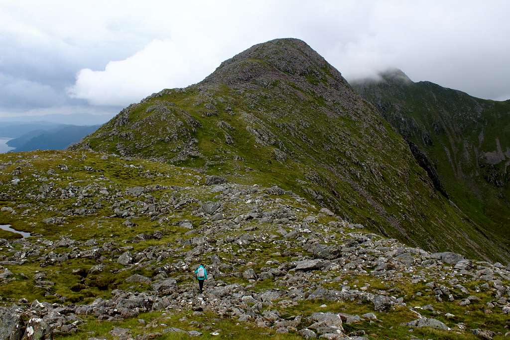
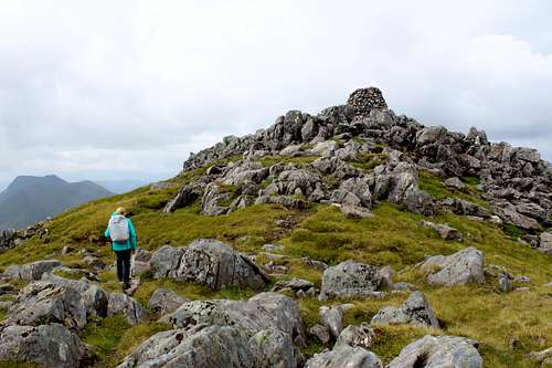
In front of us was a grassy, pointed hill which I pronounced as Sgurr nan Spainteach, our first top – in fact it was Beinn Odhar, a minor rise in the ridge. I realised that as we crested the bump and saw the main ridge.
We could only see as far as Sgurr Fhuaran, the third Munro and highest point of the ridge. Its summit was covered with cloud and looked a long way off.
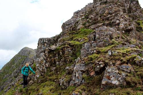
Sgurr nan Spainteach (The peak of the Spaniards) is named in memory of the Spanish soldiers who fought alongside the Jacobite soldiers against the British at the Battle of Glen Shiel in 1719. Nowadays it is considered a “Munro top” of nearby Sgurr na Ciste Dubh and most writers only give it quick mention.
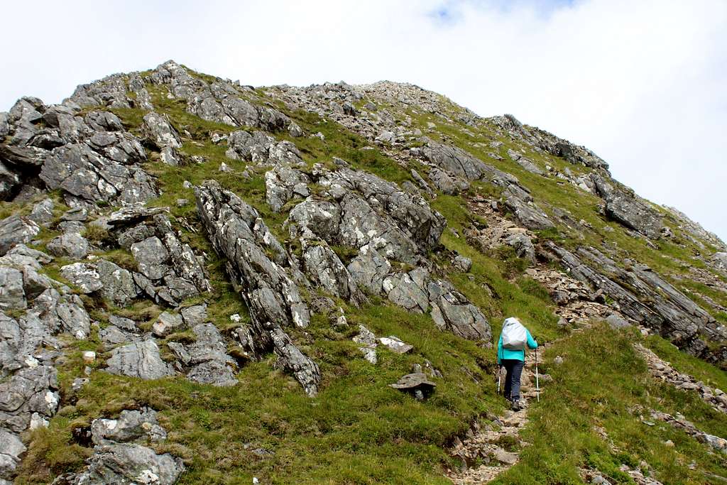
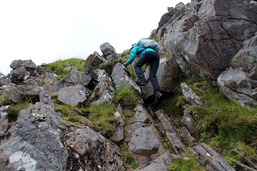
Consequently, I was surprised that it was a more significant mountain than I had imagined. From the east it has a grassy path that threads its way in between the rocky outcrops but at the summit cairn, it becomes a lot rougher and requires a short scramble down to a rocky traverse.
As we did this, I heard a rumble from the main Glen Shiel valley. I looked across to see a jet fighter flying level with us above the valley. I pointed it out to Marie and as he passed us, the pilot banked towards us, causing a vapour trail to form from the wings.
It roared past and we were just admiring it when a louder roar signaled a following jet, this time much closer. I could see the pilot in the cockpit as he flew alongside the ridge.
Almost immediately, a third jet shrieked right overhead, the whole ridge shook! As he passed over us, the pilot turned the plane upside down and rolled.
“Now he’s just showing off!” Marie said shaking her head. “They’re crazy!”
We wondered if buzzing hikers on the ridge is an R.A.F. sport?
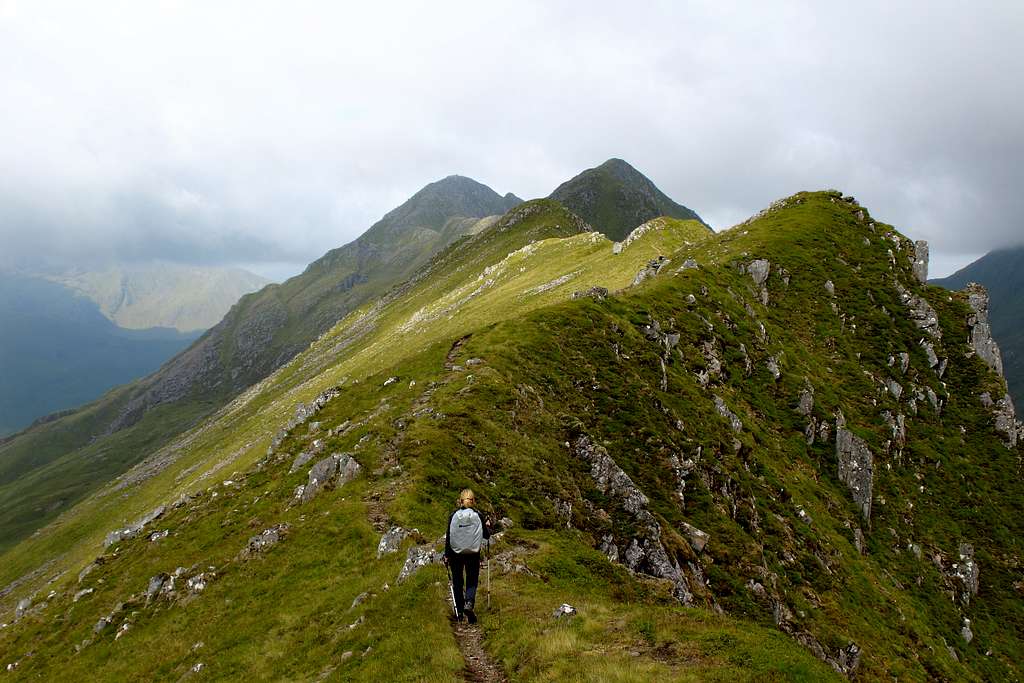
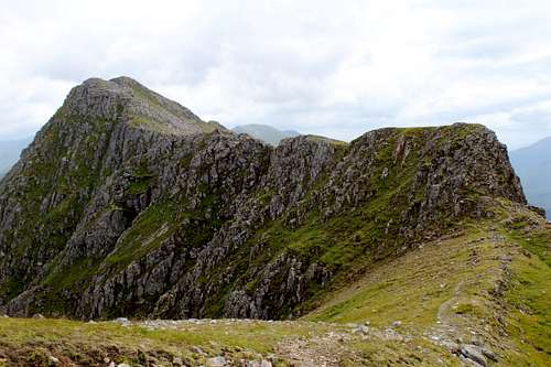
We continued the rough traverse to another scramble down a rocky buttress to the bealach beneath Sgurr na Ciste Duibhe.
|
|
The ridge above had an unusual double crest but the path upwards was easy to follow and we quickly got to the huge cairn on the summit to signal our first Munro of the day at 1027m.
We reached the summit at 12.00 noon – about 40 minutes slower than the guidebook time. Unusual for us to be that much slower but we kept closer to the timetable for the rest of the ridge.
Earlier we had noticed two figures next to the cairn, the first people we had seen. They were a long way ahead of us and we never caught them up.
The cloud had lifted a little and we had some good views albeit in flat, grey light.
The descent from Sgurr na Ciste Duibhe is over a mixture of grass with rocks. Not too difficult but the path which had been easy to follow became very feint and we lost it a few times. Surprising for such a popular ridge?
|
|
We stopped in the shelter of some rocks for lunch, then continued down to the Bealach na Craoibhe as the ridge turned north.
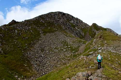
The next ascent continued in much the same way, a mixture of grass and rock although, the good path returned. The weather however, started to cloud up again and by the time we reached the summit of Sgurr na Carnach (1110m) at around 1.10pm, we were in misty cloud.
This descent involved more, quite steep scrambling down some ridged slabs – not mentioned in any of the guidebooks – before an easier descent to the Bealach na Carnach.
The next ascent rose quite steeply up a zigzag path, often covered with loose rock. Here, we met the only person we saw to speak to all day. He had left his car at the Clunie Inn then caught the bus all the way down to Allt a’ Chruinn – the hamlet at the north end of the traverse - then started his ascent from there, planning to traverse the Five Sisters and then continue on to what has become known as “The Brothers ridge” (Saileag (956m), Sgurr a’ Bhealach Dheirg (1036m) and Saileag (956m) to return to his car. Unfortunately, the bus had broken down and he was now a long way behind his planned timetable.
We wished him luck and smiled to ourselves after he had left – glad that we had not undertaken such a long route. This came back to haunt us later!
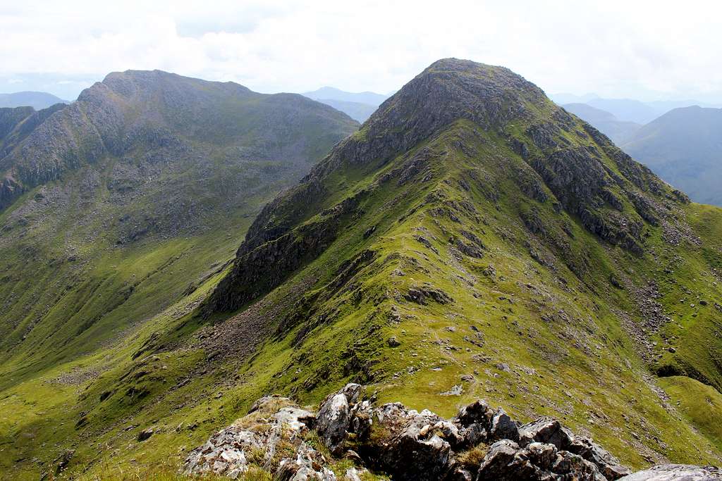
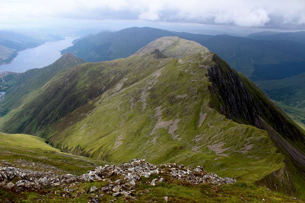
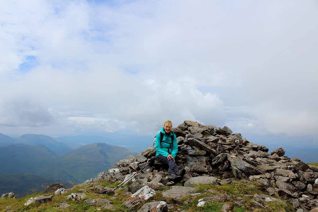
We reached the summit of Sgurr Fhuaran (1067m) much quicker than expected at 2.10 pm. This is the highest point of the ridge and as such, it had been in cloud for most of the day. Luckily for us, the cloud blew away as we reached the cairn and we had some sunlit views for a few minutes.
Looking back towards Sgurr na Carnach we could see another couple on the summit. They never caught us up and we didn’t see them again. In the whole day we only saw 5 people and only 1 to speak to.
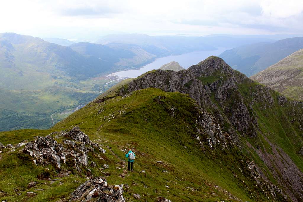
To descend, we headed down the northwest ridge a little way before heading back north and down to Bealach Buidhe. From here, with the three Munros climbed, the path contoured across the hillside avoiding the summit of Sgurr nan Saighead, a Munro top. We started along the path but realised what was happening and headed for the summit. There is a feint path along the top of the ridge and it’s best to stick to this.
From the summit cairn, we descended a little way before ascending the rocky ridge – more scrambling – up to the small summit of Beinn Bhuide (869m) by 3.50pm.
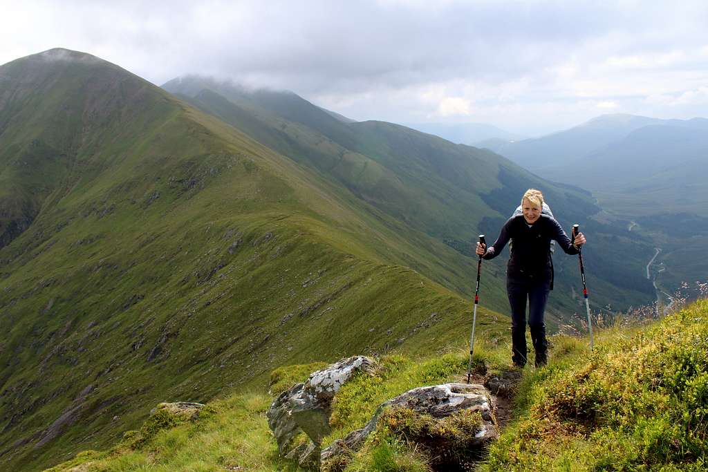
Descent down easier ground led us to the head of the Allt a’ Chruinn (river) where it was clear that most hikers descend to the valley as the well-worn path followed the river down. We wanted to continue onto Sgurr na Moraich, the so called “fifth sister”.
The ridge here is broad and grassy with rocky outcrops. We lost our feint path almost immediately and wandered from one high point to the next as clouds blew across us. We saw the obvious high point with a cairn and headed for it, arriving at 4.45 pm.
It was great to feel we had nearly completed the route and we rested for a few minutes before descending. One of the route descriptions had suggested returning to the head of the Allt a’ Chruinn to gain the path but this seemed like an unnecessary diversion.
Instead, we descended northwest down the grassy slope and looked to head back west lower down. With hindsight, the former plan might have been easier.
There was no path as we descended but this was not really a problem. We knew there was steep ground on the west side of the mountain and we needed to avoid it but I don’t think we descended far enough. Consequently, we found ourselves on a steep mixture of grass and rocks interspersed with heather that camouflaged hidden holes. The descent was very slow.
We gradually made it down, not wanting to fall at this late stage.
“Are you sure there’s a path down there?” Marie asked as we descended.
“Yes, of course.” I replied. I couldn’t see it either but the map said it was there!
My confidence waned as we got closer to the river and I still couldn’t see the path. We were about a stone’s throw from it when it suddenly appeared.
Moving down the narrow path as if to add insult to injury, the clouds cleared and the sun came out… finally!
We reached the hamlet of Allt a’ Chruinn at 6.30 pm, just over 9 ½ hours after leaving the car. A superb, exciting route which we had more or less to ourselves. The weather could have been a little better but it had been a great day.
We descended to the main road and rang the phone number of a local taxi firm we had found to get a lift back up the valley. No answer, so Marie left a message.
We wandered into a shop and bought some food and drink. Marie chatted to the proprietor.
“Do you know any local taxi firms? We couldn’t get through to the one we have.”
The man looked rather surprised.
“You won’t find many taxi’s around here. If you do, they will charge you a hefty amount just to come out, that’s before they take you anywhere!”
We left the shop and wondered what to do.
“Let’s walk along the road and try to hitch.” Marie suggested.
We started walking at 6.50 pm.
We reached Shiel Bridge just as the bus came around the corner, he pulled in to let someone off.
We ran over and asked him to drop us part way up the glen.
“Can’t do that.” He replied. “Next stop is the Clunie Inn!”
That was too far for us, so we declined.
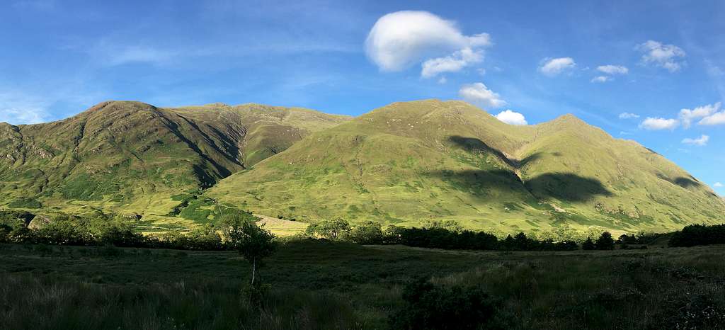
We continued walking up the road. The weather was now clear and the mountains looked fantastic in the evening light.
“Why couldn’t we have had this weather during the day?” I kept asking.
“Why doesn’t someone stop and pick us up.” Marie kept asking.
Not long after Shiel Bridge, the path at the side of the road ended. We took to the road itself – the A87 – which meant we had an occasional stream of traffic moving at about 60 mph coming along the road!
We had to jump into the verge (or over the crash barrier) – and stick our thumbs out – every time someone came along! It was incredibly dangerous but I couldn’t really see any alternative.
Time moved on.
To cut the story short – no one stopped for us.
It took two hours and forty minutes to get back to the car which we did by 9.30 pm! Over 12 1/2 hours after leaving it!
On the drive back, I measured we had walked 8 miles up the road added to the approximately 10 miles on the route itself, quite a day.
Moral of the story, organize a lift back to the start of the route before setting out! Having said that, if we had known that we would have to walk back, we wouldn’t have set out in the first place and missed a great day!
With hindsight, I wondered if we should have caught the bus up to the Clunie Inn. It might have been a slightly shorter walk and it would have been downhill. Also, we might have met the chap doing the full Sister + Brothers ridge traverse and managed to get a lift from him!
Of course, the final two days of the trip, which had been forecast as bad weather, were both sunny and bright!