"Becca" and Surroundings: tiny Excursions for Teens Children & Seniors by Aosta / 4b

"Becca" and Surroundings: tiny Excursions for Teens Children & Seniors by Aosta / 4b

Page Type Page Type: Article
Activities Activities: Hiking

Young & Fun Overview


Reading this article is suitable for Kids, Boys & Seniors again becoming Children. But around Aosta Town there are only the "Becca" di Nona and the Monte Emilius Emilius? Absolutely not! If we go to look for old Albums in the bottom drawer in the attic or find other illusions that have permeated our Youth. When neither too poor nor too beautiful we went, again starting to walk from our house, looking for new Spaces and some Adventure which then needed to tell in the country to those who move never . Not forgotten, but only unconsciously hidden in Memory, they return to the surface when, advancing in Years, he returns to be Children. A treasure chest full of gold vacuous riches, that Time has not managed to erase. Indeed emerge stronger than before and their Power is of come back in the same. For us, no, it is a real goal ...


"... Towards Arsy Alpages below Northeast Face of Mont Fallère...", by Antonio


La lettura di questo Articolo é adatta per Bambini, Ragazzi & Anziani che tornan ad esser Bambini. Ma intorno ad Aosta Città esiston soltanto la "Becca" e l'Emilius? Assolutamente no! Se andiamo a cercare vecchi Albums nel fondo dei cassetti od in soffitta troveremo altre illusioni che hanno permeato la nostra Giovinezza. Quando neppur troppo poveri e nemmen troppo belli andavamo, sempre partendo a piedi da casa nostra, alla ricerca di nuovi Spazi e qualche Avventura, che poi serviva da raccontar in Paese a quelli che non si muovono mai. Non dimenticati, ma soltanto inconsciamente nascosti nella Memoria, tornan a galla quando, avanzando negli Anni, si ritorna ad essere Bambini. Uno Scrigno d'oro ricolmo di vacue ricchezze, che il Tempo non é riuscito a cancellare. Anzi riemergono più forti di prima e la loro Potenza riporta indietro lontano nel Tempo.
Per noi no, é vera e propria meta ...


"... Bivouac & Cross on Northern Side ...", by sergioenrico


Looking at an old B&W photograph, found by accident in a drawer, rediscover many things that you had forgotten or simply shelved in the Mind. Rediscover the traces of a little past that is quickly spent, with nothing that apparently change, as if just us to transform us. Instead, if you look carefully between the lines, everything, perhaps inadvertently, changes along with us. Then there are others, and putting them together, review a movie, an old movie, Which will unfold before doing resurface Reality, though now passed. Are you seeing an Colle Antico beyond which there opens gigantic Horizons for discovering great Mountains which, seen from afar, nothing you said remaining as something detached from your Life. Here, however, the "breaths" fully as the crisp air that shakes you lungs and eyes peering becoming an Infinite Horizon. Over there you see an old bivouac surmounted by a rustic wooden cross, and if you look behind your back, review the city from where you left this morning, near your home. The first view upsets you implying that the World is large and is beyond the space that usually you know, while the second will reassure all those who have their anxieties and usual doubts youth.
Unfortunately always present. As long as this has given us right time to reflect, observe the right things better ...

MOUNTAIN S SPLITTINGS
<font color=red> EMOTIONS</font> & <font color=purple>SUGGESTIONS</font> THE <font color=purple>PHANTOM</font> of <font color=red>LONELINESS</font>
Small Church at the feet of...
The SPECTRE between Mount Velan and the Cross of Mount Fallère
Mont Fallère Summit after Northern Little Wall 1972


"... Fallére Old Illusions ...", by sergioenrico, Dario Sergio Cardellina & Osw


Guardando una vecchia fotografia in B&W, ritrovata per sbaglio in un cassetto, riscopri molte cose che avevi dimenticato oppur semplicemente accantonato nella Mente. Riscopri le tracce d'un piccolo passato, che é velocemente trascorso, senza nulla in apparenza cambiare, come se fossimo sol noi a trasformarci. Invece, se guardi bene tra le pieghe, tutto, magari inavvertitamente, cambia insieme a noi. Poi ne trovi altre e, mettendole insieme, rivedi un film, un vecchio film, che ti scorre davanti facendo riemeregere la Realtà, anche s'ormai passata. T'appar un Colle Antico che ti spalanca giganteschi Orizzonti scoprendo grandi Montagne che, viste da lontano, nulla ti dicevano rimanendo come un qualcosa distaccato dalla tua Vita. Qui invece le "respiri" pienamente come l'aria frizzante, che ti scuote i polmoni mentre gli occhi scrutan un Orizzonte che diventa Infinito. Laggiù vedi un vecchio bivacco sormontato da rustica Croce in legno, mentre se guardi alle spalle, ritrovi la città, daddove questa mattina sei partito. La prima veduta ti sconvolge facendo capir che il Mondo é grande e và oltre lo spazio solitamente conosciuto, mentre la seconda ti rassicura da tutte quelle che son l'ansie ed i soliti dubbi giovanili.
Sfortunatamente sempre presenti. Tutto ciò ci ha dato il tempo adatto per riflettere, osservando meglio le giuste cose ...


"... Costa Tardiva in Gran San Bernardo Valley ...", by Antonio


If a Child or a Family wants a beautiful Walks where you wear them, remaining around the City of Aosta? Becca di Nona? We are already gone. At Emilius? Ummm, is too far away and then, if there is snow, it becomes almost unattainable. So where do we go for a walk on top of Aosta? We must draw on youthful memories, because, looking for, we will find the way. If we go south, we can follow the old procession to the Hermitage of San Grato, also goes up towards Lake Chamolé, classical and traditional excursion Sunday after the war period. If we change the slope going to the North? The Valley of the Gran San Bernard bisects the valley behind the city of Aosta: Northeast we Becca of Roisan, Becca of Viou, Mount Mary above the Basin Senevé with the Castle of Villair Quart. In the Northwest Punta of Chaligne, above the Common of Gignod, or the nearby Punta Met between the Municipalities of Aosta and Sarre. Going a little further we can go allla Becca France to see the old landslide of July 6th, 1564, that buried the ancient Bourg-Village Thouraz or Thora with all its 600 inhabitants, or to the "mythical" Fallère (3061m), the most High elevation from Mount Faroma (3073m) to the Grande Rochère (3326m, in a distance most of 40 Kilometres). But now we are already above the Municipality of Saint Pierre with its magnificent Castle by "Toio" of Savoy, after leaving behind those of Sarriod-de-la-Tour and of Sarre and in front of us those of Aymavilles and Chatel d'Argent in Villeneuve Communes, but both beyond the Dora Baltea.
Along the way, we will surely meet many interesting.


"... Last Paradise ...", by Maria Grazia Schiapparelli


Se un Bambino od una Famiglia voglion far una bella Passeggiata, dove li portate, pur restando dattorno alla Città d'Aosta? Alla Becca di Nona? Siamo già andati. All'Emilius? Uhmmm, é troppo distante e poi, se c'é la neve, diventa quasi irraggiungibile. Allora dove andiamo a far 'na passeggiata al di sopra di Aosta? Bisogna attingere ai ricordi giovanili, perché, cercando, troveremo la strada. Se andiamo a Sud possiamo seguire la vecchia Processione per l'Eremitaggio di San Grato, oppure salire al Lago di Chamolé, classica e tradizionale escursione domenicale del dopoguerra. Se cambiamo versante andando a Settentrione? La Valle del Gran San Bernardo divide in due la Valle dietro la Città di Aosta: a Nordest abbiamo la Becca di Roisan, la Becca di Viou, il Mont Mary sopra la Conca di Senevé con il Castello del Villair di Quart. A Nordovest la Punta delle Chaligne, sopra il Comune di Gignod, oppure la vicina Punta di Met tra i Comuni di Aosta e Sarre. Andando un pò più lontano possiamo andare allla Becca France per vedere la vecchia frana del 6 Luglio 1564, che seppellì l'antico Borgo-Villaggio di Thouraz o Thora con tutti i suoi 600 abitanti, oppure al "mitico" Fallère (3061 m), la più alta elevazione dal Monte Faroma (3073 m) alla Grande Rochére (3326 m; in una distanza d'oltre 40 Kilometri). Ma ormai siam già sopra al Comune di St. Pierre col suo splendido Castello dei Savoia, dopo avere lasciato alle spalle quelli di Sarriod-de-la-Tour e di Sarre e con davanti d'Aymavilles e Chatel d'Argent a Villeneuve, entrambi già al di là della Dora.
Strada facendo, ne incontreremo sicuramente molti interessanti.


"... New Chaligne Refuge ...", by emilius

Fallère Zone (Etroubles, Gignod & Aosta Municipalities)


"... Mont Fallère Northern Area above Gignod & Etroubles in Gran San Bernardo Valley ...", by emilius


If we want to bring us in the zone of Mont Fallère (3061m), the highest mountain in Central of Dora Baltea Area, we have two possibilities: 1)- or go up the Valley of the Great St. Bernard until you reach the Municipalities of Gignod and Etroubles, attection the foot of Punta Chaligne and Fallère same. 2)- Or, moving more to the Northwest, directed toward those from Aosta Sarre and Saint Pierre, sites between the river and the area immediately to the South of the same, reaching the edge of the Basin Vetan, that here we exclude because now too far. This second fact we consider only those trips that have the opportunity to be made, if desired, also starting on foot directly from Aosta and surroundings. In the first of two hypotheses can drive along the National Road No. 26 of the Gran San Bernardo first reaching the Municipality of Gignod (994m, 6.6 Km. from Aosta; former Castle of XXII° Century built by the Lords De Ginio, hence the name but it is also the ancient "Girosolis" of the Romans, which remains, however, only the square tower restored in 1536 to defend the Valley of Aosta from the incursions of "Calvinists"). Subsequently to Etroubles (1280m, 14, 8 Km. Aosta; Casaforte Vachery twelfth Century built in 1100 by Pietro Vachery and of which remains only the square tower), where the valley, however, is already split by sending a branch towards Valpelline and the second to the fact Gran San Bernardo Hill and the nearby Conca (Basin) of By, immediately above the Municipality of Ollomont-Vesey (1349m).

Northeastern Sector

From these two common date back to the mountain pastures with various different municipal roads or "interpoderali" (farms roads) that by listing the same as you approach from the Highway, are as listed: a)- Aosta Regional Road and then to the Municipal Lin Blanc (1281m), Regional towards Arpuilles (1010m) and Exnenex (1046m) Fractions; from Aosta-Ravoire (812m) the Municipal to Exenex. b)- from Gignod-Valquartier (838m) or Cré (899m) the Municipal to Exenex, from Gignod-Lexert (1108m) Municipal Road for Tercinod (1108m) and Exenex and by the same private road for Péroulaz (1286m) connected to the North with Grand Buthier Village (1302m). By State Road at Condemine (1137m) deviation with Municipal Road to Grand Buthier, Petit Buthier (1439m), altitude 1523 metres before the junction Mendey village (1562m) from where the farm road that reaches the new Chaligne Refuge (1936m), at the foot of the Hill and Costa (Coast) Tardiva (2410m, 2418m). The same continues with two long diagonals, first to the North and then to the opposite reaching the Tsa de Chaligne (2225m), at the Northern Slope of the of the homonymous Punta (2608m). Throughout this vast area sees a sie of many paths, sometimes inter-connected, which rise in the same direction or, more towards South in the direction of the Hill (2492m) and Punta of Met (2553m), now again above the City of Aosta. c)- From the Municipality of Etroubles by the Regional Road to the Village and Echevennoz Dessous Dessus (1232 m, 1264) and from there via the trail n° 5A, that is introduced in the Walloon of Ars before reaching the Alpe di Eteley (1716m) and then through the route n° 5 to Ars Alp (1974/2027m); crossed the Torrent of Ars becomes path n° 6 reaching the Tsa (2263m; Upper and last), the Northern slopes of Mont Fallère. In this last area we can go to Mont Fallère, but it is not recommended because its Northern slope is steep and often covered with hard snow; better to go to the opposite one, starting from the new Thouraz Hamlet. Beautiful instead the hike up to the Tsa and the three lakes just above (2479m, 2520m), which is reaching towards the Southwest through a small path unnumbered; can also be done by snowshoes. Continuing to Southeast, but excluding the Tsa, from the junction 2026 metres, instead you can reach the Tardiva Pass (2410m) with the trail n° 4/5; This easy small hike
is however to be avoided in the winter because it is very exposed to avalanches.


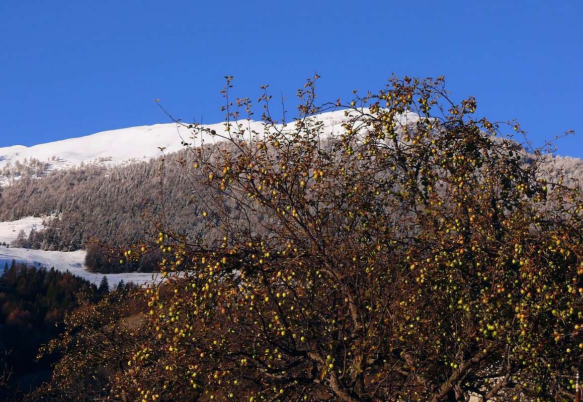
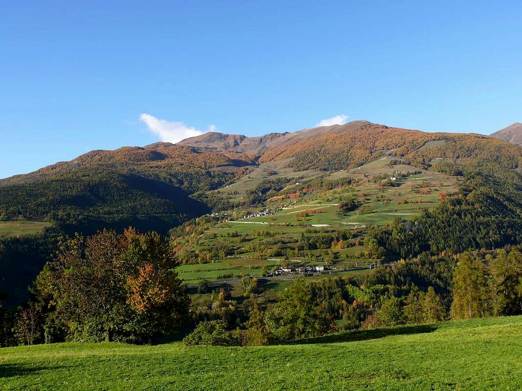
"... To Northeastern Slopes of Punta Chaligne ...", by sergioenrico


Se poi vogliamo recarci nella zona del Mont Fallère (3061m), la montagna più alta nell'area Centrale della Dora Baltea
, abbiamo due possibilità: 1)- o risalire la Valle del Gran San Bernardo fino a raggiungere i Comuni di Gignod ed Etroubles, ripettivamente ai piedi della Punta Chaligne e del Fallère medesimo. 2)- Oppure, spostandosi maggiormente a Nordovest, indirizzarsi da Aosta verso quelli di Sarre e Saint Pierre, siti tra il fiume ed il settore subito a Mezzogiorno del medesimo, arrivando fino ai margini della Conca di Vetan, che qui escludiamo poiché ormai troppo lontana. Di questa seconda infatti consideriamo esclusivamente quelle escursioni che hanno l'opportunità di essere effettuate, volendo, anche partendo a piedi direttamente da Aosta e dintorni. Nella prima delle due ipotesi si può percorrere in auto la Strada Nazionale n° 26 del Gran San Bernardo raggiungendo dapprima il Comune di Gignod (994 m, 6,6 Km. da Aosta; ex Castello del XXII° Secolo costruito dai Signori De Ginio, donde il nome, ma é anche l'antica "Girosolis" dei Romani, del quale rimane però solo la Torre quadrata restaurata nel 1536 per difendere la Valle di Aosta dalle incursioni dei "Calvinisti"). Successivamente quello di Etroubles (1280 m, 14,8 Km. da Aosta; Casaforte di Vachery del XII° Secolo costruita nel 1100 da Pietro di Vachery e della quale rimane soltanto la torre quadrata), laddove la valle però si é già sdoppiata inviando un ramo verso la Valpelline ed il secondo appunto verso il Colle del Gran San Bernardo e la viciniora Conca di By, al di sopra di Ollomont.

Settore Nordorientale

Da questi due comuni risalgono verso la montagna con i vari alpeggi diverse strade comunali o interpoderali che, elencando le medesime mentre si percorre la Strada Statale, si possono così elencare: a)- da Aosta Strada Regionale e poi Comunale per Lin Blanc (1281 m), Regionale per Arpuilles (1010 m) ed Exnenex (1046 m); da Aosta-Ravoire (812 m) Comunale per Exenex. b)- da Gignod-Valquartier (838 m) o Cré (899 m) Comunale per Exenex, da Gignod-Lexert (1108 m) Strada Comunale per Tercinod (1108 m) ed Exenex e dal medesimo strada poderale per Péroulaz (1286 m) con collegamento verso Settentrione con Grand Buthier (1302 m). Dalla SS presso Condemine (1137 m) deviazione con Strada Comunale per Grand Buthier, Petit Buthier (4139 m), bivio 1523 metri prima di Mendey (1562 m) da dove parte la strada poderale che raggiunge il nuovo Rifugio Chaligne (1936 m), ai piedi del Colle e Costa Tardiva (2410 m, 2418). La stessa continua con due lunghi diagonali dapprima a Nord e poi all'opposto raggiungendo la Tsa de Chaligne (2225 m), alle pendici del versante Settentrionale dell'omonima Punta (2608 m). Tutta questa vasta area vede una serie di numerosi sentieri, a volte tra di loro collegati, che salgono in direzione della medesima o, più verso a Sud in direzione del Colle (2492 m) e Punta di Met (2553 m), ormai a ritroso di nuovo sopra la Città di Aosta. c)- Dal Comune di Etroubles Strada Regionale per il Villaggio di Echevennoz Dessous e Dessus (1232 m, 1264) e da questo tramite il sentiero n° 5A ci si introduce nel Vallone dell'Ars raggiungendo prima l'Alpe di Eteley (1716 m) e quindi tramite il sentiero n° 5 quella di Ars (1974/2027 m); attraversato il Torrent d'Ars diventa sentiero n° 6 raggiungendo la Tsa d'Ars (2263 m), alle pendici Nord del Mont Fallère. In questa ultima zona possiamo andare al Mont Fallère, ma non é consigliabile poiché il suo Versante Settentrionale é ripido e spesso ricoperto da neve dura; meglio andare da quello opposto partendo dalla nuova Thouraz. Bella invece l'escursione fino alla Tsa ed ai tre laghetti appena al di sopra (2479 m, 2520 m), che si raggiungono verso Sudovest per mezzo di un piccolo sentiero non numerato; può essere effettuata anche con racchette da neve. Continuando a Sudest, ma escludendo la Tsa, dal bivio 2026 metri, invece si può raggiungere il Colle Tardiva (2410 m) con il sentiero n° 4/5; questa facile escursione
é da evitarsi in inverno oppure con neve alta e non ben trasformata, perché molto esposta alle valanghe.


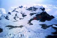
"... Pointes Tzalignes above Gignod Municipality ...", by maria grazia s


Comments

No comments posted yet.