-
 1096 Hits
-
 74.72% Score
-
 5 Votes
|
|
Route |
|---|---|
|
|
58.76277°N / 134.87248°W |
|
|
Download GPX » View Route on Map |
|
|
Hiking, Mountaineering, Scrambling |
|
|
Spring, Summer, Fall |
|
|
A long day |
|
|
III |
|
|
Overview
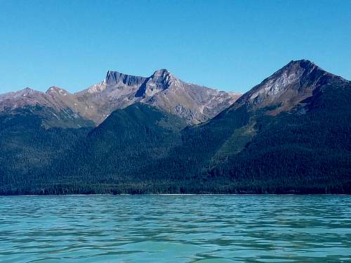
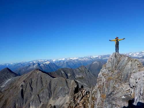
Berners Peak is a rarely visited 10 mile round trip climb up a mountain located in Berners Bay. Accessing the mountain requires a boat (kayak or motorized), route finding, and the summit has 3rd class scramble. The route climbs East up a valley to a 4,300' pass and then heads North along a ridge to the summit. From the summit (if you climb on a clear day) you can easily see onto the Gilky Glacier, look down on Antler Lake, and to the Fairweather Range. Depending on the time of year, bears activity can be a concern on the approach. If you're looking for something different, zero people, a boat ride, and a LONG day climb, this mountain is for you.
More details are in the Route Description and on the attached .gpx file.
Getting There
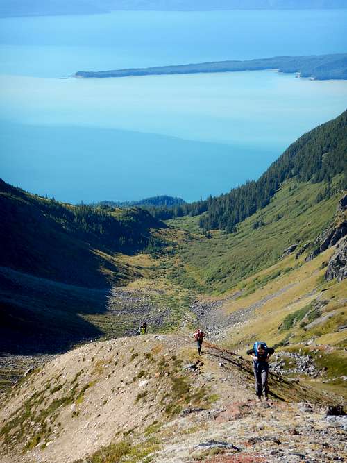
This is the fun part, to access the route to Berners Peak from downtown Juneau, Drive out Glacier Hwy to Echo Cove boat launch. From there boat, kayak, swim, paddle board, or hovercraft the 6 miles North to the cove past Sawmill Creek. Its a big horeshoe beach that has ample area to drag the watercraft on shore or moore a boat.
Route Description
The Berners Peak Standard Route starts by walking up the beach and plunging into thick woods 6 miles north of Echo Cove boat launch. From here continue generally North East for about a mile. The blueberry bushes are so thick in this section you'll be lucky to see more than a few feet in front of you. Having a GPS or compass is super helpful to not get lost in woods this thick. Keep pushing the brush until you hit a creek. Head uphill following the creek generally East and uphill. Eventually tree-line is broken, but not before beating a bit of Devils Club.
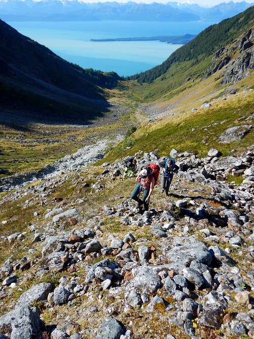
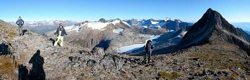
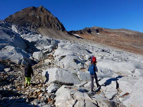
Hang to climbers left as you get close to the pass as the route steepens into a scramble to avoid some really steep stuff and continue up the valley to the pass at 4300'. Grab water before you get to the top of the valley as it’s the last running water you'll see in a while. Continue North along the backside of the ridge across a cool barren granite patch, and then across a bunch of loose boulders.
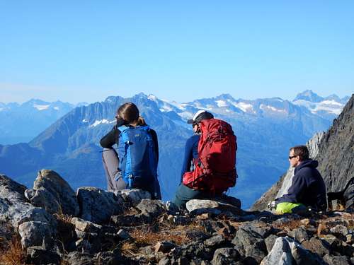
Good views of Antler Lake and the glacier above Antler Lake abound on climber’s right. Turn to the West and climb to the top of the ridge on an easier slope after about 0.5 miles on the East side of the ridge.
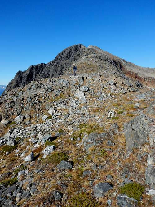
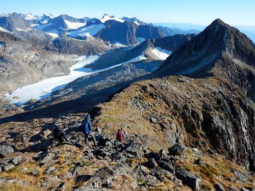
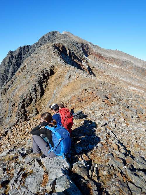
Once on the ridge, follow it to the summit. Some 3rd class rock encountered, but nothing to serious and the route is verystraight forward.
See attached .gpx for an exact route or check out the Juneau Hikes and Summits CalTopo page.
Essential Gear
Crampons, ice axe, mountaineering boots or stiff waterproof boots are necessary in the spring/early summer. Hiking boots and gators are enough to get by in the fall when all the snow has melted. Having a SPOT or InReach is a great idea. Bring extra dry/warm stuff.