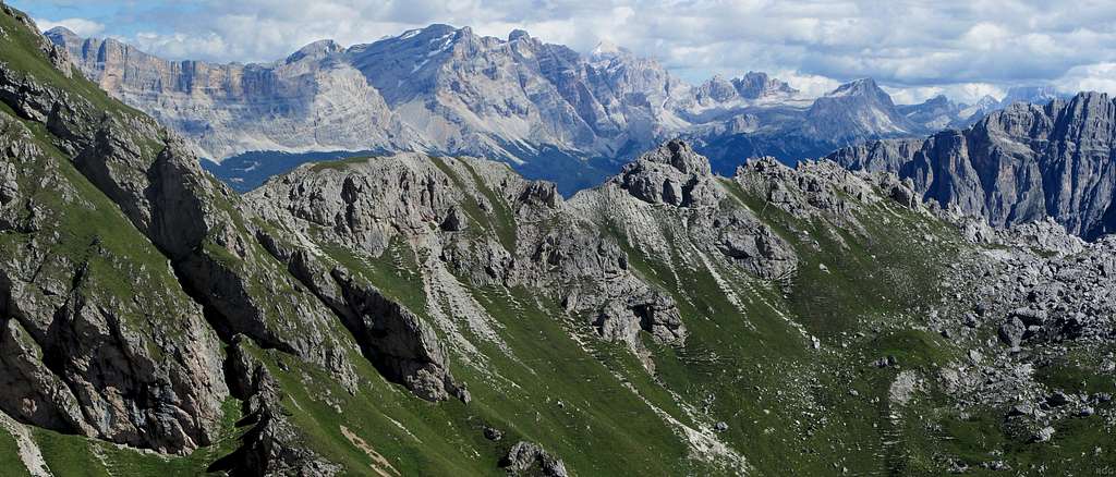
Click on the image for a much bigger version!
Zooming in from the Günther Messner Steig, spanning only about 30°, the skyline of this panorama shows some famous mountains in the Dolomites.
Some are easy to scale, others are harder, but I already found it challenging to figure out a consistent set of names for the main ones. I ran into several obstacles when I tried to create a labeled version of this panorama:
- Three languages play a role: Italian, German and Ladin.
- Italian, because this is part of Italy.
- German, because the northern part of the Dolomites only became Italian after the end of WW II (nowadays this is the province of Südtirol / Alto Adige).
- And Ladin, for that used to be the native language in a quite small part of the Dolomites.
Now, all the peaks have an Italian name, most of those that are in the former Austrian part have a German one as well, and, unsurprisingly most of those in the small Ladin area have a Ladin one. Consequently, some peaks only have an Italian name, some also have a German or a Ladin one and some even have a name in all three languages. Which name(s) should I use?
- There are some spelling and name variations. For example, the one just left of center is called Cunturines as well as Conturines in Italian, Piz dles Conturines or Piz dles Cunturines in Ladin, and Conturinesspitze or Cunturinesspitze in German - and to complicate matters more, in German the suffix "-spitze" is not always used, though I found some (anecdotal) evidence that makes me inclined to believe that the proper German name does indeed have this suffix.
What I wanted was to provide labels in all the relevant languages, which already meant up to three names. For each language, I wanted to give the name that was used most. I figured I would use different colors for each language.
For example, I considered to select Conturines because it has 37 000 hits on Google, whereas Cunturines has 9 200, and consequently I could label the summit Conturines /
Piz dles Conturines /
Conturinesspitze.
But then I looked at Lavarella - Varella - Piz Lavarella - Piz de Lavarella, and all of these also written with one less 'l' (as in Lavarela). It's the one that
appears to be the highest summit in this image, a bit left of center, so I couldn't just label some of the summits and skip this one. Since it is in Südtirol as well as in the Ladin area, I know that it must have names in three languages. However, I'm not even sure which of the names belonged to which language(s)! Help!
Anyway, to provide at least
some names:
- On the far left is Sasso delle Croce / Sas dla Crusc / Heiligkreuzkofel.
- Conturines / Piz dles Conturines / Conturinesspitze (3064m) is the peak immediately right of Lavarella, just left of center and seemingly the second highest in this photo (it's actually some 9 m higher than Lavarella).
- The bright peak just right of center is Tofana de Rozes (this one only has an Italian name, I think). It's more distant, but at 3225m it's actually the highest one in this photo.
- Further right come Lagazuoi Grande (2835m) and Lagazuoi Piccolo (2778m).
- On the far right and more distant than all the others is Monte Pelmo (3168m). It's not clear to see, but its summit is in the clouds.
17 August 2014.
