
|
|
Area/Range |
|---|---|
|
|
67.74276°N / 152.88574°W |
|
|
Hiking, Mountaineering, Trad Climbing, Sport Climbing, Toprope, Ice Climbing, Aid Climbing, Big Wall, Mixed, Skiing |
|
|
Spring, Summer, Fall, Winter |
|
|
Overview
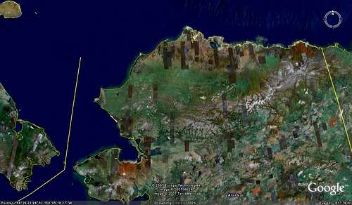
The Brooks Range extends across the top of Alaska, running East-West, from Canada's Northwest Territories across to the Chuckchi Sea near Siberia. The distance is several hundred miles. Several sets of mountain ranges are included.
 Brooks Range, the white mountains stretching across Alaska from West to East.
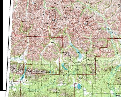 Central Brooks Range, Arrigetch Peaks, Gates of the Arctic.
 The Brooks Range consists of the following mountain sub-ranges (East to West):
From the Canadian border Westward the ranges include the Franklin Mountains, Romanzoffs, British Mountains, Chandalars, and the Davidsons.
The central area of the Brooks Range includes the Phillip Smith Mountains, Endicott Mountains and the Schwatka Mountains.
In the western region are the Jade Mountains in the Kobuk Valley behind Ambler, the Baird Mountains above Kiana, the Maiumeraks above Noatak, and the DeLong Mountains on the far western end of the Brooks Range. They taper down into the Chukchi Sea, between Bering Straits and the Arctic Ocean.
ARRIGETCH PEAKS:
The Arrigetch Peaks is a sub-range in the Central Brooks Range, a black granite spire world within Gates of The Arctic National Park. ("Arrigetch" is Inupiaq for "Fingers of The Hand Extended.")
Dramatic trip reports from climbing in the Arrigetch were posted on SuperTopo, and declared by the site's owner as "one of the best trip reports ever."
Earlier history is shown here. American Alpine Club report and Arrigetch Peaks Climbing Routes and History.
Other recent climbs in the Arrigetch (as well as the Chugach, Wrangell-St. Elias, and Alaska Range) are shown on Ryan Hokanson's blog, and Samuel Johnson's Arrigetch Expedition 2008 blog, and Alpine Essence blog covering many dramatic expeditions.
The foothills on the South slope send minor rivers, such as the Koyukuk, Southward into major river valleys, like the Tanana and Yukon Rivers, which join and flow Westward across Alaska to the Bering Sea.
The foothills on the North Slope feed many rivers which tend to flow generally North, into the Arctic Ocean. Some flow Northwest, into the Chukchi Sea, across from Siberia, Russia.
FAMOUS CLIMBING OBJECTIVES:
Well-known peaks which would be satisfying accomplishments include:
Mt. Michelson, in the Eastern Brooks Range, near the Arctic National Wildlife Refuge; Mt. Igikpak in the Central Region's Schwatka Mountains, Mt. Shulukshak; Mt. Doonerak and the Arrigetch Peaks, and various other high points on the topos. Arrigetch 2008 Report from Alpinist Magazine.
Dall sheep hunters fly in to the Brooks Range from all over the world just to scramble these peaks in search of the white sheep for big game trophies. Many train as hard as climbing athletes do. Make sure you can be seen by them so you don't get shot for wearing white.
Alaska Natives hunting caribou may also be in the narrow river canyons, hunting for subsistence foods. These are likely to include Inupiat Eskimo in the western end and North Slope areas, and Athabaskan Indians from the Koyukuk, Alatna and John Rivers of the Tanana /Yukon drainages, and Doyon of the Yukon region, including the Gwichin of Arctic Village and Venetie in the Eastern Brooks Range. Make sure you wear brightly colored clothing.
Getting There
Jet service to Anchorage, Fairbanks, Kotzebue and Barrow. Regional commuter planes like Navajo Chieftain and DeHavilland Twin Otters into villages such as Bettles, Anaktuvuk Pass; Cessna 206s into most villages; SuperCubs with tundra tires into bush landing strips bulldozed by miners out of alluvial gravel benches on hillsides. Brooks Range Aviation.
A guided trip with an outfitter of climbing or rafting trips can take some of the stress out of the planning and trip administration, freeing climbers to concentrate on route and gear management. Guided Hiking and River Rafting in the Arrigetch Peaks.
Traditional travel to the mountainous parts of the region has been by dogsled and boat from the villages. A trip can be made more interesting by flying to a village airstrip and chartering a local Native guide, and travel to the destination climb via boat or snowmachine with a local villager.
By traveling with an indigenous person, you help both that family with their cash needs for fuel and housing materials, and the local economy.
One also learns more about the countryside and culture, including survival skills.
One can add more meaning to a trip by learning local history, traditional subsistence land uses, traditional Native values, and cultural trading networks, than just tearing cross-country to cover miles to merely bag a summit log book entry.
More remote areas are not often serviced by local village guides. Commercial guides are more often used for the most remote places. Guided rafting trips into British Mountains of Eastern Brooks Range.
TERRAIN WARNING:
Cross-country hiking is not advised from low areas, which tend to be wetter, with standing water from snowmelt. This "wet tundra" is made up of tussocks of tall grass mounted on above-ground root systems, surrounded by icewater. Stepping onto one of these grassheads can cause the whole mound to rotate sideways and roll, or for the hiker's boot to slip off into the icewater, often up over the boot tops. Sudden lurching causes pack to surge, hiker to fall into icewater, possibly causing strained tendons or other injury.
"Dry tundra" is found on the well-drained rocky hillsides, where short lichens cover rocks. While slippery in rain and snow these offer much less danger. They can be achieved by selecting landing strips on geologic terraces or "bench airstrips". These are remnants of ancient deltas of rocks deposited from high energy streams stabilizing at the bottom of canyon mouths when they hit the flatter valleys, and drop their loads of sediment and tumbling rocks. Most have since been incised by further stream cutting by the main rivers in the valley bottoms, leaving the terraced benches as terrane artifacts along the side of the canyon mouth.
Another access alternative is to land on wide braided river channels. But that often puts the hiker in the midst of glacial cobbles, stone fields, and silty sandbars that blow up dustclouds in the winds that blast down through canyons, which act like wind tunnels.
In flatter vallies, with more vegetation, parties sometimes get trapped by meander loops of ancient river bends called "ox-bows." These often have high willows, where bears like to sleep or feed. Waking them by stumbling upon them is unhealthy for the body. (But strangely transcendent for the spirit...)
Riverside camps also get flooded out frequently by flash floods, or even by mere rising waters. The mountain range is so immense that unseen storms far upriver in the headwaters drop major precipitation and it takes several hours to a day or so to reach the unsuspecting campers.
Rivers rise in the night and creep into tents so that one is not aware of the rising waters until waking up to dampness.
Better to hike high, camp high, on the terraces, and come down only to maneuver around cliff ribs.
Midnight Sun: Accelerated Daylight Changes:
Beware rapid daily changes in late summer and fall. You can get trapped out on the peaks after dark. Estimating the hour of darkness from a day or 2 prior can get you in big trouble. The rate of change accelerates in the autumn, to 20 minutes of daylight lost each day.
To go from 24 hours of daylight in June to 24 hours of dark in December, requires 20 minutes less light per day -- almost half an hour less per day during autumn. So over 2 days dark arrives 40 minutes earlier, and over 3 days darkness arrives an entire hour earlier.
Red Tape
Federal Agencies:
Federal agencies regulating national parks and monuments, including National Park Service for Gates of the Arctic National Park, Kobuk Valley Monument, and others.
National Park Service site for Gates of The Arctic.
Bureau of Land Management has jurisdiction over National Petroleum Reserve-A on the North Slope foothills, and other lands. US Fish & Wildlife Service manages the Arctic National Wildlife Range. Eastern Brooks Range shown at US Fish & Wildlife Service site for Arctic National Wildlife Range, including map on linked page.
State Agencies
State agencies include Dept. of Natural Resources for mineral development.
Alaska Fish & Game manages the caribou herds, including the Porcupine herd in the Endicotts. (in cooperation with the Canadian Fish & Wildlife Service for migrations crossing into the Firth and MacKenzie River Basins in the Yukon Territory.)
Native Corporations and Tribes:
Doyon Regional Corporation in Fairbanks owns lands in the Endicotts and Schwatka Mountains primarily. Village corporations in their area retain local control of lands too. The Doyon Region extends from the Yukon border to the Koyukuk-Alatna sub-region of Gates of the Arctic NP. Trespass issues are coordinated through guide services.
Arctic Village has retained its tribal status, and is a vocal opponent of oil drilling, trying to protect the Porcupine caribou herd for traditional lifestyle of hunting and fishing.
Arctic Slope Regional Corporation in Barrow covers the North side of the Brooks Range. Its people are mostly coastal villages, except for Anatuvuk Pass. They own lands throughout the North Slope for mineral development and other purposes.
NANA Regional Corporation owns lands from Gates of the Arctic Westward to Kotzebue Sound and the Chukchi Sea. Their holdings include the Red Dog Mine and DeLong Mountains Road from the Noatak West to Cape Thompson area, near Pt. Hope. (Pt. Hope has shared services between North Slope jurisdictions and NW Arctic. NANA Regional Corporation Lands Dept.in Anchorage and Kotzebue for permits on Native lands in Western Brooks Range.
Regional Governments:
These consist of the North Slope Borough, the Fairbanks NorthStar Borough, the NW Arctic Borough. A borough is like a county. They provide localized staff of law enforcement and search & rescue, in non-federal areas.
Municipal Governments:
City councils in each village community development infrastructure like roads and trails, search & rescue in coordination with the boroughs and state, etc.
Tribal Governments:
The community of "Arctic Village" is the main sub-region where traditional tribal government jurisdiction has been retained in reservation form, to retain the full range of traditional rights, some of which are lost by adopting corporate status.
Most villages around the rest of the region retain their traditional tribal government councils under the Indian Reorganization Act ("IRA"; "IRA Councils"). They might have some law enforcement extension role that might affect mountaineers crossing jurisdictional boundaries by landing at village airstrips for jumping-off points into the mountains via river. However, most villages are distant from the mountainous slopes sought by rock climbers.
Traditional land use rights of local people are reinforced through granting of individual allotments for homesites, subsistence fishing along rivers, hunting sites on mountain lakes, etc. So planning and on-site navigation of your route should take into consideration localized land ownership boundaries.
The general principle is that these are not all masses of federal land that can be crossed at will by mountaineers as in the old days. Private property in-holdings maps can be obtained from the US Bureau of Land Management in Fairbanks, and the National Park Service in Anchorage, Bettles, and Kotzebue for your proposed routes.