
-
 7751 Hits
-
 80.49% Score
-
 12 Votes
|
|
List |
|---|---|
|
|
Aosta Valley Northeastern and Switzerland Southern Valleys |
|
|
SUPEROVERVIEW
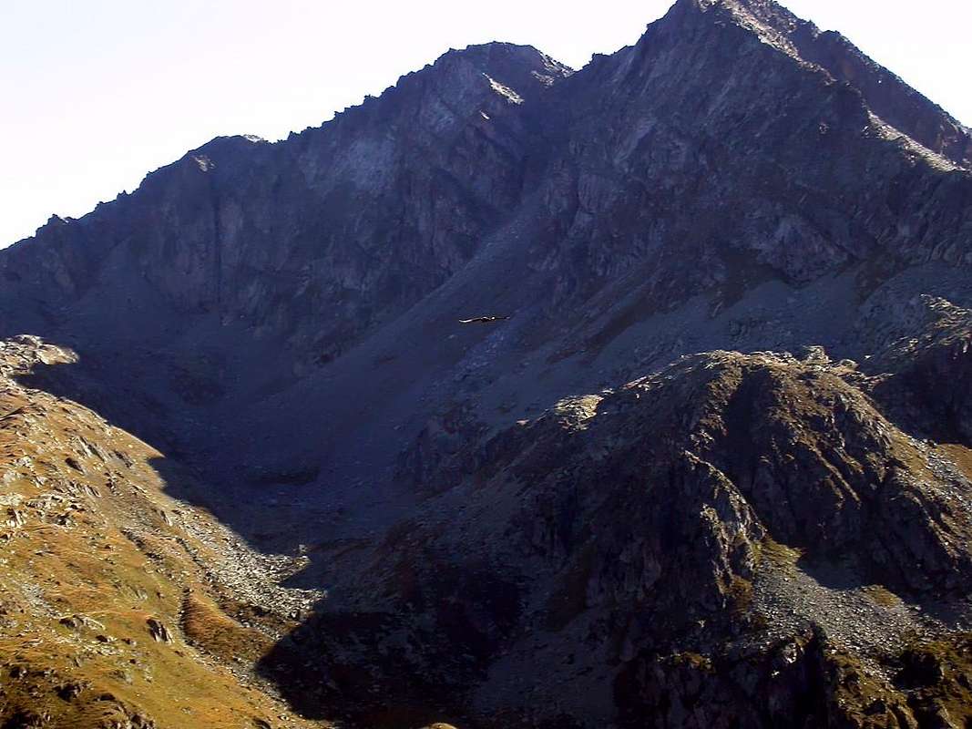
I am the undisputed QUEEN of SKY in the Alps, my flight is Eternal on Rocks and Glaciers,
by SalVal
LEGENDA
In red: paths, routes & main roads;
in green: Summits, Spurs, Buttress, Spires;
in blue: Glaciers, Dams, Lochs, Ponds, Streams, Torrents, Brooks & Fountains;
in purple: Passes, Saddles, Hills, Brèches, Carvings & Collars;
in brown: Historical Remarks, Sanctuaries, Hermitages, Oratories, Castles, Churchs, Chapels, Crosses, Cairns, Tumulus, Mines, Historic Bridges or Roads, Campings, meaning of place names & various informations.
CENTRAL PENNINE ALPS OVERVIEW > to 35° ~ Overview
MONT BLANC/JORASSES/VERTE and 33 MOUNTAIN CHAINS of the AOSTA VALLEY & SURROUNDINGS
AOSTA VALLEY 360° from West to East and from East to West in TOPOGRAPHIC clockwise system and order from Seigne Pass towards Seigne Pass (PARTS A+B+C+D+E+F+G).
THIRD PART :
PART C)- AOSTA VALLEY PARTIAL HALFCIRCULAR NORTHERN PERIMETER (35°~) OUTSIDE AREA.
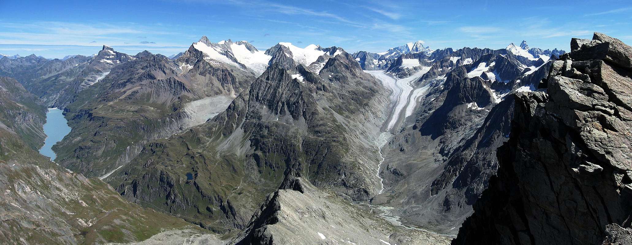
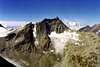
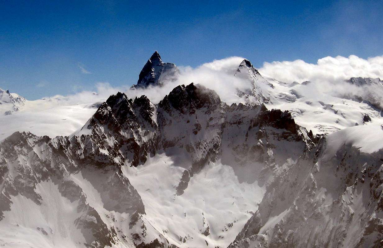
"Eastern Pennine Alps from Becca Rayette to Matterhorn/Mount Rosa, viewed from Knot of Rayette",
by as
![]()
^^^^^^^
This sector of the Pennine Alps, which begin at the Little Petit Ferret Hill at the end of the Chain of Mont Blanc and the Graian Alps therefore, includes the watershed between Italy and Switzerland, which runs from the Ayatse Pass up to the Dent of Hérens. Could be identified as the Pennine Alps Central and Oriental, although the dividing line is somewhat bland and certainly arbitrary, certainly up to the Dent d'Hérens you are experiencing some type of mountains, certainly less striking and well known. Besides the Matterhorn and the Mount Rosa Mountain Chain flaunt great magnificence, a reputation and a higher attendance. So let's call this vast area and as long ridge dividing the Central Pennine Alps, in order to distinguish it from the above mentioned and from the most westward characterized Mount Velan and the giants, however, entirely in Swiss territory, Combins, to constitute the Western Pennine Alps.
This division is different from those carried out by Gino Buscaini in the Series Guide Mounts of Italy C.A.I./T.C.I. "Pennine Alps Vol.II°", 1970 and "Pennine Alps Vol I°", 1971. Were treated in the same two areas: the Petit Ferret Pass (2490m) to Otemma Hill (3211m) and from there to Theodulpass (3317m), immediately after the Matterhorn, respectively aimed at two singles Books Guide. Here it is preferred to consider three areas, namely the Ferret Hill to Ayatse also Oyace Pass, from this to the Matterhorn and Dent d'Hérens in its own right. This division is correct from the standpoint of topographical, since the Ayatse Pass (3061m), even more than that of the Mont Gelé, starts the chain that caters more to the East on the watershed until the Osttiefmattenjoch (3572m), before the pyramid Dent d'Hérens which, in turn, "gives birth" to the South of the Chain Grandes and Petites Murailles, dividing between the Valleys of Valpelline (West) and Valtournanche.
Questo settore delle Alpi Pennine, che inizian al Colle del Petit Ferret al termine della Catena del Monte Bianco e quindi delle Alpi Graie, comprende quello spartiacque tra Italia e Svizzera che va dal Col d'Ayatse insino alla Dent d'Herin. Potrebbe essere identificato come Alpi Pennine Centrali ed Orientali, anche se la linea di demarcazione risulta alquanto blanda e sicuramente arbitraria; certamente fino alla Dent d'Herens si riscontrano un certo tipo di montagne, sicuramente meno eclatanti nonché conosciute. Oltre il Cervino e la grande Catena del Monte Rosa ostentano una magnificenza, una fama ed una frequentazione più elevate.
Chiamiamo quindi questa vasta area e lunga cresta divisoria come Alpi Pennine Centrali, onde distinguerla dalla sopra citata e da quella più verso Occidente caratterizzata dal Mont Velan e dai colossi, però interamente in territorio Svizzero, dei Combins, tale da costituire le Alpi Pennine Occidentali.
Questa divisione é diversa da quelle effettuata da Gino Buscaini nella Collana Guida dei Monti d'Italia C.A.I./T.C.I. "Alpi Pennine Vol.II°", 1970 ed "Alpi Pennine Vol. I°", 1971. Nella medesima venivan trattati due settori: dal Colle del Petit Ferret (2490 m) al Colle di Otemma (3211 m) e da questo al Colle del Teodulo (3317 m), subito dopo il Cervino, rispettivamente rivolti alle due singole Guide. Qui si é preferito prendere in considerazione tre aree, ovvero dal Colle Ferret al Col d'Ayatse oppure di Oyace (3061 m), da questo alla Dent d'Hérens e del Cervino a se stante. Questa divisione risulta corretta dal punto di vista topografico, poiché il Col d'Ayatse, più ancora di quello del Mont Gelé, dà inizio alla catena rivolgentesi più ad Est sullo spartiacque fino allo Osttiefmattenjoch (3572 m), prima della piramide della Dent d'Hérens che, a sua volta, "partorisce" verso Sud la Catena delle Grandes e Petites Murailles, divisoria tra le Valli di Valpelline (Ovest) e Valtournanche.
BETWEEN Valpelline (i) and Bagnes-Otemma / Arolla/Zermatt-Valleise Valleys (S):
From West to East-northeast BETWEEN ITALY and SWITZERLAND from:
Ayatse, Crete Sèche, Chardoney, Rayette, Epicoun, de la Aouille Tseucca, Otemma, Boetta, West and East Blanchen, Oren West and East, Eveque, Collon, Tsa de Tsan, Mount Brulé or Braoulé, Great Arete, Bouquetins, Valpelline, Westtiefmattenjoch, Osttiefmattenjoch.
*** From Dzovenno (1587-1599m)/Ru(z) (1700m) Villages to d1)- AYATSE or AYACE also O(A)YACE Pass (3061m); d2)- CRETE SECHE PASS (3144m); d3)- CHARDON(N)EY PASS (3186m); d3bis)- by BERLON PASS (3009m) to CHARDONEY PASS; d4)- RAYETTE PASS (3319m).
d1)- From Ru(z) (1700m; Parking; fountain; toilettes), by paths ---> n° 1, 2 and 3, along Crete Sèche Torrent (short cut to Berrio di Governo (Government Stone), to crossroads 1870m and from cross by path ---> n° 2, 3, by Northeast direction and partial groundroad to Moulin Torrent in hairpin bend 2074m (short cut in North to source 2249m); through path (source in quota 2140m) to Berrier Alps (2197m; source in quota 2202m). From Alps, by West-northwest direction and path ---> N° 2 to source 2249m, Berrio di Governo, Crete Sèche Refuge (2389m), and along Crete Sèche Torrent Torrent, Franco Spataro Bivouac (2600m~). From bivouac, by North direction and various paths, to cross the Plan de la Sabbla (Sand Tableland) to crossroads in quota 2700m~; from cross, by traces in Northwest direction, Lower Arolletta Glacier and moraine in term. part to Ayatse Pass (3038m).
In descent, by little rocks and moraine, to Crete Sèche Glacier in quota 2825m; to cross in Northeast to quota 2725m (traces from Crete Sèche Pass) and Balme Pass preceding route. Routes for M (EE/A), a good training.
d2)- From Ru(z), by previous paths, to Crete Sèche Refuge, Spataro Bivouac ; through previous route, to crossroads 2700m~. From cross, by North-northeast direction and small path ---> n° 2, near little Lake 2721m and steep traces in term. part, to large Crete Sèche Pass (3144m; great cairn on pass).
In descent, by traces in small debris balconies, to Eastern ramification of Crete Sèche Glacier, in quota 2845m~; by North direction, discontinous traces along the torrent, five ponds to path in quota 2421m. Through Northeast direction to bridge 2380m~, up Otemma Torrent, and preceding route Balma Pass to Chanrion Cabane. Routes for M (EE/A).
Little and GREAT BECCA BLANCHEN, near new SASSA BIVOUAC (2973m), by andrea.it
d3)- From Ru(z) by paths ---> n° 1, 2 and 3 to> crossroads 1870m and from cross by path ---> n° 2 to Crete Sèche Refuge, Spataro Bivouac ; through previous route, to crossroads 2700m~. From cross, by North-northeast direction and little path ---> n° 2, near little Lake 2721m. With Northeast direction, moraine, snowfields to Crete Sèche Plateau, term. part of Pass of Chardonney Glacier in left (Northwest), small path and traces to Chardon(n)ey Pass (3186m).
In descent, through Northeast direction, steep rubbles and little snowfields to Epicoun(e) Glacier in quota 3150m; to cross, through Northeast direction, nearly level route to Southwest Face of Jardin des Chamois. Go down, by moraines, to Otemma Torrent and bridge 2380m. After same route to Chanrion Hut. Routes for MExp., a good training.
d3bis From Ru(z), by paths ---> n° 1, 2 and 3 to crossroads 1870m and from cross, by path ---> n° 2 and 3, to Berrier Alp (2197m; source in quota 2202 m); from alp, by path ---> n° 4 and North direction, along Vertsan Torrent, in small Vertsan Comba, to Chardonney Alp (2520m). From Pastures, by little path, along the torrent, and moraine at base South Ridge of Chardonney Peak in quota 2718m; through very steep moraine, among Cyclopean boulders (really fatiguing!), to rocky strip 40 meters below the Berlon Pass (3009m). Cross, by a narrow unusual cave from right to left (West; II°-; amusing), more easy rocks in terminal part to pass. From pass, by North-northeast direction, small diagonal descent in unsteady and dangerous moraine and steep snowfields (from Chardonney Peak West-northwest Face (rocks falls danger), of Chardonney Pass Glacier, ponds, traces in steep moraine to Chardon(n)ey Pass. Routes for MExp., with a good training.
d4)- From Ru(z), by paths ---> n° 1, 2 and 3, to crossroads 1870m and from cross, by path ---> n° 2 and 3, to Berrier Alp (2197m; source in quota 2202m); from alp, by path ---> n° 4 and North direction, along Vertsan Torrent in little Vertsan Comba, to Chardonney Alp. From alp, by traces, steep moraine in Northeast, narrowing of Chardonney Lower Glacier, crossing in North-northeast, (crevasses; from Mount Cervo West Wall rocks fallings) to Rayette Pass (3319m).
In descent, by North direction, broken rocks and ice slopes(II°/II°+; 40°/45°), to Epicoun Glacier in quota 3245m~ (large bergsrunde); by previous route toward Chanrion Hut. For MExp, a good training.
*** From Chamin (1724m) to d5)- EPICOUN PASS (3233m); d6)- AOUILLE TSEUCCA PASS(3260m); d7)- OTEMMA PASS (3205m); d8)- BRECHE LABIE(E') (3468m); d9)- BOE(U)TTA PASS (3431m); d10)- Western BLANCHEN or BLANTSIN PASS (3512m); d11)- Eastern BLANCHEN or BLANTSIN PASS (3564m).
Little and GREAT BECCA BLANCHEN, near new SASSA BIVOUAC (2973m), by Osw
d5)- From Chamin (1724m), by paths ---> n° 3, 6 to Grand Chamin Alp (2010m; source at 2023m in Northeast); from alp, by North-northwest direction and path ---> n° 6 to Crottes Alps (2183, 2191, 2192m). From alps, through North direction, to quota 2292m and, by Northeast direction, (from Chamin Comba to Sassa Comba, along Sassa Torrent), to Old 2521m Boetta Alp (ruines). From alp, by North direction, steep moraine in Epicoun little Comba and, by traces to narrowing about 2470 metres; to go up, through debris to little rocky basin 2578m. By steep snowfields (35°/38°/42° in term. part at of wall base), or rubbles, to narrow couloir in quota 3015m~; to follow the winding gully, with difficult rocks, before in left to inclined balcony, after in right and, by a much narrow snowy gully, to Epicoun Pass (3233m).
In descent, by a short North-northwest little and very steep Face (45°/50°; verglass possibilities; rocks instables; 65m) towards Aouille Glacier; to cross at moraine in quota 2750m~, near the junction with great Otemma Glacier, and, by moraine along Otemma Torrent, to path in quota 2387m and previous route. For M a good Exp.
d6)- From Chamin and previous route to quota 2427m, near the junction of Otemma/Sassa Torrents; to ford and, by small trace among grassy slopes, along Epicoun Torrent to go up to quota 2656m, narrowing 2810m~ (source of torrent, 2850m~); by North direction, rubbles or snowfields to Epicoun Glacier in quota 3000m~ and at Southeast Wall base, in quota 3075/80m~. By a little and narrow gully (45°/50°; II°/II°+; briefs stretchs III°-; 180m; broken rock) to Aouille Tseucca Pass (3260m).
In descent to traverse 30 metres in left (Southwest) to a little saddle 3240/5m~. and, by a little couloir in right diagonal (37°/42°; 100/10m), to bergsrunde of Aouille Glacier, in quota 3150/5m~; to cross and, by previous route, towards Chanrion Hut. For M Exp, well training.
d7)- From Chamin and preceding route towards Old 2521m Boetta Alp (ruines); from Pasture, by North direction, grassy, moraine, between italian Otemma Torrent/little torrent, in East, excluding of route condition, to narrowing 2880m~; through steep and frontal moraine towards the remains (permafrost effect) of Pass Otemma Pass Glacier. By of moderate incline snowfields at base of South Wall in quota 3100m; before, by a dihedral-couloir, to climb and to keep of the right (below a little waterfall), after to turn in left (West; I°/II°-, a passage II°+) and easily in term. part to Otemma Pass (3205m).
In descent, through North-northeast direction, "en douce pente" in Aiguillettes Glacier to of Aiguillette Sengla or Ceingle(a) Bivouac (3202m; (belt); from bivouac, through terminal part of glacier to Otemma Glacier, in quota 2800m and, by South side to previous routes for Chanrion Hut. .
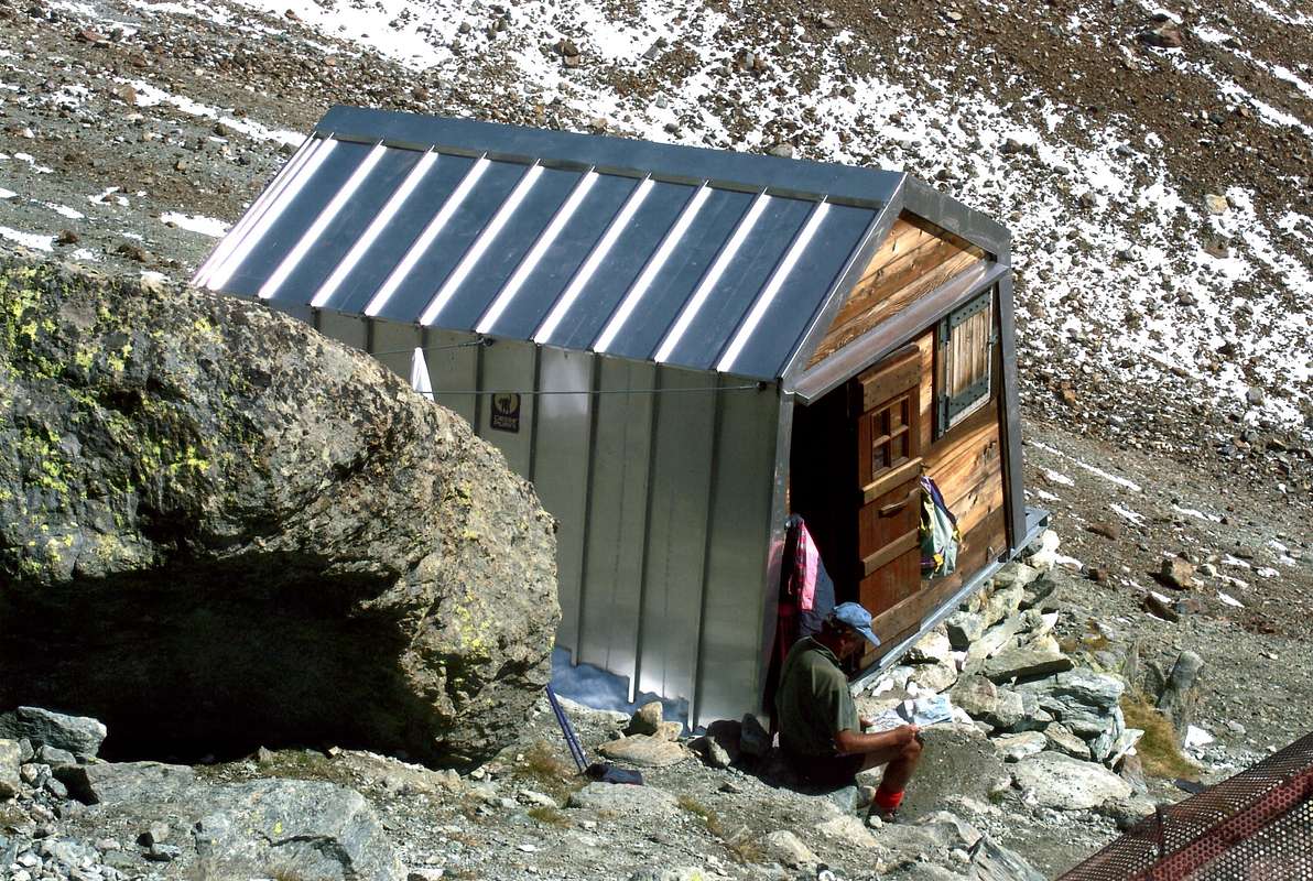
d8)- From Chamin , by paths ---> n° 3, 6 to Grand Chamin Alp (2010m; source at 2023m in Northeast); from alp, by North-northwest direction and path ---> n° 6 to Crottes Alps (2183, 2191, 2192m). >From alps,through North direction to quota 2300m~ and Northeast (from Chamin Comba to Sassa Comba, along Sassa Torrent), to Old 2581m Alp. From alp, by steep path in edge of right lateral moraine, to Sassa Bivouac (2973m; source to 250m~, in moraine Northeast); from bivouac, by moraine, Western Sassa Glacier, steep Southeast Wall (D; 300m; rocks falls danger) to Brèche Labie(é) (3468m).
In descent (rocks falls danger), through steep rocky North-northwest Face (D; 260/70m~) to Aiguillettes-Otemma Glaciers, Chanrion Hut. Routes for M Exp.
d9)- From Chamin, and preceding routes, to Western Sassa Glacier; go up glacier by progressive steep snowfields at South Wall in quota 3225/30m~ (30°/43°) and, by small couloir (55°), difficult rocks (III°/IV°; 225/30m), a very steep snowfield in terminal part (60/5°) to Boe(u)tta Pass (3431m).
In descent (Never made, rocks falls possible) by very steep iceslope, with rocks on the surface. Routes for M a lot of Exp.
d10)- From Chamin, by paths ---> n° 3, 6 to Grand Chamin Alp (2010m; source at 2023m in Northeast); from alp, by North-northwest direction and path ---> n° 6 to Crottes Alps (2183, 2191, 2192m). From pastures, by North direction, to quota 2300m~ and Northeast (from Chamin Comba to Sassa Comba, along Sassa Torrent), to 2581m Alp. From alp, by steep path in edge of right lateral moraine, to Sassa Bivouac (2973m; source to 250m~, in of moraine Northeast). From bivouac, by crossing in moraine, North-northeast direction, steep moraine, easy rocks and a snowy couloir (30°/35°) to Western Blanchen or Blantsin Pass (3512m).
In descent, by North-northwest direction, moderate (30°) slope to bergsrunde in right (East) and cross at first plateau in left (West; between 3200/3125m). After to traverse in quota to Sengla Bivouac and, previous route, to Otemma Glacier, path in quota 2387m, Chanrion Hut (2462m) and previous route. For M a good Exp.
d11)- From Chamin (1724m), by previous routes to Sassa Bivouac; from bivouac, by crossing in Northeast, steep moraine, Eastern Sassa Glacier to Sassa Pass (3256m). From pass, by easy rocks Great Becca Blanchen SW Slope, to Eastern Blanchen Pass(3564m). In descent, by Northwest direction, moderate (30°/32°) slope to bergsrunde in right (East) and cross at first plateau in left (West; between 3200/3125m). After traverse level route to Sengla Bivouac (3202m) and, previous route, to Otemma Glacier, path in quota 2387m, Chanrion Hut and previous route. For M a good Exp.,well training.
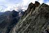
"Eastern Pennine Alps to Matterhorn/Mount Rosa, viewed from Mount Gelé",
by andrea.it
![]()
^^^^^^^
*** From Place(s) Moulin (1980m) to d12)- Prarayer Refuge-Hut (2005m); d12bis)- Departure Variant; d13)- SADDLE 3451m or OREIN Central PASS (3451m); d14)- SADDLE 3480m~ or OREIN Eastern PASS(3480m~); d15)- COLLON PASS (3080m); d16)- TSA de TSAN PASS (3244m); d16bis)- VARIANT. From Aosta Refuge (2788m); d17)- MOUNT BRAOULE PASS (3217m); d17bis)- VARIANT. After Division Pass (3315m) descent; d17ter)- DIRECT VARIANT; d18)- GREAT ARETE PASS (3295m); d19)- BOUQUETIN PASS(3357m); d20)- VALPELLINE PASS (3559m); d21)- WESTTIEFMATTENJOCH (3365m); d22)- OSTTIEFMATTENJOCH (3572m); d22bis)- to Head des Roèses Bivouac (3170m) and from bivouac to OSTTIEF.
d12)- From Place(des) Moulin (1980m; parking; front (1970m) of the Place Moulin artificial Lake, 1958m), by East Northeast direction, dirt road-path ---> n° 9, 10, 11, 12, 13, along the North lake shore, toward La Lé Chapel (+ ), Novailloz, Ley Desot, Prarayer Pastures (1988, 1998, 1961m), Prarayer Refuge-Hut, near the Dam tributaries (from left (North) to right (South) Gran Vanna, Braoulé, Valpelline Buthier, Bella Tsa, Gorge, of Little Mount Dragon (two), Solatset .
d12bis)- Departure Variant: from Place Moulin parking, by same direction, parallel and higher path ---> n° 8 to a second and higher dirt farm road in quota 2128m, near to Dzel Torrent and Pessaou Arp (2117m); continue in quota 2115/20m and to cross a two small torrents (from Little Red Aiguille), a source in quota 2125m, near Bois de Gran Plan (Great Tableland Wood), crossroads 2140m, close to Bas Orein Pasture , towards Prarayer Refuge-Hut. For Hikers and Tourists.
Also from alternative 2140m directly to Dore(i)n Comba, by North-northwest direction, path ---> n° 8; reach, in progression, the Praz Modzon Damon, Grand Orein, Garda Pastures (2153, 2165, 2216m; source), up and near to Orein Torrent. Near the last alp, to cross the torrent in right (East) and, along, to continue in Grand Place Tableland; go up contra Becca Vannetta West Face, close to Orein Lake (2940m). Reach Plan du Gan in quota 2500m~. At the end of tableland, from quota 2510m, amongst three torrents two possibilities:
1)- climb directly in Northwest and, by tiring moraine also quite steep an large snowfield (28°/30°), along two torrents to Higher Orein sources Glacier in quota 2730/80m~. Climb right (East), through a little debris or snowy (35°/38°) gully, in the shape of upside down funnel; to double, by a brief debris flow, a moderate large snowfield (25°/27°), a small snowy passage between little rocky strip the séracs fall. To reach, in quota 3025/100m~, the upper "plateau" and easily, trough moderate snowy slope (20°/25°; 70 m high), to Southwestern Dore(ei)n Pass (3264m).
2)- from quota 2510m to overcrome, by Northwest direction, path ---> n° 8 a very steep and rocky strip 120m high; to traverse the Eastern ramification of Orein Torrent in quota 2650m~ toward Collon Bivouac/Nacamuli Refuge (2818, 2828m), below the Points Orein East Summit. From bivouac-hut, through a long traverse in West and in quota 2850m~, rubbles, moraines or large snowfield (25°, even 32°) at base of narrow gully; go up in West direction and to catch the higher rocky "plateau"-basin in quota 2925/35m~ and previous route
1)-. In descent, by Northwest direction, a brief steep snowy slope with little rocks at base of Sengla North-northeast Face, in quota 3199m of the Little Mount Collon Glacier; to cross and to join with Otemma Glacier, in quota 2850m. between Sengla Northwest Ridge and Little Mount Collon South-southwest Face. Along the last glacier, by West-southwest direction towards the sources/effluents, in quota 2450m.; go down, by traces along the Otemma Torrent, below Grande Lire/Les Tsantons of Otemma rocky promontories to path in quota 2387m and preceding route d2)- . Routes for M Exp; in day, for M Exp, well training.
DESCENT ALTERNATIVES:
a)- to Sengla Bivouac (3202m, close to the Aiguillette), by ascent in South-southwest from quota 2850 metres in Blanchen or Aiguillettes Glaciers;
b)- to Vignettes Hutte (3157m) in Arolla Pigne East Crest, throuhg crossing in North-northeast, Upper Otemma Glacier, near and to Chermontane Pass (3067m);
c)- to Bouquetins Refuge (2983m), by crossing in West of Little Mount Collon Glacier, Eveque Pass (3382m) and traverse in East-northeast direction of Higher Arolla Glacier.
d13)- From Place Moulin, by previous routes, toward Higher Orein Glacier, in quota 3200m~; turn right (Northeast) to Eastern Glacier ramification ,and, by easy snowy slope, below the Orein Becca West Summit South Wall, to Saddle 3451m or Orein Central Pass (3451m), between Orein Becca West/Central Summits.
In descent, through a brief steep part (33°/30°; 55m) and following soft slopes, towards Little Mount Collon Glacier, in quota 3400m; from glacier, by Northeast direction, doubling right (North) the Orein Becca West Summit, at previous route in quota 3200m. Same preceding remarks, connections and observations. Rarely used pass. Routes for M Exp; in day, for MExp, a good training.
d14)- From Place Moulin, through preceding route, towards the outermost border of the Eastern Glacier ramification and, by a brief rocky band, to Saddle 3480m~ or Orein Eastern Pass (3480m~). In descent, by North direction, a hotter and hotter moderate slope, to glacier, in quota 3400m; turn left (West) toward previous route, also in right (Northeast) to Eveque Pass. Same preceding remarks, connections and observations. Seldom utilized pass. Routes for M Exp; in day, for M Exp, well training.
d15)- From Place Moulin to Collon Pass Bivouac/Nacamuli Refuge; from shelters, by Northeast direction, path ---> n° 8 among moraines, stony grounds and snowfields before to Eveque(?) or Orein central ramification Torrent, in quota 2805m; to cross and, by same of ground feature, to Collon Pass (3080m), between Orein Becca East Summit (Quota 3141m)/Collon The Vierge. In descent, by before North (to quota 3060m), after in right (Northeast) to cross the entire Arolla Glacier Northeast ramification, between The Eveque/Eveque Mitre Northeast Buttress and The Vierge North-northeast little Spur to quota 2825m (Bouquetins Refuge; 2934m, 800m~ in East). To continue, by North direction into glacier, leaving the Mitre Glacier in West and Bouquetins Glacier in Northwest to glacier sources, in quota 2625m~; by path in North, to join with path to Bertol Hutte (3311m, in crossroads 2430m~ and, same direction, to road to Arolla Village (1998m) in Aroll> Valley. Haute Route for Mountaineers/Skiers Exp. (BSA)
d16)- From Place Moulin, through preceding routes d12)- ,d12bis)-; continue, same direction and path, toward Bois de Gran Plan, Gran Plan Pasture (2037m), near of tributary little lake; cross twice the Braoulé Torrent, in quota 2027m and 2052m (paths ---> n° 9, in North to Braoulé Comba, up Braoulé Torrent and path ---> n° 11, in East-northeast to Bella Tsa Comba, along Bella Tsa Torrent), near alternative 2067m. Through path ---> n° 10, change in progression before in Northeast, after North direction, along of Valpelline Buthier to crossroads 2475m; turn left (Southwest) and , by path ---> n° 10, to Tsa de Tsan Pasture (2615m). From alp, through West-northwest direction, grassy slope, rubbles, moraine and snowfields, in terminal part, at East-southeast Wall base, in quota 3050m; climb directly by traces and little rocks (I°/I°+; 195m) to Tsa de Tsan Pass (3244m), between Mount Braoulé/Tsa de Tsan Point .
d16bis)- VARIANT. From Aosta Refuge (2788m; see d17)- ) to cross in West, by a brief descent, at Higher Tsa de Tsan Glacier (sources) and lateral right moraine, in quota 2715m; through South direction, of moraine edge (at 550m~), to Tsa de Tsan Alp (2615m). Or, by grassy slope and rubbles, towards, by previous route, quota 2750/75m~, above pasture.
In descent, by Northwest direction, a moderate snowy slope (30°/32°; 60m), at bergsrunde, in quota 3180/5m~; to cross the East ramification of Bouquetins Glacier in Northwest to glacier North-northeast border 2934m and, by a small ascent, to Bouquetins Refuge. Also, always in Northwest, in Otemma Glacier, to previous route d15)- , in quota 2875m. For M Exp. (EE/A).
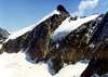
"In Eastern Pennine Alps the brief range between Petit Mont Collon & L'Eveque, viewed from Chermotane Pass",
by as
![]()
^^^^^^^
d17)- From Place Moulin, by preceding routes, to alternative 2476m and, by path ---> n° 10A, along Buthier Torrent, to crosspaths 2525m (in left, or West, the old path); to continue in right (North-northeast), through path in grassy and moraine, going beyond and in progression four Head Valpelline Glacier sources. To cross a rocky strip, before in left (North-northwest), after in right (Northeast) to Aosta Refuge, in promontory between Higher Tsa de Tsan /Head Valpelline Glaciers. From refuge, by North direction, traces in grassy, rubbles and moraine, toward Lower Tsa de Tsan Glacier, in quota 3165m~; to overcome a steep rocky band, by a of small couloirs series (I°+/II°-; 65m~), to Division Pass (3315m). From pass, by a small snowy descent, to Middle Tsa de Tsan Glacier, in quota 3280m~; cross in brief and easy descent, by West direction, in quota 3230/3200m~, below the Division Rochers. To go beyond, by 3100m level route, up great séracs fall (dangerous crevices in North!); go up, by progressive South-southwest direction, to narrowing 3120m, between Great Crest Point East Wall and Tsa de Tsan Point Northeast Spur. By moderate snowy slopes with rises, snowy "humps", small walloons to Mount Braoulé Pass (3217m), between Tsa de Tsan Point/Grande Arete Point.
In descent, by South-southwest direction, a moderate snowy slope, with debris, to bergsrunde, in quota 3150m (30°/35°; 65/70m); by a brief digression in West-southwest to preceding route d16)-, in quota 3000m. For M Exp. (EE/A), well training.
d17bis)- VARIANT. After Division Pass descent, by a more large tour in North-northwest level route 3200m, against of Bouquetins Dents, Central Summit East-northeast Ridge; to cross, by South direction, moderates snowy slopes of glacier to previous route (crevices!).
d17ter)- DIRECT VARIATION. From fork paths 2520m also from Aosta Refuge in descent towards the cross, by Northwest direction, rubbles and moraine, before along Tsa de Tsan Torrent, after at, of Tsa de Tsan Point, East Wall base, in quota 2715m; to climb by a steep snowy gully or his shores (38°/40°; I°/II°-; 500m; cairns; delicate). To cross, by a debris and steep balcony, 115m~ in right; in term. part exit out near quota 3130m (cairn) and to join with preceding glacier route. For M a good Exp or for Hunters Exp.
d18)- From Place Moulin to Aosta Refuge and from refuge, through preceding routes 17)-, 17bis)- at Northeast Slope base, in quota 3250m, near Grande Arete Point Northeast Ridge; climb the large snowy couloir to keep oneself in right (North) for to avoid rocks fallings (38°, even 43°; 545m) toward Great Arete Pass (3295m), between Great Arete Point/Barnes Point-Great Crest.
In descent, by West direction, a narrow and winding gully (45°/40°; 120m; verglass presence and rocks falls possibilities) to Arolla Glacier Eastern ramification, in quota 3175m. Before directly, after turn left (Southwest), in quota 2975m~ and to rejoin the previous route d17)-, in quota 2900m~. Routes for M a lot of Exp; in day ascent from Place Moulin, for M lots of Exp. and a good training.
d19)- From Place Moulin to Aosta Refuge and from refuge, through North-northwest direction, preceding route 17bis)-, small descent into Upper Tsa de Tsan Glacier, in quota 3265m~; to cross contra a rocky strip, below the Hanging Tsa de Tsan Glacier. Climb easily, by, before left diagonal after right, small and broken rocks (I°), rubbles to a small basin preceding the Bouquetins Pass (3357m).
In descent, by North-northwest direction, moderate slopes of Mount Miné Glacier to Bertol Dent North Summit, at North Ridge base in quota 3230m~; turn right (North) and, by a brief ascent to Bertol Hutte (3311m). From cabin, by Southwest direction, Bertol Pass, crossing Bertol Glacier, path, fork paths 2430m~ to previous route d15)-. For MExp. (EE/A), well trainings.
d20)- From Place Moulin to Aosta Refuge and from refuge, by North-northwest direction, previous routes 17bis)- and d19)- , brief descent in Upper Tsa de Tsan Glacier, in quota 3300m~; turn right (Northeast) and, by moderate and uniform slope (25°/30°; crevasses in North and everywhere in higher icebasin), to "aim" at Tete Blanche (White Head) South-southeast Face base, in quota 3500m~. In right (East), easily in terminal part to Valpelline Pass.
In descent, by North-northeast direction, in Higher Stockjigletscher, constant and easy slope, up White Head-Hérens Pass, in quota 3250m~; turn right (East-northeast) at of Stockji Summit Southwestern small Spur base, in quota 3041m. Go down directly, by a steady path, debris, small rocks and snowfields to Tiefmattengletscher left lateral moraine, in quota 2630m~. Descend in edge, by North-northeast direction, doubling in right (North) the base Stockji Northeast little Spur, in quota 2620m~. By North-northeast direction, to cross the Schonbielgletscher and, by a small trace, to Schonbielhutte (2694m). From hutte, by East-northeast direction, path, along the border of Zmuttgletschers left lateral moraine, toward Hohle Bielen (2429m), road, Hotel Stafelalp (2199m), Stafel Alps, Zermatt (1763m). Haute Route for Mountaineers/Skiers Exp. (BSA)
d21)- From Place Moulin to Aosta Refuge (2788m) and from refuge, by Southeast direction, path to under depression, in quota 2730/40m~; to cross a small torrent and, by traces, to go up frontally the of Valpelline Head Glacier lateral right moraine. Climb in edge entirely, by East-northeast direction, at basal snowfields above Valpelline Head Southwest Face; turn right (Southeast) toward of Valpelline Head Lower Glacier, in quota 3110/20m~, near Silvano Rocher (3160m). Supere, before in left diagonal, after directly, or by brief halfcircular digression in North (séracs and crevasses), a of séracs area from quota 3175m to quota 3325m~ in Western and Higher ramification of Great Murailles Glacier, between Silvano Rocher and Valpelline Head S-SE Edge. Turn left (Northeast) and, through moderate slope (28°/32°), at South-southwest Face bergsrunde, in quota 3445m~; go up left/right, by a sinuous and brief snowy couloir with little rocks (35°/42°; I°+; verglass and summital cornices possibilities) to Westtiefmattenjoch (3365m), between of Valpelline Head Southeast Ridge and Quota 3602m.
In descent, by North-northeast direction, a snowy and very steep slope (55°/48°; 175m; verglass possibilities) to bergsrunde into Tiefmattengletscher, in quota 3390m~. Cross, by North-northeast direction, moderate slope, contra Valpelline Head Northeast long Buttress to narrowing in quota 3125m~ (séracs fall to East); through a complex gully among the séracs, or a rocky diagonal balcony in right (rocks fallings danger) to Middle Tiefmattengletscher, in "plateau", quota 3040m~. Cross, by North-northeast direction, level route to a "large narrowing" 2952m~, between a rocky band in left North) and a rocky islet in East, the first séracs fall and Lower Tiefmattengletscher lateral left moraine. Go down, by North direction, traces, Stockjigletscher right moraine and, by a brief ascent, to Schonbielhutte (2694m). From hutte, by previous route d20)- to Stafel Alps, Zermatt (1763m). Routes for M a lot of Exp; in day ascent from Place Moulin, for M lots of Exp. and a good training.
d22)- From Place Moulin to Aosta Refuge (2788m) and from refuge, by preceding route d21)-, toward Western and Higher ramification of Greats Murailles Glacier, between Silvano Rocher and Valpelline Head South-southeast Edge. Continue and, by same direction, "sweet" slope towards quota 3400m~; turn left (Northeast) and, through moderate snowy slope, with a small easy rocks in final part, to Ostiefmattenjoch (3572m).
In descent, by North-northwest direction, steep gully (60°, even 65°; verglass, ice falls from Dents d'Hérens West-northwest Face, rocks fallings possibilities) into Tiefmattengletscher, in quota 3400m~. To cross, by North direction, doubling left (West) Dents d'Hérens West-nothwest Edge, South ramification at base 3351m (dangerous: rocks falls possibilities);
to descend through:
1)- directly to Dents d'Hérens Northwest Ridge at base 3160m~ (more easy, but more dangerous: rocks and ice falls possibilities) and moderate snowy slope toward previous route d21)- in "plateau";
2)- by North-northeast direction, esily, (crevasses) snowy tableland crossing (preceding route d21)-) to narrowing, in quota 3125m. In ascent for M (EE/A); in day from Place Moulin for M a good training.
In descent for M a really Exp. and very good. NEVER MADE?.
d22bis)- From Place Moulin, by previous route d17)- and others by path ---> n° 10 to quota 2230m~, between two ramifications of Tete des Roèses Torrent; from the tableland, by East-northeast direction, grassy slopes, rocks and debris steep gully, balconies along the torrent (non forced passages; II°, after I°/I°+; search abilities) to Head des Roèses Bivouac (3170m). From bivouac, by rubbles reach the Greats Murailles Glacier, in quota 3220m~ and, by North direction, to rocky islet 3468m; double in left among numerous crevasses (dangerous) and continue to a second islet (3495m; again many crevices and very dangerous). Level route in quota 3500m~, to rejoin previous route d22)-, near a mini ponds about 3485/95m~. Long and wild route for M a lot of Exp.
into VALPELLINE Valley (amongst Valpelline, Oyace and Bionaz Communes).
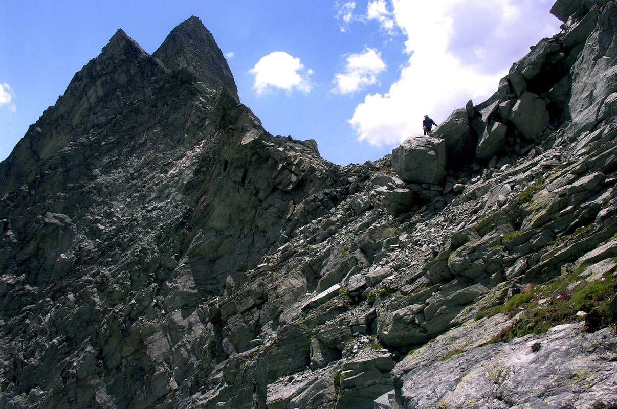
"Eastern Pennine Alps from Becca Rayette to Matterhorn/Mount Rosa, viewed from Knot of Rayette",
by andrea.it
![]()
^^^^^^^
27) Mont Berlon/Quote 3119, 3088, 2931, 2937, 2922m/Mont de Crete Sèche/Quote2907, 2902, 2893, 2543m.Becca Chardoney West, Central, NE Summits/Noeud de la Rayette/Becca Rayette/Pointes Jardin des Chamois (Quote various, the major 3271m); Monte Cervo also Serf/Quote various, the major 3384m/Pic or Gendarme de Charmontane/Tour de la Tsa/Tsa Crest/Mont de la Tsa; Mont Charmontane/Quote various, the major 2819m. Becca Picion or Becca des Pecons/Dents d'Epicoun/Petit Epicoun also Punta Maria Luisa Balestreri/Grand Epicoun also Grand Pecon; Berger de la Sassa; Petite Aouille; Aouille TSEUCCA little Groups;
"Western (to left), Central & Eastern Pennine Alps from Mount Velan/Great Combin to Aouille Tseucca/Matterhorn, viewed from Becca of Viou",
by emilius
![]()
^^^^^^^
28)- Grand Becca Blanchen/La Sengla; Punta Marcel Kurz/Becca Vannetta/Gran Vanna;/Tetes Chavanne/Blanche/Tete de Valpelline Groups.
GREAT TRAVERSE or Tour of Tsa de Tsan Basin: Division Pass-Tête de Valpelline-Tête Blanche-Tête de Chavanne-Division Pass on JULY 04th, 1976, in day from Place Moulin
![]()
![]()
From Berlon Pass little ramification to South: Mont Berlon - Mont de Crete Sèche - Crete Sèche Refuge in South-southwest. Great ramification to Northeast: Pic Chardoney - Becca Chardoney (West, Central, East Summits) - Noeud de la Rayette (Rayette Knot) - Becca Rayette little Area.
Ramification to South: Monte Cervo or Serf - Pic or Gendarme de Charmontane - Tour de la Tsa - Crète de la Tsa - Mont de la Tsa; Mont Charmontane. Great ramification to Northeast: from large Saddle 3360m Becca Picion or Becca des Pecons - Denti d'Epicoun or Dents des Pecons also Epicoun Jags - P. Maria Luisa or Petit Pecon - Grand Epicoun or Grand-Pecon; Berger de la Sassa - Quota 3457m or Aouille Tseucca Yellow Gendarmes - Aouille Tseucca (*) Area: Petite Aouille, to Otemma Pass.
![]()
![]()
From Otemma Pass Becca Labié - Sassa Bivouac in Southeast - Becca della Sassa. To North: L'Aiguillette - Aiguillettes of Sengla or Ceingla (Belt Chain) Bivouac - Punta Boetta - Little and Grand Becca Blanchen - Mont Dragon - Sengla Subgroup (South, Central, North Summits). Ramifications to Soutwest and to Southeast: from Sassa Pass to Becca des Lacs - Nez of Becca (Nose) - Becca Bovet or Mont Rouge - Pointe Nourissat - Pointe Marguerettaz- Punta Ollietti - Pointe Balliano - Tetes, Mont Rouge Lakes to East. Ramification to Southwest: from Mont Rouge - Becca Chatelé. To from Lacs Pass to Aiguilles Rouges and Blanches des Lacs - Mort Lake (Dead Lake) and Little Mort Lake - Petite Aiguille Rouge above Place Moulin great artificial Lake or Dam - (+; La Lé Chapel). To South: Pointe Gerlach and Long Lake. Continuation of the great ramification to East-northeast: from d'Oren or d'Orein Western Pass to Cime d'Oren (West, Central, East) - Collon Pass Bivouac and Nacamuli Refuge to South. To North: from Petit Mont Collon Pass Petit Mont Collon. To To Northeast: from l'Eveque Pass L'Eveque - Mitre de l'Eveque - Chancelier - Mont Collon. To To East: from Collon Pass to la Vierge - Marcel Kurz Point and ramification in the shape of an arc to Southwest: Pointe du Laurier Noir - Becca Vannetta - Punta Merendi - Gran Vanna above Prarayer Refuge. To South-southeast: Mont Braoulé - Aiguille de Lancien - Pointe and Becca des Neies also Noires. Continuation of the great ramification to Northeast: from Tsa de Tsan Pass Pointe de Tsa de Tsan - Pointe de la Grande Arete - Grande Arete - Pointe Barnes - Bouquetins Refuge in Southwest - DENTS des BOUQUETINS (South, Central *, North Summits) Area: Aosta Refuge in Southeast below the Rocher de la Division and Pass; Rocher Silvano to Southeast.
From Bouquetins Pass: Petite Tete Blanche or Tete de Chavannes - Tete Blanche to Valpelline Pass; from Pass to Southeast: Tete de Valpelline Area. And from and Head to Tiefenmatten Western and Eastern Pass.
![]()
Mountain Chains & action Colorphotos, colorpictures, B&W photographs, by Antonio GIANI & Emilio BERTONA.
Besides, Action photos & other by various AUTHORS & WRITERS:
"Tête de Valpelline", by as;
"LITTLE and GREAT BECCA BLANCHEN", by Osvaldo CARDELLINA;
"Valpelline Head (3796m) & Tsa de Tsan Glacier on 1976", by Marco COSSARD;
"Aquila reale (La Thuile), by SalVal;
"The Becca de Chardoney", by andrea.it;
"Becca Rayette", by andrea.it;
"Wide view..", by andrea.it;
"Col de Chermotane", by as;
"Where does the West Pennine and begin the Central", by Marco COSSARD "Crevassino";
"The Sabre's Rayette", by Marco COSSARD "Crevassino";
"The end of the Dents d’Ayace...", by ronfo;
"Monte Cervo", by SalVal;
"Grand Combin from Becca...", by Gabriele ROTH (gabriele).
"Voyages dans les Alpes", by Horace Bénedict De Saussure, Tome I 1779, Tome IV 1796;
"Manuel du voyageur en SUISSE et à Chamonix" - Nouvel Ebel, by Adolphe Joanne, Second Edition 1859;
"La Vallée d'Aoste", by Edoard Aubert, 1860;
"A Handbook for Travellers in Switzerland, Savoye, and Piedmont", by John Murray, Twelfth Edition 1867;
"Studi sul Gruppo del Gran Paradiso", by Martino Baretti, 1867;
"Historique de la Vallée d'Aoste", by Jean Baptiste De Tillier, 1888;
"Climbers' Guide to the Central Pennine Alps", by William Martin Conway, 1890;
"The Mountains of Cogne", by George Yeld and W.A.B. Coolidge, 1893;
"Guida delle Alpi Occidentali Vol. II°, Parte 2°, by Giovanni Bobba and Luigi Vaccarone, 1896;
"Scrambles in the Eastern Graians 1878-1897", by George Yeld, 1900;
"Nel Regno del Cervino", by Edmondo De Amicis, 1905;
"Les Alpes Occidentales", by Federico Sacco, 1913;
"Guide du Valpelline", by Abbot Joseph Maria Henry, 1925;
"Le Alpi Pennine", by Silvio Saglio, 1951;
"La Luce delle vette", by Francesco Cavazzani, 1954;
"Guida della Regione Autonoma della Valle d'Aosta", by Mario Aldrovandi, 1964;
Monte Marzo e la cresta dal Colle dei Corni al Colle di Valbella", by Piero Falchetti, 1966;
"Dal Bec d'le Steje alla Cima Battaglia", by Piero Falchetti, 1968;
"Gran Paradiso - itinerari scelti", by Roberto Mantovani and Renato Misischi, 1974;
"80 itinerari di escursionismo alpinismo sci alpinismo in valle d'aosta", by Osvaldo Cardellina, 1977;
"Guida del Monte Emilius, by Osvaldo Cardellina, 1978.
C.A.I./T.C.I. Collana Guide dei Monti d'Italia-Italy of the Mounts Guides SERIES, Volumes:
"Monte Rosa", by Sivio Saglio and Felice Boffa, 1960;
"Gran Paradiso", by Emanuele Andreis, Renato Chabod and Mario Carlo Santi, 1939; Reprint 1963;
"Monte Bianco Volume I°", by Renato Chabod, Laurent Grivel and Silvio Saglio, 1963;
"Aggiornamenti alla Guida del Gran Paradiso (Seconda Edizione)", by Renato Chabod and Piero Falchetti, 1964;
"Monte Bianco Volume II°", by Renato Chabod, Laurent Grivel, Sivio Saglio and Gino Buscaini, 1968;
"Alpi Pennine Volume II°", by Gino Buscaini, 1970;
"Alpi Pennine Volume I°, by Gino Buscaini, 1971;
"Gran Paradiso", by Emanuele Andreis, Renato Chabod and Mario Carlo Santi, Third Edit. with revisions and collaborations by Renato Chabod, Ugo Manera and Corradino Rabbi, 1980;
"Alpi Graie Centrali", by Alessandro Giorgetta, 1985;
"Monte Rosa e Mischabel", by Gino Buscaini, 1991;
"Monte Bianco Volume I°", by Gino Buscaini, 1994;
"Emilius Rosa dei Banchi Parco del M. Avic", by Giulio Berutto and Lino Fornelli, 2005;
BASE MAPS
• L'Escursionista Carta dei Sentieri n° 5 "Gran San Bernardo Ollomont" 1:25.000.
• L'Escursionista Carta dei Sentieri n° 6 "Valpelline Saint-Barthélemy" 1:25.000.
• L'Escursionista Carta dei Sentieri n° 7 "Valtournenche Monte Cervino Val d'Ayas ovest" 1:25.000.
• Kompass "Breuil/Cervinia-Zermatt" Carta turistica 1:50.000.
• I.G.C. Istituto Geografico Centrale Torino "Cervino e Monte Rosa" 1:50.000.
• CNS "Valpelline" 1:25.000.
• Cartoguide ALP "Cervino n° 4", Azienda di Promozione Turistica Monte Cervino, Ediz. Vivalda Editori - Ingenia, 1999 1:35.000.
• "Carta Turistica della Valle d'Aosta", della Regione Autonoma della Valle d'Aosta Assessorato al Turismo, a cura di Alessio Nebbia; Istituto Geografico De Agostini Novara, 1957 1.100.000.
AOSTA VALLEY 360° from West to East and from East to West in TOPOGRAPHIC clockwise system and order from Seigne Pass towards Seigne Pass (PARTS A+B+C+D+E+F+G).
THIRD PART :
PART C)- AOSTA VALLEY PARTIAL HALFCIRCULAR NORTHERN PERIMETER (35°~) OUTSIDE AREA.
by as
This sector of the Pennine Alps, which begin at the Little Petit Ferret Hill at the end of the Chain of Mont Blanc and the Graian Alps therefore, includes the watershed between Italy and Switzerland, which runs from the Ayatse Pass up to the Dent of Hérens. Could be identified as the Pennine Alps Central and Oriental, although the dividing line is somewhat bland and certainly arbitrary, certainly up to the Dent d'Hérens you are experiencing some type of mountains, certainly less striking and well known. Besides the Matterhorn and the Mount Rosa Mountain Chain flaunt great magnificence, a reputation and a higher attendance. So let's call this vast area and as long ridge dividing the Central Pennine Alps, in order to distinguish it from the above mentioned and from the most westward characterized Mount Velan and the giants, however, entirely in Swiss territory, Combins, to constitute the Western Pennine Alps.
This division is different from those carried out by Gino Buscaini in the Series Guide Mounts of Italy C.A.I./T.C.I. "Pennine Alps Vol.II°", 1970 and "Pennine Alps Vol I°", 1971. Were treated in the same two areas: the Petit Ferret Pass (2490m) to Otemma Hill (3211m) and from there to Theodulpass (3317m), immediately after the Matterhorn, respectively aimed at two singles Books Guide. Here it is preferred to consider three areas, namely the Ferret Hill to Ayatse also Oyace Pass, from this to the Matterhorn and Dent d'Hérens in its own right. This division is correct from the standpoint of topographical, since the Ayatse Pass (3061m), even more than that of the Mont Gelé, starts the chain that caters more to the East on the watershed until the Osttiefmattenjoch (3572m), before the pyramid Dent d'Hérens which, in turn, "gives birth" to the South of the Chain Grandes and Petites Murailles, dividing between the Valleys of Valpelline (West) and Valtournanche.
Questo settore delle Alpi Pennine, che inizian al Colle del Petit Ferret al termine della Catena del Monte Bianco e quindi delle Alpi Graie, comprende quello spartiacque tra Italia e Svizzera che va dal Col d'Ayatse insino alla Dent d'Herin. Potrebbe essere identificato come Alpi Pennine Centrali ed Orientali, anche se la linea di demarcazione risulta alquanto blanda e sicuramente arbitraria; certamente fino alla Dent d'Herens si riscontrano un certo tipo di montagne, sicuramente meno eclatanti nonché conosciute. Oltre il Cervino e la grande Catena del Monte Rosa ostentano una magnificenza, una fama ed una frequentazione più elevate.
Chiamiamo quindi questa vasta area e lunga cresta divisoria come Alpi Pennine Centrali, onde distinguerla dalla sopra citata e da quella più verso Occidente caratterizzata dal Mont Velan e dai colossi, però interamente in territorio Svizzero, dei Combins, tale da costituire le Alpi Pennine Occidentali.
Questa divisione é diversa da quelle effettuata da Gino Buscaini nella Collana Guida dei Monti d'Italia C.A.I./T.C.I. "Alpi Pennine Vol.II°", 1970 ed "Alpi Pennine Vol. I°", 1971. Nella medesima venivan trattati due settori: dal Colle del Petit Ferret (2490 m) al Colle di Otemma (3211 m) e da questo al Colle del Teodulo (3317 m), subito dopo il Cervino, rispettivamente rivolti alle due singole Guide. Qui si é preferito prendere in considerazione tre aree, ovvero dal Colle Ferret al Col d'Ayatse oppure di Oyace (3061 m), da questo alla Dent d'Hérens e del Cervino a se stante. Questa divisione risulta corretta dal punto di vista topografico, poiché il Col d'Ayatse, più ancora di quello del Mont Gelé, dà inizio alla catena rivolgentesi più ad Est sullo spartiacque fino allo Osttiefmattenjoch (3572 m), prima della piramide della Dent d'Hérens che, a sua volta, "partorisce" verso Sud la Catena delle Grandes e Petites Murailles, divisoria tra le Valli di Valpelline (Ovest) e Valtournanche.
Getting There
By car:- From TORINO, MILANO Cities, etc: Motorway A5. Exit at AOSTA East
C1)- *** ALL EXTERNAL PASS, saddles, brèches, collars, "carvings" & ROUTES from AOSTA's VALLEY to SWITZERLAND
C1)- *** ALL EXTERNAL PASS, saddles, brèches, "carvings" and ROUTES from AOSTA VALLEY to SWITZERLAND.BETWEEN Valpelline (i) and Bagnes-Otemma / Arolla/Zermatt-Valleise Valleys (S):
From West to East-northeast BETWEEN ITALY and SWITZERLAND from:
Ayatse, Crete Sèche, Chardoney, Rayette, Epicoun, de la Aouille Tseucca, Otemma, Boetta, West and East Blanchen, Oren West and East, Eveque, Collon, Tsa de Tsan, Mount Brulé or Braoulé, Great Arete, Bouquetins, Valpelline, Westtiefmattenjoch, Osttiefmattenjoch.
*** From Dzovenno (1587-1599m)/Ru(z) (1700m) Villages to d1)- AYATSE or AYACE also O(A)YACE Pass (3061m); d2)- CRETE SECHE PASS (3144m); d3)- CHARDON(N)EY PASS (3186m); d3bis)- by BERLON PASS (3009m) to CHARDONEY PASS; d4)- RAYETTE PASS (3319m).
d1)- From Ru(z) (1700m; Parking; fountain; toilettes), by paths ---> n° 1, 2 and 3, along Crete Sèche Torrent (short cut to Berrio di Governo (Government Stone), to crossroads 1870m and from cross by path ---> n° 2, 3, by Northeast direction and partial groundroad to Moulin Torrent in hairpin bend 2074m (short cut in North to source 2249m); through path (source in quota 2140m) to Berrier Alps (2197m; source in quota 2202m). From Alps, by West-northwest direction and path ---> N° 2 to source 2249m, Berrio di Governo, Crete Sèche Refuge (2389m), and along Crete Sèche Torrent Torrent, Franco Spataro Bivouac (2600m~). From bivouac, by North direction and various paths, to cross the Plan de la Sabbla (Sand Tableland) to crossroads in quota 2700m~; from cross, by traces in Northwest direction, Lower Arolletta Glacier and moraine in term. part to Ayatse Pass (3038m).
In descent, by little rocks and moraine, to Crete Sèche Glacier in quota 2825m; to cross in Northeast to quota 2725m (traces from Crete Sèche Pass) and Balme Pass preceding route. Routes for M (EE/A), a good training.
d2)- From Ru(z), by previous paths, to Crete Sèche Refuge, Spataro Bivouac ; through previous route, to crossroads 2700m~. From cross, by North-northeast direction and small path ---> n° 2, near little Lake 2721m and steep traces in term. part, to large Crete Sèche Pass (3144m; great cairn on pass).
In descent, by traces in small debris balconies, to Eastern ramification of Crete Sèche Glacier, in quota 2845m~; by North direction, discontinous traces along the torrent, five ponds to path in quota 2421m. Through Northeast direction to bridge 2380m~, up Otemma Torrent, and preceding route Balma Pass to Chanrion Cabane. Routes for M (EE/A).
 |
d3)- From Ru(z) by paths ---> n° 1, 2 and 3 to> crossroads 1870m and from cross by path ---> n° 2 to Crete Sèche Refuge, Spataro Bivouac ; through previous route, to crossroads 2700m~. From cross, by North-northeast direction and little path ---> n° 2, near little Lake 2721m. With Northeast direction, moraine, snowfields to Crete Sèche Plateau, term. part of Pass of Chardonney Glacier in left (Northwest), small path and traces to Chardon(n)ey Pass (3186m).
In descent, through Northeast direction, steep rubbles and little snowfields to Epicoun(e) Glacier in quota 3150m; to cross, through Northeast direction, nearly level route to Southwest Face of Jardin des Chamois. Go down, by moraines, to Otemma Torrent and bridge 2380m. After same route to Chanrion Hut. Routes for MExp., a good training.
d3bis From Ru(z), by paths ---> n° 1, 2 and 3 to crossroads 1870m and from cross, by path ---> n° 2 and 3, to Berrier Alp (2197m; source in quota 2202 m); from alp, by path ---> n° 4 and North direction, along Vertsan Torrent, in small Vertsan Comba, to Chardonney Alp (2520m). From Pastures, by little path, along the torrent, and moraine at base South Ridge of Chardonney Peak in quota 2718m; through very steep moraine, among Cyclopean boulders (really fatiguing!), to rocky strip 40 meters below the Berlon Pass (3009m). Cross, by a narrow unusual cave from right to left (West; II°-; amusing), more easy rocks in terminal part to pass. From pass, by North-northeast direction, small diagonal descent in unsteady and dangerous moraine and steep snowfields (from Chardonney Peak West-northwest Face (rocks falls danger), of Chardonney Pass Glacier, ponds, traces in steep moraine to Chardon(n)ey Pass. Routes for MExp., with a good training.
d4)- From Ru(z), by paths ---> n° 1, 2 and 3, to crossroads 1870m and from cross, by path ---> n° 2 and 3, to Berrier Alp (2197m; source in quota 2202m); from alp, by path ---> n° 4 and North direction, along Vertsan Torrent in little Vertsan Comba, to Chardonney Alp. From alp, by traces, steep moraine in Northeast, narrowing of Chardonney Lower Glacier, crossing in North-northeast, (crevasses; from Mount Cervo West Wall rocks fallings) to Rayette Pass (3319m).
In descent, by North direction, broken rocks and ice slopes(II°/II°+; 40°/45°), to Epicoun Glacier in quota 3245m~ (large bergsrunde); by previous route toward Chanrion Hut. For MExp, a good training.
*** From Chamin (1724m) to d5)- EPICOUN PASS (3233m); d6)- AOUILLE TSEUCCA PASS(3260m); d7)- OTEMMA PASS (3205m); d8)- BRECHE LABIE(E') (3468m); d9)- BOE(U)TTA PASS (3431m); d10)- Western BLANCHEN or BLANTSIN PASS (3512m); d11)- Eastern BLANCHEN or BLANTSIN PASS (3564m).
 |
d5)- From Chamin (1724m), by paths ---> n° 3, 6 to Grand Chamin Alp (2010m; source at 2023m in Northeast); from alp, by North-northwest direction and path ---> n° 6 to Crottes Alps (2183, 2191, 2192m). From alps, through North direction, to quota 2292m and, by Northeast direction, (from Chamin Comba to Sassa Comba, along Sassa Torrent), to Old 2521m Boetta Alp (ruines). From alp, by North direction, steep moraine in Epicoun little Comba and, by traces to narrowing about 2470 metres; to go up, through debris to little rocky basin 2578m. By steep snowfields (35°/38°/42° in term. part at of wall base), or rubbles, to narrow couloir in quota 3015m~; to follow the winding gully, with difficult rocks, before in left to inclined balcony, after in right and, by a much narrow snowy gully, to Epicoun Pass (3233m).
In descent, by a short North-northwest little and very steep Face (45°/50°; verglass possibilities; rocks instables; 65m) towards Aouille Glacier; to cross at moraine in quota 2750m~, near the junction with great Otemma Glacier, and, by moraine along Otemma Torrent, to path in quota 2387m and previous route. For M a good Exp.
d6)- From Chamin and previous route to quota 2427m, near the junction of Otemma/Sassa Torrents; to ford and, by small trace among grassy slopes, along Epicoun Torrent to go up to quota 2656m, narrowing 2810m~ (source of torrent, 2850m~); by North direction, rubbles or snowfields to Epicoun Glacier in quota 3000m~ and at Southeast Wall base, in quota 3075/80m~. By a little and narrow gully (45°/50°; II°/II°+; briefs stretchs III°-; 180m; broken rock) to Aouille Tseucca Pass (3260m).
In descent to traverse 30 metres in left (Southwest) to a little saddle 3240/5m~. and, by a little couloir in right diagonal (37°/42°; 100/10m), to bergsrunde of Aouille Glacier, in quota 3150/5m~; to cross and, by previous route, towards Chanrion Hut. For M Exp, well training.
d7)- From Chamin and preceding route towards Old 2521m Boetta Alp (ruines); from Pasture, by North direction, grassy, moraine, between italian Otemma Torrent/little torrent, in East, excluding of route condition, to narrowing 2880m~; through steep and frontal moraine towards the remains (permafrost effect) of Pass Otemma Pass Glacier. By of moderate incline snowfields at base of South Wall in quota 3100m; before, by a dihedral-couloir, to climb and to keep of the right (below a little waterfall), after to turn in left (West; I°/II°-, a passage II°+) and easily in term. part to Otemma Pass (3205m).
In descent, through North-northeast direction, "en douce pente" in Aiguillettes Glacier to of Aiguillette Sengla or Ceingle(a) Bivouac (3202m; (belt); from bivouac, through terminal part of glacier to Otemma Glacier, in quota 2800m and, by South side to previous routes for Chanrion Hut. .
d8)- From Chamin , by paths ---> n° 3, 6 to Grand Chamin Alp (2010m; source at 2023m in Northeast); from alp, by North-northwest direction and path ---> n° 6 to Crottes Alps (2183, 2191, 2192m). >From alps,through North direction to quota 2300m~ and Northeast (from Chamin Comba to Sassa Comba, along Sassa Torrent), to Old 2581m Alp. From alp, by steep path in edge of right lateral moraine, to Sassa Bivouac (2973m; source to 250m~, in moraine Northeast); from bivouac, by moraine, Western Sassa Glacier, steep Southeast Wall (D; 300m; rocks falls danger) to Brèche Labie(é) (3468m).
In descent (rocks falls danger), through steep rocky North-northwest Face (D; 260/70m~) to Aiguillettes-Otemma Glaciers, Chanrion Hut. Routes for M Exp.
d9)- From Chamin, and preceding routes, to Western Sassa Glacier; go up glacier by progressive steep snowfields at South Wall in quota 3225/30m~ (30°/43°) and, by small couloir (55°), difficult rocks (III°/IV°; 225/30m), a very steep snowfield in terminal part (60/5°) to Boe(u)tta Pass (3431m).
In descent (Never made, rocks falls possible) by very steep iceslope, with rocks on the surface. Routes for M a lot of Exp.
d10)- From Chamin, by paths ---> n° 3, 6 to Grand Chamin Alp (2010m; source at 2023m in Northeast); from alp, by North-northwest direction and path ---> n° 6 to Crottes Alps (2183, 2191, 2192m). From pastures, by North direction, to quota 2300m~ and Northeast (from Chamin Comba to Sassa Comba, along Sassa Torrent), to 2581m Alp. From alp, by steep path in edge of right lateral moraine, to Sassa Bivouac (2973m; source to 250m~, in of moraine Northeast). From bivouac, by crossing in moraine, North-northeast direction, steep moraine, easy rocks and a snowy couloir (30°/35°) to Western Blanchen or Blantsin Pass (3512m).
In descent, by North-northwest direction, moderate (30°) slope to bergsrunde in right (East) and cross at first plateau in left (West; between 3200/3125m). After to traverse in quota to Sengla Bivouac and, previous route, to Otemma Glacier, path in quota 2387m, Chanrion Hut (2462m) and previous route. For M a good Exp.
d11)- From Chamin (1724m), by previous routes to Sassa Bivouac; from bivouac, by crossing in Northeast, steep moraine, Eastern Sassa Glacier to Sassa Pass (3256m). From pass, by easy rocks Great Becca Blanchen SW Slope, to Eastern Blanchen Pass(3564m). In descent, by Northwest direction, moderate (30°/32°) slope to bergsrunde in right (East) and cross at first plateau in left (West; between 3200/3125m). After traverse level route to Sengla Bivouac (3202m) and, previous route, to Otemma Glacier, path in quota 2387m, Chanrion Hut and previous route. For M a good Exp.,well training.
by andrea.it
*** From Place(s) Moulin (1980m) to d12)- Prarayer Refuge-Hut (2005m); d12bis)- Departure Variant; d13)- SADDLE 3451m or OREIN Central PASS (3451m); d14)- SADDLE 3480m~ or OREIN Eastern PASS(3480m~); d15)- COLLON PASS (3080m); d16)- TSA de TSAN PASS (3244m); d16bis)- VARIANT. From Aosta Refuge (2788m); d17)- MOUNT BRAOULE PASS (3217m); d17bis)- VARIANT. After Division Pass (3315m) descent; d17ter)- DIRECT VARIANT; d18)- GREAT ARETE PASS (3295m); d19)- BOUQUETIN PASS(3357m); d20)- VALPELLINE PASS (3559m); d21)- WESTTIEFMATTENJOCH (3365m); d22)- OSTTIEFMATTENJOCH (3572m); d22bis)- to Head des Roèses Bivouac (3170m) and from bivouac to OSTTIEF.
d12)- From Place(des) Moulin (1980m; parking; front (1970m) of the Place Moulin artificial Lake, 1958m), by East Northeast direction, dirt road-path ---> n° 9, 10, 11, 12, 13, along the North lake shore, toward La Lé Chapel (+ ), Novailloz, Ley Desot, Prarayer Pastures (1988, 1998, 1961m), Prarayer Refuge-Hut, near the Dam tributaries (from left (North) to right (South) Gran Vanna, Braoulé, Valpelline Buthier, Bella Tsa, Gorge, of Little Mount Dragon (two), Solatset .
d12bis)- Departure Variant: from Place Moulin parking, by same direction, parallel and higher path ---> n° 8 to a second and higher dirt farm road in quota 2128m, near to Dzel Torrent and Pessaou Arp (2117m); continue in quota 2115/20m and to cross a two small torrents (from Little Red Aiguille), a source in quota 2125m, near Bois de Gran Plan (Great Tableland Wood), crossroads 2140m, close to Bas Orein Pasture , towards Prarayer Refuge-Hut. For Hikers and Tourists.
Also from alternative 2140m directly to Dore(i)n Comba, by North-northwest direction, path ---> n° 8; reach, in progression, the Praz Modzon Damon, Grand Orein, Garda Pastures (2153, 2165, 2216m; source), up and near to Orein Torrent. Near the last alp, to cross the torrent in right (East) and, along, to continue in Grand Place Tableland; go up contra Becca Vannetta West Face, close to Orein Lake (2940m). Reach Plan du Gan in quota 2500m~. At the end of tableland, from quota 2510m, amongst three torrents two possibilities:
1)- climb directly in Northwest and, by tiring moraine also quite steep an large snowfield (28°/30°), along two torrents to Higher Orein sources Glacier in quota 2730/80m~. Climb right (East), through a little debris or snowy (35°/38°) gully, in the shape of upside down funnel; to double, by a brief debris flow, a moderate large snowfield (25°/27°), a small snowy passage between little rocky strip the séracs fall. To reach, in quota 3025/100m~, the upper "plateau" and easily, trough moderate snowy slope (20°/25°; 70 m high), to Southwestern Dore(ei)n Pass (3264m).
2)- from quota 2510m to overcrome, by Northwest direction, path ---> n° 8 a very steep and rocky strip 120m high; to traverse the Eastern ramification of Orein Torrent in quota 2650m~ toward Collon Bivouac/Nacamuli Refuge (2818, 2828m), below the Points Orein East Summit. From bivouac-hut, through a long traverse in West and in quota 2850m~, rubbles, moraines or large snowfield (25°, even 32°) at base of narrow gully; go up in West direction and to catch the higher rocky "plateau"-basin in quota 2925/35m~ and previous route
1)-. In descent, by Northwest direction, a brief steep snowy slope with little rocks at base of Sengla North-northeast Face, in quota 3199m of the Little Mount Collon Glacier; to cross and to join with Otemma Glacier, in quota 2850m. between Sengla Northwest Ridge and Little Mount Collon South-southwest Face. Along the last glacier, by West-southwest direction towards the sources/effluents, in quota 2450m.; go down, by traces along the Otemma Torrent, below Grande Lire/Les Tsantons of Otemma rocky promontories to path in quota 2387m and preceding route d2)- . Routes for M Exp; in day, for M Exp, well training.
DESCENT ALTERNATIVES:
a)- to Sengla Bivouac (3202m, close to the Aiguillette), by ascent in South-southwest from quota 2850 metres in Blanchen or Aiguillettes Glaciers;
b)- to Vignettes Hutte (3157m) in Arolla Pigne East Crest, throuhg crossing in North-northeast, Upper Otemma Glacier, near and to Chermontane Pass (3067m);
c)- to Bouquetins Refuge (2983m), by crossing in West of Little Mount Collon Glacier, Eveque Pass (3382m) and traverse in East-northeast direction of Higher Arolla Glacier.
d13)- From Place Moulin, by previous routes, toward Higher Orein Glacier, in quota 3200m~; turn right (Northeast) to Eastern Glacier ramification ,and, by easy snowy slope, below the Orein Becca West Summit South Wall, to Saddle 3451m or Orein Central Pass (3451m), between Orein Becca West/Central Summits.
In descent, through a brief steep part (33°/30°; 55m) and following soft slopes, towards Little Mount Collon Glacier, in quota 3400m; from glacier, by Northeast direction, doubling right (North) the Orein Becca West Summit, at previous route in quota 3200m. Same preceding remarks, connections and observations. Rarely used pass. Routes for M Exp; in day, for MExp, a good training.
d14)- From Place Moulin, through preceding route, towards the outermost border of the Eastern Glacier ramification and, by a brief rocky band, to Saddle 3480m~ or Orein Eastern Pass (3480m~). In descent, by North direction, a hotter and hotter moderate slope, to glacier, in quota 3400m; turn left (West) toward previous route, also in right (Northeast) to Eveque Pass. Same preceding remarks, connections and observations. Seldom utilized pass. Routes for M Exp; in day, for M Exp, well training.
d15)- From Place Moulin to Collon Pass Bivouac/Nacamuli Refuge; from shelters, by Northeast direction, path ---> n° 8 among moraines, stony grounds and snowfields before to Eveque(?) or Orein central ramification Torrent, in quota 2805m; to cross and, by same of ground feature, to Collon Pass (3080m), between Orein Becca East Summit (Quota 3141m)/Collon The Vierge. In descent, by before North (to quota 3060m), after in right (Northeast) to cross the entire Arolla Glacier Northeast ramification, between The Eveque/Eveque Mitre Northeast Buttress and The Vierge North-northeast little Spur to quota 2825m (Bouquetins Refuge; 2934m, 800m~ in East). To continue, by North direction into glacier, leaving the Mitre Glacier in West and Bouquetins Glacier in Northwest to glacier sources, in quota 2625m~; by path in North, to join with path to Bertol Hutte (3311m, in crossroads 2430m~ and, same direction, to road to Arolla Village (1998m) in Aroll> Valley. Haute Route for Mountaineers/Skiers Exp. (BSA)
d16)- From Place Moulin, through preceding routes d12)- ,d12bis)-; continue, same direction and path, toward Bois de Gran Plan, Gran Plan Pasture (2037m), near of tributary little lake; cross twice the Braoulé Torrent, in quota 2027m and 2052m (paths ---> n° 9, in North to Braoulé Comba, up Braoulé Torrent and path ---> n° 11, in East-northeast to Bella Tsa Comba, along Bella Tsa Torrent), near alternative 2067m. Through path ---> n° 10, change in progression before in Northeast, after North direction, along of Valpelline Buthier to crossroads 2475m; turn left (Southwest) and , by path ---> n° 10, to Tsa de Tsan Pasture (2615m). From alp, through West-northwest direction, grassy slope, rubbles, moraine and snowfields, in terminal part, at East-southeast Wall base, in quota 3050m; climb directly by traces and little rocks (I°/I°+; 195m) to Tsa de Tsan Pass (3244m), between Mount Braoulé/Tsa de Tsan Point .
d16bis)- VARIANT. From Aosta Refuge (2788m; see d17)- ) to cross in West, by a brief descent, at Higher Tsa de Tsan Glacier (sources) and lateral right moraine, in quota 2715m; through South direction, of moraine edge (at 550m~), to Tsa de Tsan Alp (2615m). Or, by grassy slope and rubbles, towards, by previous route, quota 2750/75m~, above pasture.
In descent, by Northwest direction, a moderate snowy slope (30°/32°; 60m), at bergsrunde, in quota 3180/5m~; to cross the East ramification of Bouquetins Glacier in Northwest to glacier North-northeast border 2934m and, by a small ascent, to Bouquetins Refuge. Also, always in Northwest, in Otemma Glacier, to previous route d15)- , in quota 2875m. For M Exp. (EE/A).
by as
d17)- From Place Moulin, by preceding routes, to alternative 2476m and, by path ---> n° 10A, along Buthier Torrent, to crosspaths 2525m (in left, or West, the old path); to continue in right (North-northeast), through path in grassy and moraine, going beyond and in progression four Head Valpelline Glacier sources. To cross a rocky strip, before in left (North-northwest), after in right (Northeast) to Aosta Refuge, in promontory between Higher Tsa de Tsan /Head Valpelline Glaciers. From refuge, by North direction, traces in grassy, rubbles and moraine, toward Lower Tsa de Tsan Glacier, in quota 3165m~; to overcome a steep rocky band, by a of small couloirs series (I°+/II°-; 65m~), to Division Pass (3315m). From pass, by a small snowy descent, to Middle Tsa de Tsan Glacier, in quota 3280m~; cross in brief and easy descent, by West direction, in quota 3230/3200m~, below the Division Rochers. To go beyond, by 3100m level route, up great séracs fall (dangerous crevices in North!); go up, by progressive South-southwest direction, to narrowing 3120m, between Great Crest Point East Wall and Tsa de Tsan Point Northeast Spur. By moderate snowy slopes with rises, snowy "humps", small walloons to Mount Braoulé Pass (3217m), between Tsa de Tsan Point/Grande Arete Point.
In descent, by South-southwest direction, a moderate snowy slope, with debris, to bergsrunde, in quota 3150m (30°/35°; 65/70m); by a brief digression in West-southwest to preceding route d16)-, in quota 3000m. For M Exp. (EE/A), well training.
d17bis)- VARIANT. After Division Pass descent, by a more large tour in North-northwest level route 3200m, against of Bouquetins Dents, Central Summit East-northeast Ridge; to cross, by South direction, moderates snowy slopes of glacier to previous route (crevices!).
d17ter)- DIRECT VARIATION. From fork paths 2520m also from Aosta Refuge in descent towards the cross, by Northwest direction, rubbles and moraine, before along Tsa de Tsan Torrent, after at, of Tsa de Tsan Point, East Wall base, in quota 2715m; to climb by a steep snowy gully or his shores (38°/40°; I°/II°-; 500m; cairns; delicate). To cross, by a debris and steep balcony, 115m~ in right; in term. part exit out near quota 3130m (cairn) and to join with preceding glacier route. For M a good Exp or for Hunters Exp.
d18)- From Place Moulin to Aosta Refuge and from refuge, through preceding routes 17)-, 17bis)- at Northeast Slope base, in quota 3250m, near Grande Arete Point Northeast Ridge; climb the large snowy couloir to keep oneself in right (North) for to avoid rocks fallings (38°, even 43°; 545m) toward Great Arete Pass (3295m), between Great Arete Point/Barnes Point-Great Crest.
In descent, by West direction, a narrow and winding gully (45°/40°; 120m; verglass presence and rocks falls possibilities) to Arolla Glacier Eastern ramification, in quota 3175m. Before directly, after turn left (Southwest), in quota 2975m~ and to rejoin the previous route d17)-, in quota 2900m~. Routes for M a lot of Exp; in day ascent from Place Moulin, for M lots of Exp. and a good training.
d19)- From Place Moulin to Aosta Refuge and from refuge, through North-northwest direction, preceding route 17bis)-, small descent into Upper Tsa de Tsan Glacier, in quota 3265m~; to cross contra a rocky strip, below the Hanging Tsa de Tsan Glacier. Climb easily, by, before left diagonal after right, small and broken rocks (I°), rubbles to a small basin preceding the Bouquetins Pass (3357m).
In descent, by North-northwest direction, moderate slopes of Mount Miné Glacier to Bertol Dent North Summit, at North Ridge base in quota 3230m~; turn right (North) and, by a brief ascent to Bertol Hutte (3311m). From cabin, by Southwest direction, Bertol Pass, crossing Bertol Glacier, path, fork paths 2430m~ to previous route d15)-. For MExp. (EE/A), well trainings.
d20)- From Place Moulin to Aosta Refuge and from refuge, by North-northwest direction, previous routes 17bis)- and d19)- , brief descent in Upper Tsa de Tsan Glacier, in quota 3300m~; turn right (Northeast) and, by moderate and uniform slope (25°/30°; crevasses in North and everywhere in higher icebasin), to "aim" at Tete Blanche (White Head) South-southeast Face base, in quota 3500m~. In right (East), easily in terminal part to Valpelline Pass.
In descent, by North-northeast direction, in Higher Stockjigletscher, constant and easy slope, up White Head-Hérens Pass, in quota 3250m~; turn right (East-northeast) at of Stockji Summit Southwestern small Spur base, in quota 3041m. Go down directly, by a steady path, debris, small rocks and snowfields to Tiefmattengletscher left lateral moraine, in quota 2630m~. Descend in edge, by North-northeast direction, doubling in right (North) the base Stockji Northeast little Spur, in quota 2620m~. By North-northeast direction, to cross the Schonbielgletscher and, by a small trace, to Schonbielhutte (2694m). From hutte, by East-northeast direction, path, along the border of Zmuttgletschers left lateral moraine, toward Hohle Bielen (2429m), road, Hotel Stafelalp (2199m), Stafel Alps, Zermatt (1763m). Haute Route for Mountaineers/Skiers Exp. (BSA)
d21)- From Place Moulin to Aosta Refuge (2788m) and from refuge, by Southeast direction, path to under depression, in quota 2730/40m~; to cross a small torrent and, by traces, to go up frontally the of Valpelline Head Glacier lateral right moraine. Climb in edge entirely, by East-northeast direction, at basal snowfields above Valpelline Head Southwest Face; turn right (Southeast) toward of Valpelline Head Lower Glacier, in quota 3110/20m~, near Silvano Rocher (3160m). Supere, before in left diagonal, after directly, or by brief halfcircular digression in North (séracs and crevasses), a of séracs area from quota 3175m to quota 3325m~ in Western and Higher ramification of Great Murailles Glacier, between Silvano Rocher and Valpelline Head S-SE Edge. Turn left (Northeast) and, through moderate slope (28°/32°), at South-southwest Face bergsrunde, in quota 3445m~; go up left/right, by a sinuous and brief snowy couloir with little rocks (35°/42°; I°+; verglass and summital cornices possibilities) to Westtiefmattenjoch (3365m), between of Valpelline Head Southeast Ridge and Quota 3602m.
In descent, by North-northeast direction, a snowy and very steep slope (55°/48°; 175m; verglass possibilities) to bergsrunde into Tiefmattengletscher, in quota 3390m~. Cross, by North-northeast direction, moderate slope, contra Valpelline Head Northeast long Buttress to narrowing in quota 3125m~ (séracs fall to East); through a complex gully among the séracs, or a rocky diagonal balcony in right (rocks fallings danger) to Middle Tiefmattengletscher, in "plateau", quota 3040m~. Cross, by North-northeast direction, level route to a "large narrowing" 2952m~, between a rocky band in left North) and a rocky islet in East, the first séracs fall and Lower Tiefmattengletscher lateral left moraine. Go down, by North direction, traces, Stockjigletscher right moraine and, by a brief ascent, to Schonbielhutte (2694m). From hutte, by previous route d20)- to Stafel Alps, Zermatt (1763m). Routes for M a lot of Exp; in day ascent from Place Moulin, for M lots of Exp. and a good training.
d22)- From Place Moulin to Aosta Refuge (2788m) and from refuge, by preceding route d21)-, toward Western and Higher ramification of Greats Murailles Glacier, between Silvano Rocher and Valpelline Head South-southeast Edge. Continue and, by same direction, "sweet" slope towards quota 3400m~; turn left (Northeast) and, through moderate snowy slope, with a small easy rocks in final part, to Ostiefmattenjoch (3572m).
In descent, by North-northwest direction, steep gully (60°, even 65°; verglass, ice falls from Dents d'Hérens West-northwest Face, rocks fallings possibilities) into Tiefmattengletscher, in quota 3400m~. To cross, by North direction, doubling left (West) Dents d'Hérens West-nothwest Edge, South ramification at base 3351m (dangerous: rocks falls possibilities);
to descend through:
1)- directly to Dents d'Hérens Northwest Ridge at base 3160m~ (more easy, but more dangerous: rocks and ice falls possibilities) and moderate snowy slope toward previous route d21)- in "plateau";
2)- by North-northeast direction, esily, (crevasses) snowy tableland crossing (preceding route d21)-) to narrowing, in quota 3125m. In ascent for M (EE/A); in day from Place Moulin for M a good training.
In descent for M a really Exp. and very good. NEVER MADE?.
d22bis)- From Place Moulin, by previous route d17)- and others by path ---> n° 10 to quota 2230m~, between two ramifications of Tete des Roèses Torrent; from the tableland, by East-northeast direction, grassy slopes, rocks and debris steep gully, balconies along the torrent (non forced passages; II°, after I°/I°+; search abilities) to Head des Roèses Bivouac (3170m). From bivouac, by rubbles reach the Greats Murailles Glacier, in quota 3220m~ and, by North direction, to rocky islet 3468m; double in left among numerous crevasses (dangerous) and continue to a second islet (3495m; again many crevices and very dangerous). Level route in quota 3500m~, to rejoin previous route d22)-, near a mini ponds about 3485/95m~. Long and wild route for M a lot of Exp.
C2)- *** GREAT RECTANGULAR AREA, with WESTERN SIDE in MOUNT BERLON/AYATSE JAGS/TROUMA of BOUCS and EAST-NORTHEAST APEX-PRIME in VALPELLINE HEAD
C2)- *** GREAT RECTANGULAR AREA, with WESTERN SIDE in MOUNT BERLON/AYATSE JAGS/TROUMA of BOUCS and EAST-NORTHEAST APEX-PRIME in VALPELLINE HEAD,into VALPELLINE Valley (amongst Valpelline, Oyace and Bionaz Communes).
by andrea.it

27) Mont Berlon/Quote 3119, 3088, 2931, 2937, 2922m/Mont de Crete Sèche/Quote2907, 2902, 2893, 2543m.
by emilius

28)- Grand Becca Blanchen/La Sengla; Punta Marcel Kurz/Becca Vannetta/Gran Vanna;
MONT BERLON / BECCA CHARDONNAY / BECCA RAYETTE / AOUILLE TSEUCCA AREA
From Berlon Pass little ramification to South: Mont Berlon - Mont de Crete Sèche - Crete Sèche Refuge in South-southwest. Great ramification to Northeast: Pic Chardoney - Becca Chardoney (West, Central, East Summits) - Noeud de la Rayette (Rayette Knot) - Becca Rayette little Area.
 |  |  |  |  |  |  |
Ramification to South: Monte Cervo or Serf - Pic or Gendarme de Charmontane - Tour de la Tsa - Crète de la Tsa - Mont de la Tsa; Mont Charmontane. Great ramification to Northeast: from large Saddle 3360m Becca Picion or Becca des Pecons - Denti d'Epicoun or Dents des Pecons also Epicoun Jags - P. Maria Luisa or Petit Pecon - Grand Epicoun or Grand-Pecon; Berger de la Sassa - Quota 3457m or Aouille Tseucca Yellow Gendarmes - Aouille Tseucca (*) Area: Petite Aouille, to Otemma Pass.
GRAND BECCA BLANCHEN-SENGLA / BRAOULE' / DENTS de BOUQUETINS / TETE de VALPELLINE AREA
From Otemma Pass Becca Labié - Sassa Bivouac in Southeast - Becca della Sassa. To North: L'Aiguillette - Aiguillettes of Sengla or Ceingla (Belt Chain) Bivouac - Punta Boetta - Little and Grand Becca Blanchen - Mont Dragon - Sengla Subgroup (South, Central, North Summits). Ramifications to Soutwest and to Southeast: from Sassa Pass to Becca des Lacs - Nez of Becca (Nose) - Becca Bovet or Mont Rouge - Pointe Nourissat - Pointe Marguerettaz- Punta Ollietti - Pointe Balliano - Tetes, Mont Rouge Lakes to East. Ramification to Southwest: from Mont Rouge - Becca Chatelé. To
From Bouquetins Pass: Petite Tete Blanche or Tete de Chavannes - Tete Blanche to Valpelline Pass; from Pass to Southeast: Tete de Valpelline Area. And from and Head to Tiefenmatten Western and Eastern Pass.
COMPLETE WORKS & OPERA SUMMARY - BOOKS & MAPS
Idealization, of the Omnia Work and texts, by Osvaldo CARDELLINA.Mountain Chains & action Colorphotos, colorpictures, B&W photographs, by Antonio GIANI & Emilio BERTONA.
Besides, Action photos & other by various AUTHORS & WRITERS:
"Tête de Valpelline", by as;
"LITTLE and GREAT BECCA BLANCHEN", by Osvaldo CARDELLINA;
"Valpelline Head (3796m) & Tsa de Tsan Glacier on 1976", by Marco COSSARD;
"Aquila reale (La Thuile), by SalVal;
"The Becca de Chardoney", by andrea.it;
"Becca Rayette", by andrea.it;
"Wide view..", by andrea.it;
"Col de Chermotane", by as;
"Where does the West Pennine and begin the Central", by Marco COSSARD "Crevassino";
"The Sabre's Rayette", by Marco COSSARD "Crevassino";
"The end of the Dents d’Ayace...", by ronfo;
"Monte Cervo", by SalVal;
"Grand Combin from Becca...", by Gabriele ROTH (gabriele).
BASE BOOKS & MAPS
BASE BOOKS:"Voyages dans les Alpes", by Horace Bénedict De Saussure, Tome I 1779, Tome IV 1796;
"Manuel du voyageur en SUISSE et à Chamonix" - Nouvel Ebel, by Adolphe Joanne, Second Edition 1859;
"La Vallée d'Aoste", by Edoard Aubert, 1860;
"A Handbook for Travellers in Switzerland, Savoye, and Piedmont", by John Murray, Twelfth Edition 1867;
"Studi sul Gruppo del Gran Paradiso", by Martino Baretti, 1867;
"Historique de la Vallée d'Aoste", by Jean Baptiste De Tillier, 1888;
"Climbers' Guide to the Central Pennine Alps", by William Martin Conway, 1890;
"The Mountains of Cogne", by George Yeld and W.A.B. Coolidge, 1893;
"Guida delle Alpi Occidentali Vol. II°, Parte 2°, by Giovanni Bobba and Luigi Vaccarone, 1896;
"Scrambles in the Eastern Graians 1878-1897", by George Yeld, 1900;
"Nel Regno del Cervino", by Edmondo De Amicis, 1905;
"Les Alpes Occidentales", by Federico Sacco, 1913;
"Guide du Valpelline", by Abbot Joseph Maria Henry, 1925;
"Le Alpi Pennine", by Silvio Saglio, 1951;
"La Luce delle vette", by Francesco Cavazzani, 1954;
"Guida della Regione Autonoma della Valle d'Aosta", by Mario Aldrovandi, 1964;
Monte Marzo e la cresta dal Colle dei Corni al Colle di Valbella", by Piero Falchetti, 1966;
"Dal Bec d'le Steje alla Cima Battaglia", by Piero Falchetti, 1968;
"Gran Paradiso - itinerari scelti", by Roberto Mantovani and Renato Misischi, 1974;
"80 itinerari di escursionismo alpinismo sci alpinismo in valle d'aosta", by Osvaldo Cardellina, 1977;
"Guida del Monte Emilius, by Osvaldo Cardellina, 1978.
C.A.I./T.C.I. Collana Guide dei Monti d'Italia-Italy of the Mounts Guides SERIES, Volumes:
"Monte Rosa", by Sivio Saglio and Felice Boffa, 1960;
"Gran Paradiso", by Emanuele Andreis, Renato Chabod and Mario Carlo Santi, 1939; Reprint 1963;
"Monte Bianco Volume I°", by Renato Chabod, Laurent Grivel and Silvio Saglio, 1963;
"Aggiornamenti alla Guida del Gran Paradiso (Seconda Edizione)", by Renato Chabod and Piero Falchetti, 1964;
"Monte Bianco Volume II°", by Renato Chabod, Laurent Grivel, Sivio Saglio and Gino Buscaini, 1968;
"Alpi Pennine Volume II°", by Gino Buscaini, 1970;
"Alpi Pennine Volume I°, by Gino Buscaini, 1971;
"Gran Paradiso", by Emanuele Andreis, Renato Chabod and Mario Carlo Santi, Third Edit. with revisions and collaborations by Renato Chabod, Ugo Manera and Corradino Rabbi, 1980;
"Alpi Graie Centrali", by Alessandro Giorgetta, 1985;
"Monte Rosa e Mischabel", by Gino Buscaini, 1991;
"Monte Bianco Volume I°", by Gino Buscaini, 1994;
"Emilius Rosa dei Banchi Parco del M. Avic", by Giulio Berutto and Lino Fornelli, 2005;
BASE MAPS
• L'Escursionista Carta dei Sentieri n° 5 "Gran San Bernardo Ollomont" 1:25.000.
• L'Escursionista Carta dei Sentieri n° 6 "Valpelline Saint-Barthélemy" 1:25.000.
• L'Escursionista Carta dei Sentieri n° 7 "Valtournenche Monte Cervino Val d'Ayas ovest" 1:25.000.
• Kompass "Breuil/Cervinia-Zermatt" Carta turistica 1:50.000.
• I.G.C. Istituto Geografico Centrale Torino "Cervino e Monte Rosa" 1:50.000.
• CNS "Valpelline" 1:25.000.
• Cartoguide ALP "Cervino n° 4", Azienda di Promozione Turistica Monte Cervino, Ediz. Vivalda Editori - Ingenia, 1999 1:35.000.
• "Carta Turistica della Valle d'Aosta", della Regione Autonoma della Valle d'Aosta Assessorato al Turismo, a cura di Alessio Nebbia; Istituto Geografico De Agostini Novara, 1957 1.100.000.