
-
 4558 Hits
-
 75.81% Score
-
 6 Votes
|
|
Route |
|---|---|
|
|
28.36052°N / 16.87944°W |
|
|
Hiking, Scrambling |
|
|
Spring, Summer, Fall, Winter |
|
|
Half a day |
|
|
Steep Hike |
|
|
Overview
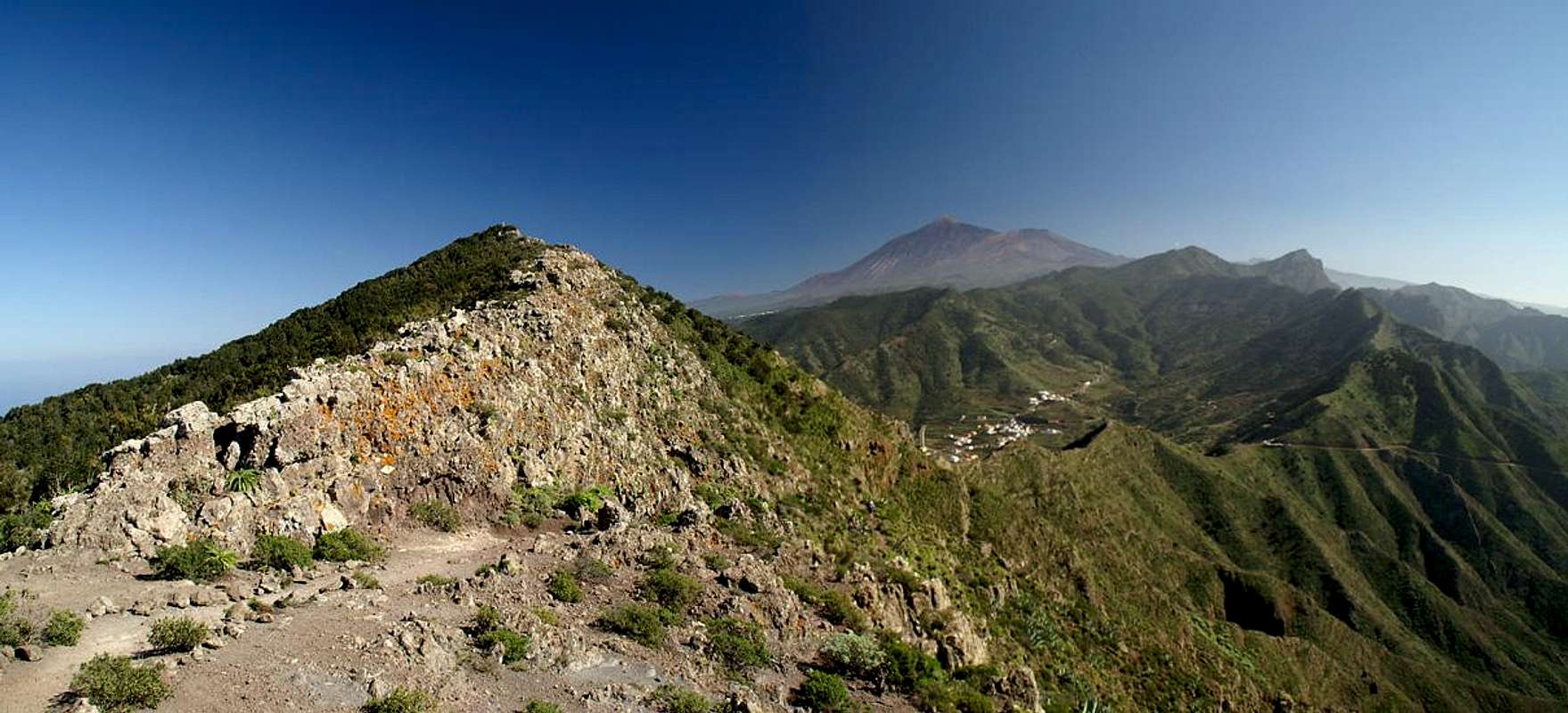
 View across Baranco del Torre View across Baranco del Torre |
Camino de los Riscos is one of the main hiking trails in the north of Tenerife. It connects Buenavista del Norte with the Teno high plateau and the village of Teno Alto upon it. It runs through a steep canyon, keeping on the western side. On a sunny day the canyon will get extremely hot so do your ascent in the early hours of the morning. The path is steep and a little exposed in its upper sections. From where it heads out to the Teno Plateau a short sidestep (descent) leads to Roque El Toscon above the north coast. From Teno Alto a 1-2h trail takes you to the perfect lookout summit of Baracàn.
Getting There
The trailhead for Camino de los Riscos is to the west of Buanavista del Norte. See the instructions on the Roque El Toscon main page for more information.Route Description
 Upon Camino de los Riscos
- Start altitude: 50m
- Summit altitude: 611m (Roque El Toscon) / 1003m (Baracàn)
- Prevailing exposure: E
- Type: 2h / 4h one way
- Protection: None
From the trailhead head south to the left of the water reservoirs. Once you have passed the second one a slippery path heads up to the right soon regaining the creek bed in the middle of the canyon. After some 400m of a rocky scramble the path leaves the bed, scrambling up the right (western) sides. It always stays on this western side of the canyon following the terrain in bold sweeping switchbacks. Two side canyons are passed before the main valley bends westward, directly heading up to the Teno Plateau.
Tthe path gets more pronounced up here and negotiates several ledges, suddenly turning north towards the east face of Roque Marubio. Right underneath the rock it turns back and after several hundred meters more heads out on the plateau. Where it does so you will find an old meeting point of the Guanches, the pre-hispanic inhabitants of the Canaries, a circle of low stones, almost placed like benches.
|


Roque El Toscon
For Roque El Toscon turn north from the Guanches meeting point and try to gain the ridge which runs from Roque Marubio to Roque El Toscon. It soon gets wider, in fact forming a small plateau of its own. This plateau is formed from sedimentary rock of all colours with deep ruts in between. Try to keep some landmarks in mind - It'll help you with your orientation on your return.
Once you turn the last of the hoodoos of this erosion plain you soon see Roque El Toscon beyond a small saddle. Descent into it using a short chimney and scramble on up the summit via the south flanks of Roque El Toscon.
 Roque Marubio from Roque El Toscon
Baracàn
Return to the Guanche Meeting point and follow the marked trail which leads south-westward to a col on the Teno Plain. Here descend towards a country road, which you can take to get to Teno Alto. There is a path cutting short a long switchback but only take this in dry conditions. The soil is very soft and eroded and can get very slippery.
 Roque de la Cruz
From Teno Alto follow the signs to Tabaiba Pass (the sign claims 2 1/2h but it's closer to one). First follow a road until you reach the last houses of the hamlet. From where it bends westwards follow it 300m until a sign leads through another colourful red gully into a dark laurisilva laurel forest. Several parallel paths lead through this forest but all return back to the daylight very close to each other on the Baracàn north-west ridge. Always follow this ridge until you get to the base of the Baracàn summit block, where a small side path turns off from the main path which leads on to Tabaiba Pass.
  |