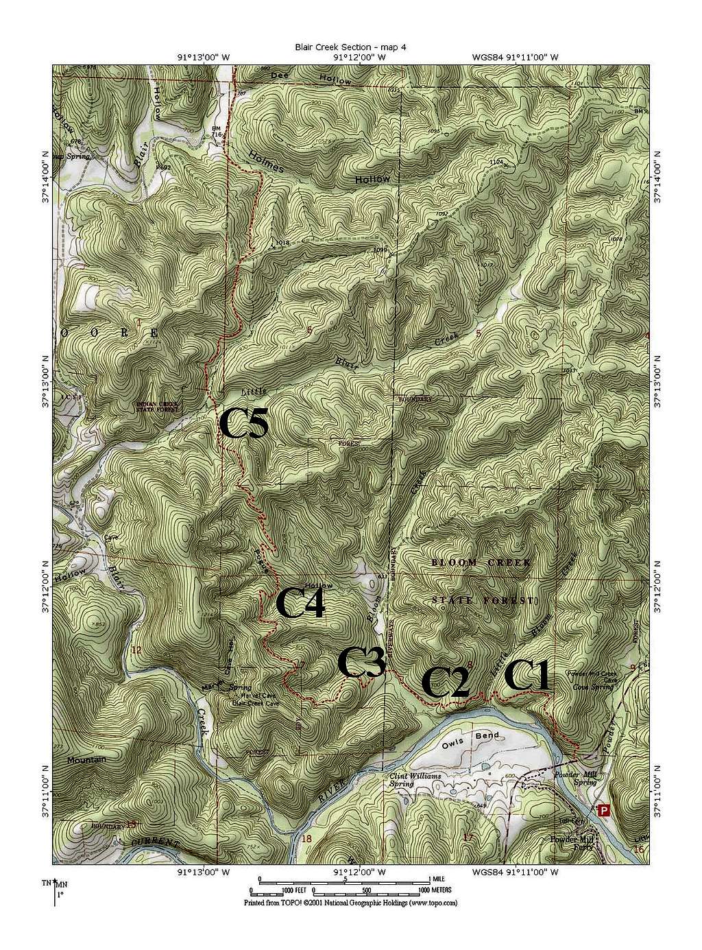
Campsites, Blair Creek Section #4, Ozark Trail
This is Map #4 of the Blair Creek Section of the Ozark Trail. This section goes through a mix of federal, state, and private lands. There are no official campsites but this map shows where unofficial sites have sprung up. All are right next to the trail and lack privacy if other parties were to come through.
C1 is a single-tent site atop a bluff above the Current River. You have to walk about 10 minutes downhill for water, and you're still within range of road noise from Hwy 106.
C2 is a multiple-tent site atop a bluff above the Current River, and has a prettier location than C1. You still have to walk 10 minutes for water and you're within range of road noise.
C3 is a multiple-tent site along Bloom Creek. It's a pretty, forested site away from road noise but right on the trail.
C4 is a one-tent site along Pogue Creek that has good water but not much else to recommend it.
C5 consists of multiple sites next to a ford of Little Blair Creek. This is a wide-open and flat area where you should be able to find sites away from the trail if you like. Watch for poison ivy.
Please note: according to the Ozark Trail Association, you're supposed to camp 100 feet from the trail, and none of these sites qualify. I asked a MDNR employee about the rule, and he didn't know about it.


