

-
 46626 Hits
-
 92.03% Score
-
 37 Votes
|
|
Area/Range |
|---|---|
|
|
36.99597°N / 91.01486°W |
|
|
Hiking |
|
|
Spring, Summer, Fall, Winter |
|
|
2561 ft / 781 m |
|
|
Overview
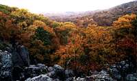
The Ozarks are a large region of rugged hills and rivers encompassing much of southern Missouri and northern Arkansas. The region just touches Illinois and Kansas, and includes a small sliver of eastern Oklahoma. It’s defined variously by its geography, its ecosystems, and its human culture.
This is not a major climbing destination, nor even a minor one, though there are some excellent developed climbing areas in the Arkansas portion of the Ozarks. Nonetheless, this area offers a surprisingly diverse set of recreational opportunities, including hiking and backpacking, caving, canoeing and kayaking, and fishing and hunting.
So far this page emphasizes the Missouri portion, with Arkansas material in progress. If you'd like to help with either part, or with Oklahoma, please PM us.
Geology

by csmcgranahan
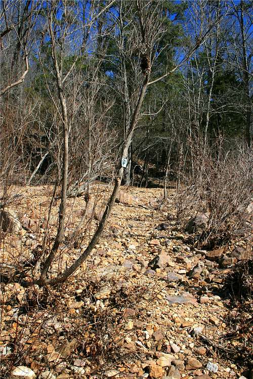
The Ozark “mountains” are in fact a plateau that has been carved by rivers and streams into the hills that we see. This makes the topography very complicated - - there are no obvious uplifts forming ridges such as you might see in real mountains, for example. Roads jump from ridge line to valley bottom in a haphazard way. Trails often descend into the drainages from their trailheads, instead of ascending as do most mountain trails elsewhere.
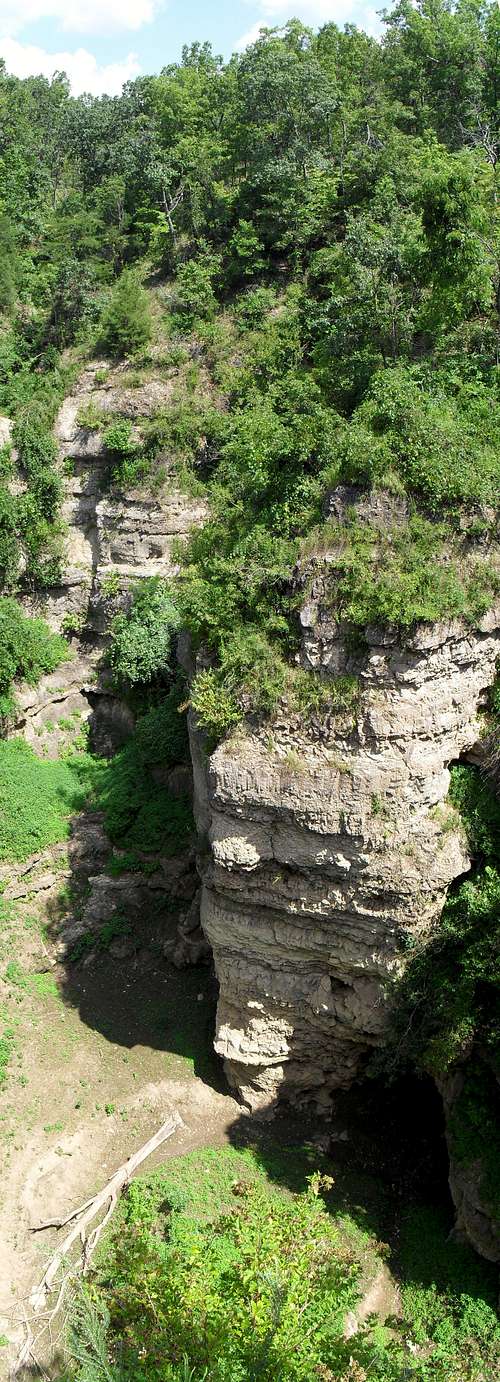
There are four main portions of the area. These are the St. Francois Mountains, the Springfield Plateau, the Salem Plateau and the Boston Mountains. These regions have lots of limestone and resulting karst formations. Springs, sinkholes, and disappearing streams are found throughout the area, as are the caves that lie beneath these surface features. This region was uplifted during the Ouachita Orogeny, when North America and South America collided in the Paleozoic period.
The National Park Service (NPS) has found over 300 caves inside the boundaries of Ozark National Scenic Riverways (ONSR). The ONSR makes up only a small sliver of the entire region, and one estimate is that the region has more than 6000 caves of various sizes. These caves range from glorified overhangs to one that is over seven miles long. The NPS identifies eight as “outstanding natural features.” (See red tape for rules on caves; there are also privately-operated caves in the region.)

Rocky Falls, a shut-in
The northeast portion of the region, the St. Francois Mountains, is a large igneous dome with rocks dating back to 1.5 billion years ago. There are reef formations along the side in some areas, reflecting the time when these mountains bordered a shallow sea. Reddish rhyolite is common in this area, and layers of this rock help form the distinctive “shut-ins” of the region.
These shut-ins form when water finds a crack through the rhyolite, creating a narrow gap for the stream. When the stream hits different rock below, it cuts open a pool. These make great swimming holes in the heat of summer.

Hawksbill Crag in the Boston Mountains
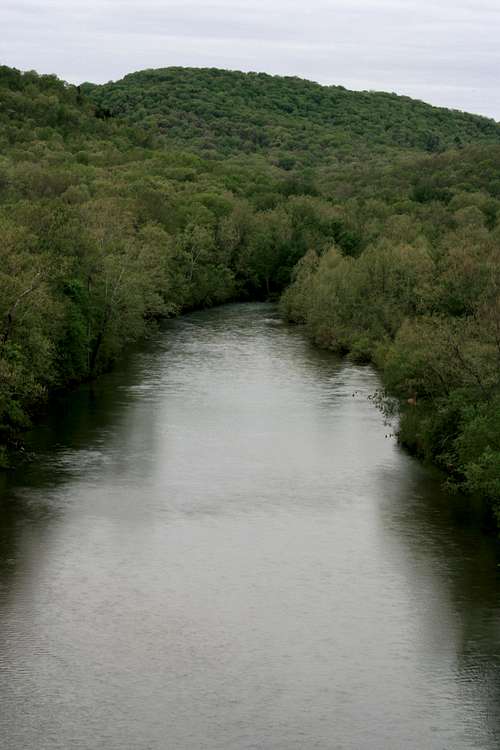
The Boston Mountains region of the Ozarks are the highest and most rugged section of the range. The mountain lies between the White River in the north and the Arkansas River to the south. A small section of the Boston Mountains extends into eastern Oklahoma. The Buffalo Lookout, at 2,561 is the highest point in the Ozarks. Notable among the many features of this area is the Buffalo River, considered by many to be the most attractive river in the eastern United States. The river is one of the longest undammed waterways in the US and is managed as a park by the National Park Service. The area is notable for its sheer cliffs, some of which reach nearly 500 feet in height. Consequently, there is a terrific number of excellent waterfalls. Hemmed-In-Hollow falls, the highest at 204 feet is the tallest waterfall between the Rockies and the Appalachians. In some area around the Buffalo River the relief between the river and the summit of surrounding peaks is almost 1,000 feet.
The Ozarks' geology, fauna and flora, human culture, and recreational opportunities resemble those available in the "Illinois Ozarks" of Shawnee National Forest and of Hoosier National Forest in Indiana, including the Deam Wilderness. The karst geology, Scots-Irish heritage, and forest ecosystems also stretch into Kentucky. It's an area worth exploring.
Ozarks Region Map
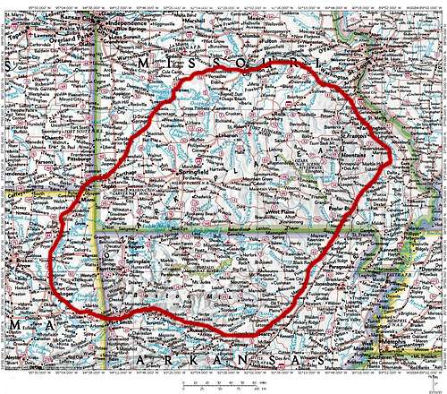 The Ozark Mountains region
Nature
The Ozarks are a biologically rich area where many biomes meet. It’s warm and fairly wet, though the glades provide semi-arid habitat on the tops of many mountains.
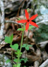
Royal catchfly, a protected species
Forests
Many parts of the Ozarks continue the kind of southern pine forest associated with Alabama and Mississippi. Pines common to the South have been replanted in many areas and clearly feed the sawmills scattered about. The creepy crawlers of the area, including ticks, chiggers, tarantulas, and cottonmouths, will also remind you of the South. Speaking of ticks, see Bob Burd's article here.
But the Ozarks are also a part of the Midwest, with eastern hardwood forests reminiscent of parts of Illinois, Indiana, and southern Michigan and Wisconsin. Oak and hickory dominate much of the region.
To their west, the Ozarks are connected to the open prairies of Oklahoma and Kansas, and share some fauna and flora found there. For example, the eastern collared lizard is more typical of the American Southwest and northern Mexico.

Stegall Mountain glade
Glades
These glades are open, rocky areas on or near the tops of hills have thin soils and high exposure to the sun. This creates a semi-arid environment with few trees, characterized by native grasses and forbs. Desert plants such as prickly-pear cactus can be found here, as can tarantulas and other desert species. The abundant insects also make the glades a good habitat for various species of lizards, including the endangered eastern collared lizard, normally found in the desert southwest.
Because the glades are isolated from one another, they are essentially “island” habitats that rely on corridors to keep them connected in a metapopulation. Maintaining connectivity requires some management. For example, forest restoration in the Peck Ranch Conservation Area was slowly squeezing out the glade, as brush and trees moved upslope during the era of fire suppression from the 1930s. Missouri DNR reintroduced the eastern collared lizard onto the mountain in 1983-89, using stock from the Taum Sauk region that was threatened by proposed developments. However, the population did not thrive as the glade continued to close in. Controlled burns since 1993 have helped to keep the glade microhabitat open.
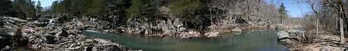 A shut-in on Rocky Creek
Streams
Another habitat worth mentioning are the small streams, many fed by springs. Some disappear into the cave network below.

Some small mussels

Hurricane Creek
When you visit, look down at all your stream crossings. There are a lot of freshwater mussels in the backcountry. Most of these mussels are threatened or endangered, and the Midwest is a global hot spot for freshwater mussels - - more than half of the world’s species are found here. They don’t get much love, environmental groups don’t put them in mass mailings, and farmers who pollute the streams of Illinois, Indiana, Iowa, Missouri and Ohio don’t known they’re destroying a global resource. The Ozarks are a good place to see what midwestern streams are supposed to look like.
Human culture
When Euro-Americans arrived the original inhabitants were members of the Osage tribe, who may have moved there to get away from the mound-builder civilizations of the Mississippi and Ohio valleys. The Osage traditionally foraged for nuts and berries and engaged in horticulture without more developed agriculture. Whites eventually pushed the Osage out, moving them to a reservation not too far away in southeastern Kansas.
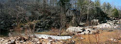 Klepzig Mill
Euro-American settlers were dominated by people from the Appalachians, mostly of Irish, Scottish, and northern English stock. They brought traditional culture with them, including Baptist religion, square dances and country music, and a fierce independence. They also brought institutions such as the custom of the open range - - farmers were expected to fence their fields to keep free-ranging livestock out, rather than being expected to fence livestock in.

Dogwoods in bloom

Farmland on the Current River
In addition to rustling cattle on the open range, another charming traditional practice was timber theft called “grandmawing.” People would gather wood on other people’s land. If caught, they would claim that the lumber came from an obscure tract in the hills that belonged to their grandmother - - hence the name.
Most of the Ozarks are inhabited by lower-income rural people, with pockets of wealthy ranches, second homes, and estates. The population is dispersed but fairly dense compared with rural populations in the prairies or intermountain west. Culturally the region will remind you of Appalachia, with related dialects spoken, a similar mix of religious denominations, and a predominance of country music with evidence of square dancing and other traditions.
The land is surprisingly rugged, and mostly not suited for agriculture. The river bottomlands that were best suited for cultivation tended to attract preservationists interested in maintaining river scenery. Creating Ozark National Scenic Riverways, for example, acquired removed much of these lands in the southeastern Ozarks, abruptly ending traditional local farming.
by csmcgranahan
The major land uses today seem to be forestry and livestock, with lead and some other minerals mined locally. There’s a little bit of oil and gas in the Oklahoma portion of the region. Cattle are most common, but there are regions with horses and swine, and many farmers seem to keep a couple goats or chickens. Northwestern Arkansas is the home of both Tyson Foods and Wal-Mart, so there’s also a lot of chickens hidden in huge buildings in that stretch of the Ozarks.
Cell phone coverage is unusual, even in towns. High points seem to have better coverage than many of the towns in valley bottoms. The dispersed settlement in much of the region encourages people to keep dogs, most of which are unleashed wanderers. If you are afraid of dogs, be advised. Even if you’re not, you might bring a trekking pole as dog defense.

Rocky Outcropping
In the late 1800s the region saw extensive agricultural development, and was largely logged out. Among other effects, this logging disrupted the forest economy and dealt the associated folk culture a significant and sudden blow. However, logging of the second-growth forest continues to provide some employment. There are both historic and modern mills scattered throughout the area, and you can expect to follow logging trucks at some point on the major secondary roads.

by Bob Smith
Weak soils made agriculture a poor replacement for forestry. Widespread erosion in the early 1900s made the soils worse. The erosion also changed the streams and rivers, leading to the gravel and sand bars that are now important “natural” features of the waterways - - but which are not native. Stream channels are now wider and shallower, and deepwater fish habitat has been lost.
Once the trees were gone, state and federal agencies encouraged reforestation in the 1930s and 1940s. Over time, this has moved from simple tree planting to more sophisticated ecosystem restoration. It’s also created the landscape we have today.
Recreation has become an important part of the region. River rafting outfits are scattered through the region, with both floats and whitewater trips popular. When the river is high, the Silver Mine campground has excellent whitewater kayaking.
The shut-ins provide great swimming holes in summer, an opportunity you can share with nonpoisonous water snakes and poisonous cottonmouths.
The Ozarks also have a long trail for distance hiking. The Ozark Trail will eventually consist of more than 500 miles of connected trail, from St. Louis to Arkansas. Its current length is more than 340 miles.
Finally, Branson, Missouri, is the leading auto and bus destination in the United States. Summitposters will avoid it like the plague, though it would be a good place to dump any non-hikers for a few days while you enjoy the backcountry.
Land Managers
Federal

Ozark NSR
Ozark National Scenic Riverways (ONSR) was created in 1964 to protect 134 miles of the Current and Jacks Fork Rivers, and the Buffalo National River (BNR) was established in 1972 to protect 135 miles of the Buffalo River. Making ONSR a national park unit reflects the days before the National Wild and Scenic Rivers Act (NWSRA) of 1968, when there weren’t other options for protecting a river from development. It claims to be the first protected river in the world.
The BNR was established to save the river from the Army Corps of Engineers, which had various plans to dam the river. I don’t know why advocates chose to use the NPS instead of the NWSRA as the vehicle for protection, but the important fact is that the river is now preserved from development.
The designation of ONSR reflected a long dispute between the US Forest Service (USFS) and the National Park Service, and among local citizens and their political leaders, about how best to protect and manage the region. Many locals would have preferred the multiple-use philosophy of the USFS to the NPS, and they continue to resent both NPS rules and the discourteous urban refugees that park status attracts.
The USFS has been in the Ozarks since 1908, when President Theodore Roosevelt designated Ozark-St. Francis National Forest. This forest was enlarged in 1939, and renamed Mark Twain National Forest. The national forest consists of nine separate sites throughout the area.
The Ozark Plateau National Wildlife Refuge in northeast Oklahoma protects cave species such as various bats, as well as some distinctive riparian creatures.
Wilderness Areas
There are now fifteen designated wilderness areas in the Ozarks. These areas are quite small compared to the wilderness giants of the west. However, these wildernesses are surprisingly wild and get little human traffic. The contiguous Lower Buffalo and Leatherwood Wilderness Areas are the largest in the Ozarks with nearly 40,000 acres of wild terrain.
Missouri Ozark Wilderness Areas
Irish - 16,277 acres
Hercules-Glades - 12,314 acres
Bell Mountain - 8,987 acres
Piney Creek - 8,142 acres
Mingo - 7,730 acres
Paddy Creek - 7,019 acres
Devils Backbone - 6,595 acres
Rockpile Mountain - 4,089 acres

Buffalo National River Wilderness
Arkansas Ozark Wilderness Areas
Buffalo National River - 34,933 acres
Leatherwood - 16,838 acres
Hurricane Creek - 15,307 acres
Upper Buffalo - 12,018 acres
Richland Creek - 11,801 acres
East Fork - 10,688 acres

MDNR sign on Taum Sauk
State
The Missouri Department of Conservation covers many streams, lakes, and forests, maintained for recreation (including hunting). It has a multiple-use philosophy that includes logging, farming, lead mining, and recreation development. However, its units include many great recreational opportunities. My favorite so far are in the Peck Ranch area between Van Horn and Powder Mill on the OT.
The Missouri Department of Natural Resource's lands include state parks and historic sites. It manages its lands for preservation, including recreational use consistent with that mission. Highpointers will be on MDNR lands when they collect Taum Sauk Mountain. Johnson's Shut-Ins and the national champion trees of Big Oak Tree State Park are also notable.
Private
The Nature Conservancy (TNC) has many lands in the area. Those managed for more strictly preservationist goals tend to have access and camping limitations.
OT Blaze
Another major land manager is the L-A-D Foundation, named after Leo A. Drey, a prominent conservationist from St. Louis. He we the largest private landowner in Missouri in his day, owning about 130,000 acres in Shannon, Reynolds, Carter, and other counties. Though interested in conservation, Drey resisted the NPS entry to the region and opposed creation of ONSR. He retained about 35 miles of river frontage on the Current and Jacks Fork rivers, which he called the “Pioneer Forest.” This Pioneer Forest remains in L-A-D hands today, along the Ozark Trail north of Powder Mill in the Blair Creek section of the Ozark Trail.
Drey managed his forest for timber and watershed stabilization, while keeping some natural areas for total preservation. For example, he never cut trees within sight of boaters on the rivers. He also wanted greater recreational use of the rivers but feared the NPS preservationist mandate would tend to restrict river use. Instead, he supported a greater role for the USFS role and its multiple-use mandate.
Finally, the Ozark Trail is managed by a non-profit association. See below.
Red Tape
by Bob Smith
Current River in ONSR
The Ozarks are a large region, and this section only scratches the surface. I’ve collected rules that are found around (1) ONSR; and (2) the Ozark Trail. I’ve left Arkansas out entirely. See the “Contacts” section below for land managers who can answer specific rules.
Canoeing.
Canoeing, kayaking, and rafting are the most popular outdoor activities in the region. Don’t bring glass containers on the rivers, and follow safe-boating rules.
Hiking and backpacking.
Hiking is a rule-free activity as far as I know. Trail junctions are often poorly marked, signs are worn and unreadable or down, and long stretches of the OT are weakly blazed. Because of the many criss-crossing trails and ATV tracks, navigation can pose challenges. Backpacking is subject to typical rules (off-trail and out-of-sight, away from water), and is not allowed on private land, some conservation trust land, and some parts of public lands (see below).
Horseback riding.
The Ozarks providing outstanding conditions for riding, and the evidence of past use is not hard to find. If you know what I mean. I haven’t found formal regulations, though there must be some. Instead, postings and other notices give common-sense rules about staying on paths, using hitching posts instead of trees, and not bathing horses in the rivers.
Mountain biking.
The Taum Sauk, Current River, and Blair Creek sections of the OT prohibit mountain biking. As it turns out, those are the sections I’ve hiked, so I can’t say how much bike use the region gets. However, more than 240 miles of the OT are open to mountain bikes so there are many opportunities.
Rock climbing
Arkansas and the Ozarks have some of the best sandstone rock climbing in the country. Some of the more popular areas are Horseshoe Canyon Ranch (HCR), Sam's Throne, and Mt. Magazine. HCR is a commercial operation which charges $5.00/day for climbers, but is well worth it. Same's Throne is located both on National Forest land and private property, so be mindful of this when you visit. Mt. Magazine is managed by Mt. Magazine State Park and is also home to the highest point in the state.
Caving.
The NPS maintains three caves for public use with a permit: Branson, Lost Man, and Bluff Cave. Contact them (see below) for more information. There are commercial caves scattered throughout the region if you prefer. Important note: as of January 2011 the NPS and USFS have closed all caves in the region. These agencies hope to prevent visitors from inadvertently introducing white-nose syndrome (WNS) into the caves. WNS has killed entire populations of bats where it is found, and it has the potential to cause extinction of already-endangered species. Please stay out of the caves for the time being!
Partying.
The OSNR and other rivers once had a reputation as attracting hard-partying groups (they don’t call them sand *bars* for nothing). To make the region a family-friendly destination, law enforcement has cracked down. I’ve had friends pick up $400 tickets. Don’t say you weren’t warned.
Two-Track for ATV and hunting access
Fishing.
State of Missouri regulations apply. Anglers need a general license as well as a valid trout tag if you are in possession of trout. In the ONSR region, fishing is allowed in the Current and Jacks Fork Rivers but prohibited in springs and spring branches. In the Trout Special Management Area of the Current River (between Montauk and Cedar Grove), only artificial lures are allowed and you must release all trout smaller than 15 inches long.
Hunting.
Deer and turkey hunting are popular and provide a major management focus for the State of Missouri. I’m sure people hunt other things, too. Contact Missouri DNR for more information.
ATVs.
Much of the region is open to ATV use. Unmapped two-tracks criss-cross the hiking trails. As a rule of thumb, if a four-wheel drive pickup could make it on the road, it’s probably open to ATVs. Missouri law on permits, safety equipment, and mufflers apply.
Camping
The Ozarks are a hodge-podge of land ownership, with National Park Service lands (Ozark National Scenic Riverways), US Forest Service Lands (Mark Twain National Forest), State of Missouri conservation lands, State of Missouri natural resources lands, private conservation lands (The Nature Conservancy and the L-A-D Foundation), and private property being used for agriculture, livestock, and forestry. The trails all have public easements if they are on public land, so hiking is straightforward.
Camping regulations vary. The US Forest Service and Missouri natural resources lands allow dispersed camping at least 100 feet from a trail and 100 feet from a stream, and prohibit camping in glades. This is essentially the NPS rule too. There are a modest number of sites that attract repeated use, most of which are attractive, flat, have fire rings, and are in technical violation of these rules.
Missouri conservation areas, such as the Peck Ranch Conservation Area (PRCA) where Stegall Mountain is located, prohibit camping. It’s more than five miles out of the PRCA from Stegall’s summit, so be prepared to hoof it a ways.
Camping is allowed on gravel bars, but respect private land ownership and no-trespassing signs. Also be aware that water levels can rise more than ten feet in an hour, so be sure to have an escape available. Don’t camp where you are blocked by bluffs.
Print Resources
Margo Carroll and Peggy Welch, Ozark Trail Guidebook. This has maps going beyond the National Geographic map (below), but they’re not topos. They are good for point-to-point mileage, and basic descriptions of the trail.
National Geographic, Trails Illustrated: Ozark National Scenic Riverways. This is only good for part of the region, but it’s good for that.
Steve Henry, The Best in Tent Camping: Missouri and the Ozarks: A Guide for Campers Who Hate RVs, Concrete Slabs, and Loud Portable Stereos, Menasha Ridge Press. I have yet to be disappointed by his recommendations, and I love the title.
Contacts
Missouri
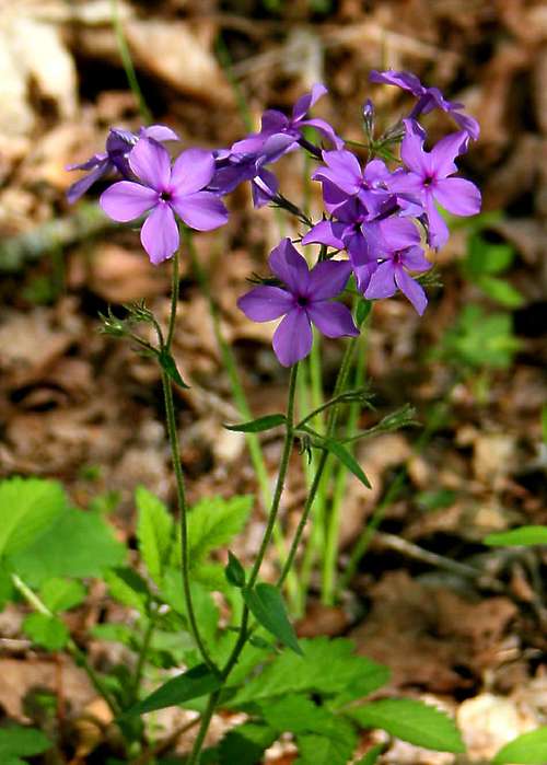
Wild Sweet William
Ozark National Scenic Riverways (National Park Service)
573-323-4236
Mark Twain National Forest
573-364-4621
Missouri Department of Conservation
417-256-7161
Missouri Department of Natural Resources
800-334-6946
The Nature Conservancy, Missouri Chapter
314-968-1105
Montauk State Park
573-548-2201
Pioneer Forest (L-A-D Foundation)
573-729-4641
Ozark Trail Association
573-786-2065
>List of Canoe Outfitters
Arkansas
Ozark National Forest
479 964-7200
Buffalo National River
870 439-2502
Concluding words
More so than most areas on SP, this one is very challenging to know well. It’s large, it’s fairly populated, and there are a lot of jurisdictions. I am under no delusions that I’ve covered everything. Please add comments and/or PM me if you know about particular regions.