
Viewing: 1-1 of 1

mdhandley - Mar 2, 2013 1:11 pm - Hasn't voted
Re: Fun one!It was a ton of fun and I can't wait to continue my quest. I'm climbing Whiteface tomorrow.
Viewing: 1-1 of 1
|
|
Trip Report |
|---|---|
|
|
44.21898°N / 73.88773°W |
|
|
Download GPX » View Route on Map |
|
|
Feb 24, 2013 |
|
|
Hiking, Mountaineering |
|
|
Winter |
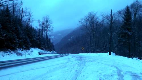
Unfortunately I was not able to leave Ft. Drum, NY until about 11:00am, and my drive took a little over 2 1/2 hours, so I arrived at the trailhead around 1:45pm. The drive took me down NY 3 East to Saranac Lake to NY 86 South, to NY 35 South, to 73 South. The trailhead is located on the right hand side of the road if you're heading south. There is a larger parking lot about 50 feet north of the small lot at the trailhead itself. It was about 35 degrees and snowing lightly when I headed off down the trail.
Trailhead Parking Lot
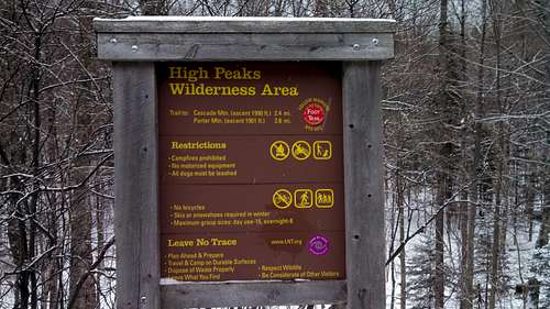
The Cascade Mtn./Porter Mtn. Trail starts out at the parking lot. There were a lot of people just coming off the trail when I arrived. This was listed as a half-day hike, and clearly I was the only one attempting it as an afternoon hike. I was a little concerned about making it back before dark, since the trail had a steep elevation gain and about 2-3 inches of snow cover. I did not have snowshoes or crampons (my new crampons are still in the mail and I left my snowshoes at the office) so I knew it was going to take a little longer than normal to hike the 5.9 miles to both peaks and back. But, I had my trusty headlamp with me, so I set off.
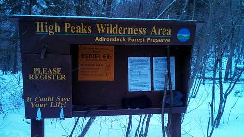
Just past the trailhead is the trail register. There was only one name before mine that day, so based on the number of people I saw just while I was there I assume most of them did not use it. I know that this is a fairly short and non-challenging hike, but it is still always a smart idea to sign in. I was definitely the last one off the trail that day, so one bad slip and fall could have gotten me in a bad situation, so I'm glad I took the time to sign in.
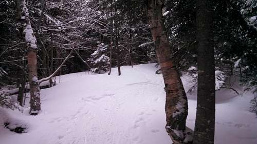
The recent snowfall, plus the light flurries that were coming down all day made this an absolutely beautiful hike. The first mile or so was a very gradual slope, so I was expecting a pretty steep second half of the ascent, since I knew that I had to gain about 1600 more feet in only about a mile and a half. I was not disappointed. The final stretch was extremely steep with a good amount of ice in several places. I had to take my time to ensure that I didn't fall. The hike was a ton of fun and a decent physical challenge for a short trail. I definitely recommend snowshoes/crampons and trekking poles to anyone doing this in winter. The trail is marked with red blazes, but it is a very heavily traveled trail and you shouldn't have any trouble following it.
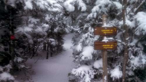
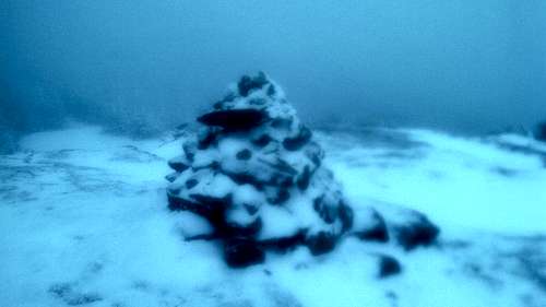
About 1.8 miles in the trail forks, the left trail (marked by the red blazes) continues up to the summit of Cascade. I went this way first. It is a very short .3 miles to the summit of Cascade. I entered a clearing near the summit, and found the cairn.
The temperature on the summit was a good 10 degrees colder and there was a lot of wind. Unfortunately the summit was entirely covered in clouds, so I didn't get to experience the view that I'd read about. Just past the cairn is a short scramble up some boulders to the high point. I approached the boulders, following a series of yellow stripes. However, about 20 feet below the top of the boulders I was staring a very steep section of rock that was covered in ice and snow. I made one attempt to start the scramble up to the top, and immediately slid down hard. I decided that since I lacked the equipment to make the scramble safely, and I was by myself, I was going to settle for making it to the cairn.
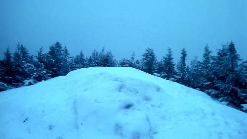
After a short hike back to the fork, I headed down the trail toward Porter. There was a very quick descent down into the col between the two peaks. It was about a .7 mile walk to the summit of Porter. Right before the summit I popped out into a clearing to find a large boulder. There were tracks leading to the left, up to the top of the boulder. At first I thought the top of the boulder was the peak of Porter, so I climbed up onto it. However, from the top I could see that the trail hooked around to the right of the boulder and headed up to the summit. I hopped back down, and walked up to the summit.
The summit of Porter is just a small clearing with no cairn or signage of any kind. I stopped for a minute to grab a drink, switch to some warmer gloves, and then headed back down. The ascent had taken me a good hour and a half. I expected the descent to be much quicker. Since the path had a good layer of snow which had been well packed by all the traffic, I was able to make some very long, very fun slides down the path on my butt. I had to be careful to control my speed with the heels of my boots, but I was able to make great time. It took me about 45 minutes to make the descent.
This was a fun, and fairly easy hike. These are the first two peaks in my quest to climb the Adirondack 46, and I think they were a great place to start. In the spring/summer/fall this would be a great hike for families with kids and pets. In the winter with good snow cover it is a little more challenging, and I recommend a good pair of snowshoes or crampons and some trekking poles. I was able to improvise with a pair of sticks, but it wasn't quite the same.
It was a ton of fun and I can't wait to continue my quest. I'm climbing Whiteface tomorrow.
Comments
Post a Comment