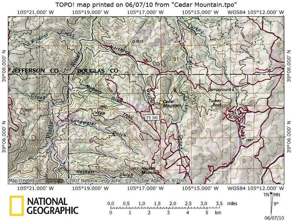
Cedar Mountain_Getting There Map
Cedar Mountain is in the far northwestern corner of Teller County near the boarder with Park, Douglas and Jefferson Counties. Major access roads are US Hwy 24 to the south and CO 67 to the east. Teller County Road 51 turns into Forest Service Road 360, which is Cedar Mountain Road.
Note: Regardless of approach, you will need a 4x4 to reach this peak. A high-clearance V8 truck, van or SUV may do in dry conditions, but if the skies open up and the dirt roads turn to soup, your stay will involuntarily extended. The roads approaching this peak go from relatively tame to steep, rutted and washed out and a 4x4 with descent clearance is the only sane option.


