|
|
Mountain/Rock |
|---|---|
|
|
27.30022°S / 68.80869°W |
|
|
Overview
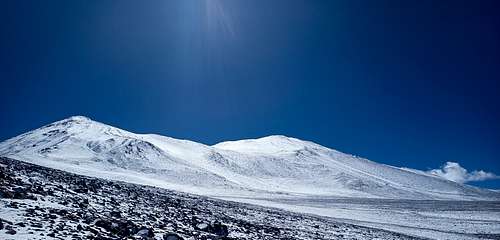
Like most of its neighbours, Cerro Los Patos (also known as Tres Quebradas, "Three Ravines") is an extinct volcano. Its main summit reaches an altitude of 6239 m, while a subsidiary summit on its western side at 5960 m might be traversed on some routes. As with most Puna de Atacama peaks, the main difficulties of an expedition are logistics rather than technique; climbing Los Patos is a steep hike or easy scramble, but getting there requires off-road travel in a cold, dry, windy, remote, and generally inhospitable area.
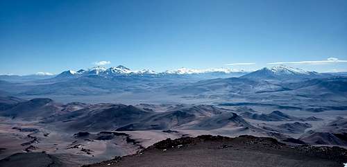
As the 40th tallest mountain in the Americas, Los Patos sees occasional ascents from peakbaggers. The summit has excellent views of the region, including Cerro Tres Cruces, Ojos del Salado, Cerro El Solo, Volcan Copiapo, and Volcan Nacimiento. However, Los Patos lacks either the somewhat greater altitude and technical interest of Cerro Tres Cruces and Ojos del Salado to the north, or the cultural history and diverse terrain of Volcan Copiapo to the west. Los Patos is infrequently climbed.
Getting There
Most expeditions will depart from Copiapo in Chile; access from Argentina may be feasible, but will require extensive off-road navigation even to reach base camp.
From Copiapo, follow C-31 to the Salar de Maricunga, optionally diverting onto C-341 if desired. Regardless, the eventual goal is to access C-601 (either from C-31 about 10 km past the border control station, or else from C-341). This becomes C-347, which leads south towards the peak.
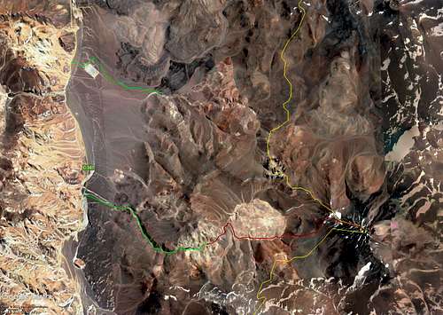
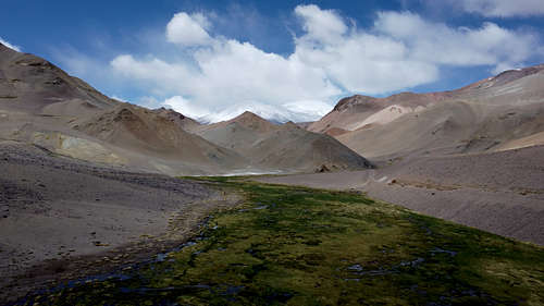
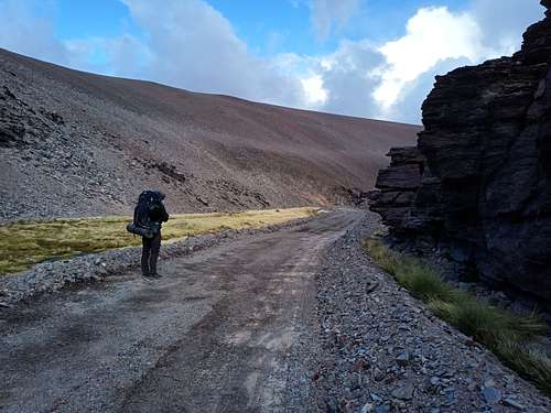
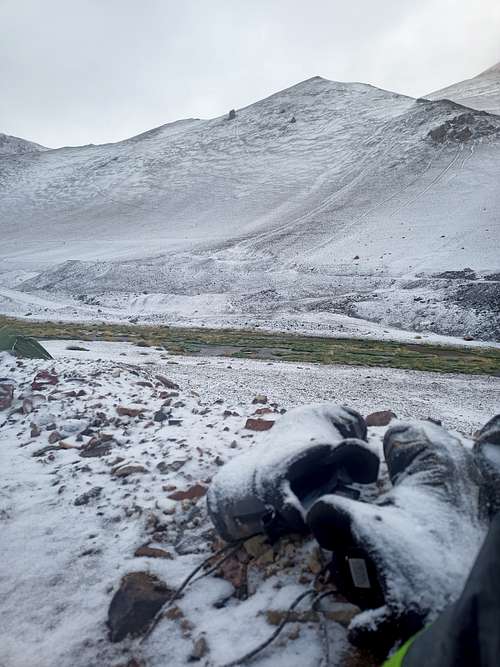
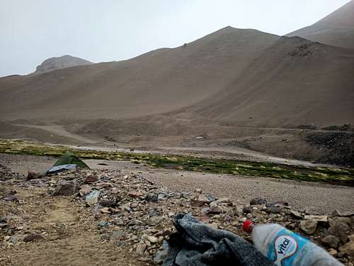
Two options exist for a base camp - one northwest of the peak, and one southwest. To reach the northwest base camp, navigate several jeep trails behind the large, abandoned Mina Marte to access Quebrada de los Patos. One of the main arms of this system of ravines leads up to a camp at roughly 4500 m. For the soutwest camp (recommended), an unnamed but well-built side-road departs the main road about 8 km past Mina Marte, just before passing by the largest of several marshes. This can be followed along Rio Lajitas, which is generally flowing and potable. As of 2023, this road was partially blocked by a landslide and may be inaccessible by vehicle past an altitude of 4350 m (no issues on foot), but otherwise terminates at roughly 4450 m. A prominent dry gully diverges almost due south at 4500 m, and leads towards the mountain itself.
Route
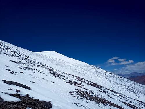
From either base camp, the route proceeds up to the col between the main and subsidiary summits, then up to the summit itself. From the northwest camp, this will involve temporarily crossing into Argentina; the route from the southwest camp is entirely within Chile. Neither route requires anything more than easy scrambling, although a careless fall could result in higher consequences on the isolated sections of steeper terrain.
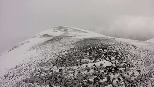
From the col, proceed east up to the summit plateau - the true summit is located at the eastern edge of the summit plateau and is marked with a cairn.
Depending of fitness and acclimatization, expeditions may or may not desire to set up a high camp. From either base camp, a direct attempt at the summit is roughly 1700 m of elevation gain and roughly 18-25 km round-trip depending on the exact camp location. The absence of any technical terrain makes this entirely feasible for a fit and acclimatized party, but it is nevertheless a long day. A high camp from either approach will reduce the summit day to a much gentler 1000 m gain and 7-8 km horizontally.
Red Tape
Chilean authorities generally desire that all mountaineers climbing in the border region register their expedition with the agency DIFROL. This is quickly and simply done at https://www.difrol.cl/en/procedures/expeditions/. As of 2023, there are no fees for this permit, and the system appears to be wholely or partially automated.
When to Climb
The usual climbing season in this area is November through March. Expeditions during this time can expect generally sunny conditions with frequent strong winds and occasional snowfall. The freezing level and snow line in the region vary considerably from season to season and even day to day, so be prepared for cold and snow at any camp.
Weather conditions in the region can be brutally cold and windy during the southern winter - climbing may be possible, but certainly inconvenient and uncomfortable.
Camping
Camping is permitted anywhere as desired. Along Rio Lajitas, there are numerous picturesque sites with access to clean, flowing water throughout the climbing season. Several ridges and gullies immediately southwest of the mountain provide sites for a high camp at up to 5200 m, if one is desired.