Toggle navigation
Mountains
Routes
Images
Trip Reports
Forum
What's New
People
Areas & Ranges
Articles
Trailheads
Canyons
Huts & Campgrounds
Albums
Logistical Centers
Fact Sheets
Lists
Custom Objects
Gear
Plans & Partners
WELCOME TO SUMMITPOST
SIGN IN
REGISTER
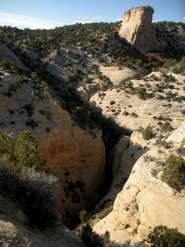
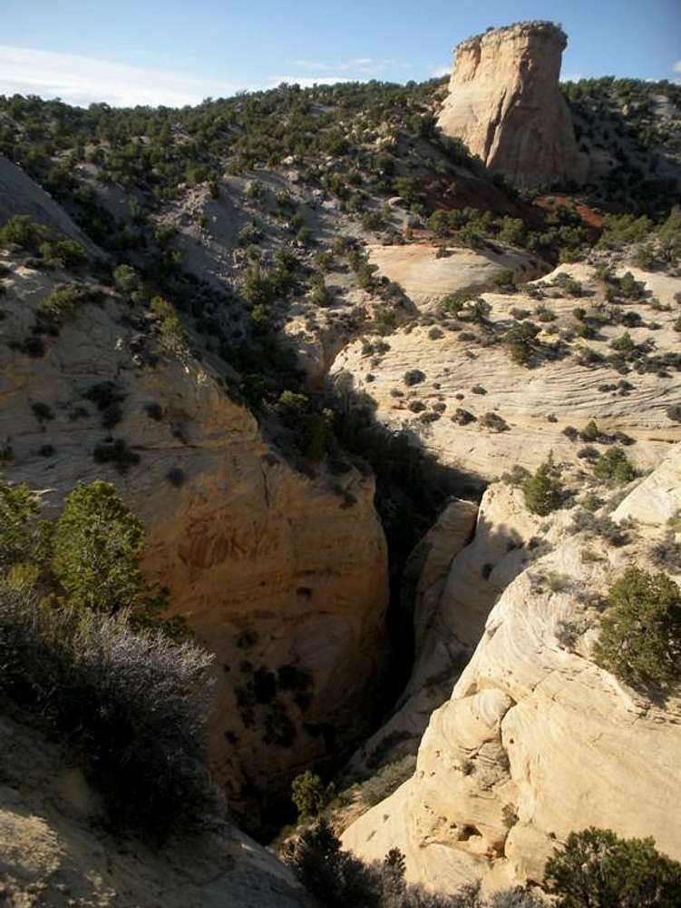
Confluence
View High-Resolution Image
Confluence
Looking down at the confluence of Buckwater Draw and its South Fork. The formation in the upper right corner of the photo can be used as a guide when coming in to the main fork via Scott's "Old Route". I enter just a little east of the formation .
« PREV
NEXT »
Props
on
May 8, 2010 11:48 pm
Comments & voting
Other parents
Lat/Lon:
40.30362°N / 108.98214°W
Image Type(s):
Canyoneering
Image ID:
619717
3749 Hits
74.92
% Score
5
Votes
Log in to vote
Comments
No comments posted yet.
to post!
Don't have an account?
Dinosaur National Monument and Vicinity
(Area/Range)
You are at
the First
Image
Viewing
#1 of 1
GALLERY
You are at
the Last
Image
Props's Image Gallery
« PREV
Viewing
#88 of 120
GALLERY
NEXT »
Dinosaur National Monument and Vicinity
(Area/Range)
Loading....
Buckwater Draw
(Canyon)
Loading....
Buckwater Draw-South Fork
(Canyon)
Loading....
×
You need to login in order to vote!
User Name
Password
Remember me
Forgot your password?
Log me out when I close my browser.
Keep me logged in all the time.
sign in as a user
Don't have an account?
Register now for FREE
Rating available
Suggested routes for you
People who climb the same things as you
Comments Available
Create Albums
Register Here


