Culebra Peak, Red Mountain & "Punta Serpiente" all lie on private land currently owned by the Cielo Vista Ranch. They require climbers to first call and an ask permission to climb. If permission is granted, climbers must sign a waiver and pay a fee. I drove up to Cielo Vista Ranch on Friday night and slept at the gate. I was amazed to see so many vehicles. I woke up from activity of the other climbers at about 5:45 am on Saturday morning. Carlos arrived just before 6 am in a pick up truck and instructed the group to drive up to the ranch. We parked and formed a line to the office in order to pay and hand in our waivers. This felt strange and I discussed this with others in line. I drove up to Fourway in a 2004 Chrysler 300m (two wheel drive and 5.1 inches of clearance). The road was not a problem. I parked and waited for a ride to the upper trailhead from a group in a four wheel drive vehicle. I began hiking and passed the only group hiking almost immediately. I followed an old jeep road until it deteriorated, then angled southeast to "Punta Serpiente". Continuing south, I passed the huge cairn and continued along the ridge to the summit. There was a summit register tube, but nothing inside. I continued along the ridge over 13,599 and up to Red Mountain. The loosest rock was found here. I looked back on Culebra and saw some people on the summit.
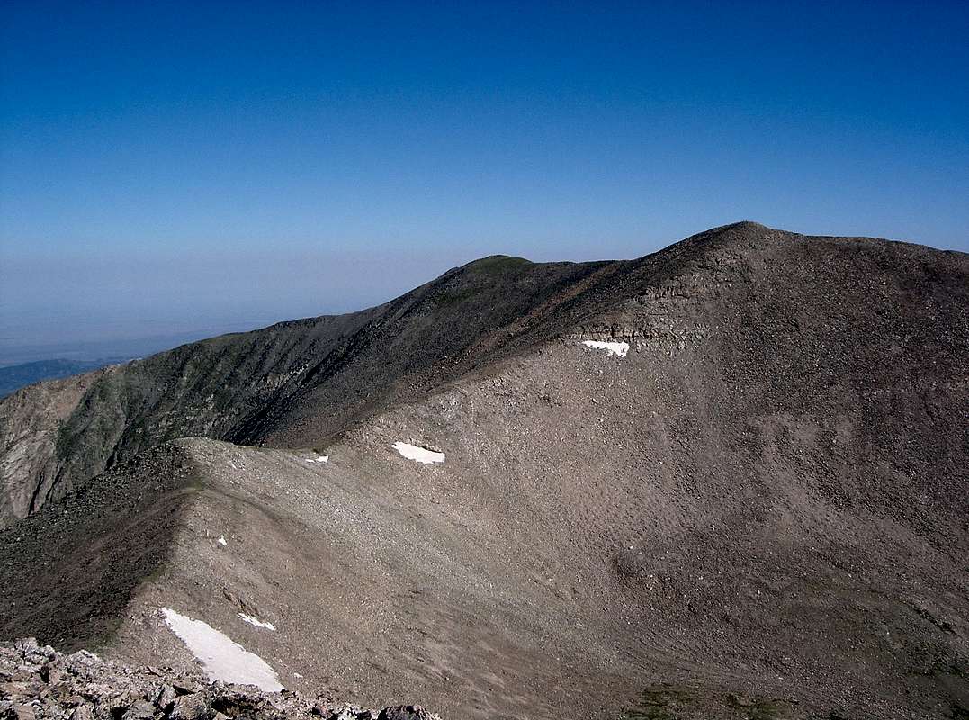
![Culebra Peak from Red Mountain]() Culebra Peak and UN 13599.
Culebra Peak and UN 13599.
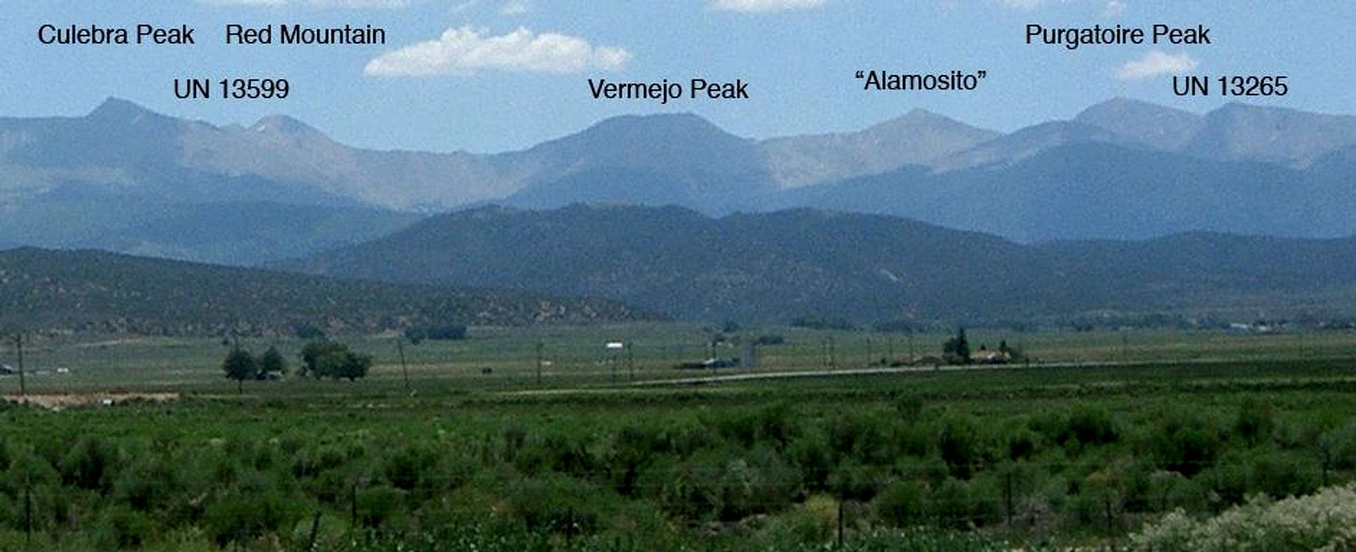
It took 2 hours and 16 minutes to reach the summit of Red Mountain from the trailhead. I descended the ridge and passed many people making their way up to Culebra. I got back to the trailhead four hours after starting. The weather was great: sunny and still, but a little too warm. I drove back to San Luis for lunch and took this photo of the Culebra Range.
![Culebra Range from San Luis]() Culebra Range.
Culebra Range.
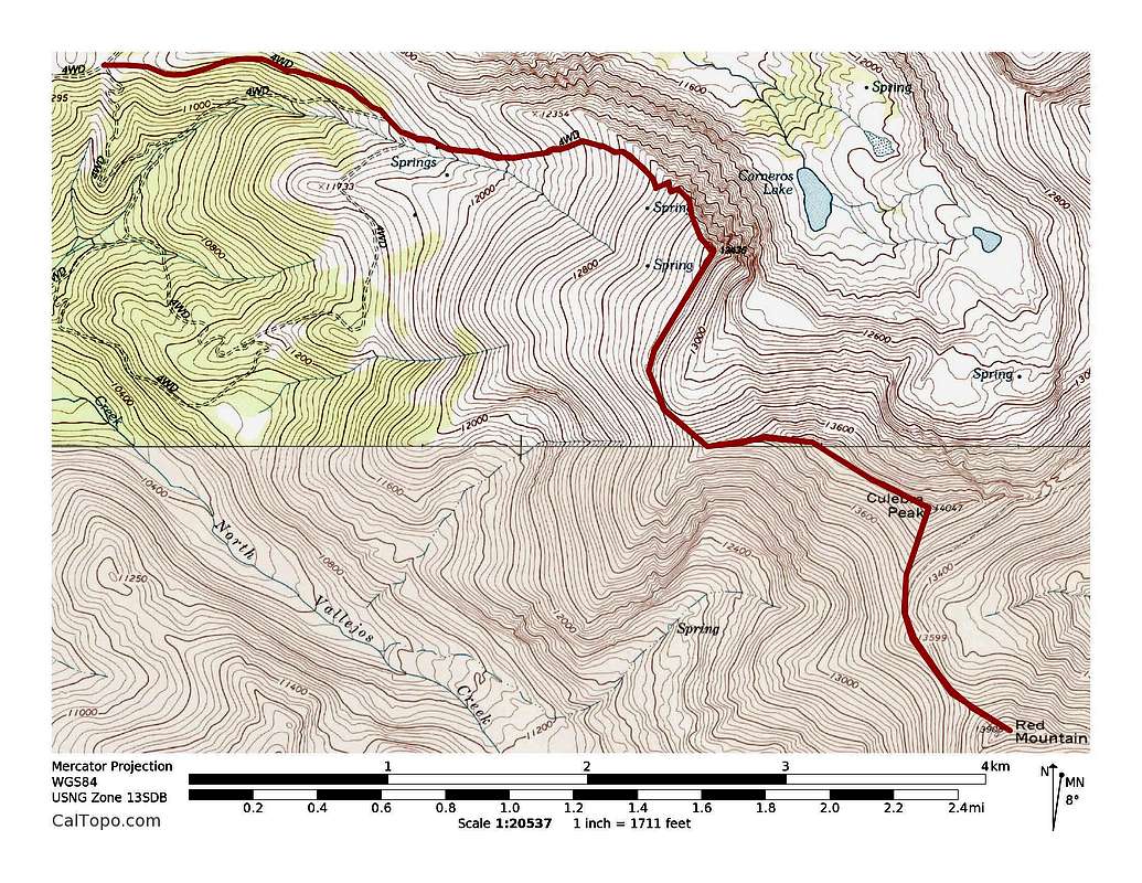
![Culebra Peak]() Culebra Peak, Red Peak & "Punta Serpiente" topo map. ~8.1 miles with ~3,400' of elevation gain.
Culebra Peak, Red Peak & "Punta Serpiente" topo map. ~8.1 miles with ~3,400' of elevation gain.
Comments
No comments posted yet.