
-
 2507 Hits
-
 74.01% Score
-
 4 Votes
|
|
Route |
|---|---|
|
|
39.34100°N / 77.7165°W |
|
|
Trad Climbing |
|
|
Spring, Summer, Fall, Winter |
|
|
Half a day |
|
|
5.4/5.5 |
|
|
5.4 (YDS) |
|
|
2 |
|
|
Overview
This is a pretty popular two-pitch route up the highest cliff in Maryland. The actual climbing is about 150', with maybe 50 or so more added for the scramble up to the top.In the summer, you want to climb this one early, before the sun gets on you. But in the winter, the afternoon sun on the dark rock can make this a pleasant climb even on cold days.
Some sources call this a 5.5 because of the crux on the second pitch. In my opinion, it is not harder than the rest, just different (see route description).
"D" Route follows the obvious corner to the left of the "Sign." It's about impossible to not find it.
First, you have to register with the rangers in town or risk being fined. This is free, but unfortunately, they don't open until 9. However, I emailed the rangers and asked about starting earlier, and they told me I could print out an itinerary including route, climbers' names, clothing colors, and experience levels, and that I could slide it under the door. A mini-crux: there is no room to slide a sheet under the door. So maybe bring a piece of tape.
Next, you have to park. The best place to park is the CSX lot near the pedestrian bridge over the river. Parking here means paying a fee or having a pass. If that lot is full, have fun finding a legal, open spot on a street, or go park in a larger visitor lot serviced by a shuttle bus. A last option is parking on Sandy Hook Road at the Maryland Heights trailhead (only a few spaces) and walking about a quarter-mile to the base of the climb, but that makes the registration part that much more of a hassle.
Finally, find a use trail before the ruined white building on Sandy Hook Road and make a steep, short hike to the start of the climb.
Route Description
Pitch 1: Climb the corner (sometimes vegetated but not a bushwhack by any means) to a large tree. Belay off this tree. Back it up if you wish, but if this tree fails, you're probably getting squashed, anyway. Although the crux is considered to be the 2nd pitch, I thought the first 20 or so feet was the crux, as the rock was a little slick and there was no pro. After that, it was easy climbing with good pro. This pitch is about 100'.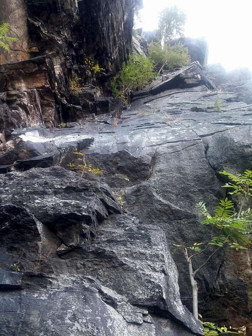
First Pitch
Pitch 2: This one is no more than 50' and the fun begins and ends at the start, as you move up a blocky chimney. Some call this 5.5, but I didn't find it harder, just a bit different. It was awkward at first, but once I got a good position, it was easy to place a #3 DMM Dragon Cam (about equal to a C4 #1) to protect the move and then make it. There are bolts with chains and rings at the end of this pitch.
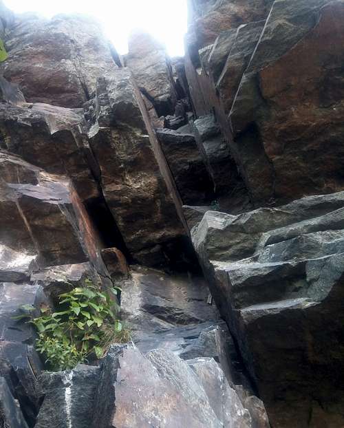
Second Pitch
Finish: Scramble up the huge chimney and top out on outcrops with an outstanding view. Sadly, you will start finding trash now. The finish is close to the hiking trail.
Descent: Rappel back down each pitch (could be tricky or slow if other parties are coming up, which is likely on a weekend), or take the trail.