Comments
No comments posted yet.
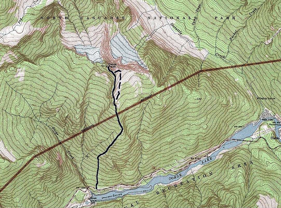
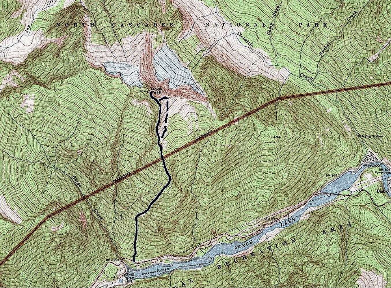
Topo map derived from the USGS Diablo Dam quadrangle. The blue line is an approximation of our route in January, 1985. The dashed section shows our variation skirting the E side of the S ridge. It turned out to be a little more difficult and exposed than a simple, direct climb of the ridge.


