
|
|
Route |
|---|---|
|
|
40.03620°N / 107.151°W |
|
|
Hiking, Mountaineering, Scrambling, Skiing |
|
|
Summer, Fall |
|
|
A long day |
|
|
Overview
There are many routes to the Devils Causeway, including an almost endless possibility of loop hikes. All routes are very scenic, and all of the routes have their own attractions. With any route you choose, be prepared for some fantastic scenery.
Surely, the most popular route up the Causeway and Peak is this route described from Stillwater Reservoir, either from the trail passing Little Causeway Lake and approaching the peak from the northeast or from the trail farther south that passes Mosquito Lake and approaches the Causeway from the southwest. Combining the two routes makes a fantastic 10.5 mile loop.
Those who don’t want to do the entire 10.5 mile loop can do a 6.0 mile out and back trip using the trail from Stillwater Reservoir and past Little Causeway Lake. This would also be the route to take for the acrophobic who may just want to view the Devils Causeway up close rather than try and cross it.
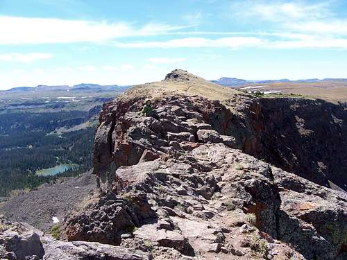 The spectacular Devils Causeway.
Map of Route
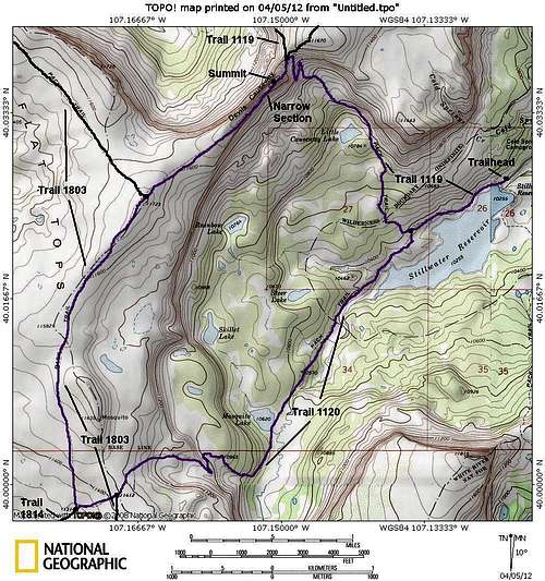 The Devils Causeway Loop is marked in purple.
Getting There
The trailhead is at the Stillwater Reservoir. From Yampa, look for the sign on the west side of Highway 131 that points the way to "National Forest Access". Turn west on to County Road 7. Follow County Road 7 for seven miles, to where the road becomes FR 900. Stay on the main road for nine miles and drive to the parking area at Stillwater Reservoir. The road is good for all vehicles in day conditions. A 4wd may be needed early or late season.
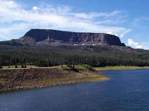 This is the trailhead at Stillwater Reservoir.
Route Description
From the trailhead, follow Trail 1119 along the north side of Stillwater Reservoir. After you are ½ way along the Reservoir, turn right at the junction and continue following Trail 1119. This trail passes Little Causeway Lake after 1.75 miles from the trailhead. The trail steepens here and climbs to the saddle northeast of the Causeway.
Turn left at the saddle and head towards the Causeway. The trail steepens and reaches the top of the peak (11820) where the narrow part of the Causeway is near. Cross the spectacular and exposed (which is safe enough if you are careful) narrow section of the Devils Causeway. The Causeway is only four feet wide in one section with cliffs dropping several hundred feet down on either side.
Once across the Causeway, pull out the map and continue to follow the trail southeast. The trail reaches an obscure junction with trail 1803. Stay left here and follow trail 1803 south. The trail fades in places and other cross country routes are possible. You can either continue on the trail south or climb over the Mosquito Benchmark.
If you stay on the trail, you will reach a junction with Trail 1814. Stay left on Trail 1803. After only a short distance, you will reach another junction with Trail 1120. This time, head left on Trail 1120 which descends gradually at first and then more steeply down to Mosquito Lake where there is a stream crossing.
The trail then descends down the now forested valley to Stillwater Reservoir. Follow the trail along the north side of the Reservoir and back to the trailhead.
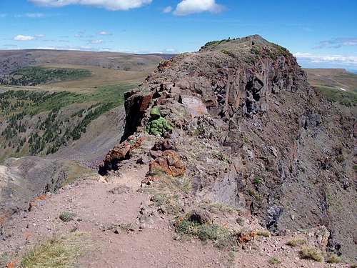 Kessler on the Devils Causeway.
Essential Gear
A good pair of boots and a topo map are needed. Due to the heavy snowfall in the Flat Tops, there may be quite a bit of snow until mid or late July in most years.