
-
 3382 Hits
-
 77.48% Score
-
 8 Votes
|
|
Mountain/Rock |
|---|---|
|
|
45.92455°N / 110.98534°W |
|
|
Trad Climbing, Sport Climbing |
|
|
Spring, Summer, Fall |
|
|
8444 ft / 2574 m |
|
|
Overview
For most travelers, the Bridger Range is little more than a sight in the distance as one drives along U.S. 89 between I-90 and White Sulphur Springs.
It's even off the radars of most climbers, which is probably fine with most Bozeman-area climbers and the relative few from elsewhere who know about the place.
The Bridger Range is a narrow band of limestone peaks. It is not considered to be among the mountain ranges of the Greater Yellowstone Ecosystem, but many consider it an outlier, similar to the Tobacco Root Mountains, the Crazy Mountains, and the Owl Creek Mountains.
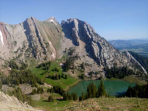
Frazier Cirque is one of the prettiest areas in this range, and although it is very close to heavily used spots like Fairy Lake and the trail up Sacagawea Peak, the range's highpoint, it does not see nearly the same usage, perhaps because although there are two trail approaches, neither begins from a major trailhead; in fact, one is not even marked.
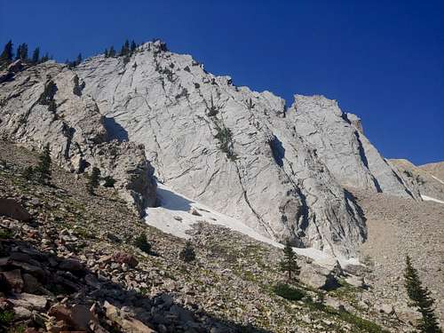
There are no named peaks surrounding Frazier Lake, but some buttresses and faces have established single- and multi-pitch trad, sport, and mixed routes.
The East Buttress has two.
Getting There
From your location, get to MT 86; its southern end is near Bozeman, and its northern end is on U.S. 89 south of White Sulphur Springs.
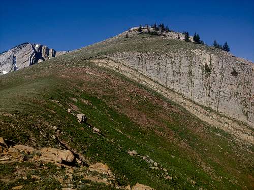
Around MP 21, turn onto a road signed for access to Fairy Lake. Follow signs for Fairy Lake and drive about 6 miles to two obvious campsites on the left side of the road. Just past the sites and on the other side of the road is a trail heading up a meadow; that is the start of the approach.
Hike up the trail, which gets really steep in places. As you near the obvious saddle, cut up and left before you reach a large patch of trees. Gain the ridge and then find a steep, loose gully leading to a basin well above Frazier Lake. Descend the gully and cut left to the base of the East Buttress.
Since the return will take you back to the top of the gully or close to it, you might want to leave anything you don't absolutely need here.
Routes
The East Buttress has two established routes at this time:
- Dad's Route-- 5.8 PG 13, trad, 4 pitches
- East Buttress Ridge-- 5.5, sport, 3 pitches
Red Tape
Nothing special; read and follow posted regulations.
When to Climb
Late spring through early fall.
Camping
Camp at Fairy Lake, the sites by the approach trail, or in dispersed sites.