Toggle navigation
Mountains
Routes
Images
Trip Reports
Forum
What's New
People
Areas & Ranges
Articles
Trailheads
Canyons
Huts & Campgrounds
Albums
Logistical Centers
Fact Sheets
Lists
Custom Objects
Gear
Plans & Partners
WELCOME TO SUMMITPOST
SIGN IN
REGISTER
Conejos Peak
Additional Parents
Saddle Creek and East Ridge
Image
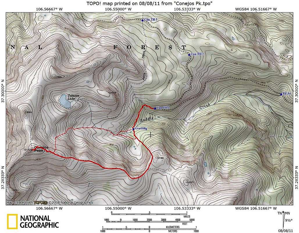
East Ridge Route, Conejos Peak
View High-Resolution Image
East Ridge Route, Conejos Peak
The solid red line starts at the lower trailhead, and is the main trail on the
East Ridge Route
. Variations (mostly along cattle trails) are dashed lines. The trails are not entirely continuous.
« PREV
NEXT »
Larry V
on
Aug 8, 2011 10:19 pm
Comments & voting
Other parents
Lat/Lon:
37.28890°N / 106.57°W
Image Type(s):
Topo/Diagram
Image ID:
736200
3335 Hits
71.06
% Score
1
Votes
Log in to vote
Comments
No comments posted yet.
to post!
Don't have an account?
Conejos Peak
(Mountain/Rock)
« PREV
Viewing
#32 of 55
GALLERY
NEXT »
Larry V's Image Gallery
« PREV
Viewing
#456 of 488
GALLERY
NEXT »
Saddle Creek and East Ridge
(Route)
Loading....
×
You need to login in order to vote!
User Name
Password
Remember me
Forgot your password?
Log me out when I close my browser.
Keep me logged in all the time.
sign in as a user
Don't have an account?
Register now for FREE
Rating available
Suggested routes for you
People who climb the same things as you
Comments Available
Create Albums
Register Here


