-
 14622 Hits
-
 77.48% Score
-
 8 Votes
|
|
Route |
|---|---|
|
|
44.91640°N / 111.4597°W |
|
|
Mountaineering, Scrambling |
|
|
Summer |
|
|
Most of a day |
|
|
Class 4 overall with an avoidable 5.2 pitch |
|
|
5.2 (YDS) |
|
|
Overview
Most people setting out with Hilgard Peak as the sole or a principal goal are going to use the east ridge as approached from the west fork of Beaver Creek.
That approach, however, skips beautiful Hilgard Basin, a justifiably popular spot in the Taylor-Hilgard Unit of the Lee Metcalf Wilderness, which protects parts of Montana's Madison Range. A paradise for people who love to explore lake basins, Hilgard Basin features almost 20 lakes and tarns, the majority of which are unnamed and not beside the trail that winds through the basin, and it is a must-visit destination. (Interestingly, Hilgard Lake is not part of Hilgard Basin proper).
So if you want to see Hilgard Basin and use it as a base camp for hiking and climbing-- other named peaks overlooking the basin are Echo Peak and Dutchman Peak-- this route page should be helpful. Be aware that the round-trip distance from base camp in Hilgard Basin is not that terribly long-- up to 12 miles-- but it will involve a long day that includes Class 4 (or harder) terrain, a short but steep climb on the return trip, and little shelter from storms in a range that, being on the western edge of the Greater Yellowstone Ecosystem, takes much of the brunt of east-tracking thunderstorms. Expect electrical storms on any summer day no matter how clear and clean the skies are at dawn.
Getting There
Between Earthquake Lake and Hebgen Lake, turn off U.S. 287 onto signed Beaver Creek Road (FR 985). Drive about 4 miles to the road's end at Potamogeton Park. Two trails depart this spot. Use the first, more southerly one, not the one over by the pit toilet. The trail you want is the Sentinel Creek Trail, and it accesses Expedition Pass and Hilgard Basin, the latter of which is a highly scenic backpacking and fishing destination.
This road is a little rocky in spots but is suitable for most passenger vehicles.
Route Information
At the Sentinel Creek TH, a sign says it is 8 miles to the turnoff for Hilgard Basin. Turiano puts it at 7. My pace suggested it is closer to six, but let's split the difference and call it 7 miles.
Anyway, follow the trail until an intersection close to timberline. Bear left for Hilgard Basin. This intersection is NOT where the USGS Hilgard Peak quad shows it; it is higher up.
From the divide above Hilgard Basin, descend and then pick a campsite somewhere in the basin. The divide is at about 9800'; the lowest point in the basin is at about 9400'.
Use the trail through the basin until its end at a saddle west of Point 10,087T (the saddle is at almost 10,000'). The trail ends abruptly at the brushy top of a cliff that doesn't look fun to descend. Walk a few yards east and notice the top of a rocky gully. This is a much easier way to descend.
 Route between Hilgard Basin and Hilgard Peak (the "upper arrow," and you would be following it "against" the arrow according to the directions on this page
Clamber down the gully and then head to Clear Lake, and then pass Tallus Lake and Hilgard Lake. It is better to work around the east sides of all three lakes, mainly because the east side of Hilgard Lake is relatively level while the west side is a boulder field. If water levels are a concern, though, then stick to the west sides to avoid stream crossings.
After Hilgard Lake, boulder-hop south and southeast. If you're lucky or use your map well, you'll pass what I think is the most spectacular tarn in the area, a small unnamed lake with a striking blue color reminiscent of the kinds of glacier-fed lakes found farther north in Glacier National Park and the Canadian Rockies. No glaciers exist in this basin anymore, but a permanent snowfield does feed the lake directly, and there must be enough glacier-like action there to give the lake its color. No other lake in the basin or the area looks anything like it. It's worth a look.
At last, you will be below the east ridge of Hilgard Peak. There is an obvious notch not far east of the summit and at the head of a steep couloir. Likely filled with snow, this couloir will pose a decision-making challenge. On the day I climbed Hilgard, Dutchman, and Echo, I had seen this couloir numerous times and from different positions. It never looked friendly considering the fact that although I had my axe, I had left my crampons behind. The top half was especially steep, not beyond my abilities but steep enough that a slip, made much easier by the absence of crampons, would almost certainly have meant a bad, perhaps fatal, fall.
But never fear! There are other couloirs farther east of the notch. If the most-direct one looks bad, choose one of the others. The one I descended proved to have soft snow that proved almost no risk of a fall even where it was steepest, though that can hardly be considered the norm and should not be taken as an indicator of the snow conditions in the direct couloir.
So...you are now at the notch. The east ridge to the summit is before you.
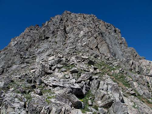
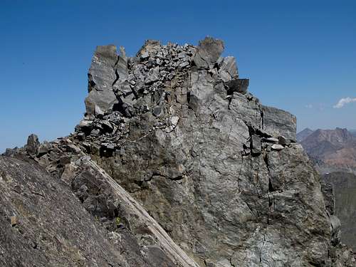
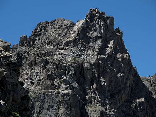
The rest of the way is not as long, hard, or scary as you might have been led to believe by some online and published accounts. As you head up the ridge and move through a narrow gully or couloir, it steepens into Class 5 terrain, but there are at least two ways around that spot. Then things get more exposed and you reach the knife-edge that leads to the summit block. The traverse of the knife-edge is described as 5.2, but I really think it's only arguably Class 4. However, the exposure on the north side of it is not to be argued with, and it may account for the rating even though it shouldn't.
For anyone not liking the knife-edge, though, there is an option to drop below it on the south side and then scramble up to the summit block.
Essential Gear
Pack an axe and crampons and then from Hilgard Basin assess whether you will need them on climbing day. You cannot see the peak or the route from the road in. You also cannot see the peak from Hilgard Basin, so your guess about crampons has to be based on conditions of other mountains in view. In my opinion, though, you'd be foolish not to have your axe at the very least.


