|
|
Route |
|---|---|
|
|
37.88095°N / 107.45805°W |
|
|
Hiking |
|
|
Summer, Fall |
|
|
Most of a day |
|
|
Class 2+ |
|
|
II |
|
|
Overview
The east slopes route up "Quarter Peak" (13674') is a natural way to attain the summit starting from the Cataract Gulch TH (9600'). The roundtrip distance is ~7.5 miles with an elevation gain of 4074'. The first ~2 miles are on a good trail to tree-line. The remainder is off-trail hiking up open grassy slopes and then a short class 2+ finish on the summit block. This route is also a good descent route if you have traversed to "Quarter Peak" from Half Peak.Getting There
About 2.2 miles south of Lake City, turn SW onto San Cristobal Road from CO 149. Reset your odometer here. About 12.1 miles from this turn-off, reach a road split. The right fork heads toward Cinnamon Pass. Take the left fork (Hinsdale County 35) toward the Sherman townsite, and reach the marked Cataract Gulch TH after a total of 13.2 miles. There is a small parking area on the south side of the road and restrooms on the north side. It is also possible to reach this TH from Silverton by going over Cinnamon Pass, but a high-clearance 4WD is highly recommended. From Lake City, a passenger car is sufficient to reach Cataract Gulch TH.Route Description
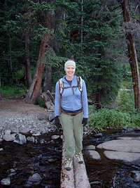
The good trail immediately crosses Cottonwood Creek on a good bridge and then a second log bridge and soon begins a steep climb up many switchbacks. The trail then passes several small waterfalls. After ~2 miles, the trail enters a talus field ~11500' (a little below treeline). You can see open grassy slopes above to the east and the summit of "Quarter Peak."There are many choices on where to leave the trail. Basically, choose a path toward open grassy slopes avoiding willow fields, and hike ~1 mile up the grassy slopes toward the ridge (~13440') to the N-NE of the summit of "Quarter Peak."
Once on the ridge, turn left (SW) and follow the ridge toward the summit block. Stay to the west (right) of the difficulties below the northeastern false summit and ascend via a steep class 2+ trail with loose rock. Reach the northeastern false summit and then descend slightly to the saddle between the false and real summits. From here, it is a short class 2 section to the summit of "Quarter Peak."


